Stay & Fish is growing — new waters, planning tools, live conditions and more are on the way. Explore what’s already live today.
Stay & Fish is growing — new waters, planning tools, live conditions and more are on the way. Explore what’s already live today.Stay & Fish is growing — new waters, planning tools, live conditions and more are on the way. Explore what’s already live today.
Historical IFI survey evidence — not current conditions. Displayed sections share waterbody codes with historical records; presence along every section, access and permission to fish are not confirmed.
More
Choose a layer to explore.
Home Water Outlook
Lough Ree
Worth considering
Light south-westerly breeze. Bright spells. No active warning affecting this water.
Ireland today · Angling conditions
What is happening across Ireland?
Reports describe observations. Conditions use measured or forecast environmental evidence. No live weather is connected yet, so this page shows honest unavailable states and the visual structure future sourced layers will use.
Visual weather stage
Ireland conditions
No verified frame available
Live visual weather is not connected.This stage is ready for sourced rain, cloud, wind, temperature and warning frames. No decorative weather is being shown as data.
National briefing
Awaiting verified weather data
No rainfall, wind, cloud, temperature or warning claim is presented without a connected source and timestamp.
Regional briefing
Midlands conditions
No sourced regional weather summary is connected. Choose a water to inspect the water-type priorities and available evidence.
Visual weather stage
Midlands conditions
No verified frame available
Live visual weather is not connected.This stage is ready for sourced rain, cloud, wind, temperature and warning frames. No decorative weather is being shown as data.
Midlands · Lake / Lough
Lough Sheelin conditions
Neutral angling conditions for this water.
Visual weather stage
Lough Sheelin conditions
No verified frame available
Live visual weather is not connected.This stage is ready for sourced rain, cloud, wind, temperature and warning frames. No decorative weather is being shown as data.
Measured conditions
Current readings unavailable
No source-backed weather, gauge or water-temperature record is connected for this water.
Angler observations
No current public observation
Coloured water, weed, clarity and surface state will remain explicitly labelled as angler observations.
Official warnings
Awaiting verified source
No warning is shown unless a current, attributed official record matches this water or region.
Angling interpretation
What matters on this lake / lough
Wind and gustsUnavailableRainfallUnavailableTemperatureUnavailableCloud and lightUnavailableWater levelUnavailableWater temperatureUnavailable
Once measurements are connected, weather, water state, seasonal context can be interpreted cautiously for the selected species.
Short outlook
Forecast timeline
Verified forecast not connectedNow, the next period, tonight, tomorrow and the three-day outlook will appear here when a sourced feed is available.
Midlands · Lake / Lough
Lough Ree conditions
Neutral angling conditions for this water.
Visual weather stage
Lough Ree conditions
No verified frame available
Live visual weather is not connected.This stage is ready for sourced rain, cloud, wind, temperature and warning frames. No decorative weather is being shown as data.
Measured conditions
Current readings unavailable
No source-backed weather, gauge or water-temperature record is connected for this water.
Angler observations
No current public observation
Coloured water, weed, clarity and surface state will remain explicitly labelled as angler observations.
Official warnings
Awaiting verified source
No warning is shown unless a current, attributed official record matches this water or region.
Angling interpretation
What matters on this lake / lough
Wind and gustsUnavailableRainfallUnavailableTemperatureUnavailableCloud and lightUnavailableWater levelUnavailableWater temperatureUnavailable
Once measurements are connected, weather, water state, seasonal context can be interpreted cautiously for the selected species.
Short outlook
Forecast timeline
Verified forecast not connectedNow, the next period, tonight, tomorrow and the three-day outlook will appear here when a sourced feed is available.
Midlands · Lake / Lough
Lough Derg conditions
Neutral angling conditions for this water.
Visual weather stage
Lough Derg conditions
No verified frame available
Live visual weather is not connected.This stage is ready for sourced rain, cloud, wind, temperature and warning frames. No decorative weather is being shown as data.
Measured conditions
Current readings unavailable
No source-backed weather, gauge or water-temperature record is connected for this water.
Angler observations
No current public observation
Coloured water, weed, clarity and surface state will remain explicitly labelled as angler observations.
Official warnings
Awaiting verified source
No warning is shown unless a current, attributed official record matches this water or region.
Angling interpretation
What matters on this lake / lough
Wind and gustsUnavailableRainfallUnavailableTemperatureUnavailableCloud and lightUnavailableWater levelUnavailableWater temperatureUnavailable
Once measurements are connected, weather, water state, seasonal context can be interpreted cautiously for the selected species.
Short outlook
Forecast timeline
Verified forecast not connectedNow, the next period, tonight, tomorrow and the three-day outlook will appear here when a sourced feed is available.
Midlands · Lake / Lough
Lough Owel conditions
Neutral angling conditions for this water.
Visual weather stage
Lough Owel conditions
No verified frame available
Live visual weather is not connected.This stage is ready for sourced rain, cloud, wind, temperature and warning frames. No decorative weather is being shown as data.
Measured conditions
Current readings unavailable
No source-backed weather, gauge or water-temperature record is connected for this water.
Angler observations
No current public observation
Coloured water, weed, clarity and surface state will remain explicitly labelled as angler observations.
Official warnings
Awaiting verified source
No warning is shown unless a current, attributed official record matches this water or region.
Angling interpretation
What matters on this lake / lough
Wind and gustsUnavailableRainfallUnavailableTemperatureUnavailableCloud and lightUnavailableWater levelUnavailableWater temperatureUnavailable
Once measurements are connected, weather, water state, seasonal context can be interpreted cautiously for the selected species.
Short outlook
Forecast timeline
Verified forecast not connectedNow, the next period, tonight, tomorrow and the three-day outlook will appear here when a sourced feed is available.
Midlands · Lake / Lough
Lough Ennell conditions
Neutral angling conditions for this water.
Visual weather stage
Lough Ennell conditions
No verified frame available
Live visual weather is not connected.This stage is ready for sourced rain, cloud, wind, temperature and warning frames. No decorative weather is being shown as data.
Measured conditions
Current readings unavailable
No source-backed weather, gauge or water-temperature record is connected for this water.
Angler observations
No current public observation
Coloured water, weed, clarity and surface state will remain explicitly labelled as angler observations.
Official warnings
Awaiting verified source
No warning is shown unless a current, attributed official record matches this water or region.
Angling interpretation
What matters on this lake / lough
Wind and gustsUnavailableRainfallUnavailableTemperatureUnavailableCloud and lightUnavailableWater levelUnavailableWater temperatureUnavailable
Once measurements are connected, weather, water state, seasonal context can be interpreted cautiously for the selected species.
Short outlook
Forecast timeline
Verified forecast not connectedNow, the next period, tonight, tomorrow and the three-day outlook will appear here when a sourced feed is available.
Midlands · Lake / Lough
Lough Derravaragh conditions
Neutral angling conditions for this water.
Visual weather stage
Lough Derravaragh conditions
No verified frame available
Live visual weather is not connected.This stage is ready for sourced rain, cloud, wind, temperature and warning frames. No decorative weather is being shown as data.
Measured conditions
Current readings unavailable
No source-backed weather, gauge or water-temperature record is connected for this water.
Angler observations
No current public observation
Coloured water, weed, clarity and surface state will remain explicitly labelled as angler observations.
Official warnings
Awaiting verified source
No warning is shown unless a current, attributed official record matches this water or region.
Angling interpretation
What matters on this lake / lough
Wind and gustsUnavailableRainfallUnavailableTemperatureUnavailableCloud and lightUnavailableWater levelUnavailableWater temperatureUnavailable
Once measurements are connected, weather, water state, seasonal context can be interpreted cautiously for the selected species.
Short outlook
Forecast timeline
Verified forecast not connectedNow, the next period, tonight, tomorrow and the three-day outlook will appear here when a sourced feed is available.
Midlands · Lake / Lough
Lough Lene conditions
Neutral angling conditions for this water.
Visual weather stage
Lough Lene conditions
No verified frame available
Live visual weather is not connected.This stage is ready for sourced rain, cloud, wind, temperature and warning frames. No decorative weather is being shown as data.
Measured conditions
Current readings unavailable
No source-backed weather, gauge or water-temperature record is connected for this water.
Angler observations
No current public observation
Coloured water, weed, clarity and surface state will remain explicitly labelled as angler observations.
Official warnings
Awaiting verified source
No warning is shown unless a current, attributed official record matches this water or region.
Angling interpretation
What matters on this lake / lough
Wind and gustsUnavailableRainfallUnavailableTemperatureUnavailableCloud and lightUnavailableWater levelUnavailableWater temperatureUnavailable
Once measurements are connected, weather, water state, seasonal context can be interpreted cautiously for the selected species.
Short outlook
Forecast timeline
Verified forecast not connectedNow, the next period, tonight, tomorrow and the three-day outlook will appear here when a sourced feed is available.
Midlands · River
River Shannon conditions
Neutral angling conditions for this water.
Visual weather stage
River Shannon conditions
No verified frame available
Live visual weather is not connected.This stage is ready for sourced rain, cloud, wind, temperature and warning frames. No decorative weather is being shown as data.
Measured conditions
Current readings unavailable
No source-backed weather, gauge or water-temperature record is connected for this water.
Angler observations
No current public observation
Coloured water, weed, clarity and surface state will remain explicitly labelled as angler observations.
Official warnings
Awaiting verified source
No warning is shown unless a current, attributed official record matches this water or region.
Angling interpretation
What matters on this river
River levelUnavailableFlow and trendUnavailableRecent rainfallUnavailableForecast rainfallUnavailableWater temperatureUnavailableFlood or low-water noticesUnavailable
Once measurements are connected, weather, water state, seasonal context can be interpreted cautiously for the selected species.
Short outlook
Forecast timeline
Verified forecast not connectedNow, the next period, tonight, tomorrow and the three-day outlook will appear here when a sourced feed is available.
Midlands · Lake / Lough
Lough Allen conditions
Neutral angling conditions for this water.
Visual weather stage
Lough Allen conditions
No verified frame available
Live visual weather is not connected.This stage is ready for sourced rain, cloud, wind, temperature and warning frames. No decorative weather is being shown as data.
Measured conditions
Current readings unavailable
No source-backed weather, gauge or water-temperature record is connected for this water.
Angler observations
No current public observation
Coloured water, weed, clarity and surface state will remain explicitly labelled as angler observations.
Official warnings
Awaiting verified source
No warning is shown unless a current, attributed official record matches this water or region.
Angling interpretation
What matters on this lake / lough
Wind and gustsUnavailableRainfallUnavailableTemperatureUnavailableCloud and lightUnavailableWater levelUnavailableWater temperatureUnavailable
Once measurements are connected, weather, water state, seasonal context can be interpreted cautiously for the selected species.
Short outlook
Forecast timeline
Verified forecast not connectedNow, the next period, tonight, tomorrow and the three-day outlook will appear here when a sourced feed is available.
Midlands · River
River Inny conditions
Neutral angling conditions for this water.
Visual weather stage
River Inny conditions
No verified frame available
Live visual weather is not connected.This stage is ready for sourced rain, cloud, wind, temperature and warning frames. No decorative weather is being shown as data.
Measured conditions
Current readings unavailable
No source-backed weather, gauge or water-temperature record is connected for this water.
Angler observations
No current public observation
Coloured water, weed, clarity and surface state will remain explicitly labelled as angler observations.
Official warnings
Awaiting verified source
No warning is shown unless a current, attributed official record matches this water or region.
Angling interpretation
What matters on this river
River levelUnavailableFlow and trendUnavailableRecent rainfallUnavailableForecast rainfallUnavailableWater temperatureUnavailableFlood or low-water noticesUnavailable
Once measurements are connected, weather, water state, seasonal context can be interpreted cautiously for the selected species.
Short outlook
Forecast timeline
Verified forecast not connectedNow, the next period, tonight, tomorrow and the three-day outlook will appear here when a sourced feed is available.
Midlands · Canal
Royal Canal conditions
Neutral angling conditions for this water.
Visual weather stage
Royal Canal conditions
No verified frame available
Live visual weather is not connected.This stage is ready for sourced rain, cloud, wind, temperature and warning frames. No decorative weather is being shown as data.
Measured conditions
Current readings unavailable
No source-backed weather, gauge or water-temperature record is connected for this water.
Angler observations
No current public observation
Coloured water, weed, clarity and surface state will remain explicitly labelled as angler observations.
Official warnings
Awaiting verified source
No warning is shown unless a current, attributed official record matches this water or region.
Angling interpretation
What matters on this canal
TemperatureUnavailableWindUnavailableCloudUnavailableRainfallUnavailableWater levelUnavailableClarity and weed observationsUnavailable
Once measurements are connected, weather, water state, seasonal context can be interpreted cautiously for the selected species.
Short outlook
Forecast timeline
Verified forecast not connectedNow, the next period, tonight, tomorrow and the three-day outlook will appear here when a sourced feed is available.
Midlands · Lake / Lough
Lough Boderg conditions
Neutral angling conditions for this water.
Visual weather stage
Lough Boderg conditions
No verified frame available
Live visual weather is not connected.This stage is ready for sourced rain, cloud, wind, temperature and warning frames. No decorative weather is being shown as data.
Measured conditions
Current readings unavailable
No source-backed weather, gauge or water-temperature record is connected for this water.
Angler observations
No current public observation
Coloured water, weed, clarity and surface state will remain explicitly labelled as angler observations.
Official warnings
Awaiting verified source
No warning is shown unless a current, attributed official record matches this water or region.
Angling interpretation
What matters on this lake / lough
Wind and gustsUnavailableRainfallUnavailableTemperatureUnavailableCloud and lightUnavailableWater levelUnavailableWater temperatureUnavailable
Once measurements are connected, weather, water state, seasonal context can be interpreted cautiously for the selected species.
Short outlook
Forecast timeline
Verified forecast not connectedNow, the next period, tonight, tomorrow and the three-day outlook will appear here when a sourced feed is available.
Regional briefing
West conditions
No sourced regional weather summary is connected. Choose a water to inspect the water-type priorities and available evidence.
Visual weather stage
West conditions
No verified frame available
Live visual weather is not connected.This stage is ready for sourced rain, cloud, wind, temperature and warning frames. No decorative weather is being shown as data.
West · Lake / Lough
Lough Corrib conditions
Neutral angling conditions for this water.
Visual weather stage
Lough Corrib conditions
No verified frame available
Live visual weather is not connected.This stage is ready for sourced rain, cloud, wind, temperature and warning frames. No decorative weather is being shown as data.
Measured conditions
Current readings unavailable
No source-backed weather, gauge or water-temperature record is connected for this water.
Angler observations
No current public observation
Coloured water, weed, clarity and surface state will remain explicitly labelled as angler observations.
Official warnings
Awaiting verified source
No warning is shown unless a current, attributed official record matches this water or region.
Angling interpretation
What matters on this lake / lough
Wind and gustsUnavailableRainfallUnavailableTemperatureUnavailableCloud and lightUnavailableWater levelUnavailableWater temperatureUnavailable
Once measurements are connected, weather, water state, seasonal context can be interpreted cautiously for the selected species.
Short outlook
Forecast timeline
Verified forecast not connectedNow, the next period, tonight, tomorrow and the three-day outlook will appear here when a sourced feed is available.
West · Lake / Lough
Lough Mask conditions
Neutral angling conditions for this water.
Visual weather stage
Lough Mask conditions
No verified frame available
Live visual weather is not connected.This stage is ready for sourced rain, cloud, wind, temperature and warning frames. No decorative weather is being shown as data.
Measured conditions
Current readings unavailable
No source-backed weather, gauge or water-temperature record is connected for this water.
Angler observations
No current public observation
Coloured water, weed, clarity and surface state will remain explicitly labelled as angler observations.
Official warnings
Awaiting verified source
No warning is shown unless a current, attributed official record matches this water or region.
Angling interpretation
What matters on this lake / lough
Wind and gustsUnavailableRainfallUnavailableTemperatureUnavailableCloud and lightUnavailableWater levelUnavailableWater temperatureUnavailable
Once measurements are connected, weather, water state, seasonal context can be interpreted cautiously for the selected species.
Short outlook
Forecast timeline
Verified forecast not connectedNow, the next period, tonight, tomorrow and the three-day outlook will appear here when a sourced feed is available.
West · Lake / Lough
Lough Carra conditions
Neutral angling conditions for this water.
Visual weather stage
Lough Carra conditions
No verified frame available
Live visual weather is not connected.This stage is ready for sourced rain, cloud, wind, temperature and warning frames. No decorative weather is being shown as data.
Measured conditions
Current readings unavailable
No source-backed weather, gauge or water-temperature record is connected for this water.
Angler observations
No current public observation
Coloured water, weed, clarity and surface state will remain explicitly labelled as angler observations.
Official warnings
Awaiting verified source
No warning is shown unless a current, attributed official record matches this water or region.
Angling interpretation
What matters on this lake / lough
Wind and gustsUnavailableRainfallUnavailableTemperatureUnavailableCloud and lightUnavailableWater levelUnavailableWater temperatureUnavailable
Once measurements are connected, weather, water state, seasonal context can be interpreted cautiously for the selected species.
Short outlook
Forecast timeline
Verified forecast not connectedNow, the next period, tonight, tomorrow and the three-day outlook will appear here when a sourced feed is available.
West · Lake / Lough
Lough Conn conditions
Neutral angling conditions for this water.
Visual weather stage
Lough Conn conditions
No verified frame available
Live visual weather is not connected.This stage is ready for sourced rain, cloud, wind, temperature and warning frames. No decorative weather is being shown as data.
Measured conditions
Current readings unavailable
No source-backed weather, gauge or water-temperature record is connected for this water.
Angler observations
No current public observation
Coloured water, weed, clarity and surface state will remain explicitly labelled as angler observations.
Official warnings
Awaiting verified source
No warning is shown unless a current, attributed official record matches this water or region.
Angling interpretation
What matters on this lake / lough
Wind and gustsUnavailableRainfallUnavailableTemperatureUnavailableCloud and lightUnavailableWater levelUnavailableWater temperatureUnavailable
Once measurements are connected, weather, water state, seasonal context can be interpreted cautiously for the selected species.
Short outlook
Forecast timeline
Verified forecast not connectedNow, the next period, tonight, tomorrow and the three-day outlook will appear here when a sourced feed is available.
West · Lake / Lough
Lough Cullin conditions
Neutral angling conditions for this water.
Visual weather stage
Lough Cullin conditions
No verified frame available
Live visual weather is not connected.This stage is ready for sourced rain, cloud, wind, temperature and warning frames. No decorative weather is being shown as data.
Measured conditions
Current readings unavailable
No source-backed weather, gauge or water-temperature record is connected for this water.
Angler observations
No current public observation
Coloured water, weed, clarity and surface state will remain explicitly labelled as angler observations.
Official warnings
Awaiting verified source
No warning is shown unless a current, attributed official record matches this water or region.
Angling interpretation
What matters on this lake / lough
Wind and gustsUnavailableRainfallUnavailableTemperatureUnavailableCloud and lightUnavailableWater levelUnavailableWater temperatureUnavailable
Once measurements are connected, weather, water state, seasonal context can be interpreted cautiously for the selected species.
Short outlook
Forecast timeline
Verified forecast not connectedNow, the next period, tonight, tomorrow and the three-day outlook will appear here when a sourced feed is available.
West · Lake / Lough
Lough Rea conditions
Neutral angling conditions for this water.
Visual weather stage
Lough Rea conditions
No verified frame available
Live visual weather is not connected.This stage is ready for sourced rain, cloud, wind, temperature and warning frames. No decorative weather is being shown as data.
Measured conditions
Current readings unavailable
No source-backed weather, gauge or water-temperature record is connected for this water.
Angler observations
No current public observation
Coloured water, weed, clarity and surface state will remain explicitly labelled as angler observations.
Official warnings
Awaiting verified source
No warning is shown unless a current, attributed official record matches this water or region.
Angling interpretation
What matters on this lake / lough
Wind and gustsUnavailableRainfallUnavailableTemperatureUnavailableCloud and lightUnavailableWater levelUnavailableWater temperatureUnavailable
Once measurements are connected, weather, water state, seasonal context can be interpreted cautiously for the selected species.
Short outlook
Forecast timeline
Verified forecast not connectedNow, the next period, tonight, tomorrow and the three-day outlook will appear here when a sourced feed is available.
West · Lake / Lough
Lough Cullaun conditions
Neutral angling conditions for this water.
Visual weather stage
Lough Cullaun conditions
No verified frame available
Live visual weather is not connected.This stage is ready for sourced rain, cloud, wind, temperature and warning frames. No decorative weather is being shown as data.
Measured conditions
Current readings unavailable
No source-backed weather, gauge or water-temperature record is connected for this water.
Angler observations
No current public observation
Coloured water, weed, clarity and surface state will remain explicitly labelled as angler observations.
Official warnings
Awaiting verified source
No warning is shown unless a current, attributed official record matches this water or region.
Angling interpretation
What matters on this lake / lough
Wind and gustsUnavailableRainfallUnavailableTemperatureUnavailableCloud and lightUnavailableWater levelUnavailableWater temperatureUnavailable
Once measurements are connected, weather, water state, seasonal context can be interpreted cautiously for the selected species.
Short outlook
Forecast timeline
Verified forecast not connectedNow, the next period, tonight, tomorrow and the three-day outlook will appear here when a sourced feed is available.
West · River
River Erriff conditions
Neutral angling conditions for this water.
Visual weather stage
River Erriff conditions
No verified frame available
Live visual weather is not connected.This stage is ready for sourced rain, cloud, wind, temperature and warning frames. No decorative weather is being shown as data.
Measured conditions
Current readings unavailable
No source-backed weather, gauge or water-temperature record is connected for this water.
Angler observations
No current public observation
Coloured water, weed, clarity and surface state will remain explicitly labelled as angler observations.
Official warnings
Awaiting verified source
No warning is shown unless a current, attributed official record matches this water or region.
Angling interpretation
What matters on this river
River levelUnavailableFlow and trendUnavailableRecent rainfallUnavailableForecast rainfallUnavailableWater temperatureUnavailableFlood or low-water noticesUnavailable
Once measurements are connected, weather, water state, seasonal context can be interpreted cautiously for the selected species.
Short outlook
Forecast timeline
Verified forecast not connectedNow, the next period, tonight, tomorrow and the three-day outlook will appear here when a sourced feed is available.
West · River
Bundorragha River conditions
Neutral angling conditions for this water.
Visual weather stage
Bundorragha River conditions
No verified frame available
Live visual weather is not connected.This stage is ready for sourced rain, cloud, wind, temperature and warning frames. No decorative weather is being shown as data.
Measured conditions
Current readings unavailable
No source-backed weather, gauge or water-temperature record is connected for this water.
Angler observations
No current public observation
Coloured water, weed, clarity and surface state will remain explicitly labelled as angler observations.
Official warnings
Awaiting verified source
No warning is shown unless a current, attributed official record matches this water or region.
Angling interpretation
What matters on this river
River levelUnavailableFlow and trendUnavailableRecent rainfallUnavailableForecast rainfallUnavailableWater temperatureUnavailableFlood or low-water noticesUnavailable
Once measurements are connected, weather, water state, seasonal context can be interpreted cautiously for the selected species.
Short outlook
Forecast timeline
Verified forecast not connectedNow, the next period, tonight, tomorrow and the three-day outlook will appear here when a sourced feed is available.
West · River
River Corrib conditions
Neutral angling conditions for this water.
Visual weather stage
River Corrib conditions
No verified frame available
Live visual weather is not connected.This stage is ready for sourced rain, cloud, wind, temperature and warning frames. No decorative weather is being shown as data.
Measured conditions
Current readings unavailable
No source-backed weather, gauge or water-temperature record is connected for this water.
Angler observations
No current public observation
Coloured water, weed, clarity and surface state will remain explicitly labelled as angler observations.
Official warnings
Awaiting verified source
No warning is shown unless a current, attributed official record matches this water or region.
Angling interpretation
What matters on this river
River levelUnavailableFlow and trendUnavailableRecent rainfallUnavailableForecast rainfallUnavailableWater temperatureUnavailableFlood or low-water noticesUnavailable
Once measurements are connected, weather, water state, seasonal context can be interpreted cautiously for the selected species.
Short outlook
Forecast timeline
Verified forecast not connectedNow, the next period, tonight, tomorrow and the three-day outlook will appear here when a sourced feed is available.
Regional briefing
Northwest conditions
No sourced regional weather summary is connected. Choose a water to inspect the water-type priorities and available evidence.
Visual weather stage
Northwest conditions
No verified frame available
Live visual weather is not connected.This stage is ready for sourced rain, cloud, wind, temperature and warning frames. No decorative weather is being shown as data.
Northwest · Lake / Lough
Lough Arrow conditions
Neutral angling conditions for this water.
Visual weather stage
Lough Arrow conditions
No verified frame available
Live visual weather is not connected.This stage is ready for sourced rain, cloud, wind, temperature and warning frames. No decorative weather is being shown as data.
Measured conditions
Current readings unavailable
No source-backed weather, gauge or water-temperature record is connected for this water.
Angler observations
No current public observation
Coloured water, weed, clarity and surface state will remain explicitly labelled as angler observations.
Official warnings
Awaiting verified source
No warning is shown unless a current, attributed official record matches this water or region.
Angling interpretation
What matters on this lake / lough
Wind and gustsUnavailableRainfallUnavailableTemperatureUnavailableCloud and lightUnavailableWater levelUnavailableWater temperatureUnavailable
Once measurements are connected, weather, water state, seasonal context can be interpreted cautiously for the selected species.
Short outlook
Forecast timeline
Verified forecast not connectedNow, the next period, tonight, tomorrow and the three-day outlook will appear here when a sourced feed is available.
Northwest · Lake / Lough
Lough Melvin conditions
Neutral angling conditions for this water.
Visual weather stage
Lough Melvin conditions
No verified frame available
Live visual weather is not connected.This stage is ready for sourced rain, cloud, wind, temperature and warning frames. No decorative weather is being shown as data.
Measured conditions
Current readings unavailable
No source-backed weather, gauge or water-temperature record is connected for this water.
Angler observations
No current public observation
Coloured water, weed, clarity and surface state will remain explicitly labelled as angler observations.
Official warnings
Awaiting verified source
No warning is shown unless a current, attributed official record matches this water or region.
Angling interpretation
What matters on this lake / lough
Wind and gustsUnavailableRainfallUnavailableTemperatureUnavailableCloud and lightUnavailableWater levelUnavailableWater temperatureUnavailable
Once measurements are connected, weather, water state, seasonal context can be interpreted cautiously for the selected species.
Short outlook
Forecast timeline
Verified forecast not connectedNow, the next period, tonight, tomorrow and the three-day outlook will appear here when a sourced feed is available.
Northwest · Lake / Lough
Lough Gill conditions
Neutral angling conditions for this water.
Visual weather stage
Lough Gill conditions
No verified frame available
Live visual weather is not connected.This stage is ready for sourced rain, cloud, wind, temperature and warning frames. No decorative weather is being shown as data.
Measured conditions
Current readings unavailable
No source-backed weather, gauge or water-temperature record is connected for this water.
Angler observations
No current public observation
Coloured water, weed, clarity and surface state will remain explicitly labelled as angler observations.
Official warnings
Awaiting verified source
No warning is shown unless a current, attributed official record matches this water or region.
Angling interpretation
What matters on this lake / lough
Wind and gustsUnavailableRainfallUnavailableTemperatureUnavailableCloud and lightUnavailableWater levelUnavailableWater temperatureUnavailable
Once measurements are connected, weather, water state, seasonal context can be interpreted cautiously for the selected species.
Short outlook
Forecast timeline
Verified forecast not connectedNow, the next period, tonight, tomorrow and the three-day outlook will appear here when a sourced feed is available.
Northwest · River
River Moy conditions
Neutral angling conditions for this water.
Visual weather stage
River Moy conditions
No verified frame available
Live visual weather is not connected.This stage is ready for sourced rain, cloud, wind, temperature and warning frames. No decorative weather is being shown as data.
Measured conditions
Current readings unavailable
No source-backed weather, gauge or water-temperature record is connected for this water.
Angler observations
No current public observation
Coloured water, weed, clarity and surface state will remain explicitly labelled as angler observations.
Official warnings
Awaiting verified source
No warning is shown unless a current, attributed official record matches this water or region.
Angling interpretation
What matters on this river
River levelUnavailableFlow and trendUnavailableRecent rainfallUnavailableForecast rainfallUnavailableWater temperatureUnavailableFlood or low-water noticesUnavailable
Once measurements are connected, weather, water state, seasonal context can be interpreted cautiously for the selected species.
Short outlook
Forecast timeline
Verified forecast not connectedNow, the next period, tonight, tomorrow and the three-day outlook will appear here when a sourced feed is available.
Northwest · River
River Drowes conditions
Neutral angling conditions for this water.
Visual weather stage
River Drowes conditions
No verified frame available
Live visual weather is not connected.This stage is ready for sourced rain, cloud, wind, temperature and warning frames. No decorative weather is being shown as data.
Measured conditions
Current readings unavailable
No source-backed weather, gauge or water-temperature record is connected for this water.
Angler observations
No current public observation
Coloured water, weed, clarity and surface state will remain explicitly labelled as angler observations.
Official warnings
Awaiting verified source
No warning is shown unless a current, attributed official record matches this water or region.
Angling interpretation
What matters on this river
River levelUnavailableFlow and trendUnavailableRecent rainfallUnavailableForecast rainfallUnavailableWater temperatureUnavailableFlood or low-water noticesUnavailable
Once measurements are connected, weather, water state, seasonal context can be interpreted cautiously for the selected species.
Short outlook
Forecast timeline
Verified forecast not connectedNow, the next period, tonight, tomorrow and the three-day outlook will appear here when a sourced feed is available.
Northwest · River
River Finn conditions
Neutral angling conditions for this water.
Visual weather stage
River Finn conditions
No verified frame available
Live visual weather is not connected.This stage is ready for sourced rain, cloud, wind, temperature and warning frames. No decorative weather is being shown as data.
Measured conditions
Current readings unavailable
No source-backed weather, gauge or water-temperature record is connected for this water.
Angler observations
No current public observation
Coloured water, weed, clarity and surface state will remain explicitly labelled as angler observations.
Official warnings
Awaiting verified source
No warning is shown unless a current, attributed official record matches this water or region.
Angling interpretation
What matters on this river
River levelUnavailableFlow and trendUnavailableRecent rainfallUnavailableForecast rainfallUnavailableWater temperatureUnavailableFlood or low-water noticesUnavailable
Once measurements are connected, weather, water state, seasonal context can be interpreted cautiously for the selected species.
Short outlook
Forecast timeline
Verified forecast not connectedNow, the next period, tonight, tomorrow and the three-day outlook will appear here when a sourced feed is available.
Northwest · River
River Owenea conditions
Neutral angling conditions for this water.
Visual weather stage
River Owenea conditions
No verified frame available
Live visual weather is not connected.This stage is ready for sourced rain, cloud, wind, temperature and warning frames. No decorative weather is being shown as data.
Measured conditions
Current readings unavailable
No source-backed weather, gauge or water-temperature record is connected for this water.
Angler observations
No current public observation
Coloured water, weed, clarity and surface state will remain explicitly labelled as angler observations.
Official warnings
Awaiting verified source
No warning is shown unless a current, attributed official record matches this water or region.
Angling interpretation
What matters on this river
River levelUnavailableFlow and trendUnavailableRecent rainfallUnavailableForecast rainfallUnavailableWater temperatureUnavailableFlood or low-water noticesUnavailable
Once measurements are connected, weather, water state, seasonal context can be interpreted cautiously for the selected species.
Short outlook
Forecast timeline
Verified forecast not connectedNow, the next period, tonight, tomorrow and the three-day outlook will appear here when a sourced feed is available.
Regional briefing
Northeast conditions
No sourced regional weather summary is connected. Choose a water to inspect the water-type priorities and available evidence.
Visual weather stage
Northeast conditions
No verified frame available
Live visual weather is not connected.This stage is ready for sourced rain, cloud, wind, temperature and warning frames. No decorative weather is being shown as data.
Northeast · Lake / Lough
Lough Ramor conditions
Neutral angling conditions for this water.
Visual weather stage
Lough Ramor conditions
No verified frame available
Live visual weather is not connected.This stage is ready for sourced rain, cloud, wind, temperature and warning frames. No decorative weather is being shown as data.
Measured conditions
Current readings unavailable
No source-backed weather, gauge or water-temperature record is connected for this water.
Angler observations
No current public observation
Coloured water, weed, clarity and surface state will remain explicitly labelled as angler observations.
Official warnings
Awaiting verified source
No warning is shown unless a current, attributed official record matches this water or region.
Angling interpretation
What matters on this lake / lough
Wind and gustsUnavailableRainfallUnavailableTemperatureUnavailableCloud and lightUnavailableWater levelUnavailableWater temperatureUnavailable
Once measurements are connected, weather, water state, seasonal context can be interpreted cautiously for the selected species.
Short outlook
Forecast timeline
Verified forecast not connectedNow, the next period, tonight, tomorrow and the three-day outlook will appear here when a sourced feed is available.
Northeast · Lake / Lough
Lough Oughter conditions
Neutral angling conditions for this water.
Visual weather stage
Lough Oughter conditions
No verified frame available
Live visual weather is not connected.This stage is ready for sourced rain, cloud, wind, temperature and warning frames. No decorative weather is being shown as data.
Measured conditions
Current readings unavailable
No source-backed weather, gauge or water-temperature record is connected for this water.
Angler observations
No current public observation
Coloured water, weed, clarity and surface state will remain explicitly labelled as angler observations.
Official warnings
Awaiting verified source
No warning is shown unless a current, attributed official record matches this water or region.
Angling interpretation
What matters on this lake / lough
Wind and gustsUnavailableRainfallUnavailableTemperatureUnavailableCloud and lightUnavailableWater levelUnavailableWater temperatureUnavailable
Once measurements are connected, weather, water state, seasonal context can be interpreted cautiously for the selected species.
Short outlook
Forecast timeline
Verified forecast not connectedNow, the next period, tonight, tomorrow and the three-day outlook will appear here when a sourced feed is available.
Northeast · Lake / Lough
Corglass Lough conditions
Neutral angling conditions for this water.
Visual weather stage
Corglass Lough conditions
No verified frame available
Live visual weather is not connected.This stage is ready for sourced rain, cloud, wind, temperature and warning frames. No decorative weather is being shown as data.
Measured conditions
Current readings unavailable
No source-backed weather, gauge or water-temperature record is connected for this water.
Angler observations
No current public observation
Coloured water, weed, clarity and surface state will remain explicitly labelled as angler observations.
Official warnings
Awaiting verified source
No warning is shown unless a current, attributed official record matches this water or region.
Angling interpretation
What matters on this lake / lough
Wind and gustsUnavailableRainfallUnavailableTemperatureUnavailableCloud and lightUnavailableWater levelUnavailableWater temperatureUnavailable
Once measurements are connected, weather, water state, seasonal context can be interpreted cautiously for the selected species.
Short outlook
Forecast timeline
Verified forecast not connectedNow, the next period, tonight, tomorrow and the three-day outlook will appear here when a sourced feed is available.
Northeast · Lake / Lough
Glasshouse Lake conditions
Neutral angling conditions for this water.
Visual weather stage
Glasshouse Lake conditions
No verified frame available
Live visual weather is not connected.This stage is ready for sourced rain, cloud, wind, temperature and warning frames. No decorative weather is being shown as data.
Measured conditions
Current readings unavailable
No source-backed weather, gauge or water-temperature record is connected for this water.
Angler observations
No current public observation
Coloured water, weed, clarity and surface state will remain explicitly labelled as angler observations.
Official warnings
Awaiting verified source
No warning is shown unless a current, attributed official record matches this water or region.
Angling interpretation
What matters on this lake / lough
Wind and gustsUnavailableRainfallUnavailableTemperatureUnavailableCloud and lightUnavailableWater levelUnavailableWater temperatureUnavailable
Once measurements are connected, weather, water state, seasonal context can be interpreted cautiously for the selected species.
Short outlook
Forecast timeline
Verified forecast not connectedNow, the next period, tonight, tomorrow and the three-day outlook will appear here when a sourced feed is available.
Northeast · Lake / Lough
Lough Gowna conditions
Neutral angling conditions for this water.
Visual weather stage
Lough Gowna conditions
No verified frame available
Live visual weather is not connected.This stage is ready for sourced rain, cloud, wind, temperature and warning frames. No decorative weather is being shown as data.
Measured conditions
Current readings unavailable
No source-backed weather, gauge or water-temperature record is connected for this water.
Angler observations
No current public observation
Coloured water, weed, clarity and surface state will remain explicitly labelled as angler observations.
Official warnings
Awaiting verified source
No warning is shown unless a current, attributed official record matches this water or region.
Angling interpretation
What matters on this lake / lough
Wind and gustsUnavailableRainfallUnavailableTemperatureUnavailableCloud and lightUnavailableWater levelUnavailableWater temperatureUnavailable
Once measurements are connected, weather, water state, seasonal context can be interpreted cautiously for the selected species.
Short outlook
Forecast timeline
Verified forecast not connectedNow, the next period, tonight, tomorrow and the three-day outlook will appear here when a sourced feed is available.
Northeast · River
River Blackwater — Lough Neagh system conditions
Neutral angling conditions for this water.
Visual weather stage
River Blackwater — Lough Neagh system conditions
No verified frame available
Live visual weather is not connected.This stage is ready for sourced rain, cloud, wind, temperature and warning frames. No decorative weather is being shown as data.
Measured conditions
Current readings unavailable
No source-backed weather, gauge or water-temperature record is connected for this water.
Angler observations
No current public observation
Coloured water, weed, clarity and surface state will remain explicitly labelled as angler observations.
Official warnings
Awaiting verified source
No warning is shown unless a current, attributed official record matches this water or region.
Angling interpretation
What matters on this river
River levelUnavailableFlow and trendUnavailableRecent rainfallUnavailableForecast rainfallUnavailableWater temperatureUnavailableFlood or low-water noticesUnavailable
Once measurements are connected, weather, water state, seasonal context can be interpreted cautiously for the selected species.
Short outlook
Forecast timeline
Verified forecast not connectedNow, the next period, tonight, tomorrow and the three-day outlook will appear here when a sourced feed is available.
Regional briefing
East conditions
No sourced regional weather summary is connected. Choose a water to inspect the water-type priorities and available evidence.
Visual weather stage
East conditions
No verified frame available
Live visual weather is not connected.This stage is ready for sourced rain, cloud, wind, temperature and warning frames. No decorative weather is being shown as data.
East · Reservoir
Blessington Lakes conditions
Neutral angling conditions for this water.
Visual weather stage
Blessington Lakes conditions
No verified frame available
Live visual weather is not connected.This stage is ready for sourced rain, cloud, wind, temperature and warning frames. No decorative weather is being shown as data.
Measured conditions
Current readings unavailable
No source-backed weather, gauge or water-temperature record is connected for this water.
Angler observations
No current public observation
Coloured water, weed, clarity and surface state will remain explicitly labelled as angler observations.
Official warnings
Awaiting verified source
No warning is shown unless a current, attributed official record matches this water or region.
Angling interpretation
What matters on this reservoir
Water levelUnavailableRelease or drawdownUnavailableWind and gustsUnavailableTemperatureUnavailableRainfallUnavailableWater clarityUnavailable
Once measurements are connected, weather, water state, seasonal context can be interpreted cautiously for the selected species.
Short outlook
Forecast timeline
Verified forecast not connectedNow, the next period, tonight, tomorrow and the three-day outlook will appear here when a sourced feed is available.
East · River
River Boyne conditions
Neutral angling conditions for this water.
Visual weather stage
River Boyne conditions
No verified frame available
Live visual weather is not connected.This stage is ready for sourced rain, cloud, wind, temperature and warning frames. No decorative weather is being shown as data.
Measured conditions
Current readings unavailable
No source-backed weather, gauge or water-temperature record is connected for this water.
Angler observations
No current public observation
Coloured water, weed, clarity and surface state will remain explicitly labelled as angler observations.
Official warnings
Awaiting verified source
No warning is shown unless a current, attributed official record matches this water or region.
Angling interpretation
What matters on this river
River levelUnavailableFlow and trendUnavailableRecent rainfallUnavailableForecast rainfallUnavailableWater temperatureUnavailableFlood or low-water noticesUnavailable
Once measurements are connected, weather, water state, seasonal context can be interpreted cautiously for the selected species.
Short outlook
Forecast timeline
Verified forecast not connectedNow, the next period, tonight, tomorrow and the three-day outlook will appear here when a sourced feed is available.
Regional briefing
Southeast conditions
No sourced regional weather summary is connected. Choose a water to inspect the water-type priorities and available evidence.
Visual weather stage
Southeast conditions
No verified frame available
Live visual weather is not connected.This stage is ready for sourced rain, cloud, wind, temperature and warning frames. No decorative weather is being shown as data.
Southeast · River
River Suir conditions
Neutral angling conditions for this water.
Visual weather stage
River Suir conditions
No verified frame available
Live visual weather is not connected.This stage is ready for sourced rain, cloud, wind, temperature and warning frames. No decorative weather is being shown as data.
Measured conditions
Current readings unavailable
No source-backed weather, gauge or water-temperature record is connected for this water.
Angler observations
No current public observation
Coloured water, weed, clarity and surface state will remain explicitly labelled as angler observations.
Official warnings
Awaiting verified source
No warning is shown unless a current, attributed official record matches this water or region.
Angling interpretation
What matters on this river
River levelUnavailableFlow and trendUnavailableRecent rainfallUnavailableForecast rainfallUnavailableWater temperatureUnavailableFlood or low-water noticesUnavailable
Once measurements are connected, weather, water state, seasonal context can be interpreted cautiously for the selected species.
Short outlook
Forecast timeline
Verified forecast not connectedNow, the next period, tonight, tomorrow and the three-day outlook will appear here when a sourced feed is available.
Southeast · River
River Slaney conditions
Neutral angling conditions for this water.
Visual weather stage
River Slaney conditions
No verified frame available
Live visual weather is not connected.This stage is ready for sourced rain, cloud, wind, temperature and warning frames. No decorative weather is being shown as data.
Measured conditions
Current readings unavailable
No source-backed weather, gauge or water-temperature record is connected for this water.
Angler observations
No current public observation
Coloured water, weed, clarity and surface state will remain explicitly labelled as angler observations.
Official warnings
Awaiting verified source
No warning is shown unless a current, attributed official record matches this water or region.
Angling interpretation
What matters on this river
River levelUnavailableFlow and trendUnavailableRecent rainfallUnavailableForecast rainfallUnavailableWater temperatureUnavailableFlood or low-water noticesUnavailable
Once measurements are connected, weather, water state, seasonal context can be interpreted cautiously for the selected species.
Short outlook
Forecast timeline
Verified forecast not connectedNow, the next period, tonight, tomorrow and the three-day outlook will appear here when a sourced feed is available.
Southeast · River
River Nore conditions
Neutral angling conditions for this water.
Visual weather stage
River Nore conditions
No verified frame available
Live visual weather is not connected.This stage is ready for sourced rain, cloud, wind, temperature and warning frames. No decorative weather is being shown as data.
Measured conditions
Current readings unavailable
No source-backed weather, gauge or water-temperature record is connected for this water.
Angler observations
No current public observation
Coloured water, weed, clarity and surface state will remain explicitly labelled as angler observations.
Official warnings
Awaiting verified source
No warning is shown unless a current, attributed official record matches this water or region.
Angling interpretation
What matters on this river
River levelUnavailableFlow and trendUnavailableRecent rainfallUnavailableForecast rainfallUnavailableWater temperatureUnavailableFlood or low-water noticesUnavailable
Once measurements are connected, weather, water state, seasonal context can be interpreted cautiously for the selected species.
Short outlook
Forecast timeline
Verified forecast not connectedNow, the next period, tonight, tomorrow and the three-day outlook will appear here when a sourced feed is available.
Regional briefing
South conditions
No sourced regional weather summary is connected. Choose a water to inspect the water-type priorities and available evidence.
Visual weather stage
South conditions
No verified frame available
Live visual weather is not connected.This stage is ready for sourced rain, cloud, wind, temperature and warning frames. No decorative weather is being shown as data.
South · River
Munster Blackwater conditions
Neutral angling conditions for this water.
Visual weather stage
Munster Blackwater conditions
No verified frame available
Live visual weather is not connected.This stage is ready for sourced rain, cloud, wind, temperature and warning frames. No decorative weather is being shown as data.
Measured conditions
Current readings unavailable
No source-backed weather, gauge or water-temperature record is connected for this water.
Angler observations
No current public observation
Coloured water, weed, clarity and surface state will remain explicitly labelled as angler observations.
Official warnings
Awaiting verified source
No warning is shown unless a current, attributed official record matches this water or region.
Angling interpretation
What matters on this river
River levelUnavailableFlow and trendUnavailableRecent rainfallUnavailableForecast rainfallUnavailableWater temperatureUnavailableFlood or low-water noticesUnavailable
Once measurements are connected, weather, water state, seasonal context can be interpreted cautiously for the selected species.
Short outlook
Forecast timeline
Verified forecast not connectedNow, the next period, tonight, tomorrow and the three-day outlook will appear here when a sourced feed is available.
Regional briefing
Southwest conditions
No sourced regional weather summary is connected. Choose a water to inspect the water-type priorities and available evidence.
Visual weather stage
Southwest conditions
No verified frame available
Live visual weather is not connected.This stage is ready for sourced rain, cloud, wind, temperature and warning frames. No decorative weather is being shown as data.
Southwest · Lake / Lough
Lough Leane conditions
Neutral angling conditions for this water.
Visual weather stage
Lough Leane conditions
No verified frame available
Live visual weather is not connected.This stage is ready for sourced rain, cloud, wind, temperature and warning frames. No decorative weather is being shown as data.
Measured conditions
Current readings unavailable
No source-backed weather, gauge or water-temperature record is connected for this water.
Angler observations
No current public observation
Coloured water, weed, clarity and surface state will remain explicitly labelled as angler observations.
Official warnings
Awaiting verified source
No warning is shown unless a current, attributed official record matches this water or region.
Angling interpretation
What matters on this lake / lough
Wind and gustsUnavailableRainfallUnavailableTemperatureUnavailableCloud and lightUnavailableWater levelUnavailableWater temperatureUnavailable
Once measurements are connected, weather, water state, seasonal context can be interpreted cautiously for the selected species.
Short outlook
Forecast timeline
Verified forecast not connectedNow, the next period, tonight, tomorrow and the three-day outlook will appear here when a sourced feed is available.
Southwest · Lake / Lough
Lough Currane conditions
Neutral angling conditions for this water.
Visual weather stage
Lough Currane conditions
No verified frame available
Live visual weather is not connected.This stage is ready for sourced rain, cloud, wind, temperature and warning frames. No decorative weather is being shown as data.
Measured conditions
Current readings unavailable
No source-backed weather, gauge or water-temperature record is connected for this water.
Angler observations
No current public observation
Coloured water, weed, clarity and surface state will remain explicitly labelled as angler observations.
Official warnings
Awaiting verified source
No warning is shown unless a current, attributed official record matches this water or region.
Angling interpretation
What matters on this lake / lough
Wind and gustsUnavailableRainfallUnavailableTemperatureUnavailableCloud and lightUnavailableWater levelUnavailableWater temperatureUnavailable
Once measurements are connected, weather, water state, seasonal context can be interpreted cautiously for the selected species.
Short outlook
Forecast timeline
Verified forecast not connectedNow, the next period, tonight, tomorrow and the three-day outlook will appear here when a sourced feed is available.
Southwest · Lake / Lough
Lough Acoose conditions
Neutral angling conditions for this water.
Visual weather stage
Lough Acoose conditions
No verified frame available
Live visual weather is not connected.This stage is ready for sourced rain, cloud, wind, temperature and warning frames. No decorative weather is being shown as data.
Measured conditions
Current readings unavailable
No source-backed weather, gauge or water-temperature record is connected for this water.
Angler observations
No current public observation
Coloured water, weed, clarity and surface state will remain explicitly labelled as angler observations.
Official warnings
Awaiting verified source
No warning is shown unless a current, attributed official record matches this water or region.
Angling interpretation
What matters on this lake / lough
Wind and gustsUnavailableRainfallUnavailableTemperatureUnavailableCloud and lightUnavailableWater levelUnavailableWater temperatureUnavailable
Once measurements are connected, weather, water state, seasonal context can be interpreted cautiously for the selected species.
Short outlook
Forecast timeline
Verified forecast not connectedNow, the next period, tonight, tomorrow and the three-day outlook will appear here when a sourced feed is available.
Southwest · Lake / Lough
Lough Allua conditions
Neutral angling conditions for this water.
Visual weather stage
Lough Allua conditions
No verified frame available
Live visual weather is not connected.This stage is ready for sourced rain, cloud, wind, temperature and warning frames. No decorative weather is being shown as data.
Measured conditions
Current readings unavailable
No source-backed weather, gauge or water-temperature record is connected for this water.
Angler observations
No current public observation
Coloured water, weed, clarity and surface state will remain explicitly labelled as angler observations.
Official warnings
Awaiting verified source
No warning is shown unless a current, attributed official record matches this water or region.
Angling interpretation
What matters on this lake / lough
Wind and gustsUnavailableRainfallUnavailableTemperatureUnavailableCloud and lightUnavailableWater levelUnavailableWater temperatureUnavailable
Once measurements are connected, weather, water state, seasonal context can be interpreted cautiously for the selected species.
Short outlook
Forecast timeline
Verified forecast not connectedNow, the next period, tonight, tomorrow and the three-day outlook will appear here when a sourced feed is available.
Southwest · River
River Lee conditions
Neutral angling conditions for this water.
Visual weather stage
River Lee conditions
No verified frame available
Live visual weather is not connected.This stage is ready for sourced rain, cloud, wind, temperature and warning frames. No decorative weather is being shown as data.
Measured conditions
Current readings unavailable
No source-backed weather, gauge or water-temperature record is connected for this water.
Angler observations
No current public observation
Coloured water, weed, clarity and surface state will remain explicitly labelled as angler observations.
Official warnings
Awaiting verified source
No warning is shown unless a current, attributed official record matches this water or region.
Angling interpretation
What matters on this river
River levelUnavailableFlow and trendUnavailableRecent rainfallUnavailableForecast rainfallUnavailableWater temperatureUnavailableFlood or low-water noticesUnavailable
Once measurements are connected, weather, water state, seasonal context can be interpreted cautiously for the selected species.
Short outlook
Forecast timeline
Verified forecast not connectedNow, the next period, tonight, tomorrow and the three-day outlook will appear here when a sourced feed is available.
Southwest · River
River Laune conditions
Neutral angling conditions for this water.
Visual weather stage
River Laune conditions
No verified frame available
Live visual weather is not connected.This stage is ready for sourced rain, cloud, wind, temperature and warning frames. No decorative weather is being shown as data.
Measured conditions
Current readings unavailable
No source-backed weather, gauge or water-temperature record is connected for this water.
Angler observations
No current public observation
Coloured water, weed, clarity and surface state will remain explicitly labelled as angler observations.
Official warnings
Awaiting verified source
No warning is shown unless a current, attributed official record matches this water or region.
Angling interpretation
What matters on this river
River levelUnavailableFlow and trendUnavailableRecent rainfallUnavailableForecast rainfallUnavailableWater temperatureUnavailableFlood or low-water noticesUnavailable
Once measurements are connected, weather, water state, seasonal context can be interpreted cautiously for the selected species.
Short outlook
Forecast timeline
Verified forecast not connectedNow, the next period, tonight, tomorrow and the three-day outlook will appear here when a sourced feed is available.
Southwest · River
River Bandon conditions
Neutral angling conditions for this water.
Visual weather stage
River Bandon conditions
No verified frame available
Live visual weather is not connected.This stage is ready for sourced rain, cloud, wind, temperature and warning frames. No decorative weather is being shown as data.
Measured conditions
Current readings unavailable
No source-backed weather, gauge or water-temperature record is connected for this water.
Angler observations
No current public observation
Coloured water, weed, clarity and surface state will remain explicitly labelled as angler observations.
Official warnings
Awaiting verified source
No warning is shown unless a current, attributed official record matches this water or region.
Angling interpretation
What matters on this river
River levelUnavailableFlow and trendUnavailableRecent rainfallUnavailableForecast rainfallUnavailableWater temperatureUnavailableFlood or low-water noticesUnavailable
Once measurements are connected, weather, water state, seasonal context can be interpreted cautiously for the selected species.
Short outlook
Forecast timeline
Verified forecast not connectedNow, the next period, tonight, tomorrow and the three-day outlook will appear here when a sourced feed is available.
Southwest · River
River Ilen conditions
Neutral angling conditions for this water.
Visual weather stage
River Ilen conditions
No verified frame available
Live visual weather is not connected.This stage is ready for sourced rain, cloud, wind, temperature and warning frames. No decorative weather is being shown as data.
Measured conditions
Current readings unavailable
No source-backed weather, gauge or water-temperature record is connected for this water.
Angler observations
No current public observation
Coloured water, weed, clarity and surface state will remain explicitly labelled as angler observations.
Official warnings
Awaiting verified source
No warning is shown unless a current, attributed official record matches this water or region.
Angling interpretation
What matters on this river
River levelUnavailableFlow and trendUnavailableRecent rainfallUnavailableForecast rainfallUnavailableWater temperatureUnavailableFlood or low-water noticesUnavailable
Once measurements are connected, weather, water state, seasonal context can be interpreted cautiously for the selected species.
Short outlook
Forecast timeline
Verified forecast not connectedNow, the next period, tonight, tomorrow and the three-day outlook will appear here when a sourced feed is available.
Southwest · River
River Roughty conditions
Neutral angling conditions for this water.
Visual weather stage
River Roughty conditions
No verified frame available
Live visual weather is not connected.This stage is ready for sourced rain, cloud, wind, temperature and warning frames. No decorative weather is being shown as data.
Measured conditions
Current readings unavailable
No source-backed weather, gauge or water-temperature record is connected for this water.
Angler observations
No current public observation
Coloured water, weed, clarity and surface state will remain explicitly labelled as angler observations.
Official warnings
Awaiting verified source
No warning is shown unless a current, attributed official record matches this water or region.
Angling interpretation
What matters on this river
River levelUnavailableFlow and trendUnavailableRecent rainfallUnavailableForecast rainfallUnavailableWater temperatureUnavailableFlood or low-water noticesUnavailable
Once measurements are connected, weather, water state, seasonal context can be interpreted cautiously for the selected species.
Short outlook
Forecast timeline
Verified forecast not connectedNow, the next period, tonight, tomorrow and the three-day outlook will appear here when a sourced feed is available.
Southwest · River
River Blackwater and Lough Brin system conditions
Neutral angling conditions for this water.
Visual weather stage
River Blackwater and Lough Brin system conditions
No verified frame available
Live visual weather is not connected.This stage is ready for sourced rain, cloud, wind, temperature and warning frames. No decorative weather is being shown as data.
Measured conditions
Current readings unavailable
No source-backed weather, gauge or water-temperature record is connected for this water.
Angler observations
No current public observation
Coloured water, weed, clarity and surface state will remain explicitly labelled as angler observations.
Official warnings
Awaiting verified source
No warning is shown unless a current, attributed official record matches this water or region.
Angling interpretation
What matters on this river
River levelUnavailableFlow and trendUnavailableRecent rainfallUnavailableForecast rainfallUnavailableWater temperatureUnavailableFlood or low-water noticesUnavailable
Once measurements are connected, weather, water state, seasonal context can be interpreted cautiously for the selected species.
Short outlook
Forecast timeline
Verified forecast not connectedNow, the next period, tonight, tomorrow and the three-day outlook will appear here when a sourced feed is available.
Discover by species
Ireland through its fish
Ireland’s fish tell the story of its lakes, rivers and connected seas. Each belongs to a particular kind of water, season and angling tradition—and each asks the angler to notice something different.
Use the navigation on the left to explore game, coarse, sea and conservation species.
01
Fish that define the water
A species is never separate from its surroundings. Brown Trout reflect the character of a lough or river; Pike and Perch reveal structure, depth and prey; shoaling coarse fish respond to flow, temperature and the shape of a swim. Begin with the fish, and the water starts to make more sense.
02
Game fish and local forms
Brown Trout, Salmon and Sea Trout sit at the heart of long Irish angling traditions. Ferox Trout belong to a small number of deep waters, while Dollaghan, Croneen, Gillaroo and Sonaghan express distinctive relationships between trout and place. Grilse add another chapter to the Salmon journey. These names matter because habitat, movement and local knowledge matter.
03
Coarse fish
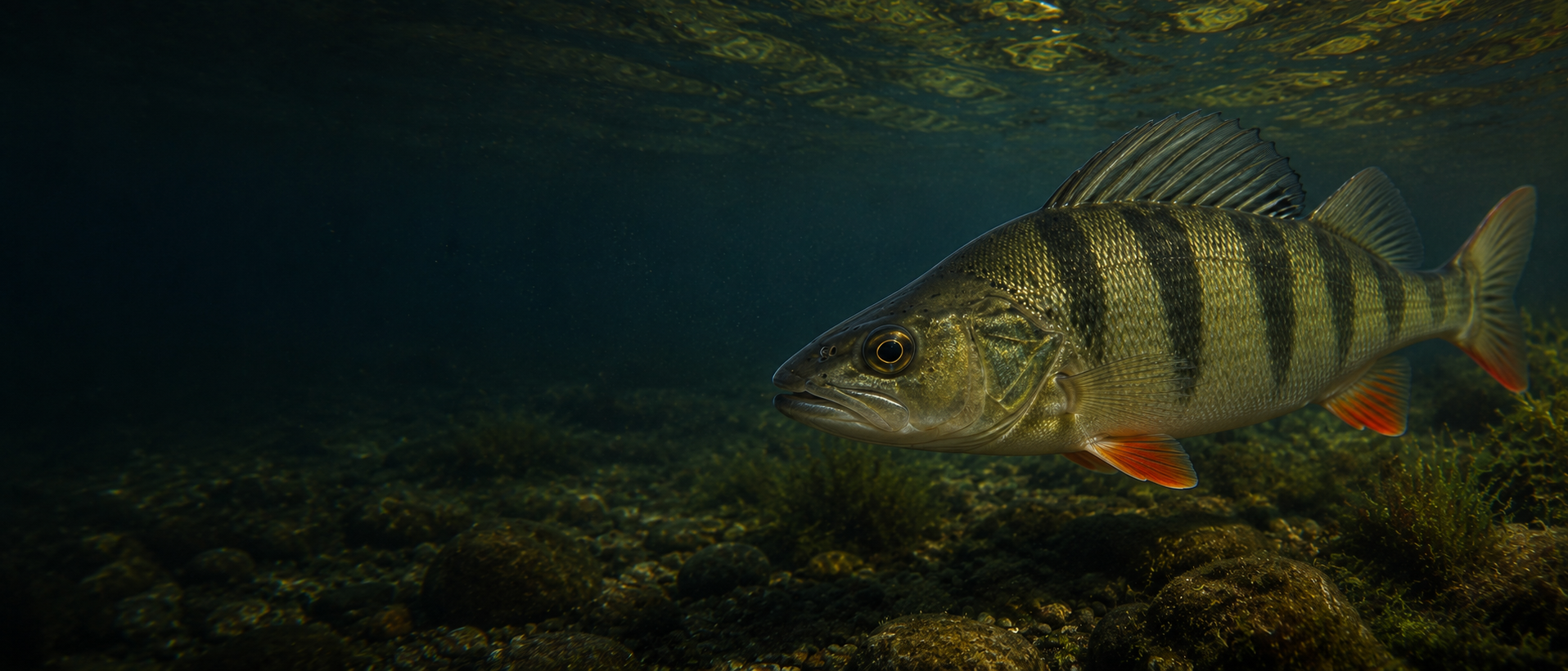
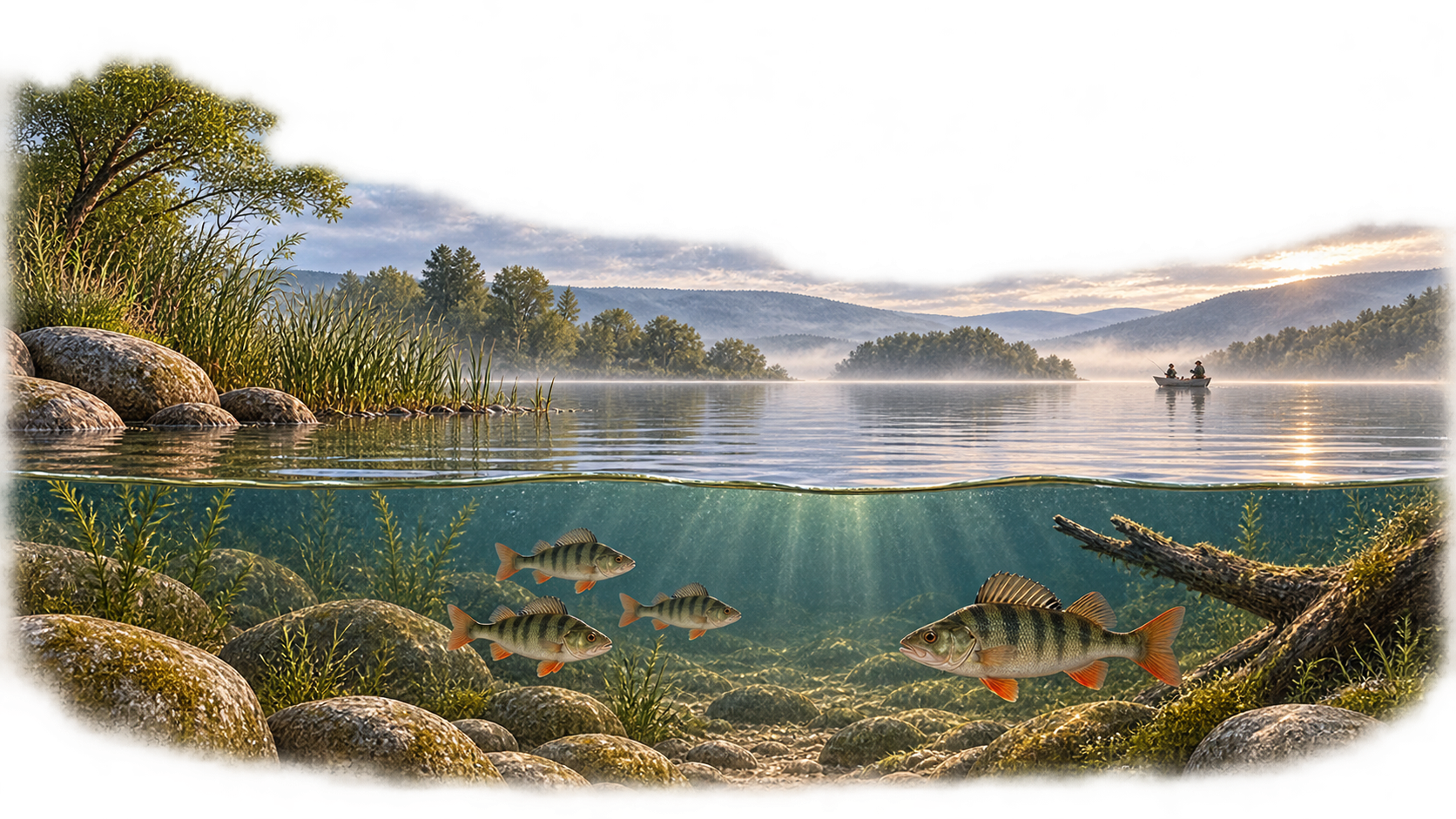
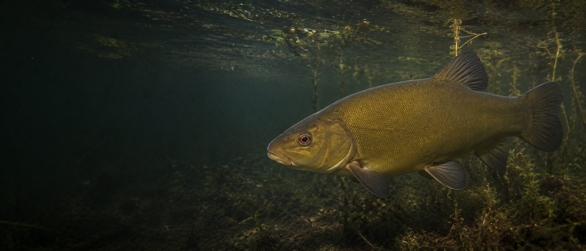
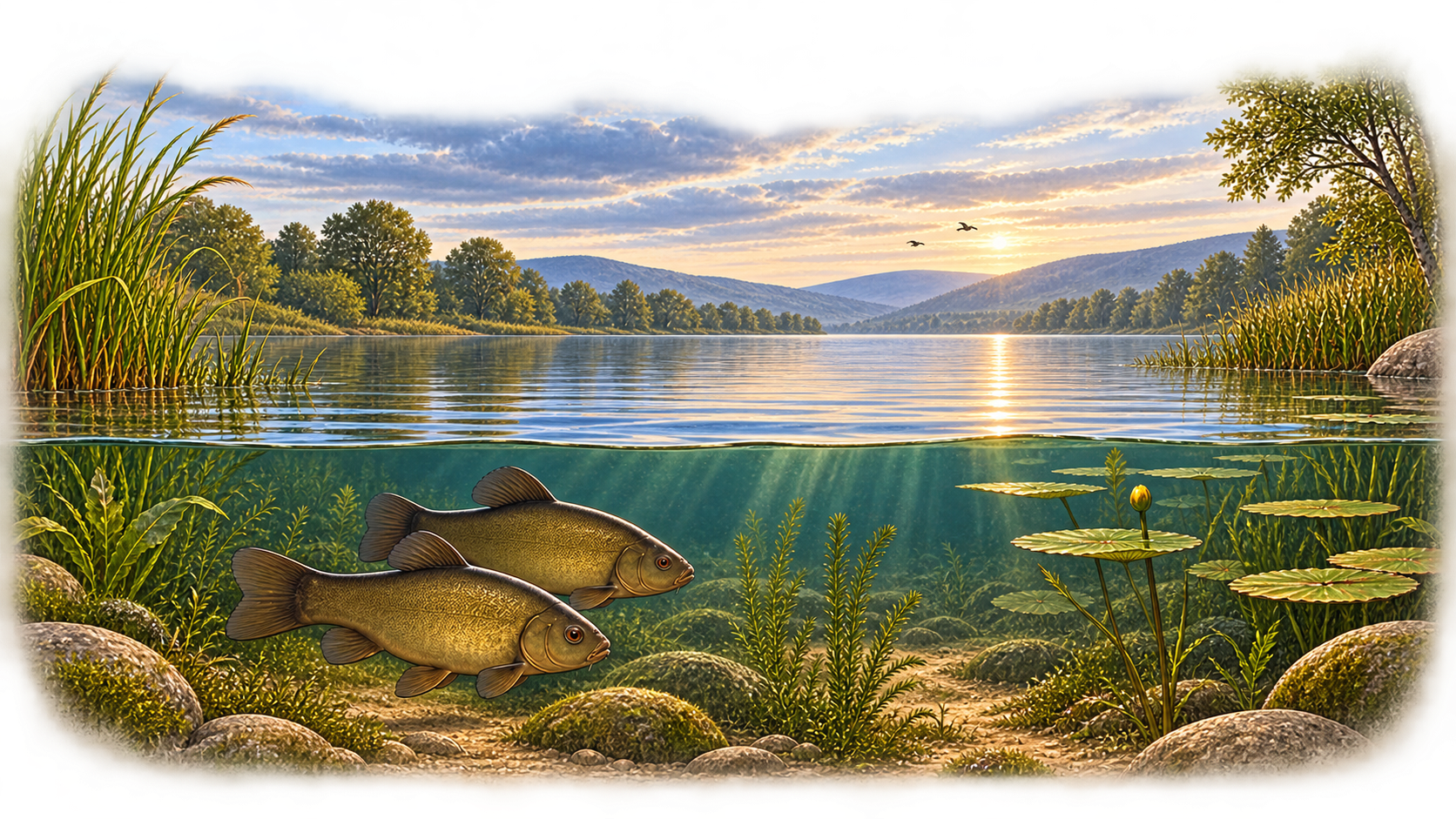
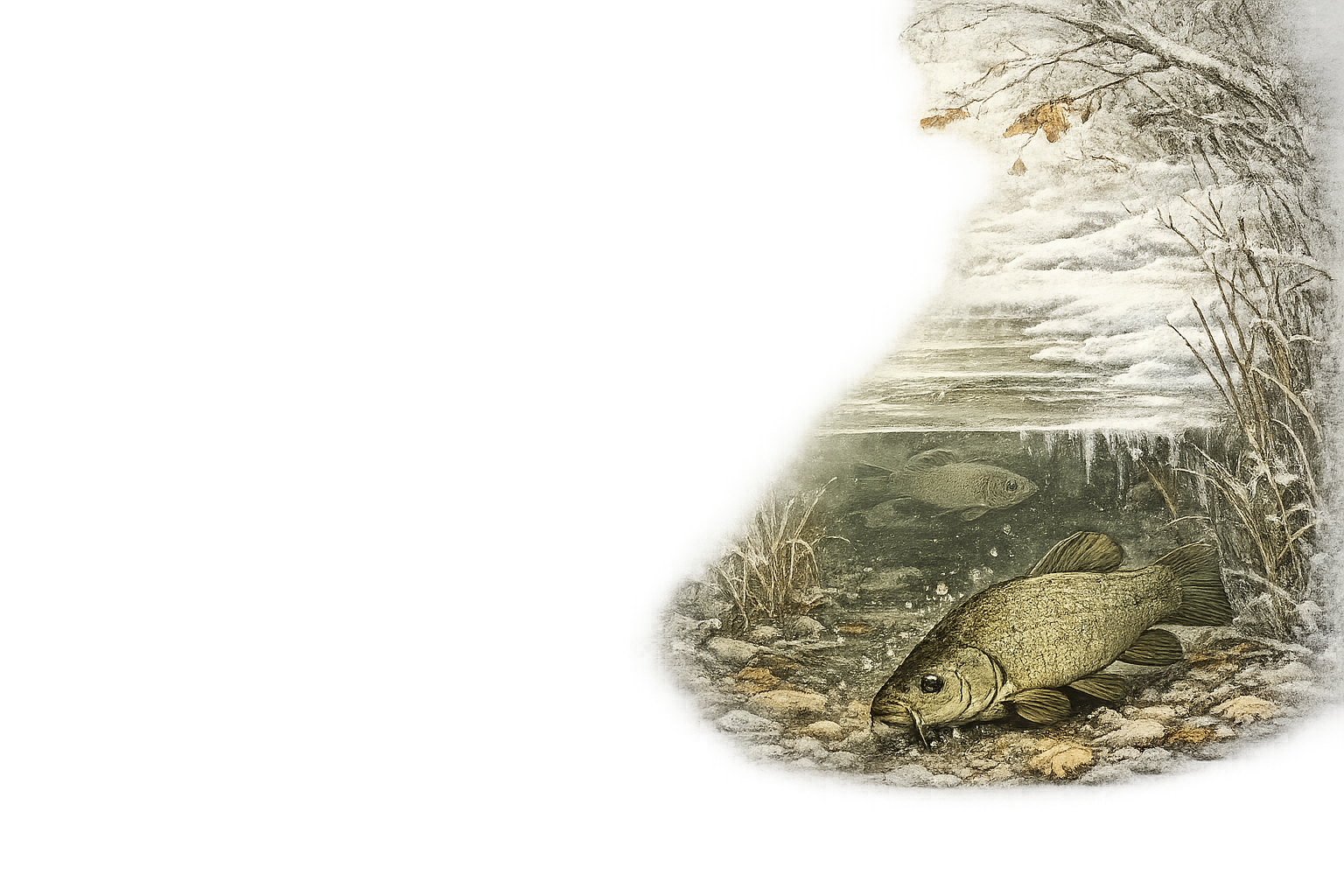
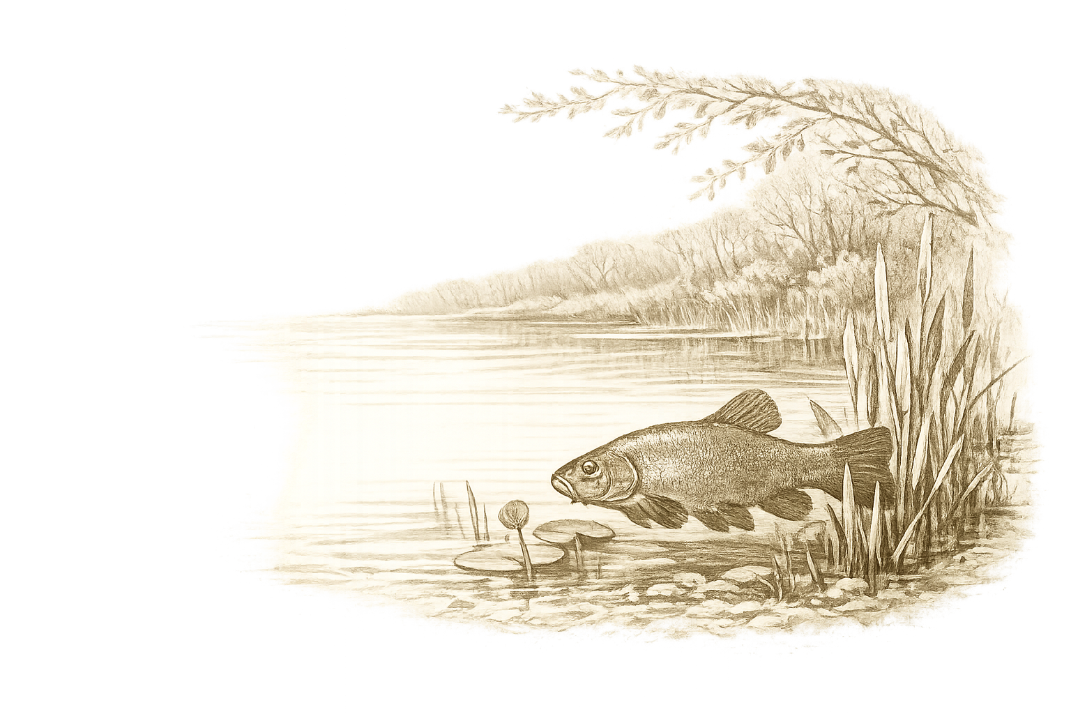
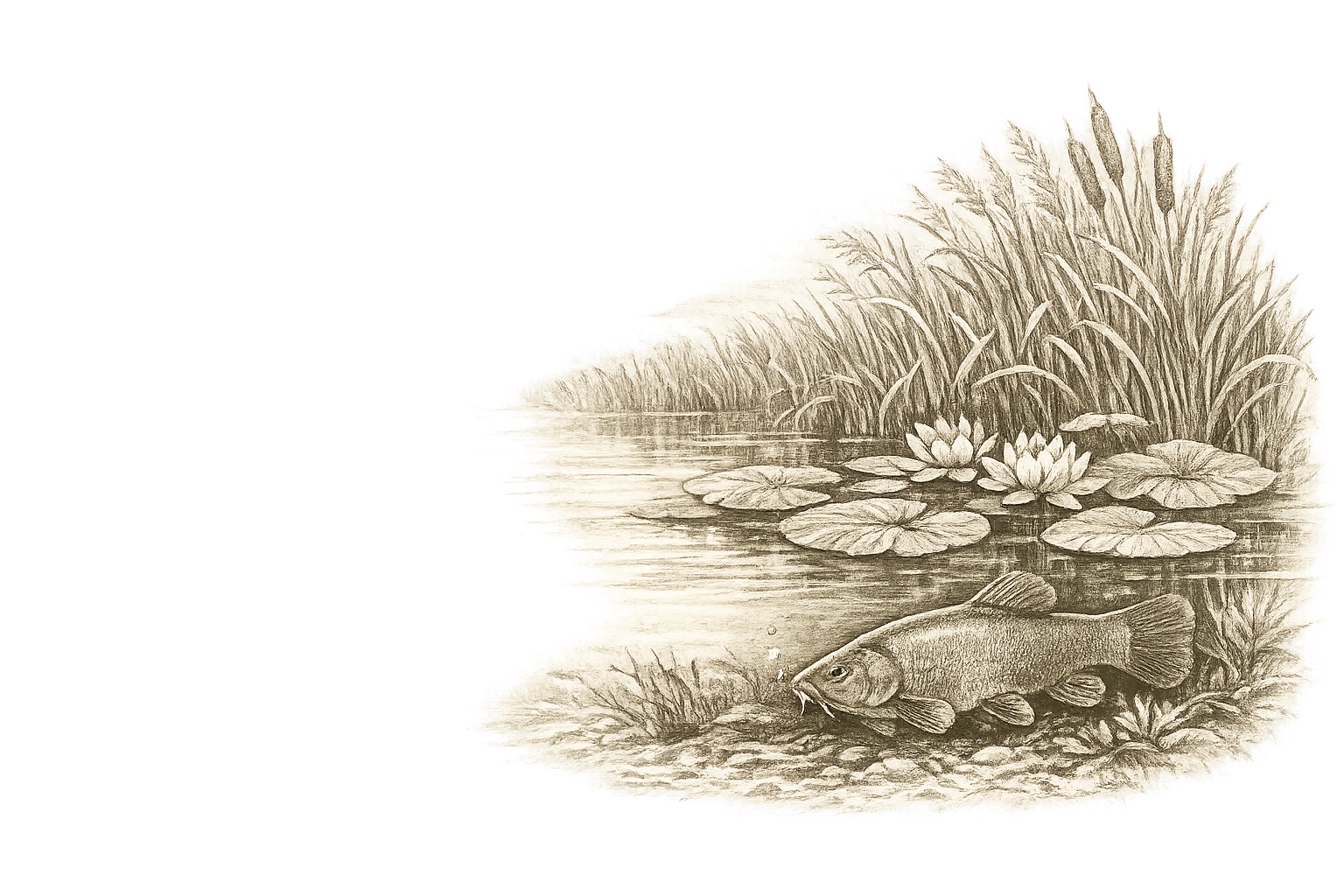
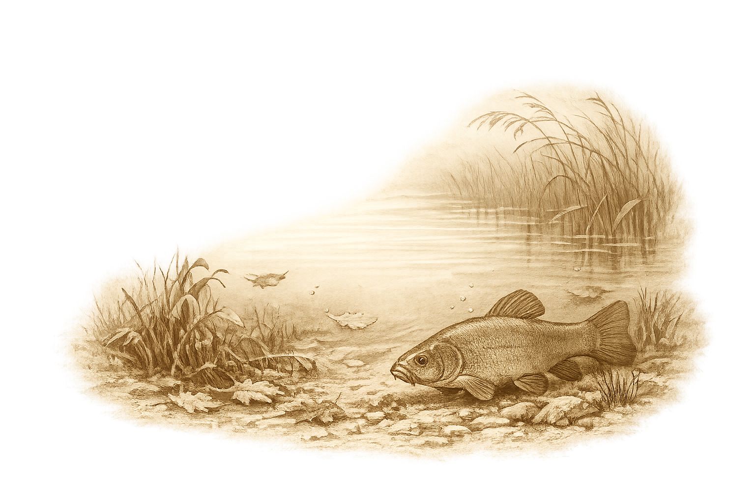
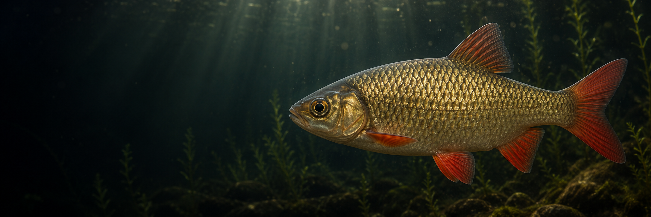
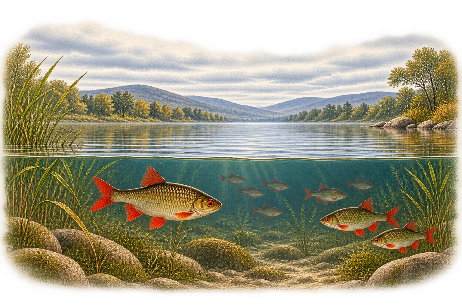
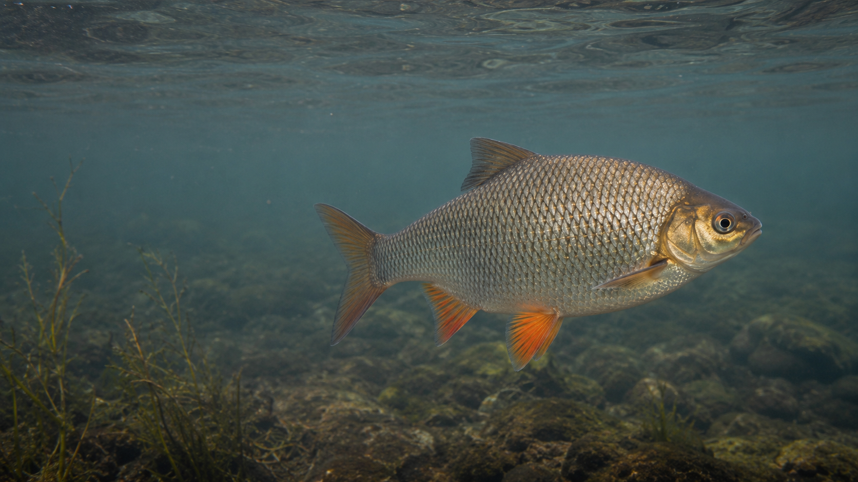
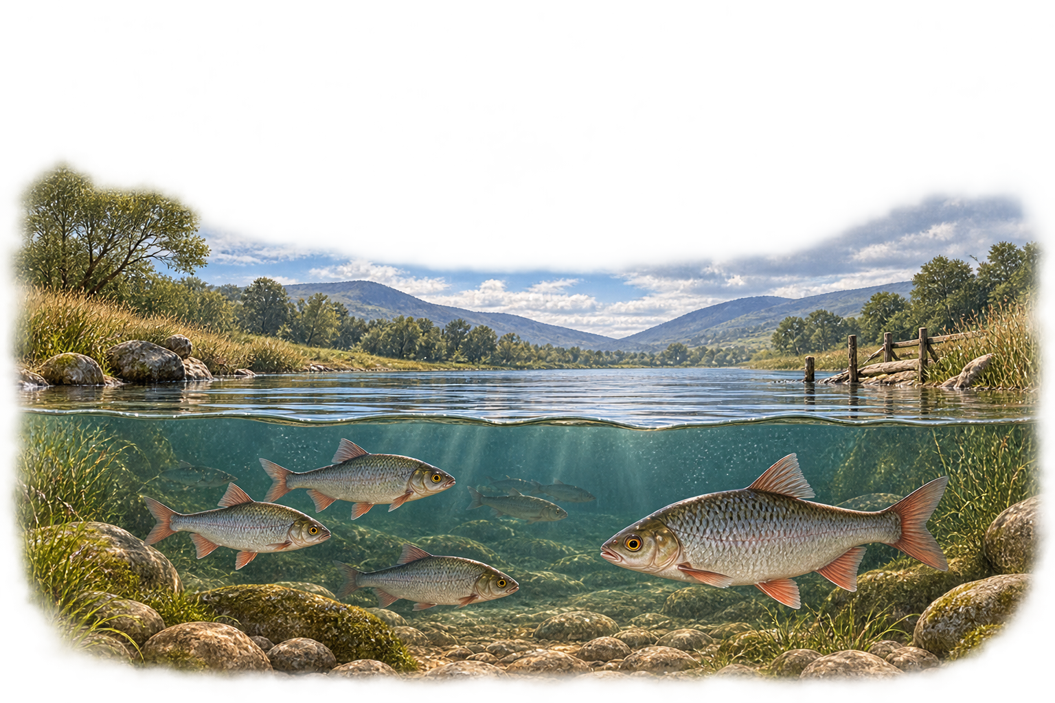
Pike, Perch, Roach, Bream, Tench, Rudd and naturally occurring hybrids create a different rhythm of fishing. Stillwaters, canals and slower river reaches may be read through weed, depth, shoal movement, margins and changing temperature. The contrast with game fishing is real, but the same habits of observation and care still lead the day.
04
From river to sea
Ireland’s marine catalogue will grow in a later phase. For now, the guide acknowledges the connection between freshwater, estuary and sea without inventing species pages or implying detail that has not yet been built.
05
Recognition is part of conservation
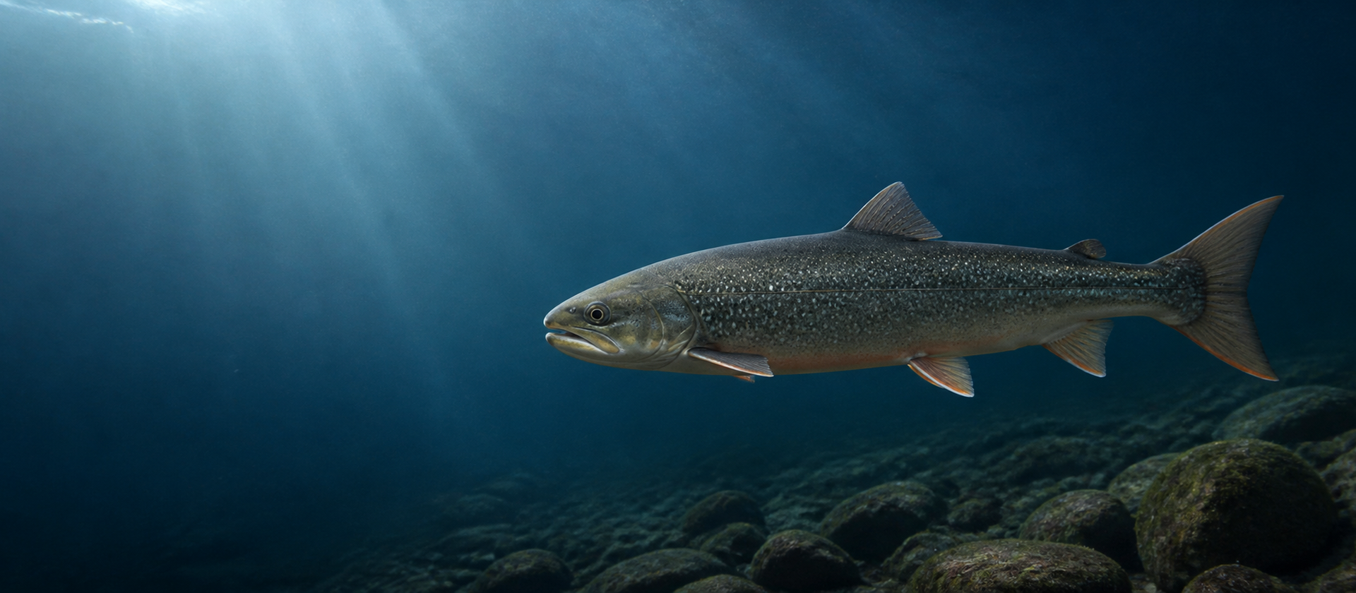
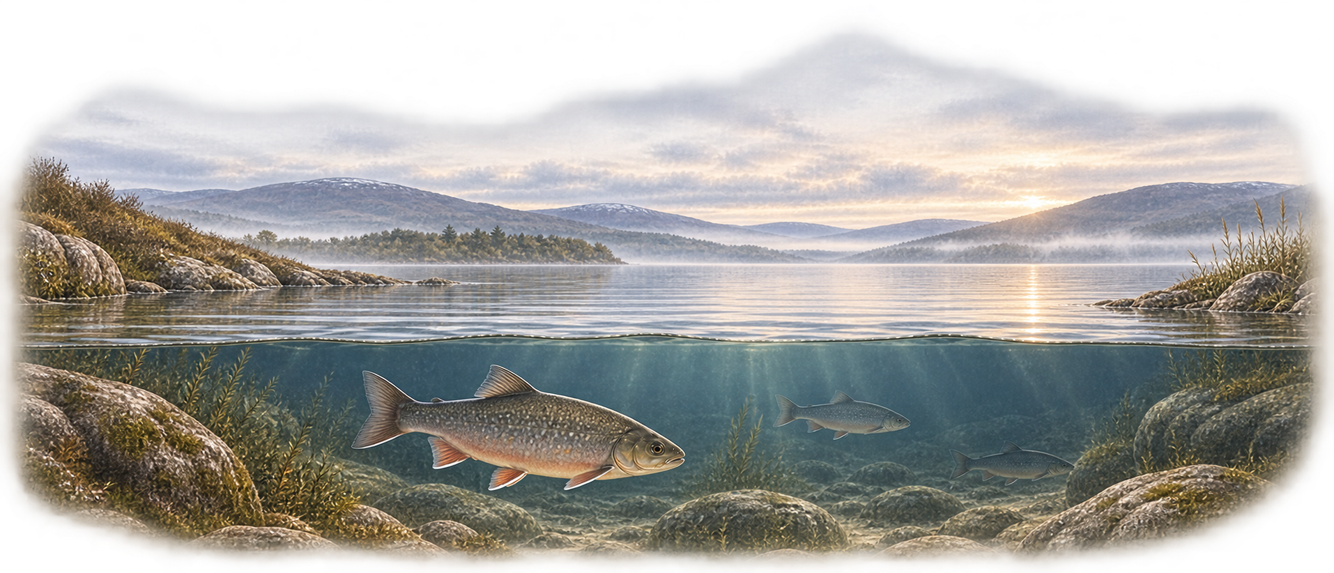
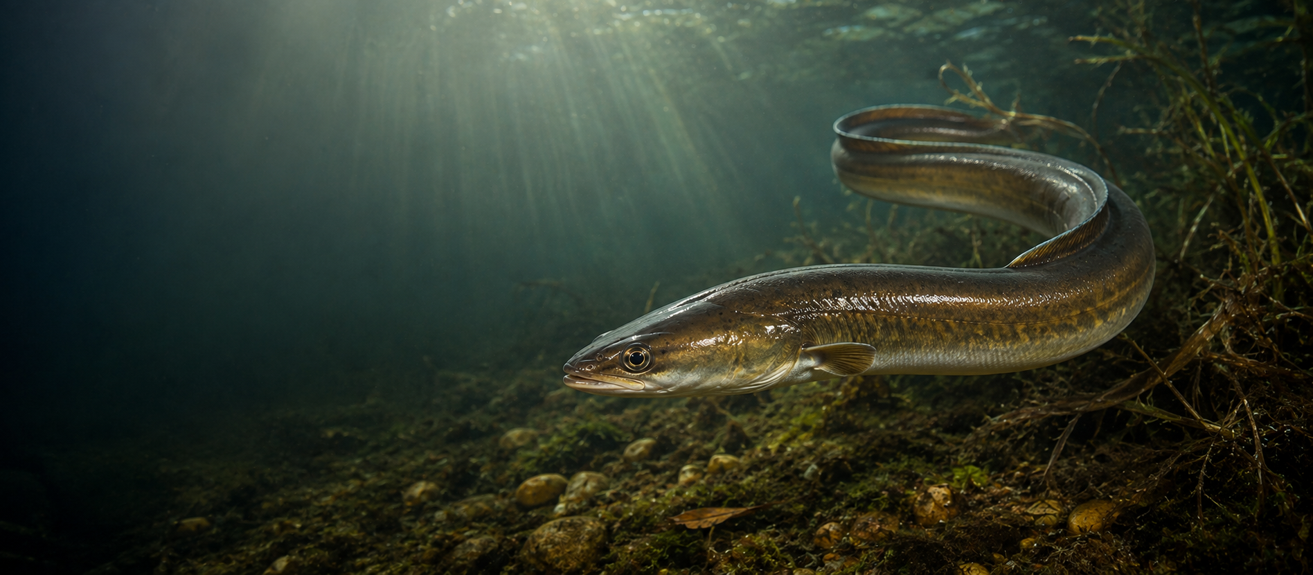
Char, Pollan and European Eel belong here because anglers may encounter or hear about vulnerable native fish. Stay & Fish presents them for recognition, context and protection—not as targets. Understanding their place in Irish waters helps keep conservation separate from destination or tactics language.
06
More than a list of fish
Species discovery is a way into the wider fishing day: the waters that support a fish, the approaches that suit it, the season around it, recent reports and conditions, and eventually a practical plan. Choose a species from the navigation, then follow those connections at your own pace.
Discover by water
Ireland, shaped by water
From broad western loughs to Shannon waters, limestone lakes, salmon rivers and quiet canals, the character of Irish fishing changes with landscape, season and flow.
Use the navigation on the left to explore Ireland’s lakes, rivers, canals and reservoirs.
01
An island defined by water
Irish fishing changes character over surprisingly short distances. A western lough exposed to Atlantic weather asks different questions from a Shannon lake, a limestone water, a spate river, a quiet canal or a managed reservoir. Each has its own scale, access and way of holding fish.
02
Waters with different moods
Wind can open one shore and quiet another. Rain can bring a river into order or push it beyond sensible fishing. Light, temperature and season alter where fish hold and how confidently they move. The name and type of water begin the plan; its mood on the day completes it.
03
Fishing across the country
Wild Brown Trout belong to lakes and rivers of very different character. Salmon and Sea Trout connect freshwater with the sea. Pike and Perch occupy structure and open water, while Roach, Bream, Tench and other coarse fish shape many stillwaters, canals and slower reaches. No single water tells the whole Irish story.
04
Reading the water
Begin with wind, shelter, flow and structure. Notice temperature, clarity, depth and the signs of seasonal movement. Good watercraft is rarely a fixed answer: it is the habit of seeing what has changed and letting that evidence guide where—and whether—to begin.
05
The journey
Choose the kind of water that suits the day, or begin with the part of Ireland you plan to visit. From there, explore what lives in each water, read the available reports and conditions, and carry the right context into a practical plan.
Begin with geography
Explore by region
Start with the part of Ireland you plan to visit, then compare the waters recorded there.
Discover by water
Lakes & Loughs
From broad western loughs and limestone lakes to quieter midland waters, Irish lake fishing can mean wild trout, pike, perch and mixed coarse fish, approached from bank or boat where access and local rules allow.
28 waters
Lake / Lough · West
Lough Corrib
Featured
Brown TroutPikePerchFerox TroutGillarooRudd
Full Stay & Fish profile available
Lake / Lough · West
Lough Mask
Featured
Brown TroutPikePerchFerox TroutGillaroo
Conservation species presentChar
Full Stay & Fish profile available
Lake / Lough · West
Lough Carra
Featured
Brown TroutPikePerch
Full Stay & Fish profile available
Lake / Lough · West
Lough Conn
Known
Brown TroutPikeSalmonGrilse
Full Stay & Fish profile not yet available
Lake / Lough · West
Lough Cullin
Known
Brown TroutPike
Full Stay & Fish profile not yet available
Lake / Lough · Northwest
Lough Arrow
Known
Brown TroutPerch
Full Stay & Fish profile not yet available
Lake / Lough · Midlands
Lough Sheelin
Featured
Brown TroutPikePerch
Full Stay & Fish profile available
Lake / Lough · Midlands
Lough Ree
Featured
Brown TroutPikePerchBreamRoachTenchRuddHybrids
Conservation species presentPollan
Full Stay & Fish profile available
Lake / Lough · Midlands
Lough Derg
Featured
Brown TroutPikePerchCroneenBreamRoachTenchRuddHybrids
Conservation species presentPollan · European Eel
Full Stay & Fish profile available
Lake / Lough · Northwest
Lough Melvin
Known
Brown TroutSonaghan
Full Stay & Fish profile not yet available
Lake / Lough · Midlands
Lough Owel
Featured
Brown TroutPikePerch
Full Stay & Fish profile available
Lake / Lough · Midlands
Lough Ennell
Featured
Brown TroutPikePerchRoachRuddHybrids
Full Stay & Fish profile available
Lake / Lough · Midlands
Lough Derravaragh
Featured
Brown TroutPikePerchHybridsBreamRoachTenchRudd
Full Stay & Fish profile available
Lake / Lough · Midlands
Lough Lene
Known
Brown Trout
Full Stay & Fish profile not yet available
Lake / Lough · Southwest
Lough Leane
Known
Brown TroutPerch
Conservation species presentEuropean Eel
Full Stay & Fish profile not yet available
Lake / Lough · Northeast
Lough Ramor
Known
Brown TroutPerchHybrids
Conservation species presentEuropean Eel
Full Stay & Fish profile not yet available
Lake / Lough · Northwest
Lough Gill
Known
Brown Trout
Full Stay & Fish profile not yet available
Lake / Lough · West
Lough Rea
Known
Brown Trout
Full Stay & Fish profile not yet available
Lake / Lough · Midlands
Lough Allen
Featured
Brown TroutPikePerchRoach
Conservation species presentPollan
Full Stay & Fish profile available
Lake / Lough · Northeast
Lough Oughter
Known
Perch
Full Stay & Fish profile not yet available
Lake / Lough · Northeast
Corglass Lough
Known
Perch
Full Stay & Fish profile not yet available
Lake / Lough · Northeast
Glasshouse Lake
Known
Perch
Full Stay & Fish profile not yet available
Lake / Lough · Northeast
Lough Gowna
Known
PerchBreamRoachHybrids
Full Stay & Fish profile not yet available
Lake / Lough · Southwest
Lough Currane
Known
SalmonSea TroutGrilse
Full Stay & Fish profile not yet available
Lake / Lough · Southwest
Lough Acoose
Known
No public target-species record
Conservation species presentChar
Full Stay & Fish profile not yet available
Lake / Lough · Southwest
Lough Allua
Known
RoachPerchHybridsBreamRuddPike
Conservation species presentEuropean Eel
Full Stay & Fish profile not yet available
Lake / Lough · West
Lough Cullaun
Known
PerchRuddPikeBrown TroutTench
Conservation species presentEuropean Eel
Full Stay & Fish profile not yet available
Lake / Lough · Midlands
Lough Boderg
Known
BreamRoachTenchRuddHybridsPerchPike
Full Stay & Fish profile not yet available
No listed waters match this search.
Discover by water
Rivers
Irish rivers change with rain, flow and season. They carry Salmon, Grilse, Sea Trout and Brown Trout, while slower reaches and connected systems can also support rich coarse fishing.
21 waters
River · Midlands
River Shannon
Known
PerchHybrids
Full Stay & Fish profile not yet available
River · Midlands
River Inny
Known
PerchHybridsBreamRoachTenchRuddPike
Full Stay & Fish profile not yet available
River · Northwest
River Moy
Known
SalmonSea TroutGrilse
Full Stay & Fish profile not yet available
River · Northeast
River Blackwater — Lough Neagh system
Known
Dollaghan
Full Stay & Fish profile not yet available
River · East
River Boyne
Known
SalmonSea TroutGrilseBrown Trout
Full Stay & Fish profile not yet available
River · Southwest
River Lee
Known
SalmonSea TroutGrilse
Full Stay & Fish profile not yet available
River · Southeast
River Suir
Known
SalmonSea TroutGrilse
Full Stay & Fish profile not yet available
River · West
River Erriff
Known
SalmonSea TroutGrilse
Full Stay & Fish profile not yet available
River · West
Bundorragha River
Known
SalmonSea TroutGrilse
Full Stay & Fish profile not yet available
River · Southeast
River Slaney
Known
SalmonSea TroutGrilse
Full Stay & Fish profile not yet available
River · Northwest
River Drowes
Known
SalmonGrilse
Full Stay & Fish profile not yet available
River · Southwest
River Laune
Known
SalmonSea Trout
Full Stay & Fish profile not yet available
River · Southwest
River Bandon
Known
SalmonSea Trout
Full Stay & Fish profile not yet available
River · Southwest
River Ilen
Known
SalmonSea TroutGrilse
Full Stay & Fish profile not yet available
River · South
Munster Blackwater
Known
SalmonSea TroutGrilse
Full Stay & Fish profile not yet available
River · Northwest
River Finn
Known
SalmonGrilse
Full Stay & Fish profile not yet available
River · Northwest
River Owenea
Known
SalmonSea TroutGrilse
Full Stay & Fish profile not yet available
River · Southwest
River Roughty
Known
SalmonSea TroutGrilse
Full Stay & Fish profile not yet available
River · Southeast
River Nore
Known
SalmonSea TroutGrilseBrown Trout
Full Stay & Fish profile not yet available
River · Southwest
River Blackwater and Lough Brin system
Known
SalmonSea TroutGrilse
Full Stay & Fish profile not yet available
River · West
River Corrib
Known
SalmonGrilse
Full Stay & Fish profile not yet available
No listed waters match this search.
Discover by water
Canals
Canals offer slower, more intimate fishing through rural and urban landscapes. Their towpaths, margins and steady water can create quiet opportunities for coarse fish where current access permits.
1 waters
Canal · Midlands
Royal Canal
Known
PerchBreamRoachTenchRuddHybridsPike
Full Stay & Fish profile not yet available
No listed waters match this search.
Discover by water
Reservoirs
Ireland’s currently listed reservoir fishing is limited but distinctive. These managed waters can combine open-water scale with practical access and fishery rules that deserve checking before a visit.
1 waters
Reservoir · East
Blessington Lakes
Featured
Brown TroutPikePerchRoach
Full Stay & Fish profile available
No listed waters match this search.
Discover by water
Midlands waters
Explore the public fishing waters currently listed for this region.
12 waters
Lake / Lough · Midlands
Lough Sheelin
Featured
Brown TroutPikePerch
Full Stay & Fish profile available
Lake / Lough · Midlands
Lough Ree
Featured
Brown TroutPikePerchBreamRoachTenchRuddHybrids
Conservation species presentPollan
Full Stay & Fish profile available
Lake / Lough · Midlands
Lough Derg
Featured
Brown TroutPikePerchCroneenBreamRoachTenchRuddHybrids
Conservation species presentPollan · European Eel
Full Stay & Fish profile available
Lake / Lough · Midlands
Lough Owel
Featured
Brown TroutPikePerch
Full Stay & Fish profile available
Lake / Lough · Midlands
Lough Ennell
Featured
Brown TroutPikePerchRoachRuddHybrids
Full Stay & Fish profile available
Lake / Lough · Midlands
Lough Derravaragh
Featured
Brown TroutPikePerchHybridsBreamRoachTenchRudd
Full Stay & Fish profile available
Lake / Lough · Midlands
Lough Lene
Known
Brown Trout
Full Stay & Fish profile not yet available
River · Midlands
River Shannon
Known
PerchHybrids
Full Stay & Fish profile not yet available
Lake / Lough · Midlands
Lough Allen
Featured
Brown TroutPikePerchRoach
Conservation species presentPollan
Full Stay & Fish profile available
River · Midlands
River Inny
Known
PerchHybridsBreamRoachTenchRuddPike
Full Stay & Fish profile not yet available
Canal · Midlands
Royal Canal
Known
PerchBreamRoachTenchRuddHybridsPike
Full Stay & Fish profile not yet available
Lake / Lough · Midlands
Lough Boderg
Known
BreamRoachTenchRuddHybridsPerchPike
Full Stay & Fish profile not yet available
No listed waters match this filter.
Discover by water
West waters
Explore the public fishing waters currently listed for this region.
10 waters
Lake / Lough · West
Lough Corrib
Featured
Brown TroutPikePerchFerox TroutGillarooRudd
Full Stay & Fish profile available
Lake / Lough · West
Lough Mask
Featured
Brown TroutPikePerchFerox TroutGillaroo
Conservation species presentChar
Full Stay & Fish profile available
Lake / Lough · West
Lough Carra
Featured
Brown TroutPikePerch
Full Stay & Fish profile available
Lake / Lough · West
Lough Conn
Known
Brown TroutPikeSalmonGrilse
Full Stay & Fish profile not yet available
Lake / Lough · West
Lough Cullin
Known
Brown TroutPike
Full Stay & Fish profile not yet available
Lake / Lough · West
Lough Rea
Known
Brown Trout
Full Stay & Fish profile not yet available
Lake / Lough · West
Lough Cullaun
Known
PerchRuddPikeBrown TroutTench
Conservation species presentEuropean Eel
Full Stay & Fish profile not yet available
River · West
River Erriff
Known
SalmonSea TroutGrilse
Full Stay & Fish profile not yet available
River · West
Bundorragha River
Known
SalmonSea TroutGrilse
Full Stay & Fish profile not yet available
River · West
River Corrib
Known
SalmonGrilse
Full Stay & Fish profile not yet available
No listed waters match this filter.
Discover by water
Northwest waters
Explore the public fishing waters currently listed for this region.
7 waters
Lake / Lough · Northwest
Lough Arrow
Known
Brown TroutPerch
Full Stay & Fish profile not yet available
Lake / Lough · Northwest
Lough Melvin
Known
Brown TroutSonaghan
Full Stay & Fish profile not yet available
Lake / Lough · Northwest
Lough Gill
Known
Brown Trout
Full Stay & Fish profile not yet available
River · Northwest
River Moy
Known
SalmonSea TroutGrilse
Full Stay & Fish profile not yet available
River · Northwest
River Drowes
Known
SalmonGrilse
Full Stay & Fish profile not yet available
River · Northwest
River Finn
Known
SalmonGrilse
Full Stay & Fish profile not yet available
River · Northwest
River Owenea
Known
SalmonSea TroutGrilse
Full Stay & Fish profile not yet available
No listed waters match this filter.
Discover by water
Northeast waters
Explore the public fishing waters currently listed for this region.
6 waters
Lake / Lough · Northeast
Lough Ramor
Known
Brown TroutPerchHybrids
Conservation species presentEuropean Eel
Full Stay & Fish profile not yet available
Lake / Lough · Northeast
Lough Oughter
Known
Perch
Full Stay & Fish profile not yet available
Lake / Lough · Northeast
Corglass Lough
Known
Perch
Full Stay & Fish profile not yet available
Lake / Lough · Northeast
Glasshouse Lake
Known
Perch
Full Stay & Fish profile not yet available
Lake / Lough · Northeast
Lough Gowna
Known
PerchBreamRoachHybrids
Full Stay & Fish profile not yet available
River · Northeast
River Blackwater — Lough Neagh system
Known
Dollaghan
Full Stay & Fish profile not yet available
No listed waters match this filter.
Discover by water
East waters
Explore the public fishing waters currently listed for this region.
2 waters
Reservoir · East
Blessington Lakes
Featured
Brown TroutPikePerchRoach
Full Stay & Fish profile available
River · East
River Boyne
Known
SalmonSea TroutGrilseBrown Trout
Full Stay & Fish profile not yet available
No listed waters match this filter.
Discover by water
Southeast waters
Explore the public fishing waters currently listed for this region.
3 waters
River · Southeast
River Suir
Known
SalmonSea TroutGrilse
Full Stay & Fish profile not yet available
River · Southeast
River Slaney
Known
SalmonSea TroutGrilse
Full Stay & Fish profile not yet available
River · Southeast
River Nore
Known
SalmonSea TroutGrilseBrown Trout
Full Stay & Fish profile not yet available
No listed waters match this filter.
Discover by water
South waters
Explore the public fishing waters currently listed for this region.
1 waters
River · South
Munster Blackwater
Known
SalmonSea TroutGrilse
Full Stay & Fish profile not yet available
No listed waters match this filter.
Discover by water
Southwest waters
Explore the public fishing waters currently listed for this region.
10 waters
Lake / Lough · Southwest
Lough Leane
Known
Brown TroutPerch
Conservation species presentEuropean Eel
Full Stay & Fish profile not yet available
Lake / Lough · Southwest
Lough Currane
Known
SalmonSea TroutGrilse
Full Stay & Fish profile not yet available
Lake / Lough · Southwest
Lough Acoose
Known
No public target-species record
Conservation species presentChar
Full Stay & Fish profile not yet available
Lake / Lough · Southwest
Lough Allua
Known
RoachPerchHybridsBreamRuddPike
Conservation species presentEuropean Eel
Full Stay & Fish profile not yet available
River · Southwest
River Lee
Known
SalmonSea TroutGrilse
Full Stay & Fish profile not yet available
River · Southwest
River Laune
Known
SalmonSea Trout
Full Stay & Fish profile not yet available
River · Southwest
River Bandon
Known
SalmonSea Trout
Full Stay & Fish profile not yet available
River · Southwest
River Ilen
Known
SalmonSea TroutGrilse
Full Stay & Fish profile not yet available
River · Southwest
River Roughty
Known
SalmonSea TroutGrilse
Full Stay & Fish profile not yet available
River · Southwest
River Blackwater and Lough Brin system
Known
SalmonSea TroutGrilse
Full Stay & Fish profile not yet available
No listed waters match this filter.
Lake / Lough · West
Lough Corrib
A full Stay & Fish water profile is available.
Featured water
Species context
Lake / Lough · West
Lough Mask
A full Stay & Fish water profile is available.
Featured water
Species context
Conservation species presentChar
Lake / Lough · West
Lough Carra
A full Stay & Fish water profile is available.
Featured water
Species context
Lake / Lough · West
Lough Conn
Supported species records are available for this water, but a full Stay & Fish profile is not yet available.
Known water
Species context
Lake / Lough · West
Lough Cullin
Supported species records are available for this water, but a full Stay & Fish profile is not yet available.
Known water
Species context
Lake / Lough · Northwest
Lough Arrow
Supported species records are available for this water, but a full Stay & Fish profile is not yet available.
Known water
Species context
Lake / Lough · Midlands
Lough Sheelin
A full Stay & Fish water profile is available.
Featured water
Species context
Lake / Lough · Midlands
Lough Ree
A full Stay & Fish water profile is available.
Featured water
Species context
Conservation species presentPollan
Lake / Lough · Midlands
Lough Derg
A full Stay & Fish water profile is available.
Featured water
Species context
Conservation species presentPollan · European Eel
Lake / Lough · Northwest
Lough Melvin
Supported species records are available for this water, but a full Stay & Fish profile is not yet available.
Known water
Species context
Lake / Lough · Midlands
Lough Owel
A full Stay & Fish water profile is available.
Featured water
Species context
Lake / Lough · Midlands
Lough Ennell
A full Stay & Fish water profile is available.
Featured water
Species context
Lake / Lough · Midlands
Lough Derravaragh
A full Stay & Fish water profile is available.
Featured water
Species context
Lake / Lough · Midlands
Lough Lene
Supported species records are available for this water, but a full Stay & Fish profile is not yet available.
Known water
Species context
Fishing is locally managed and anglers should check current club permits, rules and boat arrangements before fishing.
Lake / Lough · Southwest
Lough Leane
Supported species records are available for this water, but a full Stay & Fish profile is not yet available.
Known water
Species context
Conservation species presentEuropean Eel
Lake / Lough · Northeast
Lough Ramor
Supported species records are available for this water, but a full Stay & Fish profile is not yet available.
Known water
Species context
Conservation species presentEuropean Eel
Lake / Lough · Northwest
Lough Gill
Supported species records are available for this water, but a full Stay & Fish profile is not yet available.
Known water
Species context
Public access exists at recognised locations, but anglers must check current local access and fishery rules.
Lake / Lough · West
Lough Rea
Supported species records are available for this water, but a full Stay & Fish profile is not yet available.
Known water
Species context
Fishing is managed by Loughrea Anglers Association. Current membership, permit and rule requirements must be checked before fishing.
Reservoir · East
Blessington Lakes
A full Stay & Fish water profile is available.
Featured water
Species context
An ESB angling permit is required. Anglers must check current rules, permitted methods, seasons and access before fishing.
River · Midlands
River Shannon
Supported species records are available for this water, but a full Stay & Fish profile is not yet available.
Known water
Species context
The shared record represents the river system, not a single access point. Check the exact bank, navigation and local fishery arrangements before fishing.
Lake / Lough · Midlands
Lough Allen
A full Stay & Fish water profile is available.
Featured water
Species context
Conservation species presentPollan
Mixed Shannon fishery. Access varies by location and may cross private land.
River · Midlands
River Inny
Supported species records are available for this water, but a full Stay & Fish profile is not yet available.
Known water
Species context
IFI identifies established angling stretches, but permissions and access vary. Check the current local permit and access position before fishing.
Canal · Midlands
Royal Canal
Supported species records are available for this water, but a full Stay & Fish profile is not yet available.
Known water
Species context
Canal-bank access is available at recognised locations. Check local parking, towpath and angling rules before fishing.
Lake / Lough · Northeast
Lough Oughter
Supported species records are available for this water, but a full Stay & Fish profile is not yet available.
Known water
Species context
IFI documents bank and boat fishing at recognised parts of the complex. Access and launch arrangements vary by location.
Lake / Lough · Northeast
Corglass Lough
Supported species records are available for this water, but a full Stay & Fish profile is not yet available.
Known water
Species context
IFI describes access over a stile at the recognised fishery. Confirm the current route, parking and landowner arrangements before travelling.
Lake / Lough · Northeast
Glasshouse Lake
Supported species records are available for this water, but a full Stay & Fish profile is not yet available.
Known water
Species context
The official survey records bank fishing and established swims, but current access and parking should be checked locally.
Lake / Lough · Northeast
Lough Gowna
Supported species records are available for this water, but a full Stay & Fish profile is not yet available.
Known water
Species context
Recognised competition and coarse-angling access exists around the lake, but individual banks, parking and boat arrangements vary.
River · Northwest
River Moy
Supported species records are available for this water, but a full Stay & Fish profile is not yet available.
Known water
Species context
Salmon and Sea Trout fishing requires the applicable State licence and fishery permission. Check current regulations, conservation status and local access before fishing.
Lake / Lough · Southwest
Lough Currane
Supported species records are available for this water, but a full Stay & Fish profile is not yet available.
Known water
Species context
Check the current State licence, fishery permission, catch-and-release requirements, methods and boat arrangements before fishing.
River · Northeast
River Blackwater — Lough Neagh system
Supported species records are available for this water, but a full Stay & Fish profile is not yet available.
Known water
Species context
DAERA game rod licence and fishery permit requirements apply. Check current season, methods, bag limits and access before fishing.
Lake / Lough · Southwest
Lough Acoose
Supported species records are available for this water, but a full Stay & Fish profile is not yet available.
Known water
Species context
No public target-species record
Conservation species presentChar
Shown at lake-name precision for conservation awareness. No targeting or access guidance is provided for Arctic Char.
Lake / Lough · Southwest
Lough Allua
Supported species records are available for this water, but a full Stay & Fish profile is not yet available.
Known water
Species context
Conservation species presentEuropean Eel
IFI stock surveys confirm a mixed fish community. Check current shore access, permissions and local rules before fishing.
Lake / Lough · West
Lough Cullaun
Supported species records are available for this water, but a full Stay & Fish profile is not yet available.
Known water
Species context
Conservation species presentEuropean Eel
IFI notes restricted shore access and that a boat may be needed to fish much of the lake. Confirm current access and local rules.
Lake / Lough · Midlands
Lough Boderg
Supported species records are available for this water, but a full Stay & Fish profile is not yet available.
Known water
Species context
This is a broad lake-level record on the Upper Shannon. Check the exact bank, boat and permission arrangements before fishing.
River · East
River Boyne
Supported species records are available for this water, but a full Stay & Fish profile is not yet available.
Known water
Species context
A State licence and fishery permission are required. Check the current river status, catch-and-release rules, permitted methods and local access.
River · Southwest
River Lee
Supported species records are available for this water, but a full Stay & Fish profile is not yet available.
Known water
Species context
A State licence and fishery permission are required. Check current salmon and sea-trout regulations, local restrictions and access before fishing.
River · Southeast
River Suir
Supported species records are available for this water, but a full Stay & Fish profile is not yet available.
Known water
Species context
A State licence and fishery permission are required. Check current catch-and-release status, permitted methods and local access before fishing.
River · West
River Erriff
Supported species records are available for this water, but a full Stay & Fish profile is not yet available.
Known water
Species context
The fishery is beat-managed. Check the current licence, booking, catch-and-release rules, methods and access before fishing.
River · West
Bundorragha River
Supported species records are available for this water, but a full Stay & Fish profile is not yet available.
Known water
Species context
Part of the private Delphi fishery. Check current licence, booking, fishery rules and conservation requirements.
River · Southeast
River Slaney
Supported species records are available for this water, but a full Stay & Fish profile is not yet available.
Known water
Species context
Current closures, catch-and-release rules and method restrictions can be substantial. Check the live statutory position and fishery permission before fishing.
River · Northwest
River Drowes
Supported species records are available for this water, but a full Stay & Fish profile is not yet available.
Known water
Species context
A State licence and fishery permission are required. Check current regulations, methods and access arrangements.
River · Southwest
River Laune
Supported species records are available for this water, but a full Stay & Fish profile is not yet available.
Known water
Species context
Fishing is controlled by associations, IFI beats and private owners. Check licence, permit, methods and current regulations.
River · Southwest
River Bandon
Supported species records are available for this water, but a full Stay & Fish profile is not yet available.
Known water
Species context
A State licence and fishery permission are required. Some stretches are fly-only; check current rules and access.
River · Southwest
River Ilen
Supported species records are available for this water, but a full Stay & Fish profile is not yet available.
Known water
Species context
A State licence and club permit are required. Check current conservation status, methods and visitor access.
River · South
Munster Blackwater
Supported species records are available for this water, but a full Stay & Fish profile is not yet available.
Known water
Species context
The river contains numerous club and private fisheries. Check the exact fishery, licence, permit and current catch-and-release rules.
River · Northwest
River Finn
Supported species records are available for this water, but a full Stay & Fish profile is not yet available.
Known water
Species context
A Loughs Agency rod licence and fishery permit are required. Check current cross-border rules, methods and access.
River · Northwest
River Owenea
Supported species records are available for this water, but a full Stay & Fish profile is not yet available.
Known water
Species context
A State licence and fishery permit are required. Check current brown-tag, conservation and method rules before fishing.
River · Southwest
River Roughty
Supported species records are available for this water, but a full Stay & Fish profile is not yet available.
Known water
Species context
A State licence and local permit are required. Check current brown-tag, conservation and access rules.
River · Southeast
River Nore
Supported species records are available for this water, but a full Stay & Fish profile is not yet available.
Known water
Species context
Most fishing is club or privately controlled. Check current catch-and-release requirements, permit, methods and access.
River · Southwest
River Blackwater and Lough Brin system
Supported species records are available for this water, but a full Stay & Fish profile is not yet available.
Known water
Species context
IFI manages the river fishery and boat access on Lough Brin is separately limited. Check licence, permit, booking and current rules.
River · West
River Corrib
Supported species records are available for this water, but a full Stay & Fish profile is not yet available.
Known water
Species context
The Galway fishery is controlled and booking is required. Check current licence, fishery status, methods and conservation rules.
Discover by method
Different ways to read the water
A method is more than tackle. It is a way of responding to a species, a water, a season and the conditions in front of you.
Use the navigation on the left to explore the different ways Ireland’s waters can be fished.
01
More than one way to fish
Method grows from context. Species, water type, season, weather, local tradition and personal preference all shape the opening choice. The same angler may drift a lough, work a river fly, search structure with a lure or settle into a carefully prepared coarse swim.
02
Fly fishing
Irish fly fishing connects Brown Trout, Salmon and Sea Trout with river and lough traditions. Presentation matters, but so does reading wind, flow, depth, surface life and the rules of the selected fishery. The method begins with observation rather than a fixed pattern.
03
Lure fishing
Lures can search water actively for Pike and Perch, with limited game-fish contexts where regulations permit. Depth, cover, pace and safe bank or boat access determine how the water can be covered responsibly.
04
Bait and coarse fishing
Float, feeder and ledger approaches suit many coarse-fishing situations across stillwaters, canals and slower rivers. Natural bait, accurate feeding and patient presentation all depend on depth, flow, fishery rules and the way fish are using the swim.
05
Trolling and boat methods
On larger loughs, mobility and boat control can become part of the method. Trolling appears only in specialist guidance currently represented in the catalogue; it should never be assumed appropriate on every open water.
06
Method follows water
The useful question is not which method wins, but which method fits the species, water, season and present conditions. Explore a broad approach here, then carry that context into species tactics, a selected water and a practical plan.
Discover by method
Fly Fishing
Explore species and waters connected with fly-fishing traditions, from lough drifts and rising trout to permitted river approaches for migratory fish.
Current season: Summer
What can I fish for?
Region
Water type
41 matching waters
Waters supporting species commonly fished using this method
Lake / Lough · West
Lough Corrib
Featured
Supports species commonly fished using fly fishing.
Lake / Lough · West
Lough Mask
Featured
Supports species commonly fished using fly fishing.
Conservation species presentChar
Lake / Lough · West
Lough Carra
Featured
Supports species commonly fished using fly fishing.
Lake / Lough · West
Lough Conn
Known
Supports species commonly fished using fly fishing.
Lake / Lough · West
Lough Cullin
Known
Supports species commonly fished using fly fishing.
Lake / Lough · Northwest
Lough Arrow
Known
Supports species commonly fished using fly fishing.
Lake / Lough · Midlands
Lough Sheelin
Featured
Supports species commonly fished using fly fishing.
Lake / Lough · Midlands
Lough Ree
Featured
Supports species commonly fished using fly fishing.
Conservation species presentPollan
Lake / Lough · Midlands
Lough Derg
Featured
Supports species commonly fished using fly fishing.
Conservation species presentPollan · European Eel
Lake / Lough · Northwest
Lough Melvin
Known
Supports species commonly fished using fly fishing.
Lake / Lough · Midlands
Lough Owel
Featured
Supports species commonly fished using fly fishing.
Lake / Lough · Midlands
Lough Ennell
Featured
Supports species commonly fished using fly fishing.
Lake / Lough · Midlands
Lough Derravaragh
Featured
Supports species commonly fished using fly fishing.
Lake / Lough · Midlands
Lough Lene
Known
Supports species commonly fished using fly fishing.
Lake / Lough · Southwest
Lough Leane
Known
Supports species commonly fished using fly fishing.
Conservation species presentEuropean Eel
Lake / Lough · Northeast
Lough Ramor
Known
Supports species commonly fished using fly fishing.
Conservation species presentEuropean Eel
Lake / Lough · Northwest
Lough Gill
Known
Supports species commonly fished using fly fishing.
Lake / Lough · West
Lough Rea
Known
Supports species commonly fished using fly fishing.
Reservoir · East
Blessington Lakes
Featured
Supports species commonly fished using fly fishing.
Lake / Lough · Midlands
Lough Allen
Featured
Supports species commonly fished using fly fishing.
Conservation species presentPollan
River · Northwest
River Moy
Known
Supports species commonly fished using fly fishing.
Lake / Lough · Southwest
Lough Currane
Known
Supports species commonly fished using fly fishing.
River · Northeast
River Blackwater — Lough Neagh system
Known
Supports species commonly fished using fly fishing.
Lake / Lough · West
Lough Cullaun
Known
Supports species commonly fished using fly fishing.
Conservation species presentEuropean Eel
River · East
River Boyne
Known
Supports species commonly fished using fly fishing.
River · Southwest
River Lee
Known
Supports species commonly fished using fly fishing.
River · Southeast
River Suir
Known
Supports species commonly fished using fly fishing.
River · West
River Erriff
Known
Supports species commonly fished using fly fishing.
River · West
Bundorragha River
Known
Supports species commonly fished using fly fishing.
River · Southeast
River Slaney
Known
Supports species commonly fished using fly fishing.
River · Northwest
River Drowes
Known
Supports species commonly fished using fly fishing.
River · Southwest
River Laune
Known
Supports species commonly fished using fly fishing.
River · Southwest
River Bandon
Known
Supports species commonly fished using fly fishing.
River · Southwest
River Ilen
Known
Supports species commonly fished using fly fishing.
River · South
Munster Blackwater
Known
Supports species commonly fished using fly fishing.
River · Northwest
River Finn
Known
Supports species commonly fished using fly fishing.
River · Northwest
River Owenea
Known
Supports species commonly fished using fly fishing.
River · Southwest
River Roughty
Known
Supports species commonly fished using fly fishing.
River · Southeast
River Nore
Known
Supports species commonly fished using fly fishing.
River · Southwest
River Blackwater and Lough Brin system
Known
Supports species commonly fished using fly fishing.
River · West
River Corrib
Known
Supports species commonly fished using fly fishing.
No matching public waters are currently listed for this combination.
Discover by method
Lure Fishing
Explore active lure approaches used to search structure, depth and moving water for supported predatory and game species.
Current season: Summer
What can I fish for?
Region
Water type
49 matching waters
Waters supporting species commonly fished using this method
Lake / Lough · West
Lough Corrib
Featured
Supports species commonly fished using lure fishing.
Lake / Lough · West
Lough Mask
Featured
Supports species commonly fished using lure fishing.
Conservation species presentChar
Lake / Lough · West
Lough Carra
Featured
Supports species commonly fished using lure fishing.
Lake / Lough · West
Lough Conn
Known
Supports species commonly fished using lure fishing.
Lake / Lough · West
Lough Cullin
Known
Supports species commonly fished using lure fishing.
Lake / Lough · Northwest
Lough Arrow
Known
Supports species commonly fished using lure fishing.
Lake / Lough · Midlands
Lough Sheelin
Featured
Supports species commonly fished using lure fishing.
Lake / Lough · Midlands
Lough Ree
Featured
Supports species commonly fished using lure fishing.
Conservation species presentPollan
Lake / Lough · Midlands
Lough Derg
Featured
Supports species commonly fished using lure fishing.
Conservation species presentPollan · European Eel
Lake / Lough · Northwest
Lough Melvin
Known
Supports species commonly fished using lure fishing.
Lake / Lough · Midlands
Lough Owel
Featured
Supports species commonly fished using lure fishing.
Lake / Lough · Midlands
Lough Ennell
Featured
Supports species commonly fished using lure fishing.
Lake / Lough · Midlands
Lough Derravaragh
Featured
Supports species commonly fished using lure fishing.
Lake / Lough · Midlands
Lough Lene
Known
Supports species commonly fished using lure fishing.
Lake / Lough · Southwest
Lough Leane
Known
Supports species commonly fished using lure fishing.
Conservation species presentEuropean Eel
Lake / Lough · Northeast
Lough Ramor
Known
Supports species commonly fished using lure fishing.
Conservation species presentEuropean Eel
Lake / Lough · Northwest
Lough Gill
Known
Supports species commonly fished using lure fishing.
Lake / Lough · West
Lough Rea
Known
Supports species commonly fished using lure fishing.
Reservoir · East
Blessington Lakes
Featured
Supports species commonly fished using lure fishing.
River · Midlands
River Shannon
Known
Supports species commonly fished using lure fishing.
Lake / Lough · Midlands
Lough Allen
Featured
Supports species commonly fished using lure fishing.
Conservation species presentPollan
River · Midlands
River Inny
Known
Supports species commonly fished using lure fishing.
Canal · Midlands
Royal Canal
Known
Supports species commonly fished using lure fishing.
Lake / Lough · Northeast
Lough Oughter
Known
Supports species commonly fished using lure fishing.
Lake / Lough · Northeast
Corglass Lough
Known
Supports species commonly fished using lure fishing.
Lake / Lough · Northeast
Glasshouse Lake
Known
Supports species commonly fished using lure fishing.
Lake / Lough · Northeast
Lough Gowna
Known
Supports species commonly fished using lure fishing.
River · Northwest
River Moy
Known
Supports species commonly fished using lure fishing.
Lake / Lough · Southwest
Lough Currane
Known
Supports species commonly fished using lure fishing.
Lake / Lough · Southwest
Lough Allua
Known
Supports species commonly fished using lure fishing.
Conservation species presentEuropean Eel
Lake / Lough · West
Lough Cullaun
Known
Supports species commonly fished using lure fishing.
Conservation species presentEuropean Eel
Lake / Lough · Midlands
Lough Boderg
Known
Supports species commonly fished using lure fishing.
River · East
River Boyne
Known
Supports species commonly fished using lure fishing.
River · Southwest
River Lee
Known
Supports species commonly fished using lure fishing.
River · Southeast
River Suir
Known
Supports species commonly fished using lure fishing.
River · West
River Erriff
Known
Supports species commonly fished using lure fishing.
River · West
Bundorragha River
Known
Supports species commonly fished using lure fishing.
River · Southeast
River Slaney
Known
Supports species commonly fished using lure fishing.
River · Northwest
River Drowes
Known
Supports species commonly fished using lure fishing.
River · Southwest
River Laune
Known
Supports species commonly fished using lure fishing.
River · Southwest
River Bandon
Known
Supports species commonly fished using lure fishing.
River · Southwest
River Ilen
Known
Supports species commonly fished using lure fishing.
River · South
Munster Blackwater
Known
Supports species commonly fished using lure fishing.
River · Northwest
River Finn
Known
Supports species commonly fished using lure fishing.
River · Northwest
River Owenea
Known
Supports species commonly fished using lure fishing.
River · Southwest
River Roughty
Known
Supports species commonly fished using lure fishing.
River · Southeast
River Nore
Known
Supports species commonly fished using lure fishing.
River · Southwest
River Blackwater and Lough Brin system
Known
Supports species commonly fished using lure fishing.
River · West
River Corrib
Known
Supports species commonly fished using lure fishing.
No matching public waters are currently listed for this combination.
Discover by method
Bait Fishing
Explore supported bait approaches across still and moving water, always subject to local bait, method and conservation rules.
Current season: Summer
What can I fish for?
Region
Water type
32 matching waters
Waters supporting species commonly fished using this method
Lake / Lough · West
Lough Corrib
Featured
Supports species commonly fished using bait fishing.
Lake / Lough · West
Lough Mask
Featured
Supports species commonly fished using bait fishing.
Conservation species presentChar
Lake / Lough · West
Lough Carra
Featured
Supports species commonly fished using bait fishing.
Lake / Lough · West
Lough Conn
Known
Supports species commonly fished using bait fishing.
Lake / Lough · West
Lough Cullin
Known
Supports species commonly fished using bait fishing.
Lake / Lough · Northwest
Lough Arrow
Known
Supports species commonly fished using bait fishing.
Lake / Lough · Midlands
Lough Sheelin
Featured
Supports species commonly fished using bait fishing.
Lake / Lough · Midlands
Lough Ree
Featured
Supports species commonly fished using bait fishing.
Conservation species presentPollan
Lake / Lough · Midlands
Lough Derg
Featured
Supports species commonly fished using bait fishing.
Conservation species presentPollan · European Eel
Lake / Lough · Northwest
Lough Melvin
Known
Supports species commonly fished using bait fishing.
Lake / Lough · Midlands
Lough Owel
Featured
Supports species commonly fished using bait fishing.
Lake / Lough · Midlands
Lough Ennell
Featured
Supports species commonly fished using bait fishing.
Lake / Lough · Midlands
Lough Derravaragh
Featured
Supports species commonly fished using bait fishing.
Lake / Lough · Midlands
Lough Lene
Known
Supports species commonly fished using bait fishing.
Lake / Lough · Southwest
Lough Leane
Known
Supports species commonly fished using bait fishing.
Conservation species presentEuropean Eel
Lake / Lough · Northeast
Lough Ramor
Known
Supports species commonly fished using bait fishing.
Conservation species presentEuropean Eel
Lake / Lough · Northwest
Lough Gill
Known
Supports species commonly fished using bait fishing.
Lake / Lough · West
Lough Rea
Known
Supports species commonly fished using bait fishing.
Reservoir · East
Blessington Lakes
Featured
Supports species commonly fished using bait fishing.
River · Midlands
River Shannon
Known
Supports species commonly fished using bait fishing.
Lake / Lough · Midlands
Lough Allen
Featured
Supports species commonly fished using bait fishing.
Conservation species presentPollan
River · Midlands
River Inny
Known
Supports species commonly fished using bait fishing.
Canal · Midlands
Royal Canal
Known
Supports species commonly fished using bait fishing.
Lake / Lough · Northeast
Lough Oughter
Known
Supports species commonly fished using bait fishing.
Lake / Lough · Northeast
Corglass Lough
Known
Supports species commonly fished using bait fishing.
Lake / Lough · Northeast
Glasshouse Lake
Known
Supports species commonly fished using bait fishing.
Lake / Lough · Northeast
Lough Gowna
Known
Supports species commonly fished using bait fishing.
Lake / Lough · Southwest
Lough Allua
Known
Supports species commonly fished using bait fishing.
Conservation species presentEuropean Eel
Lake / Lough · West
Lough Cullaun
Known
Supports species commonly fished using bait fishing.
Conservation species presentEuropean Eel
Lake / Lough · Midlands
Lough Boderg
Known
Supports species commonly fished using bait fishing.
River · East
River Boyne
Known
Supports species commonly fished using bait fishing.
River · Southeast
River Nore
Known
Supports species commonly fished using bait fishing.
No matching public waters are currently listed for this combination.
Discover by method
Float Fishing
Explore float-led fishing for species using margins, shelves, channels and different levels of the water column.
Current season: Summer
What can I fish for?
Region
Water type
25 matching waters
Waters supporting species commonly fished using this method
Lake / Lough · West
Lough Corrib
Featured
Supports species commonly fished using float fishing.
Lake / Lough · West
Lough Mask
Featured
Supports species commonly fished using float fishing.
Conservation species presentChar
Lake / Lough · West
Lough Carra
Featured
Supports species commonly fished using float fishing.
Lake / Lough · West
Lough Conn
Known
Supports species commonly fished using float fishing.
Lake / Lough · West
Lough Cullin
Known
Supports species commonly fished using float fishing.
Lake / Lough · Northwest
Lough Arrow
Known
Supports species commonly fished using float fishing.
Lake / Lough · Midlands
Lough Sheelin
Featured
Supports species commonly fished using float fishing.
Lake / Lough · Midlands
Lough Ree
Featured
Supports species commonly fished using float fishing.
Conservation species presentPollan
Lake / Lough · Midlands
Lough Derg
Featured
Supports species commonly fished using float fishing.
Conservation species presentPollan · European Eel
Lake / Lough · Midlands
Lough Owel
Featured
Supports species commonly fished using float fishing.
Lake / Lough · Midlands
Lough Ennell
Featured
Supports species commonly fished using float fishing.
Lake / Lough · Midlands
Lough Derravaragh
Featured
Supports species commonly fished using float fishing.
Lake / Lough · Southwest
Lough Leane
Known
Supports species commonly fished using float fishing.
Conservation species presentEuropean Eel
Lake / Lough · Northeast
Lough Ramor
Known
Supports species commonly fished using float fishing.
Conservation species presentEuropean Eel
River · Midlands
River Shannon
Known
Supports species commonly fished using float fishing.
Lake / Lough · Midlands
Lough Allen
Featured
Supports species commonly fished using float fishing.
Conservation species presentPollan
River · Midlands
River Inny
Known
Supports species commonly fished using float fishing.
Canal · Midlands
Royal Canal
Known
Supports species commonly fished using float fishing.
Lake / Lough · Northeast
Lough Oughter
Known
Supports species commonly fished using float fishing.
Lake / Lough · Northeast
Corglass Lough
Known
Supports species commonly fished using float fishing.
Lake / Lough · Northeast
Glasshouse Lake
Known
Supports species commonly fished using float fishing.
Lake / Lough · Northeast
Lough Gowna
Known
Supports species commonly fished using float fishing.
Lake / Lough · Southwest
Lough Allua
Known
Supports species commonly fished using float fishing.
Conservation species presentEuropean Eel
Lake / Lough · West
Lough Cullaun
Known
Supports species commonly fished using float fishing.
Conservation species presentEuropean Eel
Lake / Lough · Midlands
Lough Boderg
Known
Supports species commonly fished using float fishing.
No matching public waters are currently listed for this combination.
Discover by method
Feeder & Ledger
Explore bottom-oriented feeder and ledger approaches for supported coarse species and waters.
Current season: Summer
What can I fish for?
Region
Water type
24 matching waters
Waters supporting species commonly fished using this method
Lake / Lough · West
Lough Corrib
Featured
Supports species commonly fished using feeder & ledger.
Lake / Lough · West
Lough Mask
Featured
Supports species commonly fished using feeder & ledger.
Conservation species presentChar
Lake / Lough · West
Lough Carra
Featured
Supports species commonly fished using feeder & ledger.
Lake / Lough · Northwest
Lough Arrow
Known
Supports species commonly fished using feeder & ledger.
Lake / Lough · Midlands
Lough Sheelin
Featured
Supports species commonly fished using feeder & ledger.
Lake / Lough · Midlands
Lough Ree
Featured
Supports species commonly fished using feeder & ledger.
Conservation species presentPollan
Lake / Lough · Midlands
Lough Derg
Featured
Supports species commonly fished using feeder & ledger.
Conservation species presentPollan · European Eel
Lake / Lough · Midlands
Lough Owel
Featured
Supports species commonly fished using feeder & ledger.
Lake / Lough · Midlands
Lough Ennell
Featured
Supports species commonly fished using feeder & ledger.
Lake / Lough · Midlands
Lough Derravaragh
Featured
Supports species commonly fished using feeder & ledger.
Lake / Lough · Southwest
Lough Leane
Known
Supports species commonly fished using feeder & ledger.
Conservation species presentEuropean Eel
Lake / Lough · Northeast
Lough Ramor
Known
Supports species commonly fished using feeder & ledger.
Conservation species presentEuropean Eel
Reservoir · East
Blessington Lakes
Featured
Supports species commonly fished using feeder & ledger.
River · Midlands
River Shannon
Known
Supports species commonly fished using feeder & ledger.
Lake / Lough · Midlands
Lough Allen
Featured
Supports species commonly fished using feeder & ledger.
Conservation species presentPollan
River · Midlands
River Inny
Known
Supports species commonly fished using feeder & ledger.
Canal · Midlands
Royal Canal
Known
Supports species commonly fished using feeder & ledger.
Lake / Lough · Northeast
Lough Oughter
Known
Supports species commonly fished using feeder & ledger.
Lake / Lough · Northeast
Corglass Lough
Known
Supports species commonly fished using feeder & ledger.
Lake / Lough · Northeast
Glasshouse Lake
Known
Supports species commonly fished using feeder & ledger.
Lake / Lough · Northeast
Lough Gowna
Known
Supports species commonly fished using feeder & ledger.
Lake / Lough · Southwest
Lough Allua
Known
Supports species commonly fished using feeder & ledger.
Conservation species presentEuropean Eel
Lake / Lough · West
Lough Cullaun
Known
Supports species commonly fished using feeder & ledger.
Conservation species presentEuropean Eel
Lake / Lough · Midlands
Lough Boderg
Known
Supports species commonly fished using feeder & ledger.
No matching public waters are currently listed for this combination.
Discover by method
Trolling
Explore the limited specialist species and large-water contexts where trolling is represented in current guidance.
Current season: Summer
What can I fish for?
Region
Water type
2 matching waters
Waters supporting species commonly fished using this method
Lake / Lough · West
Lough Corrib
Featured
Supports species commonly fished using trolling.
Lake / Lough · West
Lough Mask
Featured
Supports species commonly fished using trolling.
Conservation species presentChar
No matching public waters are currently listed for this combination.
DiscoverBy SpeciesBrown Trout
Discover by species
Brown Trout
Wild, adaptable and deeply connected to Ireland’s lakes and rivers.
Species overview
The changing language of trout water
Brown Trout make every Irish lake and river feel particular. Wind working onto a shore, insects lifting from a quiet bay, a shaded margin or a sudden change in depth can each alter where fish hold and how the day begins.
Slow down before choosing an approach. Read the character of the water, then bring season, access, local rules and reliable reports into the plan. The aim is not certainty, but a better reason for beginning where you do.
What to notice — Wind and surface movement • Margins, depth and shelter • Light, access and local rules
Before you travel
Read the water before you leave.
Check access, local rules, permitted methods and current conditions, then shape the day around what the water is telling you.
After the day
Keep more than the catch.
Save the weather, the water, the people, the small details and what the day taught you. Over time, these memories will help shape This Is My Life — the lasting record of an angler’s life beside the water.
Explore by water
Brown Trout waters
Explore recognised Irish waters where Brown Trout are an established angling target. Compare fishery character, access and current information before choosing where to fish.
Select a water marker to focus it and reveal its Brown Trout context.
West
Lough Corrib
Premier wild Brown Trout fishery
A vast wild limestone lake known for mayfly, sedge and traditional boat fishing. Its scale, changing wind and broad open water reward anglers who read conditions carefully and adapt through the day.
At a glance
Fishery
Wild trout
Access
Access varies
Best known for
Mayfly · Sedge · Boat fishing
Recent activityStay & Fish guide
Matching Brown Trout waters
No Brown Trout waters match these filters.
West
Lough Corrib
Premier wild trout
A vast wild limestone lake known for mayfly, sedge and traditional boat fishing.
Wild troutAccess variesMayflySedgeBoat fishing
Recent activityStay & Fish guide
West
Lough Mask
Established trout fishery
A recognised Irish water where Brown Trout are an established angling target.
Brown Trout fisheryCheck local access
Stay & Fish guide
West
Lough Carra
Established trout fishery
A recognised Irish water where Brown Trout are an established angling target.
Brown Trout fisheryCheck local access
Stay & Fish guide
West
Lough Conn
Established trout fishery
A recognised Irish water where Brown Trout are an established angling target.
Brown Trout fisheryCheck local access
Recent activityCurrent report
West
Lough Cullin
Established trout fishery
A recognised Irish water where Brown Trout are an established angling target.
Brown Trout fisheryCheck local access
Northwest
Lough Arrow
Established trout fishery
A recognised Irish water where Brown Trout are an established angling target.
Brown Trout fisheryCheck local access
Midlands
Lough Sheelin
Established trout fishery
A recognised Irish water where Brown Trout are an established angling target.
Brown Trout fisheryCheck local access
Recent activityCurrent reportStay & Fish guide
Midlands
Lough Ree
Established trout fishery
A recognised Irish water where Brown Trout are an established angling target.
Brown Trout fisheryCheck local access
Recent activityStay & Fish guide
Shannon system
Lough Derg
Established trout fishery
A recognised Irish water where Brown Trout are an established angling target.
Brown Trout fisheryCheck local access
Current reportStay & Fish guide
Northwest
Lough Melvin
Established trout fishery
A recognised Irish water where Brown Trout are an established angling target.
Brown Trout fisheryCheck local access
Midlands
Lough Owel
Established trout fishery
A recognised Irish water where Brown Trout are an established angling target.
Brown Trout fisheryCheck local access
Stay & Fish guide
Midlands
Lough Ennell
Established trout fishery
A recognised Irish water where Brown Trout are an established angling target.
Brown Trout fisheryCheck local access
Stay & Fish guide
Midlands
Lough Derravaragh
Established trout fishery
A recognised Irish water where Brown Trout are an established angling target.
Brown Trout fisheryCheck local access
Current reportStay & Fish guide
Midlands
Lough Lene
Managed trout fishery
A recognised Irish water where Brown Trout are an established angling target.
Managed troutClub-supported
Southwest
Lough Leane
Established trout fishery
A recognised Irish water where Brown Trout are an established angling target.
Brown Trout fisheryCheck local access
Border
Lough Ramor
Established trout fishery
A recognised Irish water where Brown Trout are an established angling target.
Brown Trout fisheryCheck local access
Northwest
Lough Gill
Mixed trout fishery
A recognised Irish water where Brown Trout are an established angling target.
Wild mixed fisheryAccess varies
West
Lough Rea
Managed trout fishery
A recognised Irish water where Brown Trout are an established angling target.
Managed troutClub-managed
East
Blessington Lakes
Mixed trout fishery
A recognised Irish water where Brown Trout are an established angling target.
Managed mixed fisheryPermit required
Shannon system
Lough Allen
Mixed trout fishery
A recognised Irish water where Brown Trout are an established angling target.
Wild mixed fisheryAccess varies
Stay & Fish guide
West
Lough Cullaun
Mixed trout fishery
IFI survey evidence confirms this species in Lough Cullaun; much of the shoreline is difficult to fish and current access must be checked.
Wild mixed fisheryAccess varies
East
River Boyne
Established trout fishery
IFI confirms wild Brown Trout in this river.
Brown Trout fisheryCheck local access
Southeast
River Nore
Established trout fishery
IFI confirms wild Brown Trout in this river.
Brown Trout fisheryCheck local access
Access, permissions and methods can vary by water. Always check local rules and current conditions before travelling.
Current tactics briefing
Lough Corrib tactics briefing
No recent verified report · No current live conditions
Today’s starting point
Start with a controlled wet-fly drift where a useful wave is present, but do not commit too early. Read the wind, surface movement and the balance between exposed water and shelter first. Keep dry fly in reserve until visible activity gives you a reason to change.
Stay & Fish interpretation · Limited current evidence
No recent verified angling report or live conditions are available for Lough Corrib. Seasonal guidance offers useful context, but current wind, surface activity and water conditions should shape the decision on the day.
Recent reports
No recent verified report is available.
No recent report
Current conditions
Live water and weather conditions are not yet connected to this briefing.
Not connected
Seasonal context
Mayfly, wet-fly and sedge fishing may be relevant during the appropriate part of the season, but seasonal expectation is not confirmation of current activity.
Seasonal guidance
Where to begin
Compare exposed water with sheltered margins and deeper water before settling on where to begin. Let the wind, surface activity and available cover guide the first move.
Suggested approachesRules to check
Confirm current access, permitted methods, local restrictions and safety conditions before fishing.
Check current rules
Seasonal planning
Brown Trout through the year
Choose a season to open a practical field guide with water, method and planning context.
Winter · December–FebruaryClosed period
Brown Trout in winter
The trout year is at rest on most fisheries. Cold water and short days belong to spawning recovery and preparation, not a fishing opportunity.
What this season means
The trout year is at rest on most fisheries. Cold water and short days belong to spawning recovery and preparation, not a fishing opportunity. Brown Trout in winter is best understood as wild trout responding to temperature, flow, wind and insect life. The season supplies context, not certainty: water level, temperature, recent weather and the selected fishery can all change what is possible on the day. The useful question is not whether the calendar says the fishing should be good, but whether this water is showing the depth, movement, cover and safe access that the seasonal plan depends on. Read the first hour as evidence. A change in wind, light, flow or clarity should be allowed to overturn the plan rather than being explained away.
Where to start looking
Use the closed period to learn access, contours and rules without disturbing fish. Begin with broad, repeatable features rather than a precise mark. Compare one kind of water with another, note how quickly depth or flow changes, and keep enough distance from sensitive habitat and other anglers. The aim is to find a credible piece of water that can be covered properly, not to turn seasonal guidance into a hotspot claim.
Water-type differences
Lakes and loughs
Use wind and drift to cover a purposeful line across feeding water.
Reservoirs
Treat banks, shelves and wind lanes as stillwater features rather than assuming one uniform depth.
Rivers
Work upstream or across defined seams, pockets and cover with a controlled presentation.
Presentation and pace
No targeting presentation is provided. No targeting presentation is appropriate in this state. Make one clear adjustment at a time, so a response—or a quiet spell—still teaches you something about the water.
Conditions that can change the day
Watch wind strength and direction, water level, clarity and temperature, safe access and boat conditions. These factors should change the plan rather than being treated as a promise of activity. A stable forecast can still produce very different conditions on an exposed lough, a sheltered canal and a river carrying fresh water. Check what has happened during the previous day as well as what is happening at the bank, and let safety, fish welfare and current notices override a preferred method.
Common mistakes this season
Treating biological context as an open season
Starting with a method before reading the water
Fishing through closure or sensitive spawning movement
Spring · March–MayStrong seasonal fit
Brown Trout in spring
Lengthening days and rising water temperature bring the first dependable feeding movement. On a river, a settled hatch can suddenly give shape to a quiet glide; on a lough, the first workable wind can open a drift.
What this season means
Lengthening days and rising water temperature bring the first dependable feeding movement. On a river, a settled hatch can suddenly give shape to a quiet glide; on a lough, the first workable wind can open a drift. Brown Trout in spring is best understood as wild trout responding to temperature, flow, wind and insect life. The season supplies context, not certainty: water level, temperature, recent weather and the selected fishery can all change what is possible on the day. The useful question is not whether the calendar says the fishing should be good, but whether this water is showing the depth, movement, cover and safe access that the seasonal plan depends on. Read the first hour as evidence. A change in wind, light, flow or clarity should be allowed to overturn the plan rather than being explained away.
Where to start looking
Look first at sheltered margins, river seams, shallower feeding water and places warming ahead of the main body. Begin with broad, repeatable features rather than a precise mark. Compare one kind of water with another, note how quickly depth or flow changes, and keep enough distance from sensitive habitat and other anglers. The aim is to find a credible piece of water that can be covered properly, not to turn seasonal guidance into a hotspot claim.
Water-type differences
Lakes and loughs
Use wind and drift to cover a purposeful line across feeding water.
Reservoirs
Treat banks, shelves and wind lanes as stillwater features rather than assuming one uniform depth.
Rivers
Work upstream or across defined seams, pockets and cover with a controlled presentation.
Methods that suit the season
Wet fly
Cover lake water with a controlled drift, or swing a team through suitable river water where rules allow.
Dry fly
Change only when rises or surface food give a clear reason.
Nymph
Search river seams, pocket water and deeper lies with depth and drag under control.
Presentation and pace
Begin controlled and mobile: let drift, current and visible activity decide whether to slow down. The value of Wet fly, Dry fly, Nymph lies in how each can control depth, pace or disturbance in this particular season; none should be used simply because it appears on a list. Make one clear adjustment at a time, so a response—or a quiet spell—still teaches you something about the water.
Conditions that can change the day
Watch wind strength and direction, water level, clarity and temperature, safe access and boat conditions. These factors should change the plan rather than being treated as a promise of activity. A stable forecast can still produce very different conditions on an exposed lough, a sheltered canal and a river carrying fresh water. Check what has happened during the previous day as well as what is happening at the bank, and let safety, fish welfare and current notices override a preferred method.
Common mistakes this season
Treating biological context as an open season
Starting with a method before reading the water
Fishing through closure or sensitive spawning movement
Summer · June–AugustWorth considering
Brown Trout in summer
Long light, heavier weed and richer insect life create more choices, but also shorter useful windows. Early morning, evening, cloud and a changing breeze can matter more than a full bright day.
What this season means
Long light, heavier weed and richer insect life create more choices, but also shorter useful windows. Early morning, evening, cloud and a changing breeze can matter more than a full bright day. Brown Trout in summer is best understood as wild trout responding to temperature, flow, wind and insect life. The season supplies context, not certainty: water level, temperature, recent weather and the selected fishery can all change what is possible on the day. The useful question is not whether the calendar says the fishing should be good, but whether this water is showing the depth, movement, cover and safe access that the seasonal plan depends on. Read the first hour as evidence. A change in wind, light, flow or clarity should be allowed to overturn the plan rather than being explained away.
Where to start looking
Compare windward feeding water, shaded river cover, depth changes and cooler refuge. Begin with broad, repeatable features rather than a precise mark. Compare one kind of water with another, note how quickly depth or flow changes, and keep enough distance from sensitive habitat and other anglers. The aim is to find a credible piece of water that can be covered properly, not to turn seasonal guidance into a hotspot claim.
Water-type differences
Lakes and loughs
Use wind and drift to cover a purposeful line across feeding water.
Reservoirs
Treat banks, shelves and wind lanes as stillwater features rather than assuming one uniform depth.
Rivers
Work upstream or across defined seams, pockets and cover with a controlled presentation.
Methods that suit the season
Wet fly
Cover lake water with a controlled drift, or swing a team through suitable river water where rules allow.
Dry fly
Change only when rises or surface food give a clear reason.
Nymph
Search river seams, pocket water and deeper lies with depth and drag under control.
Presentation and pace
Keep several depths and approaches available; do not persist at the surface without evidence. The value of Wet fly, Dry fly, Nymph lies in how each can control depth, pace or disturbance in this particular season; none should be used simply because it appears on a list. Make one clear adjustment at a time, so a response—or a quiet spell—still teaches you something about the water.
Conditions that can change the day
Watch wind strength and direction, water level, clarity and temperature, safe access and boat conditions. These factors should change the plan rather than being treated as a promise of activity. A stable forecast can still produce very different conditions on an exposed lough, a sheltered canal and a river carrying fresh water. Check what has happened during the previous day as well as what is happening at the bank, and let safety, fish welfare and current notices override a preferred method.
Common mistakes this season
Treating biological context as an open season
Starting with a method before reading the water
Fishing through closure or sensitive spawning movement
Autumn · September–NovemberRestricted or dates require checking
Brown Trout in autumn
Cooling water and shortening days can sharpen feeding before local closing dates. It is also the point when exact dates matter most and spawning movement deserves restraint.
What this season means
Cooling water and shortening days can sharpen feeding before local closing dates. It is also the point when exact dates matter most and spawning movement deserves restraint. Brown Trout in autumn is best understood as wild trout responding to temperature, flow, wind and insect life. The season supplies context, not certainty: water level, temperature, recent weather and the selected fishery can all change what is possible on the day. The useful question is not whether the calendar says the fishing should be good, but whether this water is showing the depth, movement, cover and safe access that the seasonal plan depends on. Read the first hour as evidence. A change in wind, light, flow or clarity should be allowed to overturn the plan rather than being explained away.
Where to start looking
Watch deeper margins, river cover and remaining insect activity, but stop where the fishery has closed. Begin with broad, repeatable features rather than a precise mark. Compare one kind of water with another, note how quickly depth or flow changes, and keep enough distance from sensitive habitat and other anglers. The aim is to find a credible piece of water that can be covered properly, not to turn seasonal guidance into a hotspot claim.
Water-type differences
Lakes and loughs
Use wind and drift to cover a purposeful line across feeding water.
Reservoirs
Treat banks, shelves and wind lanes as stillwater features rather than assuming one uniform depth.
Rivers
Work upstream or across defined seams, pockets and cover with a controlled presentation.
Presentation and pace
Fish carefully inside confirmed dates, then shift entirely to off-season planning. No targeting presentation is appropriate in this state. Make one clear adjustment at a time, so a response—or a quiet spell—still teaches you something about the water.
Conditions that can change the day
Watch wind strength and direction, water level, clarity and temperature, safe access and boat conditions. These factors should change the plan rather than being treated as a promise of activity. A stable forecast can still produce very different conditions on an exposed lough, a sheltered canal and a river carrying fresh water. Check what has happened during the previous day as well as what is happening at the bank, and let safety, fish welfare and current notices override a preferred method.
Common mistakes this season
Treating biological context as an open season
Starting with a method before reading the water
Fishing through closure or sensitive spawning movement
Brown Trout reports & conditions
Choose where to look next
Water changes faster than a seasonal pattern. Choose a region, see what verified reporting is available, then compare its age with current conditions before deciding whether the journey makes sense.
Brown Trout · Midlands
Brown Trout reports — Midlands
These are recognised species waters in the region, but none has a current verified report connected.
Known water · Lake / Lough
Lough Sheelin
No current report
No recent verified report is connected for this water.
Current measured conditions not connected
Known water · Lake / Lough
Lough Ree
No current report
No recent verified report is connected for this water.
Current measured conditions not connected
Known water · Lake / Lough
Lough Derg
No current report
No recent verified report is connected for this water.
Current measured conditions not connected
Known water · Lake / Lough
Lough Owel
No current report
No recent verified report is connected for this water.
Current measured conditions not connected
Known water · Lake / Lough
Lough Ennell
No current report
No recent verified report is connected for this water.
Current measured conditions not connected
Known water · Lake / Lough
Lough Derravaragh
No current report
No recent verified report is connected for this water.
Current measured conditions not connected
Known water · Lake / Lough
Lough Lene
No current report
No recent verified report is connected for this water.
Current measured conditions not connected
Known water · Lake / Lough
Lough Allen
No current report
No recent verified report is connected for this water.
Current measured conditions not connected
Midlands · Lake / Lough
Lough Sheelin
Brown Trout reports and conditions
Latest report
No recent verified report available
Nothing current has been connected for this water. That is an absence of evidence, not a judgement on the fishing.
Current conditions
Live readings are not connected
Check current weather, water or river information and active notices before relying on an older report.
Midlands · Lake / Lough
Lough Ree
Brown Trout reports and conditions
Latest report
No recent verified report available
Nothing current has been connected for this water. That is an absence of evidence, not a judgement on the fishing.
Current conditions
Live readings are not connected
Check current weather, water or river information and active notices before relying on an older report.
Midlands · Lake / Lough
Lough Derg
Brown Trout reports and conditions
Latest report
No recent verified report available
Nothing current has been connected for this water. That is an absence of evidence, not a judgement on the fishing.
Current conditions
Live readings are not connected
Check current weather, water or river information and active notices before relying on an older report.
Midlands · Lake / Lough
Lough Owel
Brown Trout reports and conditions
Latest report
No recent verified report available
Nothing current has been connected for this water. That is an absence of evidence, not a judgement on the fishing.
Current conditions
Live readings are not connected
Check current weather, water or river information and active notices before relying on an older report.
Midlands · Lake / Lough
Lough Ennell
Brown Trout reports and conditions
Latest report
No recent verified report available
Nothing current has been connected for this water. That is an absence of evidence, not a judgement on the fishing.
Current conditions
Live readings are not connected
Check current weather, water or river information and active notices before relying on an older report.
Midlands · Lake / Lough
Lough Derravaragh
Brown Trout reports and conditions
Latest report
No recent verified report available
Nothing current has been connected for this water. That is an absence of evidence, not a judgement on the fishing.
Current conditions
Live readings are not connected
Check current weather, water or river information and active notices before relying on an older report.
Midlands · Lake / Lough
Lough Lene
Brown Trout reports and conditions
Latest report
No recent verified report available
Nothing current has been connected for this water. That is an absence of evidence, not a judgement on the fishing.
Current conditions
Live readings are not connected
Check current weather, water or river information and active notices before relying on an older report.
Midlands · Lake / Lough
Lough Allen
Brown Trout reports and conditions
Latest report
No recent verified report available
Nothing current has been connected for this water. That is an absence of evidence, not a judgement on the fishing.
Current conditions
Live readings are not connected
Check current weather, water or river information and active notices before relying on an older report.
Brown Trout · West
Brown Trout reports — West
These are recognised species waters in the region, but none has a current verified report connected.
Known water · Lake / Lough
Lough Corrib
No current report
No recent verified report is connected for this water.
Current measured conditions not connected
Known water · Lake / Lough
Lough Mask
No current report
No recent verified report is connected for this water.
Current measured conditions not connected
Known water · Lake / Lough
Lough Carra
No current report
No recent verified report is connected for this water.
Current measured conditions not connected
Known water · Lake / Lough
Lough Conn
No current report
No recent verified report is connected for this water.
Current measured conditions not connected
Known water · Lake / Lough
Lough Cullin
No current report
No recent verified report is connected for this water.
Current measured conditions not connected
Known water · Lake / Lough
Lough Rea
No current report
No recent verified report is connected for this water.
Current measured conditions not connected
Known water · Lake / Lough
Lough Cullaun
No current report
No recent verified report is connected for this water.
Current measured conditions not connected
West · Lake / Lough
Lough Corrib
Brown Trout reports and conditions
Latest report
No recent verified report available
Nothing current has been connected for this water. That is an absence of evidence, not a judgement on the fishing.
Current conditions
Live readings are not connected
Check current weather, water or river information and active notices before relying on an older report.
West · Lake / Lough
Lough Mask
Brown Trout reports and conditions
Latest report
No recent verified report available
Nothing current has been connected for this water. That is an absence of evidence, not a judgement on the fishing.
Current conditions
Live readings are not connected
Check current weather, water or river information and active notices before relying on an older report.
West · Lake / Lough
Lough Carra
Brown Trout reports and conditions
Latest report
No recent verified report available
Nothing current has been connected for this water. That is an absence of evidence, not a judgement on the fishing.
Current conditions
Live readings are not connected
Check current weather, water or river information and active notices before relying on an older report.
West · Lake / Lough
Lough Conn
Brown Trout reports and conditions
Latest report
No recent verified report available
Nothing current has been connected for this water. That is an absence of evidence, not a judgement on the fishing.
Current conditions
Live readings are not connected
Check current weather, water or river information and active notices before relying on an older report.
West · Lake / Lough
Lough Cullin
Brown Trout reports and conditions
Latest report
No recent verified report available
Nothing current has been connected for this water. That is an absence of evidence, not a judgement on the fishing.
Current conditions
Live readings are not connected
Check current weather, water or river information and active notices before relying on an older report.
West · Lake / Lough
Lough Rea
Brown Trout reports and conditions
Latest report
No recent verified report available
Nothing current has been connected for this water. That is an absence of evidence, not a judgement on the fishing.
Current conditions
Live readings are not connected
Check current weather, water or river information and active notices before relying on an older report.
West · Lake / Lough
Lough Cullaun
Brown Trout reports and conditions
Latest report
No recent verified report available
Nothing current has been connected for this water. That is an absence of evidence, not a judgement on the fishing.
Current conditions
Live readings are not connected
Check current weather, water or river information and active notices before relying on an older report.
Brown Trout · Northwest
Brown Trout reports — Northwest
These are recognised species waters in the region, but none has a current verified report connected.
Known water · Lake / Lough
Lough Arrow
No current report
No recent verified report is connected for this water.
Current measured conditions not connected
Known water · Lake / Lough
Lough Melvin
No current report
No recent verified report is connected for this water.
Current measured conditions not connected
Known water · Lake / Lough
Lough Gill
No current report
No recent verified report is connected for this water.
Current measured conditions not connected
Northwest · Lake / Lough
Lough Arrow
Brown Trout reports and conditions
Latest report
No recent verified report available
Nothing current has been connected for this water. That is an absence of evidence, not a judgement on the fishing.
Current conditions
Live readings are not connected
Check current weather, water or river information and active notices before relying on an older report.
Northwest · Lake / Lough
Lough Melvin
Brown Trout reports and conditions
Latest report
No recent verified report available
Nothing current has been connected for this water. That is an absence of evidence, not a judgement on the fishing.
Current conditions
Live readings are not connected
Check current weather, water or river information and active notices before relying on an older report.
Northwest · Lake / Lough
Lough Gill
Brown Trout reports and conditions
Latest report
No recent verified report available
Nothing current has been connected for this water. That is an absence of evidence, not a judgement on the fishing.
Current conditions
Live readings are not connected
Check current weather, water or river information and active notices before relying on an older report.
Brown Trout · Northeast
Brown Trout reports — Northeast
These are recognised species waters in the region, but none has a current verified report connected.
Known water · Lake / Lough
Lough Ramor
No current report
No recent verified report is connected for this water.
Current measured conditions not connected
Northeast · Lake / Lough
Lough Ramor
Brown Trout reports and conditions
Latest report
No recent verified report available
Nothing current has been connected for this water. That is an absence of evidence, not a judgement on the fishing.
Current conditions
Live readings are not connected
Check current weather, water or river information and active notices before relying on an older report.
Brown Trout · East
Brown Trout reports — East
These are recognised species waters in the region, but none has a current verified report connected.
Known water · Reservoir
Blessington Lakes
No current report
No recent verified report is connected for this water.
Current measured conditions not connected
Known water · River
River Boyne
No current report
No recent verified report is connected for this water.
Current measured conditions not connected
East · Reservoir
Blessington Lakes
Brown Trout reports and conditions
Latest report
No recent verified report available
Nothing current has been connected for this water. That is an absence of evidence, not a judgement on the fishing.
Current conditions
Live readings are not connected
Check current weather, water or river information and active notices before relying on an older report.
East · River
River Boyne
Brown Trout reports and conditions
Latest report
No recent verified report available
Nothing current has been connected for this water. That is an absence of evidence, not a judgement on the fishing.
Current conditions
Live readings are not connected
Check current weather, water or river information and active notices before relying on an older report.
Brown Trout · Southeast
Brown Trout reports — Southeast
These are recognised species waters in the region, but none has a current verified report connected.
Known water · River
River Nore
No current report
No recent verified report is connected for this water.
Current measured conditions not connected
Southeast · River
River Nore
Brown Trout reports and conditions
Latest report
No recent verified report available
Nothing current has been connected for this water. That is an absence of evidence, not a judgement on the fishing.
Current conditions
Live readings are not connected
Check current weather, water or river information and active notices before relying on an older report.
Brown Trout · Southwest
Brown Trout reports — Southwest
These are recognised species waters in the region, but none has a current verified report connected.
Known water · Lake / Lough
Lough Leane
No current report
No recent verified report is connected for this water.
Current measured conditions not connected
Southwest · Lake / Lough
Lough Leane
Brown Trout reports and conditions
Latest report
No recent verified report available
Nothing current has been connected for this water. That is an absence of evidence, not a judgement on the fishing.
Current conditions
Live readings are not connected
Check current weather, water or river information and active notices before relying on an older report.
Ireland today · Angling conditions
Brown Trout conditions across Ireland
Reports describe observations. Conditions use measured or forecast environmental evidence. No live weather is connected yet, so this page shows honest unavailable states and the visual structure future sourced layers will use.
Visual weather stage
Ireland conditions
No verified frame available
Live visual weather is not connected.This stage is ready for sourced rain, cloud, wind, temperature and warning frames. No decorative weather is being shown as data.
National briefing
Awaiting verified weather data
No rainfall, wind, cloud, temperature or warning claim is presented without a connected source and timestamp.
Regional briefing
Midlands conditions
No sourced regional weather summary is connected. Choose a water to inspect the water-type priorities and available evidence.
Visual weather stage
Midlands conditions
No verified frame available
Live visual weather is not connected.This stage is ready for sourced rain, cloud, wind, temperature and warning frames. No decorative weather is being shown as data.
Midlands · Lake / Lough
Lough Sheelin conditions
Brown Trout interpretation remains separate from the underlying water and weather records.
Visual weather stage
Lough Sheelin conditions
No verified frame available
Live visual weather is not connected.This stage is ready for sourced rain, cloud, wind, temperature and warning frames. No decorative weather is being shown as data.
Measured conditions
Current readings unavailable
No source-backed weather, gauge or water-temperature record is connected for this water.
Angler observations
No current public observation
Coloured water, weed, clarity and surface state will remain explicitly labelled as angler observations.
Official warnings
Awaiting verified source
No warning is shown unless a current, attributed official record matches this water or region.
Angling interpretation
What matters on this lake / lough
Wind and gustsUnavailableRainfallUnavailableTemperatureUnavailableCloud and lightUnavailableWater levelUnavailableWater temperatureUnavailable
Once measurements are connected, wind, cloud and light, water temperature, rainfall can be interpreted cautiously for Brown Trout.
Short outlook
Forecast timeline
Verified forecast not connectedNow, the next period, tonight, tomorrow and the three-day outlook will appear here when a sourced feed is available.
Midlands · Lake / Lough
Lough Ree conditions
Brown Trout interpretation remains separate from the underlying water and weather records.
Visual weather stage
Lough Ree conditions
No verified frame available
Live visual weather is not connected.This stage is ready for sourced rain, cloud, wind, temperature and warning frames. No decorative weather is being shown as data.
Measured conditions
Current readings unavailable
No source-backed weather, gauge or water-temperature record is connected for this water.
Angler observations
No current public observation
Coloured water, weed, clarity and surface state will remain explicitly labelled as angler observations.
Official warnings
Awaiting verified source
No warning is shown unless a current, attributed official record matches this water or region.
Angling interpretation
What matters on this lake / lough
Wind and gustsUnavailableRainfallUnavailableTemperatureUnavailableCloud and lightUnavailableWater levelUnavailableWater temperatureUnavailable
Once measurements are connected, wind, cloud and light, water temperature, rainfall can be interpreted cautiously for Brown Trout.
Short outlook
Forecast timeline
Verified forecast not connectedNow, the next period, tonight, tomorrow and the three-day outlook will appear here when a sourced feed is available.
Midlands · Lake / Lough
Lough Derg conditions
Brown Trout interpretation remains separate from the underlying water and weather records.
Visual weather stage
Lough Derg conditions
No verified frame available
Live visual weather is not connected.This stage is ready for sourced rain, cloud, wind, temperature and warning frames. No decorative weather is being shown as data.
Measured conditions
Current readings unavailable
No source-backed weather, gauge or water-temperature record is connected for this water.
Angler observations
No current public observation
Coloured water, weed, clarity and surface state will remain explicitly labelled as angler observations.
Official warnings
Awaiting verified source
No warning is shown unless a current, attributed official record matches this water or region.
Angling interpretation
What matters on this lake / lough
Wind and gustsUnavailableRainfallUnavailableTemperatureUnavailableCloud and lightUnavailableWater levelUnavailableWater temperatureUnavailable
Once measurements are connected, wind, cloud and light, water temperature, rainfall can be interpreted cautiously for Brown Trout.
Short outlook
Forecast timeline
Verified forecast not connectedNow, the next period, tonight, tomorrow and the three-day outlook will appear here when a sourced feed is available.
Midlands · Lake / Lough
Lough Owel conditions
Brown Trout interpretation remains separate from the underlying water and weather records.
Visual weather stage
Lough Owel conditions
No verified frame available
Live visual weather is not connected.This stage is ready for sourced rain, cloud, wind, temperature and warning frames. No decorative weather is being shown as data.
Measured conditions
Current readings unavailable
No source-backed weather, gauge or water-temperature record is connected for this water.
Angler observations
No current public observation
Coloured water, weed, clarity and surface state will remain explicitly labelled as angler observations.
Official warnings
Awaiting verified source
No warning is shown unless a current, attributed official record matches this water or region.
Angling interpretation
What matters on this lake / lough
Wind and gustsUnavailableRainfallUnavailableTemperatureUnavailableCloud and lightUnavailableWater levelUnavailableWater temperatureUnavailable
Once measurements are connected, wind, cloud and light, water temperature, rainfall can be interpreted cautiously for Brown Trout.
Short outlook
Forecast timeline
Verified forecast not connectedNow, the next period, tonight, tomorrow and the three-day outlook will appear here when a sourced feed is available.
Midlands · Lake / Lough
Lough Ennell conditions
Brown Trout interpretation remains separate from the underlying water and weather records.
Visual weather stage
Lough Ennell conditions
No verified frame available
Live visual weather is not connected.This stage is ready for sourced rain, cloud, wind, temperature and warning frames. No decorative weather is being shown as data.
Measured conditions
Current readings unavailable
No source-backed weather, gauge or water-temperature record is connected for this water.
Angler observations
No current public observation
Coloured water, weed, clarity and surface state will remain explicitly labelled as angler observations.
Official warnings
Awaiting verified source
No warning is shown unless a current, attributed official record matches this water or region.
Angling interpretation
What matters on this lake / lough
Wind and gustsUnavailableRainfallUnavailableTemperatureUnavailableCloud and lightUnavailableWater levelUnavailableWater temperatureUnavailable
Once measurements are connected, wind, cloud and light, water temperature, rainfall can be interpreted cautiously for Brown Trout.
Short outlook
Forecast timeline
Verified forecast not connectedNow, the next period, tonight, tomorrow and the three-day outlook will appear here when a sourced feed is available.
Midlands · Lake / Lough
Lough Derravaragh conditions
Brown Trout interpretation remains separate from the underlying water and weather records.
Visual weather stage
Lough Derravaragh conditions
No verified frame available
Live visual weather is not connected.This stage is ready for sourced rain, cloud, wind, temperature and warning frames. No decorative weather is being shown as data.
Measured conditions
Current readings unavailable
No source-backed weather, gauge or water-temperature record is connected for this water.
Angler observations
No current public observation
Coloured water, weed, clarity and surface state will remain explicitly labelled as angler observations.
Official warnings
Awaiting verified source
No warning is shown unless a current, attributed official record matches this water or region.
Angling interpretation
What matters on this lake / lough
Wind and gustsUnavailableRainfallUnavailableTemperatureUnavailableCloud and lightUnavailableWater levelUnavailableWater temperatureUnavailable
Once measurements are connected, wind, cloud and light, water temperature, rainfall can be interpreted cautiously for Brown Trout.
Short outlook
Forecast timeline
Verified forecast not connectedNow, the next period, tonight, tomorrow and the three-day outlook will appear here when a sourced feed is available.
Midlands · Lake / Lough
Lough Lene conditions
Brown Trout interpretation remains separate from the underlying water and weather records.
Visual weather stage
Lough Lene conditions
No verified frame available
Live visual weather is not connected.This stage is ready for sourced rain, cloud, wind, temperature and warning frames. No decorative weather is being shown as data.
Measured conditions
Current readings unavailable
No source-backed weather, gauge or water-temperature record is connected for this water.
Angler observations
No current public observation
Coloured water, weed, clarity and surface state will remain explicitly labelled as angler observations.
Official warnings
Awaiting verified source
No warning is shown unless a current, attributed official record matches this water or region.
Angling interpretation
What matters on this lake / lough
Wind and gustsUnavailableRainfallUnavailableTemperatureUnavailableCloud and lightUnavailableWater levelUnavailableWater temperatureUnavailable
Once measurements are connected, wind, cloud and light, water temperature, rainfall can be interpreted cautiously for Brown Trout.
Short outlook
Forecast timeline
Verified forecast not connectedNow, the next period, tonight, tomorrow and the three-day outlook will appear here when a sourced feed is available.
Midlands · Lake / Lough
Lough Allen conditions
Brown Trout interpretation remains separate from the underlying water and weather records.
Visual weather stage
Lough Allen conditions
No verified frame available
Live visual weather is not connected.This stage is ready for sourced rain, cloud, wind, temperature and warning frames. No decorative weather is being shown as data.
Measured conditions
Current readings unavailable
No source-backed weather, gauge or water-temperature record is connected for this water.
Angler observations
No current public observation
Coloured water, weed, clarity and surface state will remain explicitly labelled as angler observations.
Official warnings
Awaiting verified source
No warning is shown unless a current, attributed official record matches this water or region.
Angling interpretation
What matters on this lake / lough
Wind and gustsUnavailableRainfallUnavailableTemperatureUnavailableCloud and lightUnavailableWater levelUnavailableWater temperatureUnavailable
Once measurements are connected, wind, cloud and light, water temperature, rainfall can be interpreted cautiously for Brown Trout.
Short outlook
Forecast timeline
Verified forecast not connectedNow, the next period, tonight, tomorrow and the three-day outlook will appear here when a sourced feed is available.
Regional briefing
West conditions
No sourced regional weather summary is connected. Choose a water to inspect the water-type priorities and available evidence.
Visual weather stage
West conditions
No verified frame available
Live visual weather is not connected.This stage is ready for sourced rain, cloud, wind, temperature and warning frames. No decorative weather is being shown as data.
West · Lake / Lough
Lough Corrib conditions
Brown Trout interpretation remains separate from the underlying water and weather records.
Visual weather stage
Lough Corrib conditions
No verified frame available
Live visual weather is not connected.This stage is ready for sourced rain, cloud, wind, temperature and warning frames. No decorative weather is being shown as data.
Measured conditions
Current readings unavailable
No source-backed weather, gauge or water-temperature record is connected for this water.
Angler observations
No current public observation
Coloured water, weed, clarity and surface state will remain explicitly labelled as angler observations.
Official warnings
Awaiting verified source
No warning is shown unless a current, attributed official record matches this water or region.
Angling interpretation
What matters on this lake / lough
Wind and gustsUnavailableRainfallUnavailableTemperatureUnavailableCloud and lightUnavailableWater levelUnavailableWater temperatureUnavailable
Once measurements are connected, wind, cloud and light, water temperature, rainfall can be interpreted cautiously for Brown Trout.
Short outlook
Forecast timeline
Verified forecast not connectedNow, the next period, tonight, tomorrow and the three-day outlook will appear here when a sourced feed is available.
West · Lake / Lough
Lough Mask conditions
Brown Trout interpretation remains separate from the underlying water and weather records.
Visual weather stage
Lough Mask conditions
No verified frame available
Live visual weather is not connected.This stage is ready for sourced rain, cloud, wind, temperature and warning frames. No decorative weather is being shown as data.
Measured conditions
Current readings unavailable
No source-backed weather, gauge or water-temperature record is connected for this water.
Angler observations
No current public observation
Coloured water, weed, clarity and surface state will remain explicitly labelled as angler observations.
Official warnings
Awaiting verified source
No warning is shown unless a current, attributed official record matches this water or region.
Angling interpretation
What matters on this lake / lough
Wind and gustsUnavailableRainfallUnavailableTemperatureUnavailableCloud and lightUnavailableWater levelUnavailableWater temperatureUnavailable
Once measurements are connected, wind, cloud and light, water temperature, rainfall can be interpreted cautiously for Brown Trout.
Short outlook
Forecast timeline
Verified forecast not connectedNow, the next period, tonight, tomorrow and the three-day outlook will appear here when a sourced feed is available.
West · Lake / Lough
Lough Carra conditions
Brown Trout interpretation remains separate from the underlying water and weather records.
Visual weather stage
Lough Carra conditions
No verified frame available
Live visual weather is not connected.This stage is ready for sourced rain, cloud, wind, temperature and warning frames. No decorative weather is being shown as data.
Measured conditions
Current readings unavailable
No source-backed weather, gauge or water-temperature record is connected for this water.
Angler observations
No current public observation
Coloured water, weed, clarity and surface state will remain explicitly labelled as angler observations.
Official warnings
Awaiting verified source
No warning is shown unless a current, attributed official record matches this water or region.
Angling interpretation
What matters on this lake / lough
Wind and gustsUnavailableRainfallUnavailableTemperatureUnavailableCloud and lightUnavailableWater levelUnavailableWater temperatureUnavailable
Once measurements are connected, wind, cloud and light, water temperature, rainfall can be interpreted cautiously for Brown Trout.
Short outlook
Forecast timeline
Verified forecast not connectedNow, the next period, tonight, tomorrow and the three-day outlook will appear here when a sourced feed is available.
West · Lake / Lough
Lough Conn conditions
Brown Trout interpretation remains separate from the underlying water and weather records.
Visual weather stage
Lough Conn conditions
No verified frame available
Live visual weather is not connected.This stage is ready for sourced rain, cloud, wind, temperature and warning frames. No decorative weather is being shown as data.
Measured conditions
Current readings unavailable
No source-backed weather, gauge or water-temperature record is connected for this water.
Angler observations
No current public observation
Coloured water, weed, clarity and surface state will remain explicitly labelled as angler observations.
Official warnings
Awaiting verified source
No warning is shown unless a current, attributed official record matches this water or region.
Angling interpretation
What matters on this lake / lough
Wind and gustsUnavailableRainfallUnavailableTemperatureUnavailableCloud and lightUnavailableWater levelUnavailableWater temperatureUnavailable
Once measurements are connected, wind, cloud and light, water temperature, rainfall can be interpreted cautiously for Brown Trout.
Short outlook
Forecast timeline
Verified forecast not connectedNow, the next period, tonight, tomorrow and the three-day outlook will appear here when a sourced feed is available.
West · Lake / Lough
Lough Cullin conditions
Brown Trout interpretation remains separate from the underlying water and weather records.
Visual weather stage
Lough Cullin conditions
No verified frame available
Live visual weather is not connected.This stage is ready for sourced rain, cloud, wind, temperature and warning frames. No decorative weather is being shown as data.
Measured conditions
Current readings unavailable
No source-backed weather, gauge or water-temperature record is connected for this water.
Angler observations
No current public observation
Coloured water, weed, clarity and surface state will remain explicitly labelled as angler observations.
Official warnings
Awaiting verified source
No warning is shown unless a current, attributed official record matches this water or region.
Angling interpretation
What matters on this lake / lough
Wind and gustsUnavailableRainfallUnavailableTemperatureUnavailableCloud and lightUnavailableWater levelUnavailableWater temperatureUnavailable
Once measurements are connected, wind, cloud and light, water temperature, rainfall can be interpreted cautiously for Brown Trout.
Short outlook
Forecast timeline
Verified forecast not connectedNow, the next period, tonight, tomorrow and the three-day outlook will appear here when a sourced feed is available.
West · Lake / Lough
Lough Rea conditions
Brown Trout interpretation remains separate from the underlying water and weather records.
Visual weather stage
Lough Rea conditions
No verified frame available
Live visual weather is not connected.This stage is ready for sourced rain, cloud, wind, temperature and warning frames. No decorative weather is being shown as data.
Measured conditions
Current readings unavailable
No source-backed weather, gauge or water-temperature record is connected for this water.
Angler observations
No current public observation
Coloured water, weed, clarity and surface state will remain explicitly labelled as angler observations.
Official warnings
Awaiting verified source
No warning is shown unless a current, attributed official record matches this water or region.
Angling interpretation
What matters on this lake / lough
Wind and gustsUnavailableRainfallUnavailableTemperatureUnavailableCloud and lightUnavailableWater levelUnavailableWater temperatureUnavailable
Once measurements are connected, wind, cloud and light, water temperature, rainfall can be interpreted cautiously for Brown Trout.
Short outlook
Forecast timeline
Verified forecast not connectedNow, the next period, tonight, tomorrow and the three-day outlook will appear here when a sourced feed is available.
West · Lake / Lough
Lough Cullaun conditions
Brown Trout interpretation remains separate from the underlying water and weather records.
Visual weather stage
Lough Cullaun conditions
No verified frame available
Live visual weather is not connected.This stage is ready for sourced rain, cloud, wind, temperature and warning frames. No decorative weather is being shown as data.
Measured conditions
Current readings unavailable
No source-backed weather, gauge or water-temperature record is connected for this water.
Angler observations
No current public observation
Coloured water, weed, clarity and surface state will remain explicitly labelled as angler observations.
Official warnings
Awaiting verified source
No warning is shown unless a current, attributed official record matches this water or region.
Angling interpretation
What matters on this lake / lough
Wind and gustsUnavailableRainfallUnavailableTemperatureUnavailableCloud and lightUnavailableWater levelUnavailableWater temperatureUnavailable
Once measurements are connected, wind, cloud and light, water temperature, rainfall can be interpreted cautiously for Brown Trout.
Short outlook
Forecast timeline
Verified forecast not connectedNow, the next period, tonight, tomorrow and the three-day outlook will appear here when a sourced feed is available.
Regional briefing
Northwest conditions
No sourced regional weather summary is connected. Choose a water to inspect the water-type priorities and available evidence.
Visual weather stage
Northwest conditions
No verified frame available
Live visual weather is not connected.This stage is ready for sourced rain, cloud, wind, temperature and warning frames. No decorative weather is being shown as data.
Northwest · Lake / Lough
Lough Arrow conditions
Brown Trout interpretation remains separate from the underlying water and weather records.
Visual weather stage
Lough Arrow conditions
No verified frame available
Live visual weather is not connected.This stage is ready for sourced rain, cloud, wind, temperature and warning frames. No decorative weather is being shown as data.
Measured conditions
Current readings unavailable
No source-backed weather, gauge or water-temperature record is connected for this water.
Angler observations
No current public observation
Coloured water, weed, clarity and surface state will remain explicitly labelled as angler observations.
Official warnings
Awaiting verified source
No warning is shown unless a current, attributed official record matches this water or region.
Angling interpretation
What matters on this lake / lough
Wind and gustsUnavailableRainfallUnavailableTemperatureUnavailableCloud and lightUnavailableWater levelUnavailableWater temperatureUnavailable
Once measurements are connected, wind, cloud and light, water temperature, rainfall can be interpreted cautiously for Brown Trout.
Short outlook
Forecast timeline
Verified forecast not connectedNow, the next period, tonight, tomorrow and the three-day outlook will appear here when a sourced feed is available.
Northwest · Lake / Lough
Lough Melvin conditions
Brown Trout interpretation remains separate from the underlying water and weather records.
Visual weather stage
Lough Melvin conditions
No verified frame available
Live visual weather is not connected.This stage is ready for sourced rain, cloud, wind, temperature and warning frames. No decorative weather is being shown as data.
Measured conditions
Current readings unavailable
No source-backed weather, gauge or water-temperature record is connected for this water.
Angler observations
No current public observation
Coloured water, weed, clarity and surface state will remain explicitly labelled as angler observations.
Official warnings
Awaiting verified source
No warning is shown unless a current, attributed official record matches this water or region.
Angling interpretation
What matters on this lake / lough
Wind and gustsUnavailableRainfallUnavailableTemperatureUnavailableCloud and lightUnavailableWater levelUnavailableWater temperatureUnavailable
Once measurements are connected, wind, cloud and light, water temperature, rainfall can be interpreted cautiously for Brown Trout.
Short outlook
Forecast timeline
Verified forecast not connectedNow, the next period, tonight, tomorrow and the three-day outlook will appear here when a sourced feed is available.
Northwest · Lake / Lough
Lough Gill conditions
Brown Trout interpretation remains separate from the underlying water and weather records.
Visual weather stage
Lough Gill conditions
No verified frame available
Live visual weather is not connected.This stage is ready for sourced rain, cloud, wind, temperature and warning frames. No decorative weather is being shown as data.
Measured conditions
Current readings unavailable
No source-backed weather, gauge or water-temperature record is connected for this water.
Angler observations
No current public observation
Coloured water, weed, clarity and surface state will remain explicitly labelled as angler observations.
Official warnings
Awaiting verified source
No warning is shown unless a current, attributed official record matches this water or region.
Angling interpretation
What matters on this lake / lough
Wind and gustsUnavailableRainfallUnavailableTemperatureUnavailableCloud and lightUnavailableWater levelUnavailableWater temperatureUnavailable
Once measurements are connected, wind, cloud and light, water temperature, rainfall can be interpreted cautiously for Brown Trout.
Short outlook
Forecast timeline
Verified forecast not connectedNow, the next period, tonight, tomorrow and the three-day outlook will appear here when a sourced feed is available.
Regional briefing
Northeast conditions
No sourced regional weather summary is connected. Choose a water to inspect the water-type priorities and available evidence.
Visual weather stage
Northeast conditions
No verified frame available
Live visual weather is not connected.This stage is ready for sourced rain, cloud, wind, temperature and warning frames. No decorative weather is being shown as data.
Northeast · Lake / Lough
Lough Ramor conditions
Brown Trout interpretation remains separate from the underlying water and weather records.
Visual weather stage
Lough Ramor conditions
No verified frame available
Live visual weather is not connected.This stage is ready for sourced rain, cloud, wind, temperature and warning frames. No decorative weather is being shown as data.
Measured conditions
Current readings unavailable
No source-backed weather, gauge or water-temperature record is connected for this water.
Angler observations
No current public observation
Coloured water, weed, clarity and surface state will remain explicitly labelled as angler observations.
Official warnings
Awaiting verified source
No warning is shown unless a current, attributed official record matches this water or region.
Angling interpretation
What matters on this lake / lough
Wind and gustsUnavailableRainfallUnavailableTemperatureUnavailableCloud and lightUnavailableWater levelUnavailableWater temperatureUnavailable
Once measurements are connected, wind, cloud and light, water temperature, rainfall can be interpreted cautiously for Brown Trout.
Short outlook
Forecast timeline
Verified forecast not connectedNow, the next period, tonight, tomorrow and the three-day outlook will appear here when a sourced feed is available.
Regional briefing
East conditions
No sourced regional weather summary is connected. Choose a water to inspect the water-type priorities and available evidence.
Visual weather stage
East conditions
No verified frame available
Live visual weather is not connected.This stage is ready for sourced rain, cloud, wind, temperature and warning frames. No decorative weather is being shown as data.
East · Reservoir
Blessington Lakes conditions
Brown Trout interpretation remains separate from the underlying water and weather records.
Visual weather stage
Blessington Lakes conditions
No verified frame available
Live visual weather is not connected.This stage is ready for sourced rain, cloud, wind, temperature and warning frames. No decorative weather is being shown as data.
Measured conditions
Current readings unavailable
No source-backed weather, gauge or water-temperature record is connected for this water.
Angler observations
No current public observation
Coloured water, weed, clarity and surface state will remain explicitly labelled as angler observations.
Official warnings
Awaiting verified source
No warning is shown unless a current, attributed official record matches this water or region.
Angling interpretation
What matters on this reservoir
Water levelUnavailableRelease or drawdownUnavailableWind and gustsUnavailableTemperatureUnavailableRainfallUnavailableWater clarityUnavailable
Once measurements are connected, wind, cloud and light, water temperature, rainfall can be interpreted cautiously for Brown Trout.
Short outlook
Forecast timeline
Verified forecast not connectedNow, the next period, tonight, tomorrow and the three-day outlook will appear here when a sourced feed is available.
East · River
River Boyne conditions
Brown Trout interpretation remains separate from the underlying water and weather records.
Visual weather stage
River Boyne conditions
No verified frame available
Live visual weather is not connected.This stage is ready for sourced rain, cloud, wind, temperature and warning frames. No decorative weather is being shown as data.
Measured conditions
Current readings unavailable
No source-backed weather, gauge or water-temperature record is connected for this water.
Angler observations
No current public observation
Coloured water, weed, clarity and surface state will remain explicitly labelled as angler observations.
Official warnings
Awaiting verified source
No warning is shown unless a current, attributed official record matches this water or region.
Angling interpretation
What matters on this river
River levelUnavailableFlow and trendUnavailableRecent rainfallUnavailableForecast rainfallUnavailableWater temperatureUnavailableFlood or low-water noticesUnavailable
Once measurements are connected, wind, cloud and light, water temperature, rainfall can be interpreted cautiously for Brown Trout.
Short outlook
Forecast timeline
Verified forecast not connectedNow, the next period, tonight, tomorrow and the three-day outlook will appear here when a sourced feed is available.
Regional briefing
Southeast conditions
No sourced regional weather summary is connected. Choose a water to inspect the water-type priorities and available evidence.
Visual weather stage
Southeast conditions
No verified frame available
Live visual weather is not connected.This stage is ready for sourced rain, cloud, wind, temperature and warning frames. No decorative weather is being shown as data.
Southeast · River
River Nore conditions
Brown Trout interpretation remains separate from the underlying water and weather records.
Visual weather stage
River Nore conditions
No verified frame available
Live visual weather is not connected.This stage is ready for sourced rain, cloud, wind, temperature and warning frames. No decorative weather is being shown as data.
Measured conditions
Current readings unavailable
No source-backed weather, gauge or water-temperature record is connected for this water.
Angler observations
No current public observation
Coloured water, weed, clarity and surface state will remain explicitly labelled as angler observations.
Official warnings
Awaiting verified source
No warning is shown unless a current, attributed official record matches this water or region.
Angling interpretation
What matters on this river
River levelUnavailableFlow and trendUnavailableRecent rainfallUnavailableForecast rainfallUnavailableWater temperatureUnavailableFlood or low-water noticesUnavailable
Once measurements are connected, wind, cloud and light, water temperature, rainfall can be interpreted cautiously for Brown Trout.
Short outlook
Forecast timeline
Verified forecast not connectedNow, the next period, tonight, tomorrow and the three-day outlook will appear here when a sourced feed is available.
Regional briefing
Southwest conditions
No sourced regional weather summary is connected. Choose a water to inspect the water-type priorities and available evidence.
Visual weather stage
Southwest conditions
No verified frame available
Live visual weather is not connected.This stage is ready for sourced rain, cloud, wind, temperature and warning frames. No decorative weather is being shown as data.
Southwest · Lake / Lough
Lough Leane conditions
Brown Trout interpretation remains separate from the underlying water and weather records.
Visual weather stage
Lough Leane conditions
No verified frame available
Live visual weather is not connected.This stage is ready for sourced rain, cloud, wind, temperature and warning frames. No decorative weather is being shown as data.
Measured conditions
Current readings unavailable
No source-backed weather, gauge or water-temperature record is connected for this water.
Angler observations
No current public observation
Coloured water, weed, clarity and surface state will remain explicitly labelled as angler observations.
Official warnings
Awaiting verified source
No warning is shown unless a current, attributed official record matches this water or region.
Angling interpretation
What matters on this lake / lough
Wind and gustsUnavailableRainfallUnavailableTemperatureUnavailableCloud and lightUnavailableWater levelUnavailableWater temperatureUnavailable
Once measurements are connected, wind, cloud and light, water temperature, rainfall can be interpreted cautiously for Brown Trout.
Short outlook
Forecast timeline
Verified forecast not connectedNow, the next period, tonight, tomorrow and the three-day outlook will appear here when a sourced feed is available.
DiscoverBy SpeciesPike
Discover by species
Pike
Powerful, watchful and perfectly suited to Ireland’s lakes and slow-moving waters.
Species overview
Where patience meets sudden power
Pike can make a broad lake feel intensely local. A weed edge, reed shadow, river mouth or quiet drop-off may hold a fish that remains unseen until one brief movement changes the whole day. Their stillness is part of the appeal: the water often gives only small clues before that sudden show of power.
Read cover, depth and prey movement before choosing how to fish. Wind, water level and season can shift the useful ground, so compare exposed water with quieter shelter and notice where the lake changes shape. Careful preparation and fish handling belong in the plan from the first cast, alongside access and the rules of the fishery.
Pike care — Large landing net ready before the first cast • Unhooking mat placed on level ground • Long forceps close at hand
Before you travel
Be ready before the first cast.
Check access, local rules, permitted methods and current conditions before setting off. Have the landing net, mat and unhooking tools ready as well—the day should begin with a plan for the fish, not only a plan for catching one.
After the day
Remember what the water showed you.
Note where the fish held, how the wind and water changed, which approach earned attention and where the day went quiet. Those details are often worth more than the catch itself when you return to the same water.
Explore by water
Pike waters
Explore recognised Irish waters where Pike are an established angling target. Compare fishery character, access and available information before choosing where to fish.
Select a water marker to focus it and reveal its Pike context.
Pike waters
Choose a Pike water
Established Pike fishery
Select a marker or water entry to see its context here.
At a glance
Fishery
Pike fishery
Access
Access varies
More recognised Pike waters
Continue through the full Pike water collection.
No Pike waters match these filters.
West
Lough Corrib
Established Pike fishery
A vast western lake where bays, reed margins and changes in depth form part of a substantial mixed fishery.
Pike fisheryAccess varies
West
Lough Mask
Established Pike fishery
A large western lake with sheltered bays, rocky edges and depth changes across an extensive mixed fishery.
Pike fisheryAccess varies
West
Lough Carra
Established Pike fishery
A limestone lake whose weed, reed margins, sheltered bays and rocky edges shape its mixed-fishery character.
Pike fisheryAccess varies
West
Lough Conn
Established Pike fishery
An established western Pike water where open water, bays and changing conditions reward a measured approach.
Pike fisheryAccess varies
West
Lough Cullin
Established Pike fishery
An established western Pike water where margins, open water and changing conditions shape the day.
Pike fisheryAccess varies
Midlands
Lough Sheelin
Established Pike fishery
A Midlands lake where weed, margins, sheltered bays and depth changes form part of the wider mixed fishery.
Pike fisheryAccess varies
Midlands
Lough Ree
Established Pike fishery
A broad Shannon-system lake with open reaches, sheltered bays and depth changes that reward a considered approach.
Pike fisheryAccess varies
Shannon system
Lough Derg
Established Pike fishery
A large Shannon-system water where shorelines, reed beds and deeper structure create varied Pike habitat.
Pike fisheryAccess varies
Midlands
Lough Owel
Established Pike fishery
A compact Midlands lake where margins, weed and depth changes provide varied water to read.
Pike fisheryAccess varies
Midlands
Lough Ennell
Established Pike fishery
A Midlands mixed fishery with margins, drop-offs and quieter holding water to consider.
Pike fisheryAccess varies
Midlands
Lough Derravaragh
Established Pike fishery
A long Midlands lake where reed edges, weed and changes in depth give Pike anglers varied structure.
Pike fisheryAccess varies
East
Blessington Lakes
Reservoir Pike water
A broad reservoir fishery with bays, deeper water and plenty of ground for a Pike angler to explore.
Pike fisheryCheck local access
Shannon system
Lough Allen
Established Pike fishery
A large Shannon-system lake where open water, bays and changing depths give Pike anglers plenty to consider.
Pike fisheryCheck local access
Midlands
River Inny
Established Pike fishery
Pike fisheryCheck local access
Midlands
Royal Canal
Established Pike fishery
Pike fisheryCheck local access
Southwest
Lough Allua
Established Pike fishery
Pike fisheryCheck local access
West
Lough Cullaun
Established Pike fishery
Pike fisheryCheck local access
Upper Shannon
Lough Boderg
Established Pike fishery
Pike fisheryCheck local access
Access, permissions and methods can vary by water. Always check local rules and current conditions before travelling.
Current tactics briefing
Pike tactics briefing
No recent verified report · No current live conditions
Today’s starting point
Search the water first, then choose the approach that best matches depth, cover, wind and the amount of water you need to cover.
Stay & Fish interpretation · No current evidence
No recent verified Pike report is available for this water. Use current conditions, established seasonal patterns, water character and local rules to decide how and where to begin.
Recent reports
Nothing fresh from this water yet.
That does not mean the Pike are not moving. It only means there is no reliable local word to lean on, so treat the first hour as your own report.
No recent report
Current conditions
Look at the water before choosing the method.
Wind direction, surface colour, weed, light and water temperature will tell you far more than a generic forecast. Let the first few casts confirm what the bank is showing you.
Live reading not connected
Seasonal context
Use the season as a clue, not an answer.
The time of year may suggest depth, cover and pace, but Pike do not read the calendar. Adjust quickly when the water tells you something different.
Seasonal guidance
Where to begin
Start where two types of water meet.
A weed edge, drop-off, bay mouth, channel or change in depth gives you somewhere sensible to begin. Cover it properly before moving on.
Suggested approachesRules to check
Check current access, permitted methods, permits and local restrictions before fishing.
Check current rules
Seasonal planning
Pike through the year
Choose a season to open a practical field guide with water, method and planning context.
Winter · December–FebruaryStrong seasonal fit
Pike in winter
Cold, quieter water compresses the day. Weed has thinned, daylight is short and the best work is deliberate: locate prey, identify a convincing depth and cover it properly.
What this season means
Cold, quieter water compresses the day. Weed has thinned, daylight is short and the best work is deliberate: locate prey, identify a convincing depth and cover it properly. Pike in winter is best understood as an ambush predator whose useful depth and cover move with prey and temperature. The season supplies context, not certainty: water level, temperature, recent weather and the selected fishery can all change what is possible on the day. The useful question is not whether the calendar says the fishing should be good, but whether this water is showing the depth, movement, cover and safe access that the seasonal plan depends on. Read the first hour as evidence. A change in wind, light, flow or clarity should be allowed to overturn the plan rather than being explained away.
Where to start looking
Start at defined deeper edges, remaining cover and places where prey has gathered. Begin with broad, repeatable features rather than a precise mark. Compare one kind of water with another, note how quickly depth or flow changes, and keep enough distance from sensitive habitat and other anglers. The aim is to find a credible piece of water that can be covered properly, not to turn seasonal guidance into a hotspot claim.
Water-type differences
Lakes and loughs
Work weed edges, bay mouths, drop-offs and open-water structure.
Reservoirs
Use old channels, shelves and wind-influenced prey movement.
Rivers
Use slacks, bends, deeper glides and current breaks without obstructing navigation.
Canals
Travel light and read bridges, locks, weed and changes in depth.
Methods that suit the season
Lure fishing
Vary depth, speed and angle with lures suited to the cover and fish-care plan.
Deadbaiting
Fish a carefully chosen holding area with immediate bite indication and unhooking equipment ready.
Float presentation
Control depth clearly around margins, weed and drop-offs.
Presentation and pace
Slow the retrieve and make each change of depth count. The value of Lure fishing, Deadbaiting, Float presentation lies in how each can control depth, pace or disturbance in this particular season; none should be used simply because it appears on a list. Make one clear adjustment at a time, so a response—or a quiet spell—still teaches you something about the water.
Conditions that can change the day
Watch water temperature and fish-care risk, clarity, light and weed, wind and safe access. These factors should change the plan rather than being treated as a promise of activity. A stable forecast can still produce very different conditions on an exposed lough, a sheltered canal and a river carrying fresh water. Check what has happened during the previous day as well as what is happening at the bank, and let safety, fish welfare and current notices override a preferred method.
Common mistakes this season
Moving without covering a feature
Fishing one depth all day
Starting without an unhooking and warm-water welfare plan
Spring · March–MayWorth considering
Pike in spring
Rising temperature and fresh weed redraw familiar edges. Bays, channel mouths and new cover can become useful, while fish welfare and local spawning disturbance deserve particular care.
What this season means
Rising temperature and fresh weed redraw familiar edges. Bays, channel mouths and new cover can become useful, while fish welfare and local spawning disturbance deserve particular care. Pike in spring is best understood as an ambush predator whose useful depth and cover move with prey and temperature. The season supplies context, not certainty: water level, temperature, recent weather and the selected fishery can all change what is possible on the day. The useful question is not whether the calendar says the fishing should be good, but whether this water is showing the depth, movement, cover and safe access that the seasonal plan depends on. Read the first hour as evidence. A change in wind, light, flow or clarity should be allowed to overturn the plan rather than being explained away.
Where to start looking
Compare warming bays, fresh weed and nearby depth without crowding vulnerable shallows. Begin with broad, repeatable features rather than a precise mark. Compare one kind of water with another, note how quickly depth or flow changes, and keep enough distance from sensitive habitat and other anglers. The aim is to find a credible piece of water that can be covered properly, not to turn seasonal guidance into a hotspot claim.
Water-type differences
Lakes and loughs
Work weed edges, bay mouths, drop-offs and open-water structure.
Reservoirs
Use old channels, shelves and wind-influenced prey movement.
Rivers
Use slacks, bends, deeper glides and current breaks without obstructing navigation.
Canals
Travel light and read bridges, locks, weed and changes in depth.
Methods that suit the season
Lure fishing
Vary depth, speed and angle with lures suited to the cover and fish-care plan.
Deadbaiting
Fish a carefully chosen holding area with immediate bite indication and unhooking equipment ready.
Float presentation
Control depth clearly around margins, weed and drop-offs.
Presentation and pace
Search enough water to find a response, then work the useful feature from several angles. The value of Lure fishing, Deadbaiting, Float presentation lies in how each can control depth, pace or disturbance in this particular season; none should be used simply because it appears on a list. Make one clear adjustment at a time, so a response—or a quiet spell—still teaches you something about the water.
Conditions that can change the day
Watch water temperature and fish-care risk, clarity, light and weed, wind and safe access. These factors should change the plan rather than being treated as a promise of activity. A stable forecast can still produce very different conditions on an exposed lough, a sheltered canal and a river carrying fresh water. Check what has happened during the previous day as well as what is happening at the bank, and let safety, fish welfare and current notices override a preferred method.
Common mistakes this season
Moving without covering a feature
Fishing one depth all day
Starting without an unhooking and warm-water welfare plan
Summer · June–AugustSpecialist opportunity
Pike in summer
Warm water, heavy weed and long daylight make this a specialist period. Shade, deeper edges and timing matter, and fishing should stop where water temperature makes safe handling doubtful.
What this season means
Warm water, heavy weed and long daylight make this a specialist period. Shade, deeper edges and timing matter, and fishing should stop where water temperature makes safe handling doubtful. Pike in summer is best understood as an ambush predator whose useful depth and cover move with prey and temperature. The season supplies context, not certainty: water level, temperature, recent weather and the selected fishery can all change what is possible on the day. The useful question is not whether the calendar says the fishing should be good, but whether this water is showing the depth, movement, cover and safe access that the seasonal plan depends on. Read the first hour as evidence. A change in wind, light, flow or clarity should be allowed to overturn the plan rather than being explained away.
Where to start looking
Look for comfortable water: shade, moving water, deeper weed edges and safe landing space. Begin with broad, repeatable features rather than a precise mark. Compare one kind of water with another, note how quickly depth or flow changes, and keep enough distance from sensitive habitat and other anglers. The aim is to find a credible piece of water that can be covered properly, not to turn seasonal guidance into a hotspot claim.
Water-type differences
Lakes and loughs
Work weed edges, bay mouths, drop-offs and open-water structure.
Reservoirs
Use old channels, shelves and wind-influenced prey movement.
Rivers
Use slacks, bends, deeper glides and current breaks without obstructing navigation.
Canals
Travel light and read bridges, locks, weed and changes in depth.
Methods that suit the season
Lure fishing
Vary depth, speed and angle with lures suited to the cover and fish-care plan.
Deadbaiting
Fish a carefully chosen holding area with immediate bite indication and unhooking equipment ready.
Float presentation
Control depth clearly around margins, weed and drop-offs.
Presentation and pace
Use shorter sessions and controlled depth; fish care overrides ambition. The value of Lure fishing, Deadbaiting, Float presentation lies in how each can control depth, pace or disturbance in this particular season; none should be used simply because it appears on a list. Make one clear adjustment at a time, so a response—or a quiet spell—still teaches you something about the water.
Conditions that can change the day
Watch water temperature and fish-care risk, clarity, light and weed, wind and safe access. These factors should change the plan rather than being treated as a promise of activity. A stable forecast can still produce very different conditions on an exposed lough, a sheltered canal and a river carrying fresh water. Check what has happened during the previous day as well as what is happening at the bank, and let safety, fish welfare and current notices override a preferred method.
Common mistakes this season
Moving without covering a feature
Fishing one depth all day
Starting without an unhooking and warm-water welfare plan
Autumn · September–NovemberStrong seasonal fit
Pike in autumn
Cooling water and breaking weed expose routes between cover and open water. Prey can concentrate and a mobile, feature-led day begins to make sense again.
What this season means
Cooling water and breaking weed expose routes between cover and open water. Prey can concentrate and a mobile, feature-led day begins to make sense again. Pike in autumn is best understood as an ambush predator whose useful depth and cover move with prey and temperature. The season supplies context, not certainty: water level, temperature, recent weather and the selected fishery can all change what is possible on the day. The useful question is not whether the calendar says the fishing should be good, but whether this water is showing the depth, movement, cover and safe access that the seasonal plan depends on. Read the first hour as evidence. A change in wind, light, flow or clarity should be allowed to overturn the plan rather than being explained away.
Where to start looking
Work remaining green weed, bay mouths, channels and clean drop-offs. Begin with broad, repeatable features rather than a precise mark. Compare one kind of water with another, note how quickly depth or flow changes, and keep enough distance from sensitive habitat and other anglers. The aim is to find a credible piece of water that can be covered properly, not to turn seasonal guidance into a hotspot claim.
Water-type differences
Lakes and loughs
Work weed edges, bay mouths, drop-offs and open-water structure.
Reservoirs
Use old channels, shelves and wind-influenced prey movement.
Rivers
Use slacks, bends, deeper glides and current breaks without obstructing navigation.
Canals
Travel light and read bridges, locks, weed and changes in depth.
Methods that suit the season
Lure fishing
Vary depth, speed and angle with lures suited to the cover and fish-care plan.
Deadbaiting
Fish a carefully chosen holding area with immediate bite indication and unhooking equipment ready.
Float presentation
Control depth clearly around margins, weed and drop-offs.
Presentation and pace
Cover clear transitions purposefully before moving. The value of Lure fishing, Deadbaiting, Float presentation lies in how each can control depth, pace or disturbance in this particular season; none should be used simply because it appears on a list. Make one clear adjustment at a time, so a response—or a quiet spell—still teaches you something about the water.
Conditions that can change the day
Watch water temperature and fish-care risk, clarity, light and weed, wind and safe access. These factors should change the plan rather than being treated as a promise of activity. A stable forecast can still produce very different conditions on an exposed lough, a sheltered canal and a river carrying fresh water. Check what has happened during the previous day as well as what is happening at the bank, and let safety, fish welfare and current notices override a preferred method.
Common mistakes this season
Moving without covering a feature
Fishing one depth all day
Starting without an unhooking and warm-water welfare plan
Pike reports & conditions
Choose where to look next
Water changes faster than a seasonal pattern. Choose a region, see what verified reporting is available, then compare its age with current conditions before deciding whether the journey makes sense.
Pike · Midlands
Pike reports — Midlands
These are recognised species waters in the region, but none has a current verified report connected.
Known water · Lake / Lough
Lough Sheelin
No current report
No recent verified report is connected for this water.
Current measured conditions not connected
Known water · Lake / Lough
Lough Ree
No current report
No recent verified report is connected for this water.
Current measured conditions not connected
Known water · Lake / Lough
Lough Derg
No current report
No recent verified report is connected for this water.
Current measured conditions not connected
Known water · Lake / Lough
Lough Owel
No current report
No recent verified report is connected for this water.
Current measured conditions not connected
Known water · Lake / Lough
Lough Ennell
No current report
No recent verified report is connected for this water.
Current measured conditions not connected
Known water · Lake / Lough
Lough Derravaragh
No current report
No recent verified report is connected for this water.
Current measured conditions not connected
Known water · Lake / Lough
Lough Allen
No current report
No recent verified report is connected for this water.
Current measured conditions not connected
Known water · River
River Inny
No current report
No recent verified report is connected for this water.
Current measured conditions not connected
Known water · Canal
Royal Canal
No current report
No recent verified report is connected for this water.
Current measured conditions not connected
Known water · Lake / Lough
Lough Boderg
No current report
No recent verified report is connected for this water.
Current measured conditions not connected
Midlands · Lake / Lough
Lough Sheelin
Pike reports and conditions
Latest report
No recent verified report available
Nothing current has been connected for this water. That is an absence of evidence, not a judgement on the fishing.
Current conditions
Live readings are not connected
Check current weather, water or river information and active notices before relying on an older report.
Midlands · Lake / Lough
Lough Ree
Pike reports and conditions
Latest report
No recent verified report available
Nothing current has been connected for this water. That is an absence of evidence, not a judgement on the fishing.
Current conditions
Live readings are not connected
Check current weather, water or river information and active notices before relying on an older report.
Midlands · Lake / Lough
Lough Derg
Pike reports and conditions
Latest report
No recent verified report available
Nothing current has been connected for this water. That is an absence of evidence, not a judgement on the fishing.
Current conditions
Live readings are not connected
Check current weather, water or river information and active notices before relying on an older report.
Midlands · Lake / Lough
Lough Owel
Pike reports and conditions
Latest report
No recent verified report available
Nothing current has been connected for this water. That is an absence of evidence, not a judgement on the fishing.
Current conditions
Live readings are not connected
Check current weather, water or river information and active notices before relying on an older report.
Midlands · Lake / Lough
Lough Ennell
Pike reports and conditions
Latest report
No recent verified report available
Nothing current has been connected for this water. That is an absence of evidence, not a judgement on the fishing.
Current conditions
Live readings are not connected
Check current weather, water or river information and active notices before relying on an older report.
Midlands · Lake / Lough
Lough Derravaragh
Pike reports and conditions
Latest report
No recent verified report available
Nothing current has been connected for this water. That is an absence of evidence, not a judgement on the fishing.
Current conditions
Live readings are not connected
Check current weather, water or river information and active notices before relying on an older report.
Midlands · Lake / Lough
Lough Allen
Pike reports and conditions
Latest report
No recent verified report available
Nothing current has been connected for this water. That is an absence of evidence, not a judgement on the fishing.
Current conditions
Live readings are not connected
Check current weather, water or river information and active notices before relying on an older report.
Midlands · River
River Inny
Pike reports and conditions
Latest report
No recent verified report available
Nothing current has been connected for this water. That is an absence of evidence, not a judgement on the fishing.
Current conditions
Live readings are not connected
Check current weather, water or river information and active notices before relying on an older report.
Midlands · Canal
Royal Canal
Pike reports and conditions
Latest report
No recent verified report available
Nothing current has been connected for this water. That is an absence of evidence, not a judgement on the fishing.
Current conditions
Live readings are not connected
Check current weather, water or river information and active notices before relying on an older report.
Midlands · Lake / Lough
Lough Boderg
Pike reports and conditions
Latest report
No recent verified report available
Nothing current has been connected for this water. That is an absence of evidence, not a judgement on the fishing.
Current conditions
Live readings are not connected
Check current weather, water or river information and active notices before relying on an older report.
Pike · West
Pike reports — West
These are recognised species waters in the region, but none has a current verified report connected.
Known water · Lake / Lough
Lough Corrib
No current report
No recent verified report is connected for this water.
Current measured conditions not connected
Known water · Lake / Lough
Lough Mask
No current report
No recent verified report is connected for this water.
Current measured conditions not connected
Known water · Lake / Lough
Lough Carra
No current report
No recent verified report is connected for this water.
Current measured conditions not connected
Known water · Lake / Lough
Lough Conn
No current report
No recent verified report is connected for this water.
Current measured conditions not connected
Known water · Lake / Lough
Lough Cullin
No current report
No recent verified report is connected for this water.
Current measured conditions not connected
Known water · Lake / Lough
Lough Cullaun
No current report
No recent verified report is connected for this water.
Current measured conditions not connected
West · Lake / Lough
Lough Corrib
Pike reports and conditions
Latest report
No recent verified report available
Nothing current has been connected for this water. That is an absence of evidence, not a judgement on the fishing.
Current conditions
Live readings are not connected
Check current weather, water or river information and active notices before relying on an older report.
West · Lake / Lough
Lough Mask
Pike reports and conditions
Latest report
No recent verified report available
Nothing current has been connected for this water. That is an absence of evidence, not a judgement on the fishing.
Current conditions
Live readings are not connected
Check current weather, water or river information and active notices before relying on an older report.
West · Lake / Lough
Lough Carra
Pike reports and conditions
Latest report
No recent verified report available
Nothing current has been connected for this water. That is an absence of evidence, not a judgement on the fishing.
Current conditions
Live readings are not connected
Check current weather, water or river information and active notices before relying on an older report.
West · Lake / Lough
Lough Conn
Pike reports and conditions
Latest report
No recent verified report available
Nothing current has been connected for this water. That is an absence of evidence, not a judgement on the fishing.
Current conditions
Live readings are not connected
Check current weather, water or river information and active notices before relying on an older report.
West · Lake / Lough
Lough Cullin
Pike reports and conditions
Latest report
No recent verified report available
Nothing current has been connected for this water. That is an absence of evidence, not a judgement on the fishing.
Current conditions
Live readings are not connected
Check current weather, water or river information and active notices before relying on an older report.
West · Lake / Lough
Lough Cullaun
Pike reports and conditions
Latest report
No recent verified report available
Nothing current has been connected for this water. That is an absence of evidence, not a judgement on the fishing.
Current conditions
Live readings are not connected
Check current weather, water or river information and active notices before relying on an older report.
Pike · East
Pike reports — East
These are recognised species waters in the region, but none has a current verified report connected.
Known water · Reservoir
Blessington Lakes
No current report
No recent verified report is connected for this water.
Current measured conditions not connected
East · Reservoir
Blessington Lakes
Pike reports and conditions
Latest report
No recent verified report available
Nothing current has been connected for this water. That is an absence of evidence, not a judgement on the fishing.
Current conditions
Live readings are not connected
Check current weather, water or river information and active notices before relying on an older report.
Pike · Southwest
Pike reports — Southwest
These are recognised species waters in the region, but none has a current verified report connected.
Known water · Lake / Lough
Lough Allua
No current report
No recent verified report is connected for this water.
Current measured conditions not connected
Southwest · Lake / Lough
Lough Allua
Pike reports and conditions
Latest report
No recent verified report available
Nothing current has been connected for this water. That is an absence of evidence, not a judgement on the fishing.
Current conditions
Live readings are not connected
Check current weather, water or river information and active notices before relying on an older report.
Ireland today · Angling conditions
Pike conditions across Ireland
Reports describe observations. Conditions use measured or forecast environmental evidence. No live weather is connected yet, so this page shows honest unavailable states and the visual structure future sourced layers will use.
Visual weather stage
Ireland conditions
No verified frame available
Live visual weather is not connected.This stage is ready for sourced rain, cloud, wind, temperature and warning frames. No decorative weather is being shown as data.
National briefing
Awaiting verified weather data
No rainfall, wind, cloud, temperature or warning claim is presented without a connected source and timestamp.
Regional briefing
Midlands conditions
No sourced regional weather summary is connected. Choose a water to inspect the water-type priorities and available evidence.
Visual weather stage
Midlands conditions
No verified frame available
Live visual weather is not connected.This stage is ready for sourced rain, cloud, wind, temperature and warning frames. No decorative weather is being shown as data.
Midlands · Lake / Lough
Lough Sheelin conditions
Pike interpretation remains separate from the underlying water and weather records.
Visual weather stage
Lough Sheelin conditions
No verified frame available
Live visual weather is not connected.This stage is ready for sourced rain, cloud, wind, temperature and warning frames. No decorative weather is being shown as data.
Measured conditions
Current readings unavailable
No source-backed weather, gauge or water-temperature record is connected for this water.
Angler observations
No current public observation
Coloured water, weed, clarity and surface state will remain explicitly labelled as angler observations.
Official warnings
Awaiting verified source
No warning is shown unless a current, attributed official record matches this water or region.
Angling interpretation
What matters on this lake / lough
Wind and gustsUnavailableRainfallUnavailableTemperatureUnavailableCloud and lightUnavailableWater levelUnavailableWater temperatureUnavailable
Once measurements are connected, wind, visibility, water temperature, recent weather can be interpreted cautiously for Pike.
Short outlook
Forecast timeline
Verified forecast not connectedNow, the next period, tonight, tomorrow and the three-day outlook will appear here when a sourced feed is available.
Midlands · Lake / Lough
Lough Ree conditions
Pike interpretation remains separate from the underlying water and weather records.
Visual weather stage
Lough Ree conditions
No verified frame available
Live visual weather is not connected.This stage is ready for sourced rain, cloud, wind, temperature and warning frames. No decorative weather is being shown as data.
Measured conditions
Current readings unavailable
No source-backed weather, gauge or water-temperature record is connected for this water.
Angler observations
No current public observation
Coloured water, weed, clarity and surface state will remain explicitly labelled as angler observations.
Official warnings
Awaiting verified source
No warning is shown unless a current, attributed official record matches this water or region.
Angling interpretation
What matters on this lake / lough
Wind and gustsUnavailableRainfallUnavailableTemperatureUnavailableCloud and lightUnavailableWater levelUnavailableWater temperatureUnavailable
Once measurements are connected, wind, visibility, water temperature, recent weather can be interpreted cautiously for Pike.
Short outlook
Forecast timeline
Verified forecast not connectedNow, the next period, tonight, tomorrow and the three-day outlook will appear here when a sourced feed is available.
Midlands · Lake / Lough
Lough Derg conditions
Pike interpretation remains separate from the underlying water and weather records.
Visual weather stage
Lough Derg conditions
No verified frame available
Live visual weather is not connected.This stage is ready for sourced rain, cloud, wind, temperature and warning frames. No decorative weather is being shown as data.
Measured conditions
Current readings unavailable
No source-backed weather, gauge or water-temperature record is connected for this water.
Angler observations
No current public observation
Coloured water, weed, clarity and surface state will remain explicitly labelled as angler observations.
Official warnings
Awaiting verified source
No warning is shown unless a current, attributed official record matches this water or region.
Angling interpretation
What matters on this lake / lough
Wind and gustsUnavailableRainfallUnavailableTemperatureUnavailableCloud and lightUnavailableWater levelUnavailableWater temperatureUnavailable
Once measurements are connected, wind, visibility, water temperature, recent weather can be interpreted cautiously for Pike.
Short outlook
Forecast timeline
Verified forecast not connectedNow, the next period, tonight, tomorrow and the three-day outlook will appear here when a sourced feed is available.
Midlands · Lake / Lough
Lough Owel conditions
Pike interpretation remains separate from the underlying water and weather records.
Visual weather stage
Lough Owel conditions
No verified frame available
Live visual weather is not connected.This stage is ready for sourced rain, cloud, wind, temperature and warning frames. No decorative weather is being shown as data.
Measured conditions
Current readings unavailable
No source-backed weather, gauge or water-temperature record is connected for this water.
Angler observations
No current public observation
Coloured water, weed, clarity and surface state will remain explicitly labelled as angler observations.
Official warnings
Awaiting verified source
No warning is shown unless a current, attributed official record matches this water or region.
Angling interpretation
What matters on this lake / lough
Wind and gustsUnavailableRainfallUnavailableTemperatureUnavailableCloud and lightUnavailableWater levelUnavailableWater temperatureUnavailable
Once measurements are connected, wind, visibility, water temperature, recent weather can be interpreted cautiously for Pike.
Short outlook
Forecast timeline
Verified forecast not connectedNow, the next period, tonight, tomorrow and the three-day outlook will appear here when a sourced feed is available.
Midlands · Lake / Lough
Lough Ennell conditions
Pike interpretation remains separate from the underlying water and weather records.
Visual weather stage
Lough Ennell conditions
No verified frame available
Live visual weather is not connected.This stage is ready for sourced rain, cloud, wind, temperature and warning frames. No decorative weather is being shown as data.
Measured conditions
Current readings unavailable
No source-backed weather, gauge or water-temperature record is connected for this water.
Angler observations
No current public observation
Coloured water, weed, clarity and surface state will remain explicitly labelled as angler observations.
Official warnings
Awaiting verified source
No warning is shown unless a current, attributed official record matches this water or region.
Angling interpretation
What matters on this lake / lough
Wind and gustsUnavailableRainfallUnavailableTemperatureUnavailableCloud and lightUnavailableWater levelUnavailableWater temperatureUnavailable
Once measurements are connected, wind, visibility, water temperature, recent weather can be interpreted cautiously for Pike.
Short outlook
Forecast timeline
Verified forecast not connectedNow, the next period, tonight, tomorrow and the three-day outlook will appear here when a sourced feed is available.
Midlands · Lake / Lough
Lough Derravaragh conditions
Pike interpretation remains separate from the underlying water and weather records.
Visual weather stage
Lough Derravaragh conditions
No verified frame available
Live visual weather is not connected.This stage is ready for sourced rain, cloud, wind, temperature and warning frames. No decorative weather is being shown as data.
Measured conditions
Current readings unavailable
No source-backed weather, gauge or water-temperature record is connected for this water.
Angler observations
No current public observation
Coloured water, weed, clarity and surface state will remain explicitly labelled as angler observations.
Official warnings
Awaiting verified source
No warning is shown unless a current, attributed official record matches this water or region.
Angling interpretation
What matters on this lake / lough
Wind and gustsUnavailableRainfallUnavailableTemperatureUnavailableCloud and lightUnavailableWater levelUnavailableWater temperatureUnavailable
Once measurements are connected, wind, visibility, water temperature, recent weather can be interpreted cautiously for Pike.
Short outlook
Forecast timeline
Verified forecast not connectedNow, the next period, tonight, tomorrow and the three-day outlook will appear here when a sourced feed is available.
Midlands · Lake / Lough
Lough Allen conditions
Pike interpretation remains separate from the underlying water and weather records.
Visual weather stage
Lough Allen conditions
No verified frame available
Live visual weather is not connected.This stage is ready for sourced rain, cloud, wind, temperature and warning frames. No decorative weather is being shown as data.
Measured conditions
Current readings unavailable
No source-backed weather, gauge or water-temperature record is connected for this water.
Angler observations
No current public observation
Coloured water, weed, clarity and surface state will remain explicitly labelled as angler observations.
Official warnings
Awaiting verified source
No warning is shown unless a current, attributed official record matches this water or region.
Angling interpretation
What matters on this lake / lough
Wind and gustsUnavailableRainfallUnavailableTemperatureUnavailableCloud and lightUnavailableWater levelUnavailableWater temperatureUnavailable
Once measurements are connected, wind, visibility, water temperature, recent weather can be interpreted cautiously for Pike.
Short outlook
Forecast timeline
Verified forecast not connectedNow, the next period, tonight, tomorrow and the three-day outlook will appear here when a sourced feed is available.
Midlands · River
River Inny conditions
Pike interpretation remains separate from the underlying water and weather records.
Visual weather stage
River Inny conditions
No verified frame available
Live visual weather is not connected.This stage is ready for sourced rain, cloud, wind, temperature and warning frames. No decorative weather is being shown as data.
Measured conditions
Current readings unavailable
No source-backed weather, gauge or water-temperature record is connected for this water.
Angler observations
No current public observation
Coloured water, weed, clarity and surface state will remain explicitly labelled as angler observations.
Official warnings
Awaiting verified source
No warning is shown unless a current, attributed official record matches this water or region.
Angling interpretation
What matters on this river
River levelUnavailableFlow and trendUnavailableRecent rainfallUnavailableForecast rainfallUnavailableWater temperatureUnavailableFlood or low-water noticesUnavailable
Once measurements are connected, wind, visibility, water temperature, recent weather can be interpreted cautiously for Pike.
Short outlook
Forecast timeline
Verified forecast not connectedNow, the next period, tonight, tomorrow and the three-day outlook will appear here when a sourced feed is available.
Midlands · Canal
Royal Canal conditions
Pike interpretation remains separate from the underlying water and weather records.
Visual weather stage
Royal Canal conditions
No verified frame available
Live visual weather is not connected.This stage is ready for sourced rain, cloud, wind, temperature and warning frames. No decorative weather is being shown as data.
Measured conditions
Current readings unavailable
No source-backed weather, gauge or water-temperature record is connected for this water.
Angler observations
No current public observation
Coloured water, weed, clarity and surface state will remain explicitly labelled as angler observations.
Official warnings
Awaiting verified source
No warning is shown unless a current, attributed official record matches this water or region.
Angling interpretation
What matters on this canal
TemperatureUnavailableWindUnavailableCloudUnavailableRainfallUnavailableWater levelUnavailableClarity and weed observationsUnavailable
Once measurements are connected, wind, visibility, water temperature, recent weather can be interpreted cautiously for Pike.
Short outlook
Forecast timeline
Verified forecast not connectedNow, the next period, tonight, tomorrow and the three-day outlook will appear here when a sourced feed is available.
Midlands · Lake / Lough
Lough Boderg conditions
Pike interpretation remains separate from the underlying water and weather records.
Visual weather stage
Lough Boderg conditions
No verified frame available
Live visual weather is not connected.This stage is ready for sourced rain, cloud, wind, temperature and warning frames. No decorative weather is being shown as data.
Measured conditions
Current readings unavailable
No source-backed weather, gauge or water-temperature record is connected for this water.
Angler observations
No current public observation
Coloured water, weed, clarity and surface state will remain explicitly labelled as angler observations.
Official warnings
Awaiting verified source
No warning is shown unless a current, attributed official record matches this water or region.
Angling interpretation
What matters on this lake / lough
Wind and gustsUnavailableRainfallUnavailableTemperatureUnavailableCloud and lightUnavailableWater levelUnavailableWater temperatureUnavailable
Once measurements are connected, wind, visibility, water temperature, recent weather can be interpreted cautiously for Pike.
Short outlook
Forecast timeline
Verified forecast not connectedNow, the next period, tonight, tomorrow and the three-day outlook will appear here when a sourced feed is available.
Regional briefing
West conditions
No sourced regional weather summary is connected. Choose a water to inspect the water-type priorities and available evidence.
Visual weather stage
West conditions
No verified frame available
Live visual weather is not connected.This stage is ready for sourced rain, cloud, wind, temperature and warning frames. No decorative weather is being shown as data.
West · Lake / Lough
Lough Corrib conditions
Pike interpretation remains separate from the underlying water and weather records.
Visual weather stage
Lough Corrib conditions
No verified frame available
Live visual weather is not connected.This stage is ready for sourced rain, cloud, wind, temperature and warning frames. No decorative weather is being shown as data.
Measured conditions
Current readings unavailable
No source-backed weather, gauge or water-temperature record is connected for this water.
Angler observations
No current public observation
Coloured water, weed, clarity and surface state will remain explicitly labelled as angler observations.
Official warnings
Awaiting verified source
No warning is shown unless a current, attributed official record matches this water or region.
Angling interpretation
What matters on this lake / lough
Wind and gustsUnavailableRainfallUnavailableTemperatureUnavailableCloud and lightUnavailableWater levelUnavailableWater temperatureUnavailable
Once measurements are connected, wind, visibility, water temperature, recent weather can be interpreted cautiously for Pike.
Short outlook
Forecast timeline
Verified forecast not connectedNow, the next period, tonight, tomorrow and the three-day outlook will appear here when a sourced feed is available.
West · Lake / Lough
Lough Mask conditions
Pike interpretation remains separate from the underlying water and weather records.
Visual weather stage
Lough Mask conditions
No verified frame available
Live visual weather is not connected.This stage is ready for sourced rain, cloud, wind, temperature and warning frames. No decorative weather is being shown as data.
Measured conditions
Current readings unavailable
No source-backed weather, gauge or water-temperature record is connected for this water.
Angler observations
No current public observation
Coloured water, weed, clarity and surface state will remain explicitly labelled as angler observations.
Official warnings
Awaiting verified source
No warning is shown unless a current, attributed official record matches this water or region.
Angling interpretation
What matters on this lake / lough
Wind and gustsUnavailableRainfallUnavailableTemperatureUnavailableCloud and lightUnavailableWater levelUnavailableWater temperatureUnavailable
Once measurements are connected, wind, visibility, water temperature, recent weather can be interpreted cautiously for Pike.
Short outlook
Forecast timeline
Verified forecast not connectedNow, the next period, tonight, tomorrow and the three-day outlook will appear here when a sourced feed is available.
West · Lake / Lough
Lough Carra conditions
Pike interpretation remains separate from the underlying water and weather records.
Visual weather stage
Lough Carra conditions
No verified frame available
Live visual weather is not connected.This stage is ready for sourced rain, cloud, wind, temperature and warning frames. No decorative weather is being shown as data.
Measured conditions
Current readings unavailable
No source-backed weather, gauge or water-temperature record is connected for this water.
Angler observations
No current public observation
Coloured water, weed, clarity and surface state will remain explicitly labelled as angler observations.
Official warnings
Awaiting verified source
No warning is shown unless a current, attributed official record matches this water or region.
Angling interpretation
What matters on this lake / lough
Wind and gustsUnavailableRainfallUnavailableTemperatureUnavailableCloud and lightUnavailableWater levelUnavailableWater temperatureUnavailable
Once measurements are connected, wind, visibility, water temperature, recent weather can be interpreted cautiously for Pike.
Short outlook
Forecast timeline
Verified forecast not connectedNow, the next period, tonight, tomorrow and the three-day outlook will appear here when a sourced feed is available.
West · Lake / Lough
Lough Conn conditions
Pike interpretation remains separate from the underlying water and weather records.
Visual weather stage
Lough Conn conditions
No verified frame available
Live visual weather is not connected.This stage is ready for sourced rain, cloud, wind, temperature and warning frames. No decorative weather is being shown as data.
Measured conditions
Current readings unavailable
No source-backed weather, gauge or water-temperature record is connected for this water.
Angler observations
No current public observation
Coloured water, weed, clarity and surface state will remain explicitly labelled as angler observations.
Official warnings
Awaiting verified source
No warning is shown unless a current, attributed official record matches this water or region.
Angling interpretation
What matters on this lake / lough
Wind and gustsUnavailableRainfallUnavailableTemperatureUnavailableCloud and lightUnavailableWater levelUnavailableWater temperatureUnavailable
Once measurements are connected, wind, visibility, water temperature, recent weather can be interpreted cautiously for Pike.
Short outlook
Forecast timeline
Verified forecast not connectedNow, the next period, tonight, tomorrow and the three-day outlook will appear here when a sourced feed is available.
West · Lake / Lough
Lough Cullin conditions
Pike interpretation remains separate from the underlying water and weather records.
Visual weather stage
Lough Cullin conditions
No verified frame available
Live visual weather is not connected.This stage is ready for sourced rain, cloud, wind, temperature and warning frames. No decorative weather is being shown as data.
Measured conditions
Current readings unavailable
No source-backed weather, gauge or water-temperature record is connected for this water.
Angler observations
No current public observation
Coloured water, weed, clarity and surface state will remain explicitly labelled as angler observations.
Official warnings
Awaiting verified source
No warning is shown unless a current, attributed official record matches this water or region.
Angling interpretation
What matters on this lake / lough
Wind and gustsUnavailableRainfallUnavailableTemperatureUnavailableCloud and lightUnavailableWater levelUnavailableWater temperatureUnavailable
Once measurements are connected, wind, visibility, water temperature, recent weather can be interpreted cautiously for Pike.
Short outlook
Forecast timeline
Verified forecast not connectedNow, the next period, tonight, tomorrow and the three-day outlook will appear here when a sourced feed is available.
West · Lake / Lough
Lough Cullaun conditions
Pike interpretation remains separate from the underlying water and weather records.
Visual weather stage
Lough Cullaun conditions
No verified frame available
Live visual weather is not connected.This stage is ready for sourced rain, cloud, wind, temperature and warning frames. No decorative weather is being shown as data.
Measured conditions
Current readings unavailable
No source-backed weather, gauge or water-temperature record is connected for this water.
Angler observations
No current public observation
Coloured water, weed, clarity and surface state will remain explicitly labelled as angler observations.
Official warnings
Awaiting verified source
No warning is shown unless a current, attributed official record matches this water or region.
Angling interpretation
What matters on this lake / lough
Wind and gustsUnavailableRainfallUnavailableTemperatureUnavailableCloud and lightUnavailableWater levelUnavailableWater temperatureUnavailable
Once measurements are connected, wind, visibility, water temperature, recent weather can be interpreted cautiously for Pike.
Short outlook
Forecast timeline
Verified forecast not connectedNow, the next period, tonight, tomorrow and the three-day outlook will appear here when a sourced feed is available.
Regional briefing
East conditions
No sourced regional weather summary is connected. Choose a water to inspect the water-type priorities and available evidence.
Visual weather stage
East conditions
No verified frame available
Live visual weather is not connected.This stage is ready for sourced rain, cloud, wind, temperature and warning frames. No decorative weather is being shown as data.
East · Reservoir
Blessington Lakes conditions
Pike interpretation remains separate from the underlying water and weather records.
Visual weather stage
Blessington Lakes conditions
No verified frame available
Live visual weather is not connected.This stage is ready for sourced rain, cloud, wind, temperature and warning frames. No decorative weather is being shown as data.
Measured conditions
Current readings unavailable
No source-backed weather, gauge or water-temperature record is connected for this water.
Angler observations
No current public observation
Coloured water, weed, clarity and surface state will remain explicitly labelled as angler observations.
Official warnings
Awaiting verified source
No warning is shown unless a current, attributed official record matches this water or region.
Angling interpretation
What matters on this reservoir
Water levelUnavailableRelease or drawdownUnavailableWind and gustsUnavailableTemperatureUnavailableRainfallUnavailableWater clarityUnavailable
Once measurements are connected, wind, visibility, water temperature, recent weather can be interpreted cautiously for Pike.
Short outlook
Forecast timeline
Verified forecast not connectedNow, the next period, tonight, tomorrow and the three-day outlook will appear here when a sourced feed is available.
Regional briefing
Southwest conditions
No sourced regional weather summary is connected. Choose a water to inspect the water-type priorities and available evidence.
Visual weather stage
Southwest conditions
No verified frame available
Live visual weather is not connected.This stage is ready for sourced rain, cloud, wind, temperature and warning frames. No decorative weather is being shown as data.
Southwest · Lake / Lough
Lough Allua conditions
Pike interpretation remains separate from the underlying water and weather records.
Visual weather stage
Lough Allua conditions
No verified frame available
Live visual weather is not connected.This stage is ready for sourced rain, cloud, wind, temperature and warning frames. No decorative weather is being shown as data.
Measured conditions
Current readings unavailable
No source-backed weather, gauge or water-temperature record is connected for this water.
Angler observations
No current public observation
Coloured water, weed, clarity and surface state will remain explicitly labelled as angler observations.
Official warnings
Awaiting verified source
No warning is shown unless a current, attributed official record matches this water or region.
Angling interpretation
What matters on this lake / lough
Wind and gustsUnavailableRainfallUnavailableTemperatureUnavailableCloud and lightUnavailableWater levelUnavailableWater temperatureUnavailable
Once measurements are connected, wind, visibility, water temperature, recent weather can be interpreted cautiously for Pike.
Short outlook
Forecast timeline
Verified forecast not connectedNow, the next period, tonight, tomorrow and the three-day outlook will appear here when a sourced feed is available.
DiscoverBy SpeciesChar
Discover by species
Char
Arctic Char — an ancient cold-water salmonid whose protection comes before angling.
Conservation species
An ancient fish in cold Irish water
Arctic Char (Salvelinus alpinus) are ancient cold-water salmonids, surviving in Ireland as isolated remnants of a range shaped by the last Ice Age. Their continued presence is exceptional. They depend on the cool refuge offered by clean, deep or upland lakes, and remain vulnerable to warming water, habitat change, pollution, water abstraction and pressure from introduced fish.
Rarity changes the angler's responsibility. Char belong here as fish to recognise, respect and protect, not to pursue deliberately. Historic records do not prove a population survives today, and sensitive locations should remain protected. If a suspected Char is encountered incidentally, prioritise the fish's welfare, minimise handling, follow current fisheries guidance and seek advice from Inland Fisheries Ireland before sharing location details.
What to notice — Cold, clean lake habitat • Historic records are not proof of current presence • Recognition, protection and responsible reporting
Before you travel
Check the current guidance.
Do not deliberately target Arctic Char. Protect sensitive location information and consult Inland Fisheries Ireland if a suspected record is encountered.
After the day
Record responsibly.
Keep any useful identification or observation details accurate and avoid turning sensitive information into targeting advice.
Explore by water
Char waters
See verified broad-water context for Char without turning conservation records into target-fishing directions.
Select a marker or water card to focus its shared record.
West
Lough Mask
Conservation / awareness
Arctic Char are recorded from this lake for conservation awareness only. Do not deliberately target them or disclose sensitive locations.
At a glance
Fishery
Conservation / awareness
Access
Check current local access
Location
Mayo · Galway
Explore waters
Char water directory
Only verified conservation records suitable for public water-level display appear here.
West
Lough Mask
Conservation / awareness
Arctic Char are recorded from this lake for conservation awareness only. Do not deliberately target them or disclose sensitive locations.
Mayo · GalwayLakeAwareness only
Southwest
Lough Acoose
Conservation / awareness
Arctic Char are survey-confirmed here. This water is shown for recognition and protection, not as a target fishery.
KerryLakeAwareness only
Access, permissions and methods can vary by water. Check current local rules before travelling.
Conservation guidance
Char: recognition and care
Conservation interpretation · Sensitive species
Core approach
Do not deliberately target Arctic Char. This page supports recognition, habitat stewardship and an appropriate response to an incidental encounter.
Season and habitat are presented as ecological context, never as a targeting calendar.
lake approach
Cold, deep or upland lake habitat is conservation context, not a destination guide.
Rules and responsibility
Follow current official conservation and reporting guidance; no targeting method is provided.
Check current guidance
What to recognise
Check distinguishing features carefully
Treat historic records as unconfirmed until verified
Protect precise location information
How to respond
Minimise handling and return promptly
Record only useful observations
Seek current advice from Inland Fisheries Ireland
Common mistakes
Treating historic presence as proof of a current population
Sharing sensitive locations
Turning an incidental encounter into targeting advice
Seasonal planning
Char through the year
Choose a season to open a practical ecology and conservation briefing.
Winter · December–FebruaryConservation only
Char in winter
Cold water defines Char ecology, but winter is not an invitation to target them.
What this season means
Cold water defines Char ecology, but winter is not an invitation to target them. Char in winter is best understood as a vulnerable cold-water glacial relict requiring recognition and protection. The season supplies context, not certainty: water level, temperature, recent weather and the selected fishery can all change what is possible on the day. The useful question is not whether the calendar says the fishing should be good, but whether this water is showing the depth, movement, cover and safe access that the seasonal plan depends on. Read the first hour as evidence. A change in wind, light, flow or clarity should be allowed to overturn the plan rather than being explained away.
Where to start looking
No location guidance is provided. Begin with broad, repeatable features rather than a precise mark. Compare one kind of water with another, note how quickly depth or flow changes, and keep enough distance from sensitive habitat and other anglers. The aim is to find a credible piece of water that can be covered properly, not to turn seasonal guidance into a hotspot claim.
Water-type differences
Lakes and loughs
Cold, deep or upland lake habitat is conservation context, not a destination guide.
Presentation and pace
No fishing presentation. No targeting presentation is appropriate in this state. Make one clear adjustment at a time, so a response—or a quiet spell—still teaches you something about the water.
Conditions that can change the day
Watch minimise handling and return promptly, record only useful observations, seek current advice from inland fisheries ireland. These factors should change the plan rather than being treated as a promise of activity. A stable forecast can still produce very different conditions on an exposed lough, a sheltered canal and a river carrying fresh water. Check what has happened during the previous day as well as what is happening at the bank, and let safety, fish welfare and current notices override a preferred method.
Common mistakes this season
Targeting a vulnerable species
Sharing exact locations
Keeping a suspected Char out of water for identification
Spring · March–MayConservation only
Char in spring
Spring changes lake level and habitat conditions around isolated populations.
What this season means
Spring changes lake level and habitat conditions around isolated populations. Char in spring is best understood as a vulnerable cold-water glacial relict requiring recognition and protection. The season supplies context, not certainty: water level, temperature, recent weather and the selected fishery can all change what is possible on the day. The useful question is not whether the calendar says the fishing should be good, but whether this water is showing the depth, movement, cover and safe access that the seasonal plan depends on. Read the first hour as evidence. A change in wind, light, flow or clarity should be allowed to overturn the plan rather than being explained away.
Where to start looking
Observe habitat change without exposing populations. Begin with broad, repeatable features rather than a precise mark. Compare one kind of water with another, note how quickly depth or flow changes, and keep enough distance from sensitive habitat and other anglers. The aim is to find a credible piece of water that can be covered properly, not to turn seasonal guidance into a hotspot claim.
Water-type differences
Lakes and loughs
Cold, deep or upland lake habitat is conservation context, not a destination guide.
Presentation and pace
No fishing presentation. No targeting presentation is appropriate in this state. Make one clear adjustment at a time, so a response—or a quiet spell—still teaches you something about the water.
Conditions that can change the day
Watch minimise handling and return promptly, record only useful observations, seek current advice from inland fisheries ireland. These factors should change the plan rather than being treated as a promise of activity. A stable forecast can still produce very different conditions on an exposed lough, a sheltered canal and a river carrying fresh water. Check what has happened during the previous day as well as what is happening at the bank, and let safety, fish welfare and current notices override a preferred method.
Common mistakes this season
Targeting a vulnerable species
Sharing exact locations
Keeping a suspected Char out of water for identification
Summer · June–AugustConservation only
Char in summer
Summer warming can reduce cold, oxygenated refuge and intensify climate pressure.
What this season means
Summer warming can reduce cold, oxygenated refuge and intensify climate pressure. Char in summer is best understood as a vulnerable cold-water glacial relict requiring recognition and protection. The season supplies context, not certainty: water level, temperature, recent weather and the selected fishery can all change what is possible on the day. The useful question is not whether the calendar says the fishing should be good, but whether this water is showing the depth, movement, cover and safe access that the seasonal plan depends on. Read the first hour as evidence. A change in wind, light, flow or clarity should be allowed to overturn the plan rather than being explained away.
Where to start looking
Understand deep cold-water refuge without turning depth into tactics. Begin with broad, repeatable features rather than a precise mark. Compare one kind of water with another, note how quickly depth or flow changes, and keep enough distance from sensitive habitat and other anglers. The aim is to find a credible piece of water that can be covered properly, not to turn seasonal guidance into a hotspot claim.
Water-type differences
Lakes and loughs
Cold, deep or upland lake habitat is conservation context, not a destination guide.
Presentation and pace
No fishing presentation. No targeting presentation is appropriate in this state. Make one clear adjustment at a time, so a response—or a quiet spell—still teaches you something about the water.
Conditions that can change the day
Watch minimise handling and return promptly, record only useful observations, seek current advice from inland fisheries ireland. These factors should change the plan rather than being treated as a promise of activity. A stable forecast can still produce very different conditions on an exposed lough, a sheltered canal and a river carrying fresh water. Check what has happened during the previous day as well as what is happening at the bank, and let safety, fish welfare and current notices override a preferred method.
Common mistakes this season
Targeting a vulnerable species
Sharing exact locations
Keeping a suspected Char out of water for identification
Autumn · September–NovemberConservation only
Char in autumn
Autumn brings spawning biology and particular sensitivity around gravelly shore habitat.
What this season means
Autumn brings spawning biology and particular sensitivity around gravelly shore habitat. Char in autumn is best understood as a vulnerable cold-water glacial relict requiring recognition and protection. The season supplies context, not certainty: water level, temperature, recent weather and the selected fishery can all change what is possible on the day. The useful question is not whether the calendar says the fishing should be good, but whether this water is showing the depth, movement, cover and safe access that the seasonal plan depends on. Read the first hour as evidence. A change in wind, light, flow or clarity should be allowed to overturn the plan rather than being explained away.
Where to start looking
Protect shore habitat and sensitive records. Begin with broad, repeatable features rather than a precise mark. Compare one kind of water with another, note how quickly depth or flow changes, and keep enough distance from sensitive habitat and other anglers. The aim is to find a credible piece of water that can be covered properly, not to turn seasonal guidance into a hotspot claim.
Water-type differences
Lakes and loughs
Cold, deep or upland lake habitat is conservation context, not a destination guide.
Presentation and pace
No fishing presentation. No targeting presentation is appropriate in this state. Make one clear adjustment at a time, so a response—or a quiet spell—still teaches you something about the water.
Conditions that can change the day
Watch minimise handling and return promptly, record only useful observations, seek current advice from inland fisheries ireland. These factors should change the plan rather than being treated as a promise of activity. A stable forecast can still produce very different conditions on an exposed lough, a sheltered canal and a river carrying fresh water. Check what has happened during the previous day as well as what is happening at the bank, and let safety, fish welfare and current notices override a preferred method.
Common mistakes this season
Targeting a vulnerable species
Sharing exact locations
Keeping a suspected Char out of water for identification
Char status and conditions
Read the evidence without exposing the fish
Choose a region to review verified monitoring, habitat information and official notices relevant to Char. Sensitive locations and casual catch claims are not presented as discovery content.
Char · West
Char updates — West
These waters have relevant habitat or distribution context, but no current public monitoring update is connected.
Known water · Lake / Lough
Lough Mask
No current report
No current public monitoring update is connected for this water.
Current measured conditions not connected
West · Lake / Lough
Lough Mask
Char conservation and habitat context
Latest monitoring
No recent public monitoring update available
No location-level conservation update is presented without a verified public source. Use official status information and protect sensitive records.
Current conditions
Live readings are not connected
Check current weather, water or river information and active notices before relying on an older report.
Char · Southwest
Char updates — Southwest
These waters have relevant habitat or distribution context, but no current public monitoring update is connected.
Known water · Lake / Lough
Lough Acoose
No current report
No current public monitoring update is connected for this water.
Current measured conditions not connected
Southwest · Lake / Lough
Lough Acoose
Char conservation and habitat context
Latest monitoring
No recent public monitoring update available
No location-level conservation update is presented without a verified public source. Use official status information and protect sensitive records.
Current conditions
Live readings are not connected
Check current weather, water or river information and active notices before relying on an older report.
Ireland today · Angling conditions
Char conditions across Ireland
Reports describe observations. Conditions use measured or forecast environmental evidence. No live weather is connected yet, so this page shows honest unavailable states and the visual structure future sourced layers will use.
Visual weather stage
Ireland conditions
No verified frame available
Live visual weather is not connected.This stage is ready for sourced rain, cloud, wind, temperature and warning frames. No decorative weather is being shown as data.
National briefing
Awaiting verified weather data
No rainfall, wind, cloud, temperature or warning claim is presented without a connected source and timestamp.
Regional briefing
West conditions
No sourced regional weather summary is connected. Choose a water to inspect the water-type priorities and available evidence.
Visual weather stage
West conditions
No verified frame available
Live visual weather is not connected.This stage is ready for sourced rain, cloud, wind, temperature and warning frames. No decorative weather is being shown as data.
West · Lake / Lough
Lough Mask conditions
Char environmental and habitat context
Visual weather stage
Lough Mask conditions
No verified frame available
Live visual weather is not connected.This stage is ready for sourced rain, cloud, wind, temperature and warning frames. No decorative weather is being shown as data.
Measured conditions
Current readings unavailable
No source-backed weather, gauge or water-temperature record is connected for this water.
Angler observations
No current public observation
Coloured water, weed, clarity and surface state will remain explicitly labelled as angler observations.
Official warnings
Awaiting verified source
No warning is shown unless a current, attributed official record matches this water or region.
Habitat conditions
What matters on this lake / lough
Wind and gustsUnavailableRainfallUnavailableTemperatureUnavailableCloud and lightUnavailableWater levelUnavailableWater temperatureUnavailable
No fishing opportunity or tactical claim is derived from unavailable habitat data.
Short outlook
Forecast timeline
Verified forecast not connectedNow, the next period, tonight, tomorrow and the three-day outlook will appear here when a sourced feed is available.
Regional briefing
Southwest conditions
No sourced regional weather summary is connected. Choose a water to inspect the water-type priorities and available evidence.
Visual weather stage
Southwest conditions
No verified frame available
Live visual weather is not connected.This stage is ready for sourced rain, cloud, wind, temperature and warning frames. No decorative weather is being shown as data.
Southwest · Lake / Lough
Lough Acoose conditions
Char environmental and habitat context
Visual weather stage
Lough Acoose conditions
No verified frame available
Live visual weather is not connected.This stage is ready for sourced rain, cloud, wind, temperature and warning frames. No decorative weather is being shown as data.
Measured conditions
Current readings unavailable
No source-backed weather, gauge or water-temperature record is connected for this water.
Angler observations
No current public observation
Coloured water, weed, clarity and surface state will remain explicitly labelled as angler observations.
Official warnings
Awaiting verified source
No warning is shown unless a current, attributed official record matches this water or region.
Habitat conditions
What matters on this lake / lough
Wind and gustsUnavailableRainfallUnavailableTemperatureUnavailableCloud and lightUnavailableWater levelUnavailableWater temperatureUnavailable
No fishing opportunity or tactical claim is derived from unavailable habitat data.
Short outlook
Forecast timeline
Verified forecast not connectedNow, the next period, tonight, tomorrow and the three-day outlook will appear here when a sourced feed is available.
DiscoverBy SpeciesPerch
Discover by species
Perch
Structure, light and prey movement shape where Perch are found.
Species overview
Where Perch hold and move
Perch reward an angler who notices the shape beneath the surface. Reeds, weed, stone, timber and sudden changes in depth can gather prey and give fish a place to hold without showing themselves. On Irish lakes, canals and slower river water, those edges can matter more than a broad area that looks inviting from the bank.
Read the light and water clarity alongside that structure, then watch for prey movement and changes in depth. Smaller fish may move openly in shoals, while larger Perch can sit apart, so begin carefully and let the water decide how quickly you move. Access and local rules still shape which promising-looking ground can be fished responsibly.
What to notice — Reeds, weed edges and structure • Depth changes and prey movement • Light, clarity, access and local rules
Before you travel
Read the water before you leave.
Check access, local rules, permitted methods and current conditions, then think about the structure, depth and light you are likely to meet.
After the day
Keep what the water taught you.
Save where fish held, how the light and wind changed, what the prey fish were doing and which presentation earned attention.
Explore by water
Perch waters
Explore verified Irish waters with documented Perch records. Recommended waters appear first; other verified waters remain available without implying specialist fishing quality.
Select a marker or water card to focus its shared record.
Border
Corglass Lough
Recommended Perch water
A compact Cavan coarse fishery where official surveys have recorded Perch as a dominant species.
At a glance
Fishery
Mixed coarse fishery
Access
Bank access varies
Explore waters
Perch water directory
Recommended waters are separated from other verified records; guide or book availability does not affect inclusion.
Border
Corglass Lough
Recommended Perch water
A compact Cavan coarse fishery where official surveys have recorded Perch as a dominant species.
CavanLake
Shannon system
Lough Derg
Recommended Perch water
A broad Shannon-system lake where official surveys and fishery reporting both confirm Perch.
Clare · Galway · TipperaryLake
Border
Lough Gowna
Recommended Perch water
A Cavan–Longford lake with verified Perch competition use and established coarse-angling access.
Cavan · LongfordLake
Border
Lough Oughter
Recommended Perch water
A complex Cavan lake system with recognised bank and boat-fishing locations holding Perch.
CavanLake
Midlands
Lough Ree
Recommended Perch water
A large Shannon lake with a well-documented Perch stock and extensive open-water context.
Westmeath · Longford · RoscommonLake
Midlands
River Inny
Recommended Perch water
An established Midlands coarse-fishing river with Perch recorded on recognised angling stretches.
Westmeath · LongfordRiver
East
Blessington Lakes
Other verified Perch water
Verified Perch water. Check current access and local rules before fishing.
Wicklow · KildareReservoir
Border
Glasshouse Lake
Other verified Perch water
An official survey records Perch together with established bank swims and lakeside access.
CavanLake
Shannon system
Lough Allen
Other verified Perch water
A large Shannon-system lake with Perch confirmed by the official fishery guide.
Leitrim · RoscommonLake
Southwest
Lough Allua
Other verified Perch water
Verified Perch water. Check current access and local rules before fishing.
CorkLake
Northwest
Lough Arrow
Other verified Perch water
Official comparative survey records confirm Perch in this Northwest lake.
SligoLake
Upper Shannon
Lough Boderg
Other verified Perch water
Verified Perch water. Check current access and local rules before fishing.
Roscommon · LeitrimLake
West
Lough Carra
Other verified Perch water
Perch presence is verified in official comparative survey records for this limestone lake.
MayoLake
West
Lough Corrib
Other verified Perch water
Perch are verified by the official lake survey; Corrib remains a large, exposed water requiring careful access planning.
Galway · MayoLake
West
Lough Cullaun
Other verified Perch water
Verified Perch water. Check current access and local rules before fishing.
ClareLake
Midlands
Lough Derravaragh
Other verified Perch water
Official comparative fish-stock records confirm Perch in this River Inny system lake.
WestmeathLake
Midlands
Lough Ennell
Other verified Perch water
Perch are verified in official stock comparisons and the wider Mullingar coarse-fishing context.
WestmeathLake
Southwest
Lough Leane
Other verified Perch water
Perch were among the dominant species in the 2021 official fish-stock survey.
KerryLake
West
Lough Mask
Other verified Perch water
Official comparative survey records verify Perch in this large western lake.
Mayo · GalwayLake
Midlands
Lough Owel
Other verified Perch water
Official survey records confirm Perch in this managed Midlands lake.
WestmeathLake
Border
Lough Ramor
Other verified Perch water
The official Virginia coarse-angling guide identifies Perch in this Cavan lake.
CavanLake
Midlands
Lough Sheelin
Other verified Perch water
Perch are present in this large Midlands lake, verified through official fish-stock records.
Cavan · Westmeath · MeathLake
Central Ireland
River Shannon
Other verified Perch water
Perch were recorded widely across surveyed Upper Shannon river sites.
A canal-bank coarse fishery with Perch confirmed in the official Mullingar angling guide.
WestmeathCanal
Access, permissions and methods can vary by water. Check current local rules before travelling.
Tactics framework
Perch: how to begin
Established angling guidance · Check current local conditions
Core approach
Find structure and prey first, then choose a presentation that can work the correct depth without repeatedly disturbing the shoal.
Expect depth and cover use to change with light and temperature; confirm it through bites or visible prey.
lake approach
Read weed, rock, timber and sharp depth changes.
river approach
Concentrate on slacker margins, bends and cover beside the main flow.
reservoir approach
Search shelves, old channels and concentrations of small fish.
canal approach
Use bridges, locks, moorings and weed edges as repeatable features.
Rules and responsibility
Check access, local bait rules and any fishery-specific restrictions.
Check current guidance
Start here
Light lure fishing
Search several depths around cover before slowing down on a productive line.
Worth considering
Float fishing
Present bait close to cover or at the depth shown by bites and prey.
Worth considering
Ledgered bait
Hold a bait steadily near deeper structure when fish are not moving high in the water.
Worth considering
Mobile searching
Move between defined features while keeping disturbance low.
Reading the water
Reeds, weed, stone and timber
Depth changes and prey movement
Light and water clarity
Conditions that change the plan
Clarity and cloud
Wind on exposed banks
Temperature and prey depth
Seasonal adjustment
Expect depth and cover use to change with light and temperature; confirm it through bites or visible prey.
Common mistakes
Fishing over the shoal rather than at its depth
Using tackle too heavy for clear water
Ignoring fish care when small fish are feeding quickly
Seasonal planning
Perch through the year
Choose a season to open a practical field guide with water, method and planning context.
Winter · December–FebruaryWorth considering
Perch in winter
Winter draws many Perch toward stable depth and concentrated prey. The water can look empty until one piece of structure or one depth band produces several fish.
What this season means
Winter draws many Perch toward stable depth and concentrated prey. The water can look empty until one piece of structure or one depth band produces several fish. Perch in winter is best understood as a structure-led predator whose shoals and prey shift through depth and light. The season supplies context, not certainty: water level, temperature, recent weather and the selected fishery can all change what is possible on the day. The useful question is not whether the calendar says the fishing should be good, but whether this water is showing the depth, movement, cover and safe access that the seasonal plan depends on. Read the first hour as evidence. A change in wind, light, flow or clarity should be allowed to overturn the plan rather than being explained away.
Where to start looking
Search deeper structure, bridge holes, lock cuts and steady river cover. Begin with broad, repeatable features rather than a precise mark. Compare one kind of water with another, note how quickly depth or flow changes, and keep enough distance from sensitive habitat and other anglers. The aim is to find a credible piece of water that can be covered properly, not to turn seasonal guidance into a hotspot claim.
Water-type differences
Lakes and loughs
Read weed, rock, timber and sharp depth changes.
Rivers
Concentrate on slacker margins, bends and cover beside the main flow.
Reservoirs
Search shelves, old channels and concentrations of small fish.
Canals
Use bridges, locks, moorings and weed edges as repeatable features.
Methods that suit the season
Light lure fishing
Search several depths around cover before slowing down on a productive line.
Float fishing
Present bait close to cover or at the depth shown by bites and prey.
Ledgered bait
Hold a bait steadily near deeper structure when fish are not moving high in the water.
Presentation and pace
Slow down after contact and hold the correct depth. The value of Light lure fishing, Float fishing, Ledgered bait lies in how each can control depth, pace or disturbance in this particular season; none should be used simply because it appears on a list. Make one clear adjustment at a time, so a response—or a quiet spell—still teaches you something about the water.
Conditions that can change the day
Watch clarity and cloud, wind on exposed banks, temperature and prey depth. These factors should change the plan rather than being treated as a promise of activity. A stable forecast can still produce very different conditions on an exposed lough, a sheltered canal and a river carrying fresh water. Check what has happened during the previous day as well as what is happening at the bank, and let safety, fish welfare and current notices override a preferred method.
Common mistakes this season
Fishing above or below the shoal
Treating every season like Pike fishing
Ignoring light and clarity
Spring · March–MayWorth considering
Perch in spring
Longer days spread opportunity across developing weed, warming margins and deeper cover. Shoals can move often, so the first response should guide the next depth.
What this season means
Longer days spread opportunity across developing weed, warming margins and deeper cover. Shoals can move often, so the first response should guide the next depth. Perch in spring is best understood as a structure-led predator whose shoals and prey shift through depth and light. The season supplies context, not certainty: water level, temperature, recent weather and the selected fishery can all change what is possible on the day. The useful question is not whether the calendar says the fishing should be good, but whether this water is showing the depth, movement, cover and safe access that the seasonal plan depends on. Read the first hour as evidence. A change in wind, light, flow or clarity should be allowed to overturn the plan rather than being explained away.
Where to start looking
Compare warming shallows with nearby depth, fresh weed and river slacks. Begin with broad, repeatable features rather than a precise mark. Compare one kind of water with another, note how quickly depth or flow changes, and keep enough distance from sensitive habitat and other anglers. The aim is to find a credible piece of water that can be covered properly, not to turn seasonal guidance into a hotspot claim.
Water-type differences
Lakes and loughs
Read weed, rock, timber and sharp depth changes.
Rivers
Concentrate on slacker margins, bends and cover beside the main flow.
Reservoirs
Search shelves, old channels and concentrations of small fish.
Canals
Use bridges, locks, moorings and weed edges as repeatable features.
Methods that suit the season
Light lure fishing
Search several depths around cover before slowing down on a productive line.
Float fishing
Present bait close to cover or at the depth shown by bites and prey.
Ledgered bait
Hold a bait steadily near deeper structure when fish are not moving high in the water.
Presentation and pace
Search lightly, then repeat the productive angle without disturbing the shoal. The value of Light lure fishing, Float fishing, Ledgered bait lies in how each can control depth, pace or disturbance in this particular season; none should be used simply because it appears on a list. Make one clear adjustment at a time, so a response—or a quiet spell—still teaches you something about the water.
Conditions that can change the day
Watch clarity and cloud, wind on exposed banks, temperature and prey depth. These factors should change the plan rather than being treated as a promise of activity. A stable forecast can still produce very different conditions on an exposed lough, a sheltered canal and a river carrying fresh water. Check what has happened during the previous day as well as what is happening at the bank, and let safety, fish welfare and current notices override a preferred method.
Common mistakes this season
Fishing above or below the shoal
Treating every season like Pike fishing
Ignoring light and clarity
Summer · June–AugustStrong seasonal fit
Perch in summer
Weed, shade and prey are abundant. Early and late light can bring fish higher, while bright periods may push better fish tight to cover or deeper edges.
What this season means
Weed, shade and prey are abundant. Early and late light can bring fish higher, while bright periods may push better fish tight to cover or deeper edges. Perch in summer is best understood as a structure-led predator whose shoals and prey shift through depth and light. The season supplies context, not certainty: water level, temperature, recent weather and the selected fishery can all change what is possible on the day. The useful question is not whether the calendar says the fishing should be good, but whether this water is showing the depth, movement, cover and safe access that the seasonal plan depends on. Read the first hour as evidence. A change in wind, light, flow or clarity should be allowed to overturn the plan rather than being explained away.
Where to start looking
Use weed edges, shade, rock, timber and prey activity through several depths. Begin with broad, repeatable features rather than a precise mark. Compare one kind of water with another, note how quickly depth or flow changes, and keep enough distance from sensitive habitat and other anglers. The aim is to find a credible piece of water that can be covered properly, not to turn seasonal guidance into a hotspot claim.
Water-type differences
Lakes and loughs
Read weed, rock, timber and sharp depth changes.
Rivers
Concentrate on slacker margins, bends and cover beside the main flow.
Reservoirs
Search shelves, old channels and concentrations of small fish.
Canals
Use bridges, locks, moorings and weed edges as repeatable features.
Methods that suit the season
Light lure fishing
Search several depths around cover before slowing down on a productive line.
Float fishing
Present bait close to cover or at the depth shown by bites and prey.
Ledgered bait
Hold a bait steadily near deeper structure when fish are not moving high in the water.
Presentation and pace
Vary depth before speed; clearer water often rewards restraint. The value of Light lure fishing, Float fishing, Ledgered bait lies in how each can control depth, pace or disturbance in this particular season; none should be used simply because it appears on a list. Make one clear adjustment at a time, so a response—or a quiet spell—still teaches you something about the water.
Conditions that can change the day
Watch clarity and cloud, wind on exposed banks, temperature and prey depth. These factors should change the plan rather than being treated as a promise of activity. A stable forecast can still produce very different conditions on an exposed lough, a sheltered canal and a river carrying fresh water. Check what has happened during the previous day as well as what is happening at the bank, and let safety, fish welfare and current notices override a preferred method.
Common mistakes this season
Fishing above or below the shoal
Treating every season like Pike fishing
Ignoring light and clarity
Autumn · September–NovemberStrong seasonal fit
Perch in autumn
Cooling water and gathering prey give autumn a purposeful feel. Shoals often become easier to track around structure, channels and defined depth changes.
What this season means
Cooling water and gathering prey give autumn a purposeful feel. Shoals often become easier to track around structure, channels and defined depth changes. Perch in autumn is best understood as a structure-led predator whose shoals and prey shift through depth and light. The season supplies context, not certainty: water level, temperature, recent weather and the selected fishery can all change what is possible on the day. The useful question is not whether the calendar says the fishing should be good, but whether this water is showing the depth, movement, cover and safe access that the seasonal plan depends on. Read the first hour as evidence. A change in wind, light, flow or clarity should be allowed to overturn the plan rather than being explained away.
Where to start looking
Follow prey toward channels, drop-offs, bridge structures and remaining weed. Begin with broad, repeatable features rather than a precise mark. Compare one kind of water with another, note how quickly depth or flow changes, and keep enough distance from sensitive habitat and other anglers. The aim is to find a credible piece of water that can be covered properly, not to turn seasonal guidance into a hotspot claim.
Water-type differences
Lakes and loughs
Read weed, rock, timber and sharp depth changes.
Rivers
Concentrate on slacker margins, bends and cover beside the main flow.
Reservoirs
Search shelves, old channels and concentrations of small fish.
Canals
Use bridges, locks, moorings and weed edges as repeatable features.
Methods that suit the season
Light lure fishing
Search several depths around cover before slowing down on a productive line.
Float fishing
Present bait close to cover or at the depth shown by bites and prey.
Ledgered bait
Hold a bait steadily near deeper structure when fish are not moving high in the water.
Presentation and pace
Stay mobile until prey or bites establish a line, then fish it carefully. The value of Light lure fishing, Float fishing, Ledgered bait lies in how each can control depth, pace or disturbance in this particular season; none should be used simply because it appears on a list. Make one clear adjustment at a time, so a response—or a quiet spell—still teaches you something about the water.
Conditions that can change the day
Watch clarity and cloud, wind on exposed banks, temperature and prey depth. These factors should change the plan rather than being treated as a promise of activity. A stable forecast can still produce very different conditions on an exposed lough, a sheltered canal and a river carrying fresh water. Check what has happened during the previous day as well as what is happening at the bank, and let safety, fish welfare and current notices override a preferred method.
Common mistakes this season
Fishing above or below the shoal
Treating every season like Pike fishing
Ignoring light and clarity
Perch reports & conditions
Choose where to look next
Water changes faster than a seasonal pattern. Choose a region, see what verified reporting is available, then compare its age with current conditions before deciding whether the journey makes sense.
Perch · Midlands
Perch reports — Midlands
These are recognised species waters in the region, but none has a current verified report connected.
Known water · Lake / Lough
Lough Derg
No current report
No recent verified report is connected for this water.
Current measured conditions not connected
Known water · Lake / Lough
Lough Ree
No current report
No recent verified report is connected for this water.
Current measured conditions not connected
Known water · River
River Inny
No current report
No recent verified report is connected for this water.
Current measured conditions not connected
Known water · Lake / Lough
Lough Allen
No current report
No recent verified report is connected for this water.
Current measured conditions not connected
Known water · Lake / Lough
Lough Boderg
No current report
No recent verified report is connected for this water.
Current measured conditions not connected
Known water · Lake / Lough
Lough Derravaragh
No current report
No recent verified report is connected for this water.
Current measured conditions not connected
Known water · Lake / Lough
Lough Ennell
No current report
No recent verified report is connected for this water.
Current measured conditions not connected
Known water · Lake / Lough
Lough Owel
No current report
No recent verified report is connected for this water.
Current measured conditions not connected
Known water · Lake / Lough
Lough Sheelin
No current report
No recent verified report is connected for this water.
Current measured conditions not connected
Known water · River
River Shannon
No current report
No recent verified report is connected for this water.
Current measured conditions not connected
Known water · Canal
Royal Canal
No current report
No recent verified report is connected for this water.
Current measured conditions not connected
Midlands · Lake / Lough
Lough Derg
Perch reports and conditions
Latest report
No recent verified report available
Nothing current has been connected for this water. That is an absence of evidence, not a judgement on the fishing.
Current conditions
Live readings are not connected
Check current weather, water or river information and active notices before relying on an older report.
Midlands · Lake / Lough
Lough Ree
Perch reports and conditions
Latest report
No recent verified report available
Nothing current has been connected for this water. That is an absence of evidence, not a judgement on the fishing.
Current conditions
Live readings are not connected
Check current weather, water or river information and active notices before relying on an older report.
Midlands · River
River Inny
Perch reports and conditions
Latest report
No recent verified report available
Nothing current has been connected for this water. That is an absence of evidence, not a judgement on the fishing.
Current conditions
Live readings are not connected
Check current weather, water or river information and active notices before relying on an older report.
Midlands · Lake / Lough
Lough Allen
Perch reports and conditions
Latest report
No recent verified report available
Nothing current has been connected for this water. That is an absence of evidence, not a judgement on the fishing.
Current conditions
Live readings are not connected
Check current weather, water or river information and active notices before relying on an older report.
Midlands · Lake / Lough
Lough Boderg
Perch reports and conditions
Latest report
No recent verified report available
Nothing current has been connected for this water. That is an absence of evidence, not a judgement on the fishing.
Current conditions
Live readings are not connected
Check current weather, water or river information and active notices before relying on an older report.
Midlands · Lake / Lough
Lough Derravaragh
Perch reports and conditions
Latest report
No recent verified report available
Nothing current has been connected for this water. That is an absence of evidence, not a judgement on the fishing.
Current conditions
Live readings are not connected
Check current weather, water or river information and active notices before relying on an older report.
Midlands · Lake / Lough
Lough Ennell
Perch reports and conditions
Latest report
No recent verified report available
Nothing current has been connected for this water. That is an absence of evidence, not a judgement on the fishing.
Current conditions
Live readings are not connected
Check current weather, water or river information and active notices before relying on an older report.
Midlands · Lake / Lough
Lough Owel
Perch reports and conditions
Latest report
No recent verified report available
Nothing current has been connected for this water. That is an absence of evidence, not a judgement on the fishing.
Current conditions
Live readings are not connected
Check current weather, water or river information and active notices before relying on an older report.
Midlands · Lake / Lough
Lough Sheelin
Perch reports and conditions
Latest report
No recent verified report available
Nothing current has been connected for this water. That is an absence of evidence, not a judgement on the fishing.
Current conditions
Live readings are not connected
Check current weather, water or river information and active notices before relying on an older report.
Midlands · River
River Shannon
Perch reports and conditions
Latest report
No recent verified report available
Nothing current has been connected for this water. That is an absence of evidence, not a judgement on the fishing.
Current conditions
Live readings are not connected
Check current weather, water or river information and active notices before relying on an older report.
Midlands · Canal
Royal Canal
Perch reports and conditions
Latest report
No recent verified report available
Nothing current has been connected for this water. That is an absence of evidence, not a judgement on the fishing.
Current conditions
Live readings are not connected
Check current weather, water or river information and active notices before relying on an older report.
Perch · West
Perch reports — West
These are recognised species waters in the region, but none has a current verified report connected.
Known water · Lake / Lough
Lough Carra
No current report
No recent verified report is connected for this water.
Current measured conditions not connected
Known water · Lake / Lough
Lough Corrib
No current report
No recent verified report is connected for this water.
Current measured conditions not connected
Known water · Lake / Lough
Lough Cullaun
No current report
No recent verified report is connected for this water.
Current measured conditions not connected
Known water · Lake / Lough
Lough Mask
No current report
No recent verified report is connected for this water.
Current measured conditions not connected
West · Lake / Lough
Lough Carra
Perch reports and conditions
Latest report
No recent verified report available
Nothing current has been connected for this water. That is an absence of evidence, not a judgement on the fishing.
Current conditions
Live readings are not connected
Check current weather, water or river information and active notices before relying on an older report.
West · Lake / Lough
Lough Corrib
Perch reports and conditions
Latest report
No recent verified report available
Nothing current has been connected for this water. That is an absence of evidence, not a judgement on the fishing.
Current conditions
Live readings are not connected
Check current weather, water or river information and active notices before relying on an older report.
West · Lake / Lough
Lough Cullaun
Perch reports and conditions
Latest report
No recent verified report available
Nothing current has been connected for this water. That is an absence of evidence, not a judgement on the fishing.
Current conditions
Live readings are not connected
Check current weather, water or river information and active notices before relying on an older report.
West · Lake / Lough
Lough Mask
Perch reports and conditions
Latest report
No recent verified report available
Nothing current has been connected for this water. That is an absence of evidence, not a judgement on the fishing.
Current conditions
Live readings are not connected
Check current weather, water or river information and active notices before relying on an older report.
Perch · Northwest
Perch reports — Northwest
These are recognised species waters in the region, but none has a current verified report connected.
Known water · Lake / Lough
Lough Arrow
No current report
No recent verified report is connected for this water.
Current measured conditions not connected
Northwest · Lake / Lough
Lough Arrow
Perch reports and conditions
Latest report
No recent verified report available
Nothing current has been connected for this water. That is an absence of evidence, not a judgement on the fishing.
Current conditions
Live readings are not connected
Check current weather, water or river information and active notices before relying on an older report.
Perch · Northeast
Perch reports — Northeast
These are recognised species waters in the region, but none has a current verified report connected.
Known water · Lake / Lough
Corglass Lough
No current report
No recent verified report is connected for this water.
Current measured conditions not connected
Known water · Lake / Lough
Lough Gowna
No current report
No recent verified report is connected for this water.
Current measured conditions not connected
Known water · Lake / Lough
Lough Oughter
No current report
No recent verified report is connected for this water.
Current measured conditions not connected
Known water · Lake / Lough
Glasshouse Lake
No current report
No recent verified report is connected for this water.
Current measured conditions not connected
Known water · Lake / Lough
Lough Ramor
No current report
No recent verified report is connected for this water.
Current measured conditions not connected
Northeast · Lake / Lough
Corglass Lough
Perch reports and conditions
Latest report
No recent verified report available
Nothing current has been connected for this water. That is an absence of evidence, not a judgement on the fishing.
Current conditions
Live readings are not connected
Check current weather, water or river information and active notices before relying on an older report.
Northeast · Lake / Lough
Lough Gowna
Perch reports and conditions
Latest report
No recent verified report available
Nothing current has been connected for this water. That is an absence of evidence, not a judgement on the fishing.
Current conditions
Live readings are not connected
Check current weather, water or river information and active notices before relying on an older report.
Northeast · Lake / Lough
Lough Oughter
Perch reports and conditions
Latest report
No recent verified report available
Nothing current has been connected for this water. That is an absence of evidence, not a judgement on the fishing.
Current conditions
Live readings are not connected
Check current weather, water or river information and active notices before relying on an older report.
Northeast · Lake / Lough
Glasshouse Lake
Perch reports and conditions
Latest report
No recent verified report available
Nothing current has been connected for this water. That is an absence of evidence, not a judgement on the fishing.
Current conditions
Live readings are not connected
Check current weather, water or river information and active notices before relying on an older report.
Northeast · Lake / Lough
Lough Ramor
Perch reports and conditions
Latest report
No recent verified report available
Nothing current has been connected for this water. That is an absence of evidence, not a judgement on the fishing.
Current conditions
Live readings are not connected
Check current weather, water or river information and active notices before relying on an older report.
Perch · East
Perch reports — East
These are recognised species waters in the region, but none has a current verified report connected.
Known water · Reservoir
Blessington Lakes
No current report
No recent verified report is connected for this water.
Current measured conditions not connected
East · Reservoir
Blessington Lakes
Perch reports and conditions
Latest report
No recent verified report available
Nothing current has been connected for this water. That is an absence of evidence, not a judgement on the fishing.
Current conditions
Live readings are not connected
Check current weather, water or river information and active notices before relying on an older report.
Perch · Southwest
Perch reports — Southwest
These are recognised species waters in the region, but none has a current verified report connected.
Known water · Lake / Lough
Lough Allua
No current report
No recent verified report is connected for this water.
Current measured conditions not connected
Known water · Lake / Lough
Lough Leane
No current report
No recent verified report is connected for this water.
Current measured conditions not connected
Southwest · Lake / Lough
Lough Allua
Perch reports and conditions
Latest report
No recent verified report available
Nothing current has been connected for this water. That is an absence of evidence, not a judgement on the fishing.
Current conditions
Live readings are not connected
Check current weather, water or river information and active notices before relying on an older report.
Southwest · Lake / Lough
Lough Leane
Perch reports and conditions
Latest report
No recent verified report available
Nothing current has been connected for this water. That is an absence of evidence, not a judgement on the fishing.
Current conditions
Live readings are not connected
Check current weather, water or river information and active notices before relying on an older report.
Ireland today · Angling conditions
Perch conditions across Ireland
Reports describe observations. Conditions use measured or forecast environmental evidence. No live weather is connected yet, so this page shows honest unavailable states and the visual structure future sourced layers will use.
Visual weather stage
Ireland conditions
No verified frame available
Live visual weather is not connected.This stage is ready for sourced rain, cloud, wind, temperature and warning frames. No decorative weather is being shown as data.
National briefing
Awaiting verified weather data
No rainfall, wind, cloud, temperature or warning claim is presented without a connected source and timestamp.
Regional briefing
Midlands conditions
No sourced regional weather summary is connected. Choose a water to inspect the water-type priorities and available evidence.
Visual weather stage
Midlands conditions
No verified frame available
Live visual weather is not connected.This stage is ready for sourced rain, cloud, wind, temperature and warning frames. No decorative weather is being shown as data.
Midlands · Lake / Lough
Lough Derg conditions
Perch interpretation remains separate from the underlying water and weather records.
Visual weather stage
Lough Derg conditions
No verified frame available
Live visual weather is not connected.This stage is ready for sourced rain, cloud, wind, temperature and warning frames. No decorative weather is being shown as data.
Measured conditions
Current readings unavailable
No source-backed weather, gauge or water-temperature record is connected for this water.
Angler observations
No current public observation
Coloured water, weed, clarity and surface state will remain explicitly labelled as angler observations.
Official warnings
Awaiting verified source
No warning is shown unless a current, attributed official record matches this water or region.
Angling interpretation
What matters on this lake / lough
Wind and gustsUnavailableRainfallUnavailableTemperatureUnavailableCloud and lightUnavailableWater levelUnavailableWater temperatureUnavailable
Once measurements are connected, weather, water state, seasonal context can be interpreted cautiously for Perch.
Short outlook
Forecast timeline
Verified forecast not connectedNow, the next period, tonight, tomorrow and the three-day outlook will appear here when a sourced feed is available.
Midlands · Lake / Lough
Lough Ree conditions
Perch interpretation remains separate from the underlying water and weather records.
Visual weather stage
Lough Ree conditions
No verified frame available
Live visual weather is not connected.This stage is ready for sourced rain, cloud, wind, temperature and warning frames. No decorative weather is being shown as data.
Measured conditions
Current readings unavailable
No source-backed weather, gauge or water-temperature record is connected for this water.
Angler observations
No current public observation
Coloured water, weed, clarity and surface state will remain explicitly labelled as angler observations.
Official warnings
Awaiting verified source
No warning is shown unless a current, attributed official record matches this water or region.
Angling interpretation
What matters on this lake / lough
Wind and gustsUnavailableRainfallUnavailableTemperatureUnavailableCloud and lightUnavailableWater levelUnavailableWater temperatureUnavailable
Once measurements are connected, weather, water state, seasonal context can be interpreted cautiously for Perch.
Short outlook
Forecast timeline
Verified forecast not connectedNow, the next period, tonight, tomorrow and the three-day outlook will appear here when a sourced feed is available.
Midlands · River
River Inny conditions
Perch interpretation remains separate from the underlying water and weather records.
Visual weather stage
River Inny conditions
No verified frame available
Live visual weather is not connected.This stage is ready for sourced rain, cloud, wind, temperature and warning frames. No decorative weather is being shown as data.
Measured conditions
Current readings unavailable
No source-backed weather, gauge or water-temperature record is connected for this water.
Angler observations
No current public observation
Coloured water, weed, clarity and surface state will remain explicitly labelled as angler observations.
Official warnings
Awaiting verified source
No warning is shown unless a current, attributed official record matches this water or region.
Angling interpretation
What matters on this river
River levelUnavailableFlow and trendUnavailableRecent rainfallUnavailableForecast rainfallUnavailableWater temperatureUnavailableFlood or low-water noticesUnavailable
Once measurements are connected, weather, water state, seasonal context can be interpreted cautiously for Perch.
Short outlook
Forecast timeline
Verified forecast not connectedNow, the next period, tonight, tomorrow and the three-day outlook will appear here when a sourced feed is available.
Midlands · Lake / Lough
Lough Allen conditions
Perch interpretation remains separate from the underlying water and weather records.
Visual weather stage
Lough Allen conditions
No verified frame available
Live visual weather is not connected.This stage is ready for sourced rain, cloud, wind, temperature and warning frames. No decorative weather is being shown as data.
Measured conditions
Current readings unavailable
No source-backed weather, gauge or water-temperature record is connected for this water.
Angler observations
No current public observation
Coloured water, weed, clarity and surface state will remain explicitly labelled as angler observations.
Official warnings
Awaiting verified source
No warning is shown unless a current, attributed official record matches this water or region.
Angling interpretation
What matters on this lake / lough
Wind and gustsUnavailableRainfallUnavailableTemperatureUnavailableCloud and lightUnavailableWater levelUnavailableWater temperatureUnavailable
Once measurements are connected, weather, water state, seasonal context can be interpreted cautiously for Perch.
Short outlook
Forecast timeline
Verified forecast not connectedNow, the next period, tonight, tomorrow and the three-day outlook will appear here when a sourced feed is available.
Midlands · Lake / Lough
Lough Boderg conditions
Perch interpretation remains separate from the underlying water and weather records.
Visual weather stage
Lough Boderg conditions
No verified frame available
Live visual weather is not connected.This stage is ready for sourced rain, cloud, wind, temperature and warning frames. No decorative weather is being shown as data.
Measured conditions
Current readings unavailable
No source-backed weather, gauge or water-temperature record is connected for this water.
Angler observations
No current public observation
Coloured water, weed, clarity and surface state will remain explicitly labelled as angler observations.
Official warnings
Awaiting verified source
No warning is shown unless a current, attributed official record matches this water or region.
Angling interpretation
What matters on this lake / lough
Wind and gustsUnavailableRainfallUnavailableTemperatureUnavailableCloud and lightUnavailableWater levelUnavailableWater temperatureUnavailable
Once measurements are connected, weather, water state, seasonal context can be interpreted cautiously for Perch.
Short outlook
Forecast timeline
Verified forecast not connectedNow, the next period, tonight, tomorrow and the three-day outlook will appear here when a sourced feed is available.
Midlands · Lake / Lough
Lough Derravaragh conditions
Perch interpretation remains separate from the underlying water and weather records.
Visual weather stage
Lough Derravaragh conditions
No verified frame available
Live visual weather is not connected.This stage is ready for sourced rain, cloud, wind, temperature and warning frames. No decorative weather is being shown as data.
Measured conditions
Current readings unavailable
No source-backed weather, gauge or water-temperature record is connected for this water.
Angler observations
No current public observation
Coloured water, weed, clarity and surface state will remain explicitly labelled as angler observations.
Official warnings
Awaiting verified source
No warning is shown unless a current, attributed official record matches this water or region.
Angling interpretation
What matters on this lake / lough
Wind and gustsUnavailableRainfallUnavailableTemperatureUnavailableCloud and lightUnavailableWater levelUnavailableWater temperatureUnavailable
Once measurements are connected, weather, water state, seasonal context can be interpreted cautiously for Perch.
Short outlook
Forecast timeline
Verified forecast not connectedNow, the next period, tonight, tomorrow and the three-day outlook will appear here when a sourced feed is available.
Midlands · Lake / Lough
Lough Ennell conditions
Perch interpretation remains separate from the underlying water and weather records.
Visual weather stage
Lough Ennell conditions
No verified frame available
Live visual weather is not connected.This stage is ready for sourced rain, cloud, wind, temperature and warning frames. No decorative weather is being shown as data.
Measured conditions
Current readings unavailable
No source-backed weather, gauge or water-temperature record is connected for this water.
Angler observations
No current public observation
Coloured water, weed, clarity and surface state will remain explicitly labelled as angler observations.
Official warnings
Awaiting verified source
No warning is shown unless a current, attributed official record matches this water or region.
Angling interpretation
What matters on this lake / lough
Wind and gustsUnavailableRainfallUnavailableTemperatureUnavailableCloud and lightUnavailableWater levelUnavailableWater temperatureUnavailable
Once measurements are connected, weather, water state, seasonal context can be interpreted cautiously for Perch.
Short outlook
Forecast timeline
Verified forecast not connectedNow, the next period, tonight, tomorrow and the three-day outlook will appear here when a sourced feed is available.
Midlands · Lake / Lough
Lough Owel conditions
Perch interpretation remains separate from the underlying water and weather records.
Visual weather stage
Lough Owel conditions
No verified frame available
Live visual weather is not connected.This stage is ready for sourced rain, cloud, wind, temperature and warning frames. No decorative weather is being shown as data.
Measured conditions
Current readings unavailable
No source-backed weather, gauge or water-temperature record is connected for this water.
Angler observations
No current public observation
Coloured water, weed, clarity and surface state will remain explicitly labelled as angler observations.
Official warnings
Awaiting verified source
No warning is shown unless a current, attributed official record matches this water or region.
Angling interpretation
What matters on this lake / lough
Wind and gustsUnavailableRainfallUnavailableTemperatureUnavailableCloud and lightUnavailableWater levelUnavailableWater temperatureUnavailable
Once measurements are connected, weather, water state, seasonal context can be interpreted cautiously for Perch.
Short outlook
Forecast timeline
Verified forecast not connectedNow, the next period, tonight, tomorrow and the three-day outlook will appear here when a sourced feed is available.
Midlands · Lake / Lough
Lough Sheelin conditions
Perch interpretation remains separate from the underlying water and weather records.
Visual weather stage
Lough Sheelin conditions
No verified frame available
Live visual weather is not connected.This stage is ready for sourced rain, cloud, wind, temperature and warning frames. No decorative weather is being shown as data.
Measured conditions
Current readings unavailable
No source-backed weather, gauge or water-temperature record is connected for this water.
Angler observations
No current public observation
Coloured water, weed, clarity and surface state will remain explicitly labelled as angler observations.
Official warnings
Awaiting verified source
No warning is shown unless a current, attributed official record matches this water or region.
Angling interpretation
What matters on this lake / lough
Wind and gustsUnavailableRainfallUnavailableTemperatureUnavailableCloud and lightUnavailableWater levelUnavailableWater temperatureUnavailable
Once measurements are connected, weather, water state, seasonal context can be interpreted cautiously for Perch.
Short outlook
Forecast timeline
Verified forecast not connectedNow, the next period, tonight, tomorrow and the three-day outlook will appear here when a sourced feed is available.
Midlands · River
River Shannon conditions
Perch interpretation remains separate from the underlying water and weather records.
Visual weather stage
River Shannon conditions
No verified frame available
Live visual weather is not connected.This stage is ready for sourced rain, cloud, wind, temperature and warning frames. No decorative weather is being shown as data.
Measured conditions
Current readings unavailable
No source-backed weather, gauge or water-temperature record is connected for this water.
Angler observations
No current public observation
Coloured water, weed, clarity and surface state will remain explicitly labelled as angler observations.
Official warnings
Awaiting verified source
No warning is shown unless a current, attributed official record matches this water or region.
Angling interpretation
What matters on this river
River levelUnavailableFlow and trendUnavailableRecent rainfallUnavailableForecast rainfallUnavailableWater temperatureUnavailableFlood or low-water noticesUnavailable
Once measurements are connected, weather, water state, seasonal context can be interpreted cautiously for Perch.
Short outlook
Forecast timeline
Verified forecast not connectedNow, the next period, tonight, tomorrow and the three-day outlook will appear here when a sourced feed is available.
Midlands · Canal
Royal Canal conditions
Perch interpretation remains separate from the underlying water and weather records.
Visual weather stage
Royal Canal conditions
No verified frame available
Live visual weather is not connected.This stage is ready for sourced rain, cloud, wind, temperature and warning frames. No decorative weather is being shown as data.
Measured conditions
Current readings unavailable
No source-backed weather, gauge or water-temperature record is connected for this water.
Angler observations
No current public observation
Coloured water, weed, clarity and surface state will remain explicitly labelled as angler observations.
Official warnings
Awaiting verified source
No warning is shown unless a current, attributed official record matches this water or region.
Angling interpretation
What matters on this canal
TemperatureUnavailableWindUnavailableCloudUnavailableRainfallUnavailableWater levelUnavailableClarity and weed observationsUnavailable
Once measurements are connected, weather, water state, seasonal context can be interpreted cautiously for Perch.
Short outlook
Forecast timeline
Verified forecast not connectedNow, the next period, tonight, tomorrow and the three-day outlook will appear here when a sourced feed is available.
Regional briefing
West conditions
No sourced regional weather summary is connected. Choose a water to inspect the water-type priorities and available evidence.
Visual weather stage
West conditions
No verified frame available
Live visual weather is not connected.This stage is ready for sourced rain, cloud, wind, temperature and warning frames. No decorative weather is being shown as data.
West · Lake / Lough
Lough Carra conditions
Perch interpretation remains separate from the underlying water and weather records.
Visual weather stage
Lough Carra conditions
No verified frame available
Live visual weather is not connected.This stage is ready for sourced rain, cloud, wind, temperature and warning frames. No decorative weather is being shown as data.
Measured conditions
Current readings unavailable
No source-backed weather, gauge or water-temperature record is connected for this water.
Angler observations
No current public observation
Coloured water, weed, clarity and surface state will remain explicitly labelled as angler observations.
Official warnings
Awaiting verified source
No warning is shown unless a current, attributed official record matches this water or region.
Angling interpretation
What matters on this lake / lough
Wind and gustsUnavailableRainfallUnavailableTemperatureUnavailableCloud and lightUnavailableWater levelUnavailableWater temperatureUnavailable
Once measurements are connected, weather, water state, seasonal context can be interpreted cautiously for Perch.
Short outlook
Forecast timeline
Verified forecast not connectedNow, the next period, tonight, tomorrow and the three-day outlook will appear here when a sourced feed is available.
West · Lake / Lough
Lough Corrib conditions
Perch interpretation remains separate from the underlying water and weather records.
Visual weather stage
Lough Corrib conditions
No verified frame available
Live visual weather is not connected.This stage is ready for sourced rain, cloud, wind, temperature and warning frames. No decorative weather is being shown as data.
Measured conditions
Current readings unavailable
No source-backed weather, gauge or water-temperature record is connected for this water.
Angler observations
No current public observation
Coloured water, weed, clarity and surface state will remain explicitly labelled as angler observations.
Official warnings
Awaiting verified source
No warning is shown unless a current, attributed official record matches this water or region.
Angling interpretation
What matters on this lake / lough
Wind and gustsUnavailableRainfallUnavailableTemperatureUnavailableCloud and lightUnavailableWater levelUnavailableWater temperatureUnavailable
Once measurements are connected, weather, water state, seasonal context can be interpreted cautiously for Perch.
Short outlook
Forecast timeline
Verified forecast not connectedNow, the next period, tonight, tomorrow and the three-day outlook will appear here when a sourced feed is available.
West · Lake / Lough
Lough Cullaun conditions
Perch interpretation remains separate from the underlying water and weather records.
Visual weather stage
Lough Cullaun conditions
No verified frame available
Live visual weather is not connected.This stage is ready for sourced rain, cloud, wind, temperature and warning frames. No decorative weather is being shown as data.
Measured conditions
Current readings unavailable
No source-backed weather, gauge or water-temperature record is connected for this water.
Angler observations
No current public observation
Coloured water, weed, clarity and surface state will remain explicitly labelled as angler observations.
Official warnings
Awaiting verified source
No warning is shown unless a current, attributed official record matches this water or region.
Angling interpretation
What matters on this lake / lough
Wind and gustsUnavailableRainfallUnavailableTemperatureUnavailableCloud and lightUnavailableWater levelUnavailableWater temperatureUnavailable
Once measurements are connected, weather, water state, seasonal context can be interpreted cautiously for Perch.
Short outlook
Forecast timeline
Verified forecast not connectedNow, the next period, tonight, tomorrow and the three-day outlook will appear here when a sourced feed is available.
West · Lake / Lough
Lough Mask conditions
Perch interpretation remains separate from the underlying water and weather records.
Visual weather stage
Lough Mask conditions
No verified frame available
Live visual weather is not connected.This stage is ready for sourced rain, cloud, wind, temperature and warning frames. No decorative weather is being shown as data.
Measured conditions
Current readings unavailable
No source-backed weather, gauge or water-temperature record is connected for this water.
Angler observations
No current public observation
Coloured water, weed, clarity and surface state will remain explicitly labelled as angler observations.
Official warnings
Awaiting verified source
No warning is shown unless a current, attributed official record matches this water or region.
Angling interpretation
What matters on this lake / lough
Wind and gustsUnavailableRainfallUnavailableTemperatureUnavailableCloud and lightUnavailableWater levelUnavailableWater temperatureUnavailable
Once measurements are connected, weather, water state, seasonal context can be interpreted cautiously for Perch.
Short outlook
Forecast timeline
Verified forecast not connectedNow, the next period, tonight, tomorrow and the three-day outlook will appear here when a sourced feed is available.
Regional briefing
Northwest conditions
No sourced regional weather summary is connected. Choose a water to inspect the water-type priorities and available evidence.
Visual weather stage
Northwest conditions
No verified frame available
Live visual weather is not connected.This stage is ready for sourced rain, cloud, wind, temperature and warning frames. No decorative weather is being shown as data.
Northwest · Lake / Lough
Lough Arrow conditions
Perch interpretation remains separate from the underlying water and weather records.
Visual weather stage
Lough Arrow conditions
No verified frame available
Live visual weather is not connected.This stage is ready for sourced rain, cloud, wind, temperature and warning frames. No decorative weather is being shown as data.
Measured conditions
Current readings unavailable
No source-backed weather, gauge or water-temperature record is connected for this water.
Angler observations
No current public observation
Coloured water, weed, clarity and surface state will remain explicitly labelled as angler observations.
Official warnings
Awaiting verified source
No warning is shown unless a current, attributed official record matches this water or region.
Angling interpretation
What matters on this lake / lough
Wind and gustsUnavailableRainfallUnavailableTemperatureUnavailableCloud and lightUnavailableWater levelUnavailableWater temperatureUnavailable
Once measurements are connected, weather, water state, seasonal context can be interpreted cautiously for Perch.
Short outlook
Forecast timeline
Verified forecast not connectedNow, the next period, tonight, tomorrow and the three-day outlook will appear here when a sourced feed is available.
Regional briefing
Northeast conditions
No sourced regional weather summary is connected. Choose a water to inspect the water-type priorities and available evidence.
Visual weather stage
Northeast conditions
No verified frame available
Live visual weather is not connected.This stage is ready for sourced rain, cloud, wind, temperature and warning frames. No decorative weather is being shown as data.
Northeast · Lake / Lough
Corglass Lough conditions
Perch interpretation remains separate from the underlying water and weather records.
Visual weather stage
Corglass Lough conditions
No verified frame available
Live visual weather is not connected.This stage is ready for sourced rain, cloud, wind, temperature and warning frames. No decorative weather is being shown as data.
Measured conditions
Current readings unavailable
No source-backed weather, gauge or water-temperature record is connected for this water.
Angler observations
No current public observation
Coloured water, weed, clarity and surface state will remain explicitly labelled as angler observations.
Official warnings
Awaiting verified source
No warning is shown unless a current, attributed official record matches this water or region.
Angling interpretation
What matters on this lake / lough
Wind and gustsUnavailableRainfallUnavailableTemperatureUnavailableCloud and lightUnavailableWater levelUnavailableWater temperatureUnavailable
Once measurements are connected, weather, water state, seasonal context can be interpreted cautiously for Perch.
Short outlook
Forecast timeline
Verified forecast not connectedNow, the next period, tonight, tomorrow and the three-day outlook will appear here when a sourced feed is available.
Northeast · Lake / Lough
Lough Gowna conditions
Perch interpretation remains separate from the underlying water and weather records.
Visual weather stage
Lough Gowna conditions
No verified frame available
Live visual weather is not connected.This stage is ready for sourced rain, cloud, wind, temperature and warning frames. No decorative weather is being shown as data.
Measured conditions
Current readings unavailable
No source-backed weather, gauge or water-temperature record is connected for this water.
Angler observations
No current public observation
Coloured water, weed, clarity and surface state will remain explicitly labelled as angler observations.
Official warnings
Awaiting verified source
No warning is shown unless a current, attributed official record matches this water or region.
Angling interpretation
What matters on this lake / lough
Wind and gustsUnavailableRainfallUnavailableTemperatureUnavailableCloud and lightUnavailableWater levelUnavailableWater temperatureUnavailable
Once measurements are connected, weather, water state, seasonal context can be interpreted cautiously for Perch.
Short outlook
Forecast timeline
Verified forecast not connectedNow, the next period, tonight, tomorrow and the three-day outlook will appear here when a sourced feed is available.
Northeast · Lake / Lough
Lough Oughter conditions
Perch interpretation remains separate from the underlying water and weather records.
Visual weather stage
Lough Oughter conditions
No verified frame available
Live visual weather is not connected.This stage is ready for sourced rain, cloud, wind, temperature and warning frames. No decorative weather is being shown as data.
Measured conditions
Current readings unavailable
No source-backed weather, gauge or water-temperature record is connected for this water.
Angler observations
No current public observation
Coloured water, weed, clarity and surface state will remain explicitly labelled as angler observations.
Official warnings
Awaiting verified source
No warning is shown unless a current, attributed official record matches this water or region.
Angling interpretation
What matters on this lake / lough
Wind and gustsUnavailableRainfallUnavailableTemperatureUnavailableCloud and lightUnavailableWater levelUnavailableWater temperatureUnavailable
Once measurements are connected, weather, water state, seasonal context can be interpreted cautiously for Perch.
Short outlook
Forecast timeline
Verified forecast not connectedNow, the next period, tonight, tomorrow and the three-day outlook will appear here when a sourced feed is available.
Northeast · Lake / Lough
Glasshouse Lake conditions
Perch interpretation remains separate from the underlying water and weather records.
Visual weather stage
Glasshouse Lake conditions
No verified frame available
Live visual weather is not connected.This stage is ready for sourced rain, cloud, wind, temperature and warning frames. No decorative weather is being shown as data.
Measured conditions
Current readings unavailable
No source-backed weather, gauge or water-temperature record is connected for this water.
Angler observations
No current public observation
Coloured water, weed, clarity and surface state will remain explicitly labelled as angler observations.
Official warnings
Awaiting verified source
No warning is shown unless a current, attributed official record matches this water or region.
Angling interpretation
What matters on this lake / lough
Wind and gustsUnavailableRainfallUnavailableTemperatureUnavailableCloud and lightUnavailableWater levelUnavailableWater temperatureUnavailable
Once measurements are connected, weather, water state, seasonal context can be interpreted cautiously for Perch.
Short outlook
Forecast timeline
Verified forecast not connectedNow, the next period, tonight, tomorrow and the three-day outlook will appear here when a sourced feed is available.
Northeast · Lake / Lough
Lough Ramor conditions
Perch interpretation remains separate from the underlying water and weather records.
Visual weather stage
Lough Ramor conditions
No verified frame available
Live visual weather is not connected.This stage is ready for sourced rain, cloud, wind, temperature and warning frames. No decorative weather is being shown as data.
Measured conditions
Current readings unavailable
No source-backed weather, gauge or water-temperature record is connected for this water.
Angler observations
No current public observation
Coloured water, weed, clarity and surface state will remain explicitly labelled as angler observations.
Official warnings
Awaiting verified source
No warning is shown unless a current, attributed official record matches this water or region.
Angling interpretation
What matters on this lake / lough
Wind and gustsUnavailableRainfallUnavailableTemperatureUnavailableCloud and lightUnavailableWater levelUnavailableWater temperatureUnavailable
Once measurements are connected, weather, water state, seasonal context can be interpreted cautiously for Perch.
Short outlook
Forecast timeline
Verified forecast not connectedNow, the next period, tonight, tomorrow and the three-day outlook will appear here when a sourced feed is available.
Regional briefing
East conditions
No sourced regional weather summary is connected. Choose a water to inspect the water-type priorities and available evidence.
Visual weather stage
East conditions
No verified frame available
Live visual weather is not connected.This stage is ready for sourced rain, cloud, wind, temperature and warning frames. No decorative weather is being shown as data.
East · Reservoir
Blessington Lakes conditions
Perch interpretation remains separate from the underlying water and weather records.
Visual weather stage
Blessington Lakes conditions
No verified frame available
Live visual weather is not connected.This stage is ready for sourced rain, cloud, wind, temperature and warning frames. No decorative weather is being shown as data.
Measured conditions
Current readings unavailable
No source-backed weather, gauge or water-temperature record is connected for this water.
Angler observations
No current public observation
Coloured water, weed, clarity and surface state will remain explicitly labelled as angler observations.
Official warnings
Awaiting verified source
No warning is shown unless a current, attributed official record matches this water or region.
Angling interpretation
What matters on this reservoir
Water levelUnavailableRelease or drawdownUnavailableWind and gustsUnavailableTemperatureUnavailableRainfallUnavailableWater clarityUnavailable
Once measurements are connected, weather, water state, seasonal context can be interpreted cautiously for Perch.
Short outlook
Forecast timeline
Verified forecast not connectedNow, the next period, tonight, tomorrow and the three-day outlook will appear here when a sourced feed is available.
Regional briefing
Southwest conditions
No sourced regional weather summary is connected. Choose a water to inspect the water-type priorities and available evidence.
Visual weather stage
Southwest conditions
No verified frame available
Live visual weather is not connected.This stage is ready for sourced rain, cloud, wind, temperature and warning frames. No decorative weather is being shown as data.
Southwest · Lake / Lough
Lough Allua conditions
Perch interpretation remains separate from the underlying water and weather records.
Visual weather stage
Lough Allua conditions
No verified frame available
Live visual weather is not connected.This stage is ready for sourced rain, cloud, wind, temperature and warning frames. No decorative weather is being shown as data.
Measured conditions
Current readings unavailable
No source-backed weather, gauge or water-temperature record is connected for this water.
Angler observations
No current public observation
Coloured water, weed, clarity and surface state will remain explicitly labelled as angler observations.
Official warnings
Awaiting verified source
No warning is shown unless a current, attributed official record matches this water or region.
Angling interpretation
What matters on this lake / lough
Wind and gustsUnavailableRainfallUnavailableTemperatureUnavailableCloud and lightUnavailableWater levelUnavailableWater temperatureUnavailable
Once measurements are connected, weather, water state, seasonal context can be interpreted cautiously for Perch.
Short outlook
Forecast timeline
Verified forecast not connectedNow, the next period, tonight, tomorrow and the three-day outlook will appear here when a sourced feed is available.
Southwest · Lake / Lough
Lough Leane conditions
Perch interpretation remains separate from the underlying water and weather records.
Visual weather stage
Lough Leane conditions
No verified frame available
Live visual weather is not connected.This stage is ready for sourced rain, cloud, wind, temperature and warning frames. No decorative weather is being shown as data.
Measured conditions
Current readings unavailable
No source-backed weather, gauge or water-temperature record is connected for this water.
Angler observations
No current public observation
Coloured water, weed, clarity and surface state will remain explicitly labelled as angler observations.
Official warnings
Awaiting verified source
No warning is shown unless a current, attributed official record matches this water or region.
Angling interpretation
What matters on this lake / lough
Wind and gustsUnavailableRainfallUnavailableTemperatureUnavailableCloud and lightUnavailableWater levelUnavailableWater temperatureUnavailable
Once measurements are connected, weather, water state, seasonal context can be interpreted cautiously for Perch.
Short outlook
Forecast timeline
Verified forecast not connectedNow, the next period, tonight, tomorrow and the three-day outlook will appear here when a sourced feed is available.
DiscoverBy SpeciesRoach
Discover by species
Roach
A familiar coarse fish that rewards balance and consistency.
Species overview
The fine balance of Roach fishing
Roach can turn an ordinary stretch of lake, river or canal into absorbing fishing. Their presence is often revealed through small details: a steady tow, a change in depth, fine bubbles, dimpling fish or bites that arrive only after a swim has settled. Shoals can make familiar water feel newly alive, yet their position may change quietly through the day.
Success is less about force than balance. Read flow, depth, light and the pace at which bites develop; feed with restraint and notice whether fish are rising, holding mid-water or staying close to the bottom. A measured start leaves room to respond when temperature, clarity or water movement alters the line the shoal is using.
What to notice — Wind and surface movement
Before you travel
Read the water before you leave.
Check access, local rules, permitted methods and current conditions before travelling.
After the day
Keep what the water taught you.
Save the weather, water, method and small details while they are still fresh.
Explore by water
Roach waters
Explore verified Roach waters. Featured waters have a full Stay & Fish profile; known waters remain visible while fuller coverage is prepared.
Select a marker or water card to focus its shared record.
Midlands
Lough Ree
Featured Roach water
Verified coarse-fish presence around the Lough Ree system; local access and fishery arrangements vary.
At a glance
Fishery
Lake fishery
Access
Check current local access
Location
Westmeath · Longford · Roscommon
Explore waters
Roach water directory
Verified associations remain visible even where a full Stay & Fish water profile is not yet available.
Midlands
Lough Ree
Featured Roach water
Verified coarse-fish presence around the Lough Ree system; local access and fishery arrangements vary.
Westmeath · Longford · RoscommonLakeFull Stay & Fish coverage
Shannon system
Lough Derg
Featured Roach water
Verified coarse-fish presence in the Lough Derg system; this broad record does not identify a guaranteed swim.
Clare · Galway · TipperaryLakeFull Stay & Fish coverage
Midlands
Lough Ennell
Featured Roach water
IFI survey records confirm this coarse-fish relationship at Lough Ennell; the record does not imply current activity at a particular shore.
WestmeathLakeFull Stay & Fish coverage
Midlands
Lough Derravaragh
Featured Roach water
IFI records this coarse species at Lough Derravaragh alongside its better-known game and Pike context.
WestmeathLakeFull Stay & Fish coverage
East
Blessington Lakes
Known Roach water
Blessington Lakes has a verified Roach association. Local access and fishery rules still require checking.
Wicklow · KildareReservoirProfile not yet available
Shannon system
Lough Allen
Featured Roach water
Lough Allen has a verified Roach association. Local access and fishery rules still require checking.
Leitrim · RoscommonLakeFull Stay & Fish coverage
Midlands
River Inny
Known Roach water
A verified River Inny relationship. The shared record covers a river system, so permissions and the exact bank must be checked.
Westmeath · LongfordRiverProfile not yet available
Midlands
Royal Canal
Known Roach water
Verified on the Royal Canal around Mullingar; towpath access and current canal-angling rules should be checked before fishing.
WestmeathCanalProfile not yet available
Border
Lough Gowna
Known Roach water
Verified mixed-coarse presence in the Lough Gowna complex; access differs between recognised banks.
Cavan · LongfordLakeProfile not yet available
Southwest
Lough Allua
Known Roach water
A recent IFI stock survey confirms this species in Lough Allua; access and local fishery arrangements still require checking.
CorkLakeProfile not yet available
Upper Shannon
Lough Boderg
Known Roach water
IFI identifies Lough Boderg as a mixed Upper Shannon fishery for this species; the lake-level record does not imply a guaranteed bank or swim.
Roscommon · LeitrimLakeProfile not yet available
Access, permissions and methods can vary by water. Check current local rules before travelling.
Tactics framework
Roach: how to begin
Established angling guidance · Check current local conditions
Core approach
Build the swim gradually and let bite pace, depth and tow decide whether to feed, refine or change line.
Refine feed and presentation as shoals move between margins, mid-water and deeper lines.
lake approach
Use shelves, weed edges and wind-influenced margins.
reservoir approach
Use shelves, weed edges and wind-influenced margins.
river approach
Balance float or feeder tackle to the pace and depth of the flow.
canal approach
Fish accurately to the far shelf, track or near margin with restrained feeding.
Rules and responsibility
Check access, bait limits and local coarse-fish rules.
Check current guidance
Start here
Float fishing
Use shotting and depth to present naturally through or just off the bottom.
Worth considering
Feeder fishing
Build a compact area when depth, distance or tow makes float control difficult.
Worth considering
Pole fishing
Feed and present accurately where access and fishery rules suit it.
Worth considering
Light ledgering
Hold a small bait steadily when fish are low and the water is moving.
Reading the water
Shelves, weed and steady flow
Dimpling fish, bubbles and liners
How quickly the swim settles
Conditions that change the plan
Tow or current pace
Light and clarity
Temperature and water level
Seasonal adjustment
Refine feed and presentation as shoals move between margins, mid-water and deeper lines.
Common mistakes
Feeding heavily before locating fish
Ignoring a change in depth
Failing to scale tackle to clarity and bite pace
Seasonal planning
Roach through the year
Choose a season to open a practical field guide with water, method and planning context.
Winter · December–FebruaryStrong seasonal fit
Roach in winter
Roach remain a genuine winter prospect. Shoals often favour stable depth and steady water, and a modest feeding rhythm can turn a cold, quiet swim into absorbing fishing.
What this season means
Roach remain a genuine winter prospect. Shoals often favour stable depth and steady water, and a modest feeding rhythm can turn a cold, quiet swim into absorbing fishing. Roach in winter is best understood as a shoaling coarse fish that rewards fine balance, accurate feeding and attention to depth. The season supplies context, not certainty: water level, temperature, recent weather and the selected fishery can all change what is possible on the day. The useful question is not whether the calendar says the fishing should be good, but whether this water is showing the depth, movement, cover and safe access that the seasonal plan depends on. Read the first hour as evidence. A change in wind, light, flow or clarity should be allowed to overturn the plan rather than being explained away.
Where to start looking
Choose stable river glides, canal tracks and deeper lake shelves. Begin with broad, repeatable features rather than a precise mark. Compare one kind of water with another, note how quickly depth or flow changes, and keep enough distance from sensitive habitat and other anglers. The aim is to find a credible piece of water that can be covered properly, not to turn seasonal guidance into a hotspot claim.
Water-type differences
Lakes and loughs
Use shelves, weed edges and wind-influenced margins.
Reservoirs
Use shelves, weed edges and wind-influenced margins.
Rivers
Balance float or feeder tackle to the pace and depth of the flow.
Canals
Fish accurately to the far shelf, track or near margin with restrained feeding.
Methods that suit the season
Float fishing
Use shotting and depth to present naturally through or just off the bottom.
Feeder fishing
Build a compact area when depth, distance or tow makes float control difficult.
Pole fishing
Feed and present accurately where access and fishery rules suit it.
Presentation and pace
Feed little and regularly; refine tackle as the bite pace develops. The value of Float fishing, Feeder fishing, Pole fishing lies in how each can control depth, pace or disturbance in this particular season; none should be used simply because it appears on a list. Make one clear adjustment at a time, so a response—or a quiet spell—still teaches you something about the water.
Conditions that can change the day
Watch tow or current pace, light and clarity, temperature and water level. These factors should change the plan rather than being treated as a promise of activity. A stable forecast can still produce very different conditions on an exposed lough, a sheltered canal and a river carrying fresh water. Check what has happened during the previous day as well as what is happening at the bank, and let safety, fish welfare and current notices override a preferred method.
Common mistakes this season
Feeding heavily into cold water
Ignoring a depth change
Using tackle too coarse for clarity and bite pace
Spring · March–MayWorth considering
Roach in spring
Changing levels and lengthening days can spread shoals between river flow, canal shelves and lake margins. The swim may take time to settle.
What this season means
Changing levels and lengthening days can spread shoals between river flow, canal shelves and lake margins. The swim may take time to settle. Roach in spring is best understood as a shoaling coarse fish that rewards fine balance, accurate feeding and attention to depth. The season supplies context, not certainty: water level, temperature, recent weather and the selected fishery can all change what is possible on the day. The useful question is not whether the calendar says the fishing should be good, but whether this water is showing the depth, movement, cover and safe access that the seasonal plan depends on. Read the first hour as evidence. A change in wind, light, flow or clarity should be allowed to overturn the plan rather than being explained away.
Where to start looking
Read warming margins, steady flow and shelves close to cover. Begin with broad, repeatable features rather than a precise mark. Compare one kind of water with another, note how quickly depth or flow changes, and keep enough distance from sensitive habitat and other anglers. The aim is to find a credible piece of water that can be covered properly, not to turn seasonal guidance into a hotspot claim.
Water-type differences
Lakes and loughs
Use shelves, weed edges and wind-influenced margins.
Reservoirs
Use shelves, weed edges and wind-influenced margins.
Rivers
Balance float or feeder tackle to the pace and depth of the flow.
Canals
Fish accurately to the far shelf, track or near margin with restrained feeding.
Methods that suit the season
Float fishing
Use shotting and depth to present naturally through or just off the bottom.
Feeder fishing
Build a compact area when depth, distance or tow makes float control difficult.
Pole fishing
Feed and present accurately where access and fishery rules suit it.
Presentation and pace
Give the swim time, but change depth when liners or missed bites suggest movement. The value of Float fishing, Feeder fishing, Pole fishing lies in how each can control depth, pace or disturbance in this particular season; none should be used simply because it appears on a list. Make one clear adjustment at a time, so a response—or a quiet spell—still teaches you something about the water.
Conditions that can change the day
Watch tow or current pace, light and clarity, temperature and water level. These factors should change the plan rather than being treated as a promise of activity. A stable forecast can still produce very different conditions on an exposed lough, a sheltered canal and a river carrying fresh water. Check what has happened during the previous day as well as what is happening at the bank, and let safety, fish welfare and current notices override a preferred method.
Common mistakes this season
Feeding heavily into cold water
Ignoring a depth change
Using tackle too coarse for clarity and bite pace
Summer · June–AugustWorth considering
Roach in summer
Fish can occupy several layers of the water. Weed, light and natural food make observation and restrained feeding more valuable than one fixed formula.
What this season means
Fish can occupy several layers of the water. Weed, light and natural food make observation and restrained feeding more valuable than one fixed formula. Roach in summer is best understood as a shoaling coarse fish that rewards fine balance, accurate feeding and attention to depth. The season supplies context, not certainty: water level, temperature, recent weather and the selected fishery can all change what is possible on the day. The useful question is not whether the calendar says the fishing should be good, but whether this water is showing the depth, movement, cover and safe access that the seasonal plan depends on. Read the first hour as evidence. A change in wind, light, flow or clarity should be allowed to overturn the plan rather than being explained away.
Where to start looking
Watch the surface and mid-water before committing everything to the bottom. Begin with broad, repeatable features rather than a precise mark. Compare one kind of water with another, note how quickly depth or flow changes, and keep enough distance from sensitive habitat and other anglers. The aim is to find a credible piece of water that can be covered properly, not to turn seasonal guidance into a hotspot claim.
Water-type differences
Lakes and loughs
Use shelves, weed edges and wind-influenced margins.
Reservoirs
Use shelves, weed edges and wind-influenced margins.
Rivers
Balance float or feeder tackle to the pace and depth of the flow.
Canals
Fish accurately to the far shelf, track or near margin with restrained feeding.
Methods that suit the season
Float fishing
Use shotting and depth to present naturally through or just off the bottom.
Feeder fishing
Build a compact area when depth, distance or tow makes float control difficult.
Pole fishing
Feed and present accurately where access and fishery rules suit it.
Presentation and pace
Avoid overfeeding and follow fish vertically. The value of Float fishing, Feeder fishing, Pole fishing lies in how each can control depth, pace or disturbance in this particular season; none should be used simply because it appears on a list. Make one clear adjustment at a time, so a response—or a quiet spell—still teaches you something about the water.
Conditions that can change the day
Watch tow or current pace, light and clarity, temperature and water level. These factors should change the plan rather than being treated as a promise of activity. A stable forecast can still produce very different conditions on an exposed lough, a sheltered canal and a river carrying fresh water. Check what has happened during the previous day as well as what is happening at the bank, and let safety, fish welfare and current notices override a preferred method.
Common mistakes this season
Feeding heavily into cold water
Ignoring a depth change
Using tackle too coarse for clarity and bite pace
Autumn · September–NovemberStrong seasonal fit
Roach in autumn
Cooling water begins to gather shoals and makes accurate float or feeder work increasingly dependable.
What this season means
Cooling water begins to gather shoals and makes accurate float or feeder work increasingly dependable. Roach in autumn is best understood as a shoaling coarse fish that rewards fine balance, accurate feeding and attention to depth. The season supplies context, not certainty: water level, temperature, recent weather and the selected fishery can all change what is possible on the day. The useful question is not whether the calendar says the fishing should be good, but whether this water is showing the depth, movement, cover and safe access that the seasonal plan depends on. Read the first hour as evidence. A change in wind, light, flow or clarity should be allowed to overturn the plan rather than being explained away.
Where to start looking
Use channel edges, bridge areas, steady glides and deeper margins. Begin with broad, repeatable features rather than a precise mark. Compare one kind of water with another, note how quickly depth or flow changes, and keep enough distance from sensitive habitat and other anglers. The aim is to find a credible piece of water that can be covered properly, not to turn seasonal guidance into a hotspot claim.
Water-type differences
Lakes and loughs
Use shelves, weed edges and wind-influenced margins.
Reservoirs
Use shelves, weed edges and wind-influenced margins.
Rivers
Balance float or feeder tackle to the pace and depth of the flow.
Canals
Fish accurately to the far shelf, track or near margin with restrained feeding.
Methods that suit the season
Float fishing
Use shotting and depth to present naturally through or just off the bottom.
Feeder fishing
Build a compact area when depth, distance or tow makes float control difficult.
Pole fishing
Feed and present accurately where access and fishery rules suit it.
Presentation and pace
Build a compact area and let the shoal settle. The value of Float fishing, Feeder fishing, Pole fishing lies in how each can control depth, pace or disturbance in this particular season; none should be used simply because it appears on a list. Make one clear adjustment at a time, so a response—or a quiet spell—still teaches you something about the water.
Conditions that can change the day
Watch tow or current pace, light and clarity, temperature and water level. These factors should change the plan rather than being treated as a promise of activity. A stable forecast can still produce very different conditions on an exposed lough, a sheltered canal and a river carrying fresh water. Check what has happened during the previous day as well as what is happening at the bank, and let safety, fish welfare and current notices override a preferred method.
Common mistakes this season
Feeding heavily into cold water
Ignoring a depth change
Using tackle too coarse for clarity and bite pace
Roach reports & conditions
Choose where to look next
Water changes faster than a seasonal pattern. Choose a region, see what verified reporting is available, then compare its age with current conditions before deciding whether the journey makes sense.
Roach · Midlands
Roach reports — Midlands
These are recognised species waters in the region, but none has a current verified report connected.
Known water · Lake / Lough
Lough Ree
No current report
No recent verified report is connected for this water.
Current measured conditions not connected
Known water · Lake / Lough
Lough Derg
No current report
No recent verified report is connected for this water.
Current measured conditions not connected
Known water · Lake / Lough
Lough Ennell
No current report
No recent verified report is connected for this water.
Current measured conditions not connected
Known water · Lake / Lough
Lough Derravaragh
No current report
No recent verified report is connected for this water.
Current measured conditions not connected
Known water · Lake / Lough
Lough Allen
No current report
No recent verified report is connected for this water.
Current measured conditions not connected
Known water · River
River Inny
No current report
No recent verified report is connected for this water.
Current measured conditions not connected
Known water · Canal
Royal Canal
No current report
No recent verified report is connected for this water.
Current measured conditions not connected
Known water · Lake / Lough
Lough Boderg
No current report
No recent verified report is connected for this water.
Current measured conditions not connected
Midlands · Lake / Lough
Lough Ree
Roach reports and conditions
Latest report
No recent verified report available
Nothing current has been connected for this water. That is an absence of evidence, not a judgement on the fishing.
Current conditions
Live readings are not connected
Check current weather, water or river information and active notices before relying on an older report.
Midlands · Lake / Lough
Lough Derg
Roach reports and conditions
Latest report
No recent verified report available
Nothing current has been connected for this water. That is an absence of evidence, not a judgement on the fishing.
Current conditions
Live readings are not connected
Check current weather, water or river information and active notices before relying on an older report.
Midlands · Lake / Lough
Lough Ennell
Roach reports and conditions
Latest report
No recent verified report available
Nothing current has been connected for this water. That is an absence of evidence, not a judgement on the fishing.
Current conditions
Live readings are not connected
Check current weather, water or river information and active notices before relying on an older report.
Midlands · Lake / Lough
Lough Derravaragh
Roach reports and conditions
Latest report
No recent verified report available
Nothing current has been connected for this water. That is an absence of evidence, not a judgement on the fishing.
Current conditions
Live readings are not connected
Check current weather, water or river information and active notices before relying on an older report.
Midlands · Lake / Lough
Lough Allen
Roach reports and conditions
Latest report
No recent verified report available
Nothing current has been connected for this water. That is an absence of evidence, not a judgement on the fishing.
Current conditions
Live readings are not connected
Check current weather, water or river information and active notices before relying on an older report.
Midlands · River
River Inny
Roach reports and conditions
Latest report
No recent verified report available
Nothing current has been connected for this water. That is an absence of evidence, not a judgement on the fishing.
Current conditions
Live readings are not connected
Check current weather, water or river information and active notices before relying on an older report.
Midlands · Canal
Royal Canal
Roach reports and conditions
Latest report
No recent verified report available
Nothing current has been connected for this water. That is an absence of evidence, not a judgement on the fishing.
Current conditions
Live readings are not connected
Check current weather, water or river information and active notices before relying on an older report.
Midlands · Lake / Lough
Lough Boderg
Roach reports and conditions
Latest report
No recent verified report available
Nothing current has been connected for this water. That is an absence of evidence, not a judgement on the fishing.
Current conditions
Live readings are not connected
Check current weather, water or river information and active notices before relying on an older report.
Roach · Northeast
Roach reports — Northeast
These are recognised species waters in the region, but none has a current verified report connected.
Known water · Lake / Lough
Lough Gowna
No current report
No recent verified report is connected for this water.
Current measured conditions not connected
Northeast · Lake / Lough
Lough Gowna
Roach reports and conditions
Latest report
No recent verified report available
Nothing current has been connected for this water. That is an absence of evidence, not a judgement on the fishing.
Current conditions
Live readings are not connected
Check current weather, water or river information and active notices before relying on an older report.
Roach · East
Roach reports — East
These are recognised species waters in the region, but none has a current verified report connected.
Known water · Reservoir
Blessington Lakes
No current report
No recent verified report is connected for this water.
Current measured conditions not connected
East · Reservoir
Blessington Lakes
Roach reports and conditions
Latest report
No recent verified report available
Nothing current has been connected for this water. That is an absence of evidence, not a judgement on the fishing.
Current conditions
Live readings are not connected
Check current weather, water or river information and active notices before relying on an older report.
Roach · Southwest
Roach reports — Southwest
These are recognised species waters in the region, but none has a current verified report connected.
Known water · Lake / Lough
Lough Allua
No current report
No recent verified report is connected for this water.
Current measured conditions not connected
Southwest · Lake / Lough
Lough Allua
Roach reports and conditions
Latest report
No recent verified report available
Nothing current has been connected for this water. That is an absence of evidence, not a judgement on the fishing.
Current conditions
Live readings are not connected
Check current weather, water or river information and active notices before relying on an older report.
Ireland today · Angling conditions
Roach conditions across Ireland
Reports describe observations. Conditions use measured or forecast environmental evidence. No live weather is connected yet, so this page shows honest unavailable states and the visual structure future sourced layers will use.
Visual weather stage
Ireland conditions
No verified frame available
Live visual weather is not connected.This stage is ready for sourced rain, cloud, wind, temperature and warning frames. No decorative weather is being shown as data.
National briefing
Awaiting verified weather data
No rainfall, wind, cloud, temperature or warning claim is presented without a connected source and timestamp.
Regional briefing
Midlands conditions
No sourced regional weather summary is connected. Choose a water to inspect the water-type priorities and available evidence.
Visual weather stage
Midlands conditions
No verified frame available
Live visual weather is not connected.This stage is ready for sourced rain, cloud, wind, temperature and warning frames. No decorative weather is being shown as data.
Midlands · Lake / Lough
Lough Ree conditions
Roach interpretation remains separate from the underlying water and weather records.
Visual weather stage
Lough Ree conditions
No verified frame available
Live visual weather is not connected.This stage is ready for sourced rain, cloud, wind, temperature and warning frames. No decorative weather is being shown as data.
Measured conditions
Current readings unavailable
No source-backed weather, gauge or water-temperature record is connected for this water.
Angler observations
No current public observation
Coloured water, weed, clarity and surface state will remain explicitly labelled as angler observations.
Official warnings
Awaiting verified source
No warning is shown unless a current, attributed official record matches this water or region.
Angling interpretation
What matters on this lake / lough
Wind and gustsUnavailableRainfallUnavailableTemperatureUnavailableCloud and lightUnavailableWater levelUnavailableWater temperatureUnavailable
Once measurements are connected, weather, water state, seasonal context can be interpreted cautiously for Roach.
Short outlook
Forecast timeline
Verified forecast not connectedNow, the next period, tonight, tomorrow and the three-day outlook will appear here when a sourced feed is available.
Midlands · Lake / Lough
Lough Derg conditions
Roach interpretation remains separate from the underlying water and weather records.
Visual weather stage
Lough Derg conditions
No verified frame available
Live visual weather is not connected.This stage is ready for sourced rain, cloud, wind, temperature and warning frames. No decorative weather is being shown as data.
Measured conditions
Current readings unavailable
No source-backed weather, gauge or water-temperature record is connected for this water.
Angler observations
No current public observation
Coloured water, weed, clarity and surface state will remain explicitly labelled as angler observations.
Official warnings
Awaiting verified source
No warning is shown unless a current, attributed official record matches this water or region.
Angling interpretation
What matters on this lake / lough
Wind and gustsUnavailableRainfallUnavailableTemperatureUnavailableCloud and lightUnavailableWater levelUnavailableWater temperatureUnavailable
Once measurements are connected, weather, water state, seasonal context can be interpreted cautiously for Roach.
Short outlook
Forecast timeline
Verified forecast not connectedNow, the next period, tonight, tomorrow and the three-day outlook will appear here when a sourced feed is available.
Midlands · Lake / Lough
Lough Ennell conditions
Roach interpretation remains separate from the underlying water and weather records.
Visual weather stage
Lough Ennell conditions
No verified frame available
Live visual weather is not connected.This stage is ready for sourced rain, cloud, wind, temperature and warning frames. No decorative weather is being shown as data.
Measured conditions
Current readings unavailable
No source-backed weather, gauge or water-temperature record is connected for this water.
Angler observations
No current public observation
Coloured water, weed, clarity and surface state will remain explicitly labelled as angler observations.
Official warnings
Awaiting verified source
No warning is shown unless a current, attributed official record matches this water or region.
Angling interpretation
What matters on this lake / lough
Wind and gustsUnavailableRainfallUnavailableTemperatureUnavailableCloud and lightUnavailableWater levelUnavailableWater temperatureUnavailable
Once measurements are connected, weather, water state, seasonal context can be interpreted cautiously for Roach.
Short outlook
Forecast timeline
Verified forecast not connectedNow, the next period, tonight, tomorrow and the three-day outlook will appear here when a sourced feed is available.
Midlands · Lake / Lough
Lough Derravaragh conditions
Roach interpretation remains separate from the underlying water and weather records.
Visual weather stage
Lough Derravaragh conditions
No verified frame available
Live visual weather is not connected.This stage is ready for sourced rain, cloud, wind, temperature and warning frames. No decorative weather is being shown as data.
Measured conditions
Current readings unavailable
No source-backed weather, gauge or water-temperature record is connected for this water.
Angler observations
No current public observation
Coloured water, weed, clarity and surface state will remain explicitly labelled as angler observations.
Official warnings
Awaiting verified source
No warning is shown unless a current, attributed official record matches this water or region.
Angling interpretation
What matters on this lake / lough
Wind and gustsUnavailableRainfallUnavailableTemperatureUnavailableCloud and lightUnavailableWater levelUnavailableWater temperatureUnavailable
Once measurements are connected, weather, water state, seasonal context can be interpreted cautiously for Roach.
Short outlook
Forecast timeline
Verified forecast not connectedNow, the next period, tonight, tomorrow and the three-day outlook will appear here when a sourced feed is available.
Midlands · Lake / Lough
Lough Allen conditions
Roach interpretation remains separate from the underlying water and weather records.
Visual weather stage
Lough Allen conditions
No verified frame available
Live visual weather is not connected.This stage is ready for sourced rain, cloud, wind, temperature and warning frames. No decorative weather is being shown as data.
Measured conditions
Current readings unavailable
No source-backed weather, gauge or water-temperature record is connected for this water.
Angler observations
No current public observation
Coloured water, weed, clarity and surface state will remain explicitly labelled as angler observations.
Official warnings
Awaiting verified source
No warning is shown unless a current, attributed official record matches this water or region.
Angling interpretation
What matters on this lake / lough
Wind and gustsUnavailableRainfallUnavailableTemperatureUnavailableCloud and lightUnavailableWater levelUnavailableWater temperatureUnavailable
Once measurements are connected, weather, water state, seasonal context can be interpreted cautiously for Roach.
Short outlook
Forecast timeline
Verified forecast not connectedNow, the next period, tonight, tomorrow and the three-day outlook will appear here when a sourced feed is available.
Midlands · River
River Inny conditions
Roach interpretation remains separate from the underlying water and weather records.
Visual weather stage
River Inny conditions
No verified frame available
Live visual weather is not connected.This stage is ready for sourced rain, cloud, wind, temperature and warning frames. No decorative weather is being shown as data.
Measured conditions
Current readings unavailable
No source-backed weather, gauge or water-temperature record is connected for this water.
Angler observations
No current public observation
Coloured water, weed, clarity and surface state will remain explicitly labelled as angler observations.
Official warnings
Awaiting verified source
No warning is shown unless a current, attributed official record matches this water or region.
Angling interpretation
What matters on this river
River levelUnavailableFlow and trendUnavailableRecent rainfallUnavailableForecast rainfallUnavailableWater temperatureUnavailableFlood or low-water noticesUnavailable
Once measurements are connected, weather, water state, seasonal context can be interpreted cautiously for Roach.
Short outlook
Forecast timeline
Verified forecast not connectedNow, the next period, tonight, tomorrow and the three-day outlook will appear here when a sourced feed is available.
Midlands · Canal
Royal Canal conditions
Roach interpretation remains separate from the underlying water and weather records.
Visual weather stage
Royal Canal conditions
No verified frame available
Live visual weather is not connected.This stage is ready for sourced rain, cloud, wind, temperature and warning frames. No decorative weather is being shown as data.
Measured conditions
Current readings unavailable
No source-backed weather, gauge or water-temperature record is connected for this water.
Angler observations
No current public observation
Coloured water, weed, clarity and surface state will remain explicitly labelled as angler observations.
Official warnings
Awaiting verified source
No warning is shown unless a current, attributed official record matches this water or region.
Angling interpretation
What matters on this canal
TemperatureUnavailableWindUnavailableCloudUnavailableRainfallUnavailableWater levelUnavailableClarity and weed observationsUnavailable
Once measurements are connected, weather, water state, seasonal context can be interpreted cautiously for Roach.
Short outlook
Forecast timeline
Verified forecast not connectedNow, the next period, tonight, tomorrow and the three-day outlook will appear here when a sourced feed is available.
Midlands · Lake / Lough
Lough Boderg conditions
Roach interpretation remains separate from the underlying water and weather records.
Visual weather stage
Lough Boderg conditions
No verified frame available
Live visual weather is not connected.This stage is ready for sourced rain, cloud, wind, temperature and warning frames. No decorative weather is being shown as data.
Measured conditions
Current readings unavailable
No source-backed weather, gauge or water-temperature record is connected for this water.
Angler observations
No current public observation
Coloured water, weed, clarity and surface state will remain explicitly labelled as angler observations.
Official warnings
Awaiting verified source
No warning is shown unless a current, attributed official record matches this water or region.
Angling interpretation
What matters on this lake / lough
Wind and gustsUnavailableRainfallUnavailableTemperatureUnavailableCloud and lightUnavailableWater levelUnavailableWater temperatureUnavailable
Once measurements are connected, weather, water state, seasonal context can be interpreted cautiously for Roach.
Short outlook
Forecast timeline
Verified forecast not connectedNow, the next period, tonight, tomorrow and the three-day outlook will appear here when a sourced feed is available.
Regional briefing
Northeast conditions
No sourced regional weather summary is connected. Choose a water to inspect the water-type priorities and available evidence.
Visual weather stage
Northeast conditions
No verified frame available
Live visual weather is not connected.This stage is ready for sourced rain, cloud, wind, temperature and warning frames. No decorative weather is being shown as data.
Northeast · Lake / Lough
Lough Gowna conditions
Roach interpretation remains separate from the underlying water and weather records.
Visual weather stage
Lough Gowna conditions
No verified frame available
Live visual weather is not connected.This stage is ready for sourced rain, cloud, wind, temperature and warning frames. No decorative weather is being shown as data.
Measured conditions
Current readings unavailable
No source-backed weather, gauge or water-temperature record is connected for this water.
Angler observations
No current public observation
Coloured water, weed, clarity and surface state will remain explicitly labelled as angler observations.
Official warnings
Awaiting verified source
No warning is shown unless a current, attributed official record matches this water or region.
Angling interpretation
What matters on this lake / lough
Wind and gustsUnavailableRainfallUnavailableTemperatureUnavailableCloud and lightUnavailableWater levelUnavailableWater temperatureUnavailable
Once measurements are connected, weather, water state, seasonal context can be interpreted cautiously for Roach.
Short outlook
Forecast timeline
Verified forecast not connectedNow, the next period, tonight, tomorrow and the three-day outlook will appear here when a sourced feed is available.
Regional briefing
East conditions
No sourced regional weather summary is connected. Choose a water to inspect the water-type priorities and available evidence.
Visual weather stage
East conditions
No verified frame available
Live visual weather is not connected.This stage is ready for sourced rain, cloud, wind, temperature and warning frames. No decorative weather is being shown as data.
East · Reservoir
Blessington Lakes conditions
Roach interpretation remains separate from the underlying water and weather records.
Visual weather stage
Blessington Lakes conditions
No verified frame available
Live visual weather is not connected.This stage is ready for sourced rain, cloud, wind, temperature and warning frames. No decorative weather is being shown as data.
Measured conditions
Current readings unavailable
No source-backed weather, gauge or water-temperature record is connected for this water.
Angler observations
No current public observation
Coloured water, weed, clarity and surface state will remain explicitly labelled as angler observations.
Official warnings
Awaiting verified source
No warning is shown unless a current, attributed official record matches this water or region.
Angling interpretation
What matters on this reservoir
Water levelUnavailableRelease or drawdownUnavailableWind and gustsUnavailableTemperatureUnavailableRainfallUnavailableWater clarityUnavailable
Once measurements are connected, weather, water state, seasonal context can be interpreted cautiously for Roach.
Short outlook
Forecast timeline
Verified forecast not connectedNow, the next period, tonight, tomorrow and the three-day outlook will appear here when a sourced feed is available.
Regional briefing
Southwest conditions
No sourced regional weather summary is connected. Choose a water to inspect the water-type priorities and available evidence.
Visual weather stage
Southwest conditions
No verified frame available
Live visual weather is not connected.This stage is ready for sourced rain, cloud, wind, temperature and warning frames. No decorative weather is being shown as data.
Southwest · Lake / Lough
Lough Allua conditions
Roach interpretation remains separate from the underlying water and weather records.
Visual weather stage
Lough Allua conditions
No verified frame available
Live visual weather is not connected.This stage is ready for sourced rain, cloud, wind, temperature and warning frames. No decorative weather is being shown as data.
Measured conditions
Current readings unavailable
No source-backed weather, gauge or water-temperature record is connected for this water.
Angler observations
No current public observation
Coloured water, weed, clarity and surface state will remain explicitly labelled as angler observations.
Official warnings
Awaiting verified source
No warning is shown unless a current, attributed official record matches this water or region.
Angling interpretation
What matters on this lake / lough
Wind and gustsUnavailableRainfallUnavailableTemperatureUnavailableCloud and lightUnavailableWater levelUnavailableWater temperatureUnavailable
Once measurements are connected, weather, water state, seasonal context can be interpreted cautiously for Roach.
Short outlook
Forecast timeline
Verified forecast not connectedNow, the next period, tonight, tomorrow and the three-day outlook will appear here when a sourced feed is available.
DiscoverBy SpeciesBream
Discover by species
Bream
Patient fishing for a fish that can transform a quiet swim.
Species overview
Patience before the shoal arrives
Bream fishing is built around preparation and belief in the swim. A broad shelf, a soft-bottomed bay, a channel edge or an open-water route may look quiet for hours before a shoal changes everything. Their arrival is often read indirectly through fine bubbles, liners or a settled rhythm of bites rather than any obvious show at the surface.
Choose the water and feeding plan with care, then give both time to work. Depth, bottom character and the route a wind takes across open water can all influence where confidence develops. Watch the signs without turning every quiet spell into a reason to start again, and keep access, conditions and the scale of the water in the wider plan.
What to notice — Wind and surface movement
Before you travel
Read the water before you leave.
Check access, local rules, permitted methods and current conditions before travelling.
After the day
Keep what the water taught you.
Save the weather, water, method and small details while they are still fresh.
Explore by water
Bream waters
Explore verified Bream waters. Featured waters have a full Stay & Fish profile; known waters remain visible while fuller coverage is prepared.
Select a marker or water card to focus its shared record.
Midlands
Lough Ree
Featured Bream water
Verified coarse-fish presence around the Lough Ree system; local access and fishery arrangements vary.
At a glance
Fishery
Lake fishery
Access
Check current local access
Location
Westmeath · Longford · Roscommon
Explore waters
Bream water directory
Verified associations remain visible even where a full Stay & Fish water profile is not yet available.
Midlands
Lough Ree
Featured Bream water
Verified coarse-fish presence around the Lough Ree system; local access and fishery arrangements vary.
Westmeath · Longford · RoscommonLakeFull Stay & Fish coverage
Shannon system
Lough Derg
Featured Bream water
Verified coarse-fish presence in the Lough Derg system; this broad record does not identify a guaranteed swim.
Clare · Galway · TipperaryLakeFull Stay & Fish coverage
Midlands
Lough Derravaragh
Featured Bream water
IFI records this coarse species at Lough Derravaragh alongside its better-known game and Pike context.
WestmeathLakeFull Stay & Fish coverage
Midlands
River Inny
Known Bream water
A verified River Inny relationship. The shared record covers a river system, so permissions and the exact bank must be checked.
Westmeath · LongfordRiverProfile not yet available
Midlands
Royal Canal
Known Bream water
Verified on the Royal Canal around Mullingar; towpath access and current canal-angling rules should be checked before fishing.
WestmeathCanalProfile not yet available
Border
Lough Gowna
Known Bream water
Verified mixed-coarse presence in the Lough Gowna complex; access differs between recognised banks.
Cavan · LongfordLakeProfile not yet available
Southwest
Lough Allua
Known Bream water
A recent IFI stock survey confirms this species in Lough Allua; access and local fishery arrangements still require checking.
CorkLakeProfile not yet available
Upper Shannon
Lough Boderg
Known Bream water
IFI identifies Lough Boderg as a mixed Upper Shannon fishery for this species; the lake-level record does not imply a guaranteed bank or swim.
Roscommon · LeitrimLakeProfile not yet available
Access, permissions and methods can vary by water. Check current local rules before travelling.
Tactics framework
Bream: how to begin
Established angling guidance · Check current local conditions
Core approach
Choose a route or holding area, establish a measured feeding plan and give the swim enough time to settle.
Let temperature and shoal movement change how much time and feed the swim receives.
lake approach
Look for shelves, soft-bottomed bays and open-water routes.
river approach
Use deeper, steadier glides and inside bends where a shoal can settle.
canal approach
Treat channel tracks, wider basins and boat movement as part of the swim.
Rules and responsibility
Check access, bait limits and local coarse-fish regulations.
Check current guidance
Start here
Feeder fishing
Place feed accurately at a chosen depth or channel edge.
Worth considering
Ledgering
Hold bait steadily where tow or distance works against a float.
Worth considering
Float fishing
Use on manageable depths and margins where presentation can remain stable.
Worth considering
Prepared swim
Build confidence with measured feed rather than repeated large introductions.
Reading the water
Shelves, channels and soft ground
Wind lanes and open-water routes
Fine bubbles, liners and bite rhythm
Conditions that change the plan
Wind direction
Water level and temperature
Disturbance and boat traffic
Seasonal adjustment
Let temperature and shoal movement change how much time and feed the swim receives.
Common mistakes
Abandoning a sound swim too quickly
Overfeeding before fish arrive
Ignoring bottom character
Seasonal planning
Bream through the year
Choose a season to open a practical field guide with water, method and planning context.
Winter · December–FebruarySpecialist opportunity
Bream in winter
Winter Bream fishing is possible but specialist. Cold water can make long quiet spells longer, so water choice and evidence of a settled shoal matter more than volume of feed.
What this season means
Winter Bream fishing is possible but specialist. Cold water can make long quiet spells longer, so water choice and evidence of a settled shoal matter more than volume of feed. Bream in winter is best understood as a shoaling bottom feeder for which location, preparation and patience matter. The season supplies context, not certainty: water level, temperature, recent weather and the selected fishery can all change what is possible on the day. The useful question is not whether the calendar says the fishing should be good, but whether this water is showing the depth, movement, cover and safe access that the seasonal plan depends on. Read the first hour as evidence. A change in wind, light, flow or clarity should be allowed to overturn the plan rather than being explained away.
Where to start looking
Use known deep holding water, stable channels and sheltered lakes. Begin with broad, repeatable features rather than a precise mark. Compare one kind of water with another, note how quickly depth or flow changes, and keep enough distance from sensitive habitat and other anglers. The aim is to find a credible piece of water that can be covered properly, not to turn seasonal guidance into a hotspot claim.
Water-type differences
Lakes and loughs
Look for shelves, soft-bottomed bays and open-water routes.
Rivers
Use deeper, steadier glides and inside bends where a shoal can settle.
Canals
Treat channel tracks, wider basins and boat movement as part of the swim.
Methods that suit the season
Feeder fishing
Place feed accurately at a chosen depth or channel edge.
Ledgering
Hold bait steadily where tow or distance works against a float.
Float fishing
Use on manageable depths and margins where presentation can remain stable.
Presentation and pace
Keep feed restrained and give a credible swim time. The value of Feeder fishing, Ledgering, Float fishing lies in how each can control depth, pace or disturbance in this particular season; none should be used simply because it appears on a list. Make one clear adjustment at a time, so a response—or a quiet spell—still teaches you something about the water.
Conditions that can change the day
Watch wind direction, water level and temperature, disturbance and boat traffic. These factors should change the plan rather than being treated as a promise of activity. A stable forecast can still produce very different conditions on an exposed lough, a sheltered canal and a river carrying fresh water. Check what has happened during the previous day as well as what is happening at the bank, and let safety, fish welfare and current notices override a preferred method.
Common mistakes this season
Overfeeding before fish arrive
Leaving a sound swim too quickly
Ignoring bottom character and wind
Spring · March–MayWorth considering
Bream in spring
Warming water begins to make open routes, shelves and deeper bays worth preparing. A measured feeding plan has time to work.
What this season means
Warming water begins to make open routes, shelves and deeper bays worth preparing. A measured feeding plan has time to work. Bream in spring is best understood as a shoaling bottom feeder for which location, preparation and patience matter. The season supplies context, not certainty: water level, temperature, recent weather and the selected fishery can all change what is possible on the day. The useful question is not whether the calendar says the fishing should be good, but whether this water is showing the depth, movement, cover and safe access that the seasonal plan depends on. Read the first hour as evidence. A change in wind, light, flow or clarity should be allowed to overturn the plan rather than being explained away.
Where to start looking
Look for shelves, channel edges and bays with a route from deeper water. Begin with broad, repeatable features rather than a precise mark. Compare one kind of water with another, note how quickly depth or flow changes, and keep enough distance from sensitive habitat and other anglers. The aim is to find a credible piece of water that can be covered properly, not to turn seasonal guidance into a hotspot claim.
Water-type differences
Lakes and loughs
Look for shelves, soft-bottomed bays and open-water routes.
Rivers
Use deeper, steadier glides and inside bends where a shoal can settle.
Canals
Treat channel tracks, wider basins and boat movement as part of the swim.
Methods that suit the season
Feeder fishing
Place feed accurately at a chosen depth or channel edge.
Ledgering
Hold bait steadily where tow or distance works against a float.
Float fishing
Use on manageable depths and margins where presentation can remain stable.
Presentation and pace
Build accurately instead of spreading feed widely. The value of Feeder fishing, Ledgering, Float fishing lies in how each can control depth, pace or disturbance in this particular season; none should be used simply because it appears on a list. Make one clear adjustment at a time, so a response—or a quiet spell—still teaches you something about the water.
Conditions that can change the day
Watch wind direction, water level and temperature, disturbance and boat traffic. These factors should change the plan rather than being treated as a promise of activity. A stable forecast can still produce very different conditions on an exposed lough, a sheltered canal and a river carrying fresh water. Check what has happened during the previous day as well as what is happening at the bank, and let safety, fish welfare and current notices override a preferred method.
Common mistakes this season
Overfeeding before fish arrive
Leaving a sound swim too quickly
Ignoring bottom character and wind
Summer · June–AugustStrong seasonal fit
Bream in summer
Summer gives Bream fishing its classic rhythm: warm evenings, quiet water, liners and bubbles that suggest a shoal has finally reached the swim.
What this season means
Summer gives Bream fishing its classic rhythm: warm evenings, quiet water, liners and bubbles that suggest a shoal has finally reached the swim. Bream in summer is best understood as a shoaling bottom feeder for which location, preparation and patience matter. The season supplies context, not certainty: water level, temperature, recent weather and the selected fishery can all change what is possible on the day. The useful question is not whether the calendar says the fishing should be good, but whether this water is showing the depth, movement, cover and safe access that the seasonal plan depends on. Read the first hour as evidence. A change in wind, light, flow or clarity should be allowed to overturn the plan rather than being explained away.
Where to start looking
Choose open-water routes, soft-bottomed bays and clear feeding ground. Begin with broad, repeatable features rather than a precise mark. Compare one kind of water with another, note how quickly depth or flow changes, and keep enough distance from sensitive habitat and other anglers. The aim is to find a credible piece of water that can be covered properly, not to turn seasonal guidance into a hotspot claim.
Water-type differences
Lakes and loughs
Look for shelves, soft-bottomed bays and open-water routes.
Rivers
Use deeper, steadier glides and inside bends where a shoal can settle.
Canals
Treat channel tracks, wider basins and boat movement as part of the swim.
Methods that suit the season
Feeder fishing
Place feed accurately at a chosen depth or channel edge.
Ledgering
Hold bait steadily where tow or distance works against a float.
Float fishing
Use on manageable depths and margins where presentation can remain stable.
Presentation and pace
Prepare carefully, then resist changing a sound plan too soon. The value of Feeder fishing, Ledgering, Float fishing lies in how each can control depth, pace or disturbance in this particular season; none should be used simply because it appears on a list. Make one clear adjustment at a time, so a response—or a quiet spell—still teaches you something about the water.
Conditions that can change the day
Watch wind direction, water level and temperature, disturbance and boat traffic. These factors should change the plan rather than being treated as a promise of activity. A stable forecast can still produce very different conditions on an exposed lough, a sheltered canal and a river carrying fresh water. Check what has happened during the previous day as well as what is happening at the bank, and let safety, fish welfare and current notices override a preferred method.
Common mistakes this season
Overfeeding before fish arrive
Leaving a sound swim too quickly
Ignoring bottom character and wind
Autumn · September–NovemberWorth considering
Bream in autumn
Cooling water can still produce purposeful feeding, but shorter days and unsettled levels make timing and water choice more important.
What this season means
Cooling water can still produce purposeful feeding, but shorter days and unsettled levels make timing and water choice more important. Bream in autumn is best understood as a shoaling bottom feeder for which location, preparation and patience matter. The season supplies context, not certainty: water level, temperature, recent weather and the selected fishery can all change what is possible on the day. The useful question is not whether the calendar says the fishing should be good, but whether this water is showing the depth, movement, cover and safe access that the seasonal plan depends on. Read the first hour as evidence. A change in wind, light, flow or clarity should be allowed to overturn the plan rather than being explained away.
Where to start looking
Follow remaining warm water, channel edges and sheltered areas. Begin with broad, repeatable features rather than a precise mark. Compare one kind of water with another, note how quickly depth or flow changes, and keep enough distance from sensitive habitat and other anglers. The aim is to find a credible piece of water that can be covered properly, not to turn seasonal guidance into a hotspot claim.
Water-type differences
Lakes and loughs
Look for shelves, soft-bottomed bays and open-water routes.
Rivers
Use deeper, steadier glides and inside bends where a shoal can settle.
Canals
Treat channel tracks, wider basins and boat movement as part of the swim.
Methods that suit the season
Feeder fishing
Place feed accurately at a chosen depth or channel edge.
Ledgering
Hold bait steadily where tow or distance works against a float.
Float fishing
Use on manageable depths and margins where presentation can remain stable.
Presentation and pace
Reduce feed as temperature and response dictate. The value of Feeder fishing, Ledgering, Float fishing lies in how each can control depth, pace or disturbance in this particular season; none should be used simply because it appears on a list. Make one clear adjustment at a time, so a response—or a quiet spell—still teaches you something about the water.
Conditions that can change the day
Watch wind direction, water level and temperature, disturbance and boat traffic. These factors should change the plan rather than being treated as a promise of activity. A stable forecast can still produce very different conditions on an exposed lough, a sheltered canal and a river carrying fresh water. Check what has happened during the previous day as well as what is happening at the bank, and let safety, fish welfare and current notices override a preferred method.
Common mistakes this season
Overfeeding before fish arrive
Leaving a sound swim too quickly
Ignoring bottom character and wind
Bream reports & conditions
Choose where to look next
Water changes faster than a seasonal pattern. Choose a region, see what verified reporting is available, then compare its age with current conditions before deciding whether the journey makes sense.
Bream · Midlands
Bream reports — Midlands
These are recognised species waters in the region, but none has a current verified report connected.
Known water · Lake / Lough
Lough Ree
No current report
No recent verified report is connected for this water.
Current measured conditions not connected
Known water · Lake / Lough
Lough Derg
No current report
No recent verified report is connected for this water.
Current measured conditions not connected
Known water · Lake / Lough
Lough Derravaragh
No current report
No recent verified report is connected for this water.
Current measured conditions not connected
Known water · River
River Inny
No current report
No recent verified report is connected for this water.
Current measured conditions not connected
Known water · Canal
Royal Canal
No current report
No recent verified report is connected for this water.
Current measured conditions not connected
Known water · Lake / Lough
Lough Boderg
No current report
No recent verified report is connected for this water.
Current measured conditions not connected
Midlands · Lake / Lough
Lough Ree
Bream reports and conditions
Latest report
No recent verified report available
Nothing current has been connected for this water. That is an absence of evidence, not a judgement on the fishing.
Current conditions
Live readings are not connected
Check current weather, water or river information and active notices before relying on an older report.
Midlands · Lake / Lough
Lough Derg
Bream reports and conditions
Latest report
No recent verified report available
Nothing current has been connected for this water. That is an absence of evidence, not a judgement on the fishing.
Current conditions
Live readings are not connected
Check current weather, water or river information and active notices before relying on an older report.
Midlands · Lake / Lough
Lough Derravaragh
Bream reports and conditions
Latest report
No recent verified report available
Nothing current has been connected for this water. That is an absence of evidence, not a judgement on the fishing.
Current conditions
Live readings are not connected
Check current weather, water or river information and active notices before relying on an older report.
Midlands · River
River Inny
Bream reports and conditions
Latest report
No recent verified report available
Nothing current has been connected for this water. That is an absence of evidence, not a judgement on the fishing.
Current conditions
Live readings are not connected
Check current weather, water or river information and active notices before relying on an older report.
Midlands · Canal
Royal Canal
Bream reports and conditions
Latest report
No recent verified report available
Nothing current has been connected for this water. That is an absence of evidence, not a judgement on the fishing.
Current conditions
Live readings are not connected
Check current weather, water or river information and active notices before relying on an older report.
Midlands · Lake / Lough
Lough Boderg
Bream reports and conditions
Latest report
No recent verified report available
Nothing current has been connected for this water. That is an absence of evidence, not a judgement on the fishing.
Current conditions
Live readings are not connected
Check current weather, water or river information and active notices before relying on an older report.
Bream · Northeast
Bream reports — Northeast
These are recognised species waters in the region, but none has a current verified report connected.
Known water · Lake / Lough
Lough Gowna
No current report
No recent verified report is connected for this water.
Current measured conditions not connected
Northeast · Lake / Lough
Lough Gowna
Bream reports and conditions
Latest report
No recent verified report available
Nothing current has been connected for this water. That is an absence of evidence, not a judgement on the fishing.
Current conditions
Live readings are not connected
Check current weather, water or river information and active notices before relying on an older report.
Bream · Southwest
Bream reports — Southwest
These are recognised species waters in the region, but none has a current verified report connected.
Known water · Lake / Lough
Lough Allua
No current report
No recent verified report is connected for this water.
Current measured conditions not connected
Southwest · Lake / Lough
Lough Allua
Bream reports and conditions
Latest report
No recent verified report available
Nothing current has been connected for this water. That is an absence of evidence, not a judgement on the fishing.
Current conditions
Live readings are not connected
Check current weather, water or river information and active notices before relying on an older report.
Ireland today · Angling conditions
Bream conditions across Ireland
Reports describe observations. Conditions use measured or forecast environmental evidence. No live weather is connected yet, so this page shows honest unavailable states and the visual structure future sourced layers will use.
Visual weather stage
Ireland conditions
No verified frame available
Live visual weather is not connected.This stage is ready for sourced rain, cloud, wind, temperature and warning frames. No decorative weather is being shown as data.
National briefing
Awaiting verified weather data
No rainfall, wind, cloud, temperature or warning claim is presented without a connected source and timestamp.
Regional briefing
Midlands conditions
No sourced regional weather summary is connected. Choose a water to inspect the water-type priorities and available evidence.
Visual weather stage
Midlands conditions
No verified frame available
Live visual weather is not connected.This stage is ready for sourced rain, cloud, wind, temperature and warning frames. No decorative weather is being shown as data.
Midlands · Lake / Lough
Lough Ree conditions
Bream interpretation remains separate from the underlying water and weather records.
Visual weather stage
Lough Ree conditions
No verified frame available
Live visual weather is not connected.This stage is ready for sourced rain, cloud, wind, temperature and warning frames. No decorative weather is being shown as data.
Measured conditions
Current readings unavailable
No source-backed weather, gauge or water-temperature record is connected for this water.
Angler observations
No current public observation
Coloured water, weed, clarity and surface state will remain explicitly labelled as angler observations.
Official warnings
Awaiting verified source
No warning is shown unless a current, attributed official record matches this water or region.
Angling interpretation
What matters on this lake / lough
Wind and gustsUnavailableRainfallUnavailableTemperatureUnavailableCloud and lightUnavailableWater levelUnavailableWater temperatureUnavailable
Once measurements are connected, weather, water state, seasonal context can be interpreted cautiously for Bream.
Short outlook
Forecast timeline
Verified forecast not connectedNow, the next period, tonight, tomorrow and the three-day outlook will appear here when a sourced feed is available.
Midlands · Lake / Lough
Lough Derg conditions
Bream interpretation remains separate from the underlying water and weather records.
Visual weather stage
Lough Derg conditions
No verified frame available
Live visual weather is not connected.This stage is ready for sourced rain, cloud, wind, temperature and warning frames. No decorative weather is being shown as data.
Measured conditions
Current readings unavailable
No source-backed weather, gauge or water-temperature record is connected for this water.
Angler observations
No current public observation
Coloured water, weed, clarity and surface state will remain explicitly labelled as angler observations.
Official warnings
Awaiting verified source
No warning is shown unless a current, attributed official record matches this water or region.
Angling interpretation
What matters on this lake / lough
Wind and gustsUnavailableRainfallUnavailableTemperatureUnavailableCloud and lightUnavailableWater levelUnavailableWater temperatureUnavailable
Once measurements are connected, weather, water state, seasonal context can be interpreted cautiously for Bream.
Short outlook
Forecast timeline
Verified forecast not connectedNow, the next period, tonight, tomorrow and the three-day outlook will appear here when a sourced feed is available.
Midlands · Lake / Lough
Lough Derravaragh conditions
Bream interpretation remains separate from the underlying water and weather records.
Visual weather stage
Lough Derravaragh conditions
No verified frame available
Live visual weather is not connected.This stage is ready for sourced rain, cloud, wind, temperature and warning frames. No decorative weather is being shown as data.
Measured conditions
Current readings unavailable
No source-backed weather, gauge or water-temperature record is connected for this water.
Angler observations
No current public observation
Coloured water, weed, clarity and surface state will remain explicitly labelled as angler observations.
Official warnings
Awaiting verified source
No warning is shown unless a current, attributed official record matches this water or region.
Angling interpretation
What matters on this lake / lough
Wind and gustsUnavailableRainfallUnavailableTemperatureUnavailableCloud and lightUnavailableWater levelUnavailableWater temperatureUnavailable
Once measurements are connected, weather, water state, seasonal context can be interpreted cautiously for Bream.
Short outlook
Forecast timeline
Verified forecast not connectedNow, the next period, tonight, tomorrow and the three-day outlook will appear here when a sourced feed is available.
Midlands · River
River Inny conditions
Bream interpretation remains separate from the underlying water and weather records.
Visual weather stage
River Inny conditions
No verified frame available
Live visual weather is not connected.This stage is ready for sourced rain, cloud, wind, temperature and warning frames. No decorative weather is being shown as data.
Measured conditions
Current readings unavailable
No source-backed weather, gauge or water-temperature record is connected for this water.
Angler observations
No current public observation
Coloured water, weed, clarity and surface state will remain explicitly labelled as angler observations.
Official warnings
Awaiting verified source
No warning is shown unless a current, attributed official record matches this water or region.
Angling interpretation
What matters on this river
River levelUnavailableFlow and trendUnavailableRecent rainfallUnavailableForecast rainfallUnavailableWater temperatureUnavailableFlood or low-water noticesUnavailable
Once measurements are connected, weather, water state, seasonal context can be interpreted cautiously for Bream.
Short outlook
Forecast timeline
Verified forecast not connectedNow, the next period, tonight, tomorrow and the three-day outlook will appear here when a sourced feed is available.
Midlands · Canal
Royal Canal conditions
Bream interpretation remains separate from the underlying water and weather records.
Visual weather stage
Royal Canal conditions
No verified frame available
Live visual weather is not connected.This stage is ready for sourced rain, cloud, wind, temperature and warning frames. No decorative weather is being shown as data.
Measured conditions
Current readings unavailable
No source-backed weather, gauge or water-temperature record is connected for this water.
Angler observations
No current public observation
Coloured water, weed, clarity and surface state will remain explicitly labelled as angler observations.
Official warnings
Awaiting verified source
No warning is shown unless a current, attributed official record matches this water or region.
Angling interpretation
What matters on this canal
TemperatureUnavailableWindUnavailableCloudUnavailableRainfallUnavailableWater levelUnavailableClarity and weed observationsUnavailable
Once measurements are connected, weather, water state, seasonal context can be interpreted cautiously for Bream.
Short outlook
Forecast timeline
Verified forecast not connectedNow, the next period, tonight, tomorrow and the three-day outlook will appear here when a sourced feed is available.
Midlands · Lake / Lough
Lough Boderg conditions
Bream interpretation remains separate from the underlying water and weather records.
Visual weather stage
Lough Boderg conditions
No verified frame available
Live visual weather is not connected.This stage is ready for sourced rain, cloud, wind, temperature and warning frames. No decorative weather is being shown as data.
Measured conditions
Current readings unavailable
No source-backed weather, gauge or water-temperature record is connected for this water.
Angler observations
No current public observation
Coloured water, weed, clarity and surface state will remain explicitly labelled as angler observations.
Official warnings
Awaiting verified source
No warning is shown unless a current, attributed official record matches this water or region.
Angling interpretation
What matters on this lake / lough
Wind and gustsUnavailableRainfallUnavailableTemperatureUnavailableCloud and lightUnavailableWater levelUnavailableWater temperatureUnavailable
Once measurements are connected, weather, water state, seasonal context can be interpreted cautiously for Bream.
Short outlook
Forecast timeline
Verified forecast not connectedNow, the next period, tonight, tomorrow and the three-day outlook will appear here when a sourced feed is available.
Regional briefing
Northeast conditions
No sourced regional weather summary is connected. Choose a water to inspect the water-type priorities and available evidence.
Visual weather stage
Northeast conditions
No verified frame available
Live visual weather is not connected.This stage is ready for sourced rain, cloud, wind, temperature and warning frames. No decorative weather is being shown as data.
Northeast · Lake / Lough
Lough Gowna conditions
Bream interpretation remains separate from the underlying water and weather records.
Visual weather stage
Lough Gowna conditions
No verified frame available
Live visual weather is not connected.This stage is ready for sourced rain, cloud, wind, temperature and warning frames. No decorative weather is being shown as data.
Measured conditions
Current readings unavailable
No source-backed weather, gauge or water-temperature record is connected for this water.
Angler observations
No current public observation
Coloured water, weed, clarity and surface state will remain explicitly labelled as angler observations.
Official warnings
Awaiting verified source
No warning is shown unless a current, attributed official record matches this water or region.
Angling interpretation
What matters on this lake / lough
Wind and gustsUnavailableRainfallUnavailableTemperatureUnavailableCloud and lightUnavailableWater levelUnavailableWater temperatureUnavailable
Once measurements are connected, weather, water state, seasonal context can be interpreted cautiously for Bream.
Short outlook
Forecast timeline
Verified forecast not connectedNow, the next period, tonight, tomorrow and the three-day outlook will appear here when a sourced feed is available.
Regional briefing
Southwest conditions
No sourced regional weather summary is connected. Choose a water to inspect the water-type priorities and available evidence.
Visual weather stage
Southwest conditions
No verified frame available
Live visual weather is not connected.This stage is ready for sourced rain, cloud, wind, temperature and warning frames. No decorative weather is being shown as data.
Southwest · Lake / Lough
Lough Allua conditions
Bream interpretation remains separate from the underlying water and weather records.
Visual weather stage
Lough Allua conditions
No verified frame available
Live visual weather is not connected.This stage is ready for sourced rain, cloud, wind, temperature and warning frames. No decorative weather is being shown as data.
Measured conditions
Current readings unavailable
No source-backed weather, gauge or water-temperature record is connected for this water.
Angler observations
No current public observation
Coloured water, weed, clarity and surface state will remain explicitly labelled as angler observations.
Official warnings
Awaiting verified source
No warning is shown unless a current, attributed official record matches this water or region.
Angling interpretation
What matters on this lake / lough
Wind and gustsUnavailableRainfallUnavailableTemperatureUnavailableCloud and lightUnavailableWater levelUnavailableWater temperatureUnavailable
Once measurements are connected, weather, water state, seasonal context can be interpreted cautiously for Bream.
Short outlook
Forecast timeline
Verified forecast not connectedNow, the next period, tonight, tomorrow and the three-day outlook will appear here when a sourced feed is available.
DiscoverBy SpeciesTench
Discover by species
Tench
Strong, deliberate fish of weeded margins and quiet water.
Species overview
Quiet water, deliberate fish
Tench belong to the intimate edges of a water: weed lanes, soft margins, lily beds and shelves that come alive in the quieter hours. Their signs can be slight, from pinprick bubbles to a stem moving where the surface appears still. That quiet presence gives even a compact Irish stillwater a strong sense of hidden life.
Begin by finding clean ground close to cover and by preparing the swim without overwhelming it. Early light, warmth and calm conditions can help, while depth, weed growth and disturbance may alter where fish feel secure. Patient observation matters on every visit, as do a careful approach to the bank, dependable access and enough preparation to handle a powerful fish properly.
What to notice — Wind and surface movement
Before you travel
Read the water before you leave.
Check access, local rules, permitted methods and current conditions before travelling.
After the day
Keep what the water taught you.
Save the weather, water, method and small details while they are still fresh.
Explore by water
Tench waters
Explore verified Tench waters. Featured waters have a full Stay & Fish profile; known waters remain visible while fuller coverage is prepared.
Select a marker or water card to focus its shared record.
Midlands
Lough Ree
Featured Tench water
Verified coarse-fish presence around the Lough Ree system; local access and fishery arrangements vary.
At a glance
Fishery
Lake fishery
Access
Check current local access
Location
Westmeath · Longford · Roscommon
Explore waters
Tench water directory
Verified associations remain visible even where a full Stay & Fish water profile is not yet available.
Midlands
Lough Ree
Featured Tench water
Verified coarse-fish presence around the Lough Ree system; local access and fishery arrangements vary.
Westmeath · Longford · RoscommonLakeFull Stay & Fish coverage
Shannon system
Lough Derg
Featured Tench water
Verified coarse-fish presence in the Lough Derg system; this broad record does not identify a guaranteed swim.
Clare · Galway · TipperaryLakeFull Stay & Fish coverage
Midlands
Lough Derravaragh
Featured Tench water
IFI records this coarse species at Lough Derravaragh alongside its better-known game and Pike context.
WestmeathLakeFull Stay & Fish coverage
Midlands
River Inny
Known Tench water
A verified River Inny relationship. The shared record covers a river system, so permissions and the exact bank must be checked.
Westmeath · LongfordRiverProfile not yet available
Midlands
Royal Canal
Known Tench water
Verified on the Royal Canal around Mullingar; towpath access and current canal-angling rules should be checked before fishing.
WestmeathCanalProfile not yet available
West
Lough Cullaun
Known Tench water
IFI survey evidence confirms this species in Lough Cullaun; much of the shoreline is difficult to fish and current access must be checked.
ClareLakeProfile not yet available
Upper Shannon
Lough Boderg
Known Tench water
IFI identifies Lough Boderg as a mixed Upper Shannon fishery for this species; the lake-level record does not imply a guaranteed bank or swim.
Roscommon · LeitrimLakeProfile not yet available
Access, permissions and methods can vary by water. Check current local rules before travelling.
Tactics framework
Tench: how to begin
Established angling guidance · Check current local conditions
Core approach
Find clean ground beside secure cover, approach quietly and prepare the swim without overwhelming it.
Warmer, quieter periods can alter confidence and feeding windows, but signs in the swim remain more useful than the date.
lake approach
Prioritise weed lanes, lilies, soft margins and shelves.
river approach
Read the river's depth, pace, cover and access before choosing an approach.
canal approach
Use quiet basins, reed edges and clear patches beside cover.
Rules and responsibility
Check access, fishery rules and any bait restrictions.
Check current guidance
Start here
Lift-method float
Present close to the bottom beside weed with clear bite indication.
Worth considering
Feeder fishing
Reach a clean patch or shelf while keeping feed controlled.
Worth considering
Ledgering
Fish a stable bait on clean ground when float presentation is awkward.
Worth considering
Margin fishing
Use close cover quietly where landing space and fish care are secure.
Reading the water
Pinprick bubbles and moving stems
Clean patches beside weed
Margins that remain quiet and accessible
Conditions that change the plan
Warmth and early light
Weed growth and oxygen risk
Disturbance and water level
Seasonal adjustment
Warmer, quieter periods can alter confidence and feeding windows, but signs in the swim remain more useful than the date.
Common mistakes
Fishing directly into unsafe weed
Overfeeding a small swim
Arriving without a landing and unhooking plan
Seasonal planning
Tench through the year
Choose a season to open a practical field guide with water, method and planning context.
Winter · December–FebruarySpecialist opportunity
Tench in winter
Winter is not the defining Tench experience. Activity can be limited and any fishing is specialist, with no reason to force a warm-season plan onto cold, still water.
What this season means
Winter is not the defining Tench experience. Activity can be limited and any fishing is specialist, with no reason to force a warm-season plan onto cold, still water. Tench in winter is best understood as a powerful stillwater fish closely associated with warmth, weed and quiet margins. The season supplies context, not certainty: water level, temperature, recent weather and the selected fishery can all change what is possible on the day. The useful question is not whether the calendar says the fishing should be good, but whether this water is showing the depth, movement, cover and safe access that the seasonal plan depends on. Read the first hour as evidence. A change in wind, light, flow or clarity should be allowed to overturn the plan rather than being explained away.
Where to start looking
Use known deeper refuge only where records justify a specialist attempt. Begin with broad, repeatable features rather than a precise mark. Compare one kind of water with another, note how quickly depth or flow changes, and keep enough distance from sensitive habitat and other anglers. The aim is to find a credible piece of water that can be covered properly, not to turn seasonal guidance into a hotspot claim.
Water-type differences
Lakes and loughs
Prioritise weed lanes, lilies, soft margins and shelves.
Rivers
Read the river's depth, pace and access in winter.
Canals
Use quiet basins, reed edges and clear patches beside cover.
Methods that suit the season
Lift-method float
Present close to the bottom beside weed with clear bite indication.
Feeder fishing
Reach a clean patch or shelf while keeping feed controlled.
Ledgering
Fish a stable bait on clean ground when float presentation is awkward.
Presentation and pace
Use very restrained feed and realistic expectations. The value of Lift-method float, Feeder fishing, Ledgering lies in how each can control depth, pace or disturbance in this particular season; none should be used simply because it appears on a list. Make one clear adjustment at a time, so a response—or a quiet spell—still teaches you something about the water.
Conditions that can change the day
Watch warmth and early light, weed growth and oxygen risk, disturbance and water level. These factors should change the plan rather than being treated as a promise of activity. A stable forecast can still produce very different conditions on an exposed lough, a sheltered canal and a river carrying fresh water. Check what has happened during the previous day as well as what is happening at the bank, and let safety, fish welfare and current notices override a preferred method.
Common mistakes this season
Fishing summer margins in winter
Overfeeding a small swim
Placing tackle where a Tench cannot be landed safely
Spring · March–MayWorth considering
Tench in spring
As margins warm and fresh growth appears, Tench water begins to feel alive again. Pinprick bubbles, moving stems and a clean patch beside cover become meaningful.
What this season means
As margins warm and fresh growth appears, Tench water begins to feel alive again. Pinprick bubbles, moving stems and a clean patch beside cover become meaningful. Tench in spring is best understood as a powerful stillwater fish closely associated with warmth, weed and quiet margins. The season supplies context, not certainty: water level, temperature, recent weather and the selected fishery can all change what is possible on the day. The useful question is not whether the calendar says the fishing should be good, but whether this water is showing the depth, movement, cover and safe access that the seasonal plan depends on. Read the first hour as evidence. A change in wind, light, flow or clarity should be allowed to overturn the plan rather than being explained away.
Where to start looking
Find clean ground beside emerging weed and water that warms without becoming stagnant. Begin with broad, repeatable features rather than a precise mark. Compare one kind of water with another, note how quickly depth or flow changes, and keep enough distance from sensitive habitat and other anglers. The aim is to find a credible piece of water that can be covered properly, not to turn seasonal guidance into a hotspot claim.
Water-type differences
Lakes and loughs
Prioritise weed lanes, lilies, soft margins and shelves.
Rivers
Read the river's depth, pace and access in spring.
Canals
Use quiet basins, reed edges and clear patches beside cover.
Methods that suit the season
Lift-method float
Present close to the bottom beside weed with clear bite indication.
Feeder fishing
Reach a clean patch or shelf while keeping feed controlled.
Ledgering
Fish a stable bait on clean ground when float presentation is awkward.
Presentation and pace
Prepare quietly and let signs develop before changing line. The value of Lift-method float, Feeder fishing, Ledgering lies in how each can control depth, pace or disturbance in this particular season; none should be used simply because it appears on a list. Make one clear adjustment at a time, so a response—or a quiet spell—still teaches you something about the water.
Conditions that can change the day
Watch warmth and early light, weed growth and oxygen risk, disturbance and water level. These factors should change the plan rather than being treated as a promise of activity. A stable forecast can still produce very different conditions on an exposed lough, a sheltered canal and a river carrying fresh water. Check what has happened during the previous day as well as what is happening at the bank, and let safety, fish welfare and current notices override a preferred method.
Common mistakes this season
Fishing summer margins in winter
Overfeeding a small swim
Placing tackle where a Tench cannot be landed safely
Summer · June–AugustStrong seasonal fit
Tench in summer
Summer Tench fishing belongs to first light, warm margins and short intense feeding spells. A quiet swim beside weed can change in minutes when bubbles begin to track across it.
What this season means
Summer Tench fishing belongs to first light, warm margins and short intense feeding spells. A quiet swim beside weed can change in minutes when bubbles begin to track across it. Tench in summer is best understood as a powerful stillwater fish closely associated with warmth, weed and quiet margins. The season supplies context, not certainty: water level, temperature, recent weather and the selected fishery can all change what is possible on the day. The useful question is not whether the calendar says the fishing should be good, but whether this water is showing the depth, movement, cover and safe access that the seasonal plan depends on. Read the first hour as evidence. A change in wind, light, flow or clarity should be allowed to overturn the plan rather than being explained away.
Where to start looking
Prioritise lilies, weed lanes, soft margins and safe landing space. Begin with broad, repeatable features rather than a precise mark. Compare one kind of water with another, note how quickly depth or flow changes, and keep enough distance from sensitive habitat and other anglers. The aim is to find a credible piece of water that can be covered properly, not to turn seasonal guidance into a hotspot claim.
Water-type differences
Lakes and loughs
Prioritise weed lanes, lilies, soft margins and shelves.
Rivers
Read the river's depth, pace and access in summer.
Canals
Use quiet basins, reed edges and clear patches beside cover.
Methods that suit the season
Lift-method float
Present close to the bottom beside weed with clear bite indication.
Feeder fishing
Reach a clean patch or shelf while keeping feed controlled.
Ledgering
Fish a stable bait on clean ground when float presentation is awkward.
Presentation and pace
Arrive early, keep disturbance low and have fish-care equipment ready. The value of Lift-method float, Feeder fishing, Ledgering lies in how each can control depth, pace or disturbance in this particular season; none should be used simply because it appears on a list. Make one clear adjustment at a time, so a response—or a quiet spell—still teaches you something about the water.
Conditions that can change the day
Watch warmth and early light, weed growth and oxygen risk, disturbance and water level. These factors should change the plan rather than being treated as a promise of activity. A stable forecast can still produce very different conditions on an exposed lough, a sheltered canal and a river carrying fresh water. Check what has happened during the previous day as well as what is happening at the bank, and let safety, fish welfare and current notices override a preferred method.
Common mistakes this season
Fishing summer margins in winter
Overfeeding a small swim
Placing tackle where a Tench cannot be landed safely
Early autumn can remain worthwhile before cooling water shortens the windows and draws the season inward.
What this season means
Early autumn can remain worthwhile before cooling water shortens the windows and draws the season inward. Tench in autumn is best understood as a powerful stillwater fish closely associated with warmth, weed and quiet margins. The season supplies context, not certainty: water level, temperature, recent weather and the selected fishery can all change what is possible on the day. The useful question is not whether the calendar says the fishing should be good, but whether this water is showing the depth, movement, cover and safe access that the seasonal plan depends on. Read the first hour as evidence. A change in wind, light, flow or clarity should be allowed to overturn the plan rather than being explained away.
Where to start looking
Use remaining green weed, slightly deeper margins and sheltered water. Begin with broad, repeatable features rather than a precise mark. Compare one kind of water with another, note how quickly depth or flow changes, and keep enough distance from sensitive habitat and other anglers. The aim is to find a credible piece of water that can be covered properly, not to turn seasonal guidance into a hotspot claim.
Water-type differences
Lakes and loughs
Prioritise weed lanes, lilies, soft margins and shelves.
Rivers
Read the river's depth, pace and access in autumn.
Canals
Use quiet basins, reed edges and clear patches beside cover.
Methods that suit the season
Lift-method float
Present close to the bottom beside weed with clear bite indication.
Feeder fishing
Reach a clean patch or shelf while keeping feed controlled.
Ledgering
Fish a stable bait on clean ground when float presentation is awkward.
Presentation and pace
Scale feeding down as the water cools. The value of Lift-method float, Feeder fishing, Ledgering lies in how each can control depth, pace or disturbance in this particular season; none should be used simply because it appears on a list. Make one clear adjustment at a time, so a response—or a quiet spell—still teaches you something about the water.
Conditions that can change the day
Watch warmth and early light, weed growth and oxygen risk, disturbance and water level. These factors should change the plan rather than being treated as a promise of activity. A stable forecast can still produce very different conditions on an exposed lough, a sheltered canal and a river carrying fresh water. Check what has happened during the previous day as well as what is happening at the bank, and let safety, fish welfare and current notices override a preferred method.
Common mistakes this season
Fishing summer margins in winter
Overfeeding a small swim
Placing tackle where a Tench cannot be landed safely
Tench reports & conditions
Choose where to look next
Water changes faster than a seasonal pattern. Choose a region, see what verified reporting is available, then compare its age with current conditions before deciding whether the journey makes sense.
Tench · Midlands
Tench reports — Midlands
These are recognised species waters in the region, but none has a current verified report connected.
Known water · Lake / Lough
Lough Ree
No current report
No recent verified report is connected for this water.
Current measured conditions not connected
Known water · Lake / Lough
Lough Derg
No current report
No recent verified report is connected for this water.
Current measured conditions not connected
Known water · Lake / Lough
Lough Derravaragh
No current report
No recent verified report is connected for this water.
Current measured conditions not connected
Known water · River
River Inny
No current report
No recent verified report is connected for this water.
Current measured conditions not connected
Known water · Canal
Royal Canal
No current report
No recent verified report is connected for this water.
Current measured conditions not connected
Known water · Lake / Lough
Lough Boderg
No current report
No recent verified report is connected for this water.
Current measured conditions not connected
Midlands · Lake / Lough
Lough Ree
Tench reports and conditions
Latest report
No recent verified report available
Nothing current has been connected for this water. That is an absence of evidence, not a judgement on the fishing.
Current conditions
Live readings are not connected
Check current weather, water or river information and active notices before relying on an older report.
Midlands · Lake / Lough
Lough Derg
Tench reports and conditions
Latest report
No recent verified report available
Nothing current has been connected for this water. That is an absence of evidence, not a judgement on the fishing.
Current conditions
Live readings are not connected
Check current weather, water or river information and active notices before relying on an older report.
Midlands · Lake / Lough
Lough Derravaragh
Tench reports and conditions
Latest report
No recent verified report available
Nothing current has been connected for this water. That is an absence of evidence, not a judgement on the fishing.
Current conditions
Live readings are not connected
Check current weather, water or river information and active notices before relying on an older report.
Midlands · River
River Inny
Tench reports and conditions
Latest report
No recent verified report available
Nothing current has been connected for this water. That is an absence of evidence, not a judgement on the fishing.
Current conditions
Live readings are not connected
Check current weather, water or river information and active notices before relying on an older report.
Midlands · Canal
Royal Canal
Tench reports and conditions
Latest report
No recent verified report available
Nothing current has been connected for this water. That is an absence of evidence, not a judgement on the fishing.
Current conditions
Live readings are not connected
Check current weather, water or river information and active notices before relying on an older report.
Midlands · Lake / Lough
Lough Boderg
Tench reports and conditions
Latest report
No recent verified report available
Nothing current has been connected for this water. That is an absence of evidence, not a judgement on the fishing.
Current conditions
Live readings are not connected
Check current weather, water or river information and active notices before relying on an older report.
Tench · West
Tench reports — West
These are recognised species waters in the region, but none has a current verified report connected.
Known water · Lake / Lough
Lough Cullaun
No current report
No recent verified report is connected for this water.
Current measured conditions not connected
West · Lake / Lough
Lough Cullaun
Tench reports and conditions
Latest report
No recent verified report available
Nothing current has been connected for this water. That is an absence of evidence, not a judgement on the fishing.
Current conditions
Live readings are not connected
Check current weather, water or river information and active notices before relying on an older report.
Ireland today · Angling conditions
Tench conditions across Ireland
Reports describe observations. Conditions use measured or forecast environmental evidence. No live weather is connected yet, so this page shows honest unavailable states and the visual structure future sourced layers will use.
Visual weather stage
Ireland conditions
No verified frame available
Live visual weather is not connected.This stage is ready for sourced rain, cloud, wind, temperature and warning frames. No decorative weather is being shown as data.
National briefing
Awaiting verified weather data
No rainfall, wind, cloud, temperature or warning claim is presented without a connected source and timestamp.
Regional briefing
Midlands conditions
No sourced regional weather summary is connected. Choose a water to inspect the water-type priorities and available evidence.
Visual weather stage
Midlands conditions
No verified frame available
Live visual weather is not connected.This stage is ready for sourced rain, cloud, wind, temperature and warning frames. No decorative weather is being shown as data.
Midlands · Lake / Lough
Lough Ree conditions
Tench interpretation remains separate from the underlying water and weather records.
Visual weather stage
Lough Ree conditions
No verified frame available
Live visual weather is not connected.This stage is ready for sourced rain, cloud, wind, temperature and warning frames. No decorative weather is being shown as data.
Measured conditions
Current readings unavailable
No source-backed weather, gauge or water-temperature record is connected for this water.
Angler observations
No current public observation
Coloured water, weed, clarity and surface state will remain explicitly labelled as angler observations.
Official warnings
Awaiting verified source
No warning is shown unless a current, attributed official record matches this water or region.
Angling interpretation
What matters on this lake / lough
Wind and gustsUnavailableRainfallUnavailableTemperatureUnavailableCloud and lightUnavailableWater levelUnavailableWater temperatureUnavailable
Once measurements are connected, warmth, wind, cloud, temperature trend can be interpreted cautiously for Tench.
Short outlook
Forecast timeline
Verified forecast not connectedNow, the next period, tonight, tomorrow and the three-day outlook will appear here when a sourced feed is available.
Midlands · Lake / Lough
Lough Derg conditions
Tench interpretation remains separate from the underlying water and weather records.
Visual weather stage
Lough Derg conditions
No verified frame available
Live visual weather is not connected.This stage is ready for sourced rain, cloud, wind, temperature and warning frames. No decorative weather is being shown as data.
Measured conditions
Current readings unavailable
No source-backed weather, gauge or water-temperature record is connected for this water.
Angler observations
No current public observation
Coloured water, weed, clarity and surface state will remain explicitly labelled as angler observations.
Official warnings
Awaiting verified source
No warning is shown unless a current, attributed official record matches this water or region.
Angling interpretation
What matters on this lake / lough
Wind and gustsUnavailableRainfallUnavailableTemperatureUnavailableCloud and lightUnavailableWater levelUnavailableWater temperatureUnavailable
Once measurements are connected, warmth, wind, cloud, temperature trend can be interpreted cautiously for Tench.
Short outlook
Forecast timeline
Verified forecast not connectedNow, the next period, tonight, tomorrow and the three-day outlook will appear here when a sourced feed is available.
Midlands · Lake / Lough
Lough Derravaragh conditions
Tench interpretation remains separate from the underlying water and weather records.
Visual weather stage
Lough Derravaragh conditions
No verified frame available
Live visual weather is not connected.This stage is ready for sourced rain, cloud, wind, temperature and warning frames. No decorative weather is being shown as data.
Measured conditions
Current readings unavailable
No source-backed weather, gauge or water-temperature record is connected for this water.
Angler observations
No current public observation
Coloured water, weed, clarity and surface state will remain explicitly labelled as angler observations.
Official warnings
Awaiting verified source
No warning is shown unless a current, attributed official record matches this water or region.
Angling interpretation
What matters on this lake / lough
Wind and gustsUnavailableRainfallUnavailableTemperatureUnavailableCloud and lightUnavailableWater levelUnavailableWater temperatureUnavailable
Once measurements are connected, warmth, wind, cloud, temperature trend can be interpreted cautiously for Tench.
Short outlook
Forecast timeline
Verified forecast not connectedNow, the next period, tonight, tomorrow and the three-day outlook will appear here when a sourced feed is available.
Midlands · River
River Inny conditions
Tench interpretation remains separate from the underlying water and weather records.
Visual weather stage
River Inny conditions
No verified frame available
Live visual weather is not connected.This stage is ready for sourced rain, cloud, wind, temperature and warning frames. No decorative weather is being shown as data.
Measured conditions
Current readings unavailable
No source-backed weather, gauge or water-temperature record is connected for this water.
Angler observations
No current public observation
Coloured water, weed, clarity and surface state will remain explicitly labelled as angler observations.
Official warnings
Awaiting verified source
No warning is shown unless a current, attributed official record matches this water or region.
Angling interpretation
What matters on this river
River levelUnavailableFlow and trendUnavailableRecent rainfallUnavailableForecast rainfallUnavailableWater temperatureUnavailableFlood or low-water noticesUnavailable
Once measurements are connected, warmth, wind, cloud, temperature trend can be interpreted cautiously for Tench.
Short outlook
Forecast timeline
Verified forecast not connectedNow, the next period, tonight, tomorrow and the three-day outlook will appear here when a sourced feed is available.
Midlands · Canal
Royal Canal conditions
Tench interpretation remains separate from the underlying water and weather records.
Visual weather stage
Royal Canal conditions
No verified frame available
Live visual weather is not connected.This stage is ready for sourced rain, cloud, wind, temperature and warning frames. No decorative weather is being shown as data.
Measured conditions
Current readings unavailable
No source-backed weather, gauge or water-temperature record is connected for this water.
Angler observations
No current public observation
Coloured water, weed, clarity and surface state will remain explicitly labelled as angler observations.
Official warnings
Awaiting verified source
No warning is shown unless a current, attributed official record matches this water or region.
Angling interpretation
What matters on this canal
TemperatureUnavailableWindUnavailableCloudUnavailableRainfallUnavailableWater levelUnavailableClarity and weed observationsUnavailable
Once measurements are connected, warmth, wind, cloud, temperature trend can be interpreted cautiously for Tench.
Short outlook
Forecast timeline
Verified forecast not connectedNow, the next period, tonight, tomorrow and the three-day outlook will appear here when a sourced feed is available.
Midlands · Lake / Lough
Lough Boderg conditions
Tench interpretation remains separate from the underlying water and weather records.
Visual weather stage
Lough Boderg conditions
No verified frame available
Live visual weather is not connected.This stage is ready for sourced rain, cloud, wind, temperature and warning frames. No decorative weather is being shown as data.
Measured conditions
Current readings unavailable
No source-backed weather, gauge or water-temperature record is connected for this water.
Angler observations
No current public observation
Coloured water, weed, clarity and surface state will remain explicitly labelled as angler observations.
Official warnings
Awaiting verified source
No warning is shown unless a current, attributed official record matches this water or region.
Angling interpretation
What matters on this lake / lough
Wind and gustsUnavailableRainfallUnavailableTemperatureUnavailableCloud and lightUnavailableWater levelUnavailableWater temperatureUnavailable
Once measurements are connected, warmth, wind, cloud, temperature trend can be interpreted cautiously for Tench.
Short outlook
Forecast timeline
Verified forecast not connectedNow, the next period, tonight, tomorrow and the three-day outlook will appear here when a sourced feed is available.
Regional briefing
West conditions
No sourced regional weather summary is connected. Choose a water to inspect the water-type priorities and available evidence.
Visual weather stage
West conditions
No verified frame available
Live visual weather is not connected.This stage is ready for sourced rain, cloud, wind, temperature and warning frames. No decorative weather is being shown as data.
West · Lake / Lough
Lough Cullaun conditions
Tench interpretation remains separate from the underlying water and weather records.
Visual weather stage
Lough Cullaun conditions
No verified frame available
Live visual weather is not connected.This stage is ready for sourced rain, cloud, wind, temperature and warning frames. No decorative weather is being shown as data.
Measured conditions
Current readings unavailable
No source-backed weather, gauge or water-temperature record is connected for this water.
Angler observations
No current public observation
Coloured water, weed, clarity and surface state will remain explicitly labelled as angler observations.
Official warnings
Awaiting verified source
No warning is shown unless a current, attributed official record matches this water or region.
Angling interpretation
What matters on this lake / lough
Wind and gustsUnavailableRainfallUnavailableTemperatureUnavailableCloud and lightUnavailableWater levelUnavailableWater temperatureUnavailable
Once measurements are connected, warmth, wind, cloud, temperature trend can be interpreted cautiously for Tench.
Short outlook
Forecast timeline
Verified forecast not connectedNow, the next period, tonight, tomorrow and the three-day outlook will appear here when a sourced feed is available.
DiscoverBy SpeciesRudd
Discover by species
Rudd
Golden coarse fish at home around warm, weedy water.
Species overview
Golden fish in the upper water
Rudd bring life to warm, weedy water. They may show beneath insects, along reed shadows or over submerged growth, their position changing as light, wind and surface food move across the swim. A flash near the surface or a small disturbance beside cover can reveal fish that disappear again as quickly as they arrived.
Approach quietly and look before feeding. Depth and cover still matter when bright conditions move fish away from open water, while a breeze may gather natural food along one margin. Read those changes before settling on a line, and keep the presentation restrained enough to suit clear water, wary fish and the access available around a heavily grown bank.
What to notice — Wind and surface movement
Before you travel
Read the water before you leave.
Check access, local rules, permitted methods and current conditions before travelling.
After the day
Keep what the water taught you.
Save the weather, water, method and small details while they are still fresh.
Explore by water
Rudd waters
Explore verified Rudd waters. Featured waters have a full Stay & Fish profile; known waters remain visible while fuller coverage is prepared.
Select a marker or water card to focus its shared record.
West
Lough Corrib
Featured Rudd water
IFI survey evidence confirms Rudd in Lough Corrib; this broad record does not present the lake as a specialist Rudd venue.
At a glance
Fishery
Lake fishery
Access
Check current local access
Location
Galway · Mayo
Explore waters
Rudd water directory
Verified associations remain visible even where a full Stay & Fish water profile is not yet available.
West
Lough Corrib
Featured Rudd water
IFI survey evidence confirms Rudd in Lough Corrib; this broad record does not present the lake as a specialist Rudd venue.
Galway · MayoLakeFull Stay & Fish coverage
Midlands
Lough Ree
Featured Rudd water
Verified coarse-fish presence around the Lough Ree system; local access and fishery arrangements vary.
Westmeath · Longford · RoscommonLakeFull Stay & Fish coverage
Shannon system
Lough Derg
Featured Rudd water
Verified coarse-fish presence in the Lough Derg system; this broad record does not identify a guaranteed swim.
Clare · Galway · TipperaryLakeFull Stay & Fish coverage
Midlands
Lough Ennell
Featured Rudd water
IFI survey records confirm this coarse-fish relationship at Lough Ennell; the record does not imply current activity at a particular shore.
WestmeathLakeFull Stay & Fish coverage
Midlands
Lough Derravaragh
Featured Rudd water
IFI records this coarse species at Lough Derravaragh alongside its better-known game and Pike context.
WestmeathLakeFull Stay & Fish coverage
Midlands
River Inny
Known Rudd water
A verified River Inny relationship. The shared record covers a river system, so permissions and the exact bank must be checked.
Westmeath · LongfordRiverProfile not yet available
Midlands
Royal Canal
Known Rudd water
Verified on the Royal Canal around Mullingar; towpath access and current canal-angling rules should be checked before fishing.
WestmeathCanalProfile not yet available
Southwest
Lough Allua
Known Rudd water
A recent IFI stock survey confirms this species in Lough Allua; access and local fishery arrangements still require checking.
CorkLakeProfile not yet available
West
Lough Cullaun
Known Rudd water
IFI survey evidence confirms this species in Lough Cullaun; much of the shoreline is difficult to fish and current access must be checked.
ClareLakeProfile not yet available
Upper Shannon
Lough Boderg
Known Rudd water
IFI identifies Lough Boderg as a mixed Upper Shannon fishery for this species; the lake-level record does not imply a guaranteed bank or swim.
Roscommon · LeitrimLakeProfile not yet available
Access, permissions and methods can vary by water. Check current local rules before travelling.
Tactics framework
Rudd: how to begin
Established angling guidance · Check current local conditions
Core approach
Look first, feed lightly and keep the presentation unobtrusive enough for fish using the upper water and weed edges.
Follow fish vertically as warmth, light and insect life change rather than assuming they remain on the surface.
lake approach
Watch reed shadows, submerged weed and breeze-collected food.
river approach
Use slow reaches and backwaters where surface food gathers.
canal approach
Read warm, weedy pounds and quiet margins.
Rules and responsibility
Check access, local bait rules and coarse-fish regulations.
Check current guidance
Start here
Surface presentation
Offer a restrained bait only where fish are visibly feeding high.
Worth considering
Light float fishing
Set depth to follow fish using the upper or middle water.
Worth considering
Waggler fishing
Reach beyond near-bank disturbance while retaining delicate presentation.
Worth considering
Margin fishing
Approach cover quietly and avoid unsafe weed.
Reading the water
Surface movement and insects
Reed shadows and weed lanes
Light, breeze and water clarity
Conditions that change the plan
Warmth and light
Wind collecting natural food
Weed and safe landing space
Seasonal adjustment
Follow fish vertically as warmth, light and insect life change rather than assuming they remain on the surface.
Common mistakes
Feeding before watching
Fishing too heavily in clear water
Placing tackle into weed that prevents safe landing
Seasonal planning
Rudd through the year
Choose a season to open a practical field guide with water, method and planning context.
Winter · December–FebruarySpecialist opportunity
Rudd in winter
Winter Rudd fishing is specialist and subdued. Fish may sit deeper and offer little of the surface character that defines warmer months.
What this season means
Winter Rudd fishing is specialist and subdued. Fish may sit deeper and offer little of the surface character that defines warmer months. Rudd in winter is best understood as an upper-water coarse fish influenced by warmth, weed, light and drifting natural food. The season supplies context, not certainty: water level, temperature, recent weather and the selected fishery can all change what is possible on the day. The useful question is not whether the calendar says the fishing should be good, but whether this water is showing the depth, movement, cover and safe access that the seasonal plan depends on. Read the first hour as evidence. A change in wind, light, flow or clarity should be allowed to overturn the plan rather than being explained away.
Where to start looking
Use stable deeper water rather than searching empty winter surface. Begin with broad, repeatable features rather than a precise mark. Compare one kind of water with another, note how quickly depth or flow changes, and keep enough distance from sensitive habitat and other anglers. The aim is to find a credible piece of water that can be covered properly, not to turn seasonal guidance into a hotspot claim.
Water-type differences
Lakes and loughs
Watch reed shadows, submerged weed and breeze-collected food.
Rivers
Use slow reaches and backwaters where surface food gathers.
Canals
Read warm, weedy pounds and quiet margins.
Methods that suit the season
Surface presentation
Offer a restrained bait only where fish are visibly feeding high.
Light float fishing
Set depth to follow fish using the upper or middle water.
Waggler fishing
Reach beyond near-bank disturbance while retaining delicate presentation.
Presentation and pace
Fish delicately and accept sparse opportunity. The value of Surface presentation, Light float fishing, Waggler fishing lies in how each can control depth, pace or disturbance in this particular season; none should be used simply because it appears on a list. Make one clear adjustment at a time, so a response—or a quiet spell—still teaches you something about the water.
Conditions that can change the day
Watch warmth and light, wind collecting natural food, weed and safe landing space. These factors should change the plan rather than being treated as a promise of activity. A stable forecast can still produce very different conditions on an exposed lough, a sheltered canal and a river carrying fresh water. Check what has happened during the previous day as well as what is happening at the bank, and let safety, fish welfare and current notices override a preferred method.
Common mistakes this season
Assuming fish remain on top
Feeding before observing
Using heavy tackle in clear water
Spring · March–MayWorth considering
Rudd in spring
Fresh weed and longer light begin to lift fish through the water column. A quiet approach matters before any feed is introduced.
What this season means
Fresh weed and longer light begin to lift fish through the water column. A quiet approach matters before any feed is introduced. Rudd in spring is best understood as an upper-water coarse fish influenced by warmth, weed, light and drifting natural food. The season supplies context, not certainty: water level, temperature, recent weather and the selected fishery can all change what is possible on the day. The useful question is not whether the calendar says the fishing should be good, but whether this water is showing the depth, movement, cover and safe access that the seasonal plan depends on. Read the first hour as evidence. A change in wind, light, flow or clarity should be allowed to overturn the plan rather than being explained away.
Where to start looking
Watch new weed, reed shadows and sheltered water warming first. Begin with broad, repeatable features rather than a precise mark. Compare one kind of water with another, note how quickly depth or flow changes, and keep enough distance from sensitive habitat and other anglers. The aim is to find a credible piece of water that can be covered properly, not to turn seasonal guidance into a hotspot claim.
Water-type differences
Lakes and loughs
Watch reed shadows, submerged weed and breeze-collected food.
Rivers
Use slow reaches and backwaters where surface food gathers.
Canals
Read warm, weedy pounds and quiet margins.
Methods that suit the season
Surface presentation
Offer a restrained bait only where fish are visibly feeding high.
Light float fishing
Set depth to follow fish using the upper or middle water.
Waggler fishing
Reach beyond near-bank disturbance while retaining delicate presentation.
Presentation and pace
Look before feeding; keep the first presentation light. The value of Surface presentation, Light float fishing, Waggler fishing lies in how each can control depth, pace or disturbance in this particular season; none should be used simply because it appears on a list. Make one clear adjustment at a time, so a response—or a quiet spell—still teaches you something about the water.
Conditions that can change the day
Watch warmth and light, wind collecting natural food, weed and safe landing space. These factors should change the plan rather than being treated as a promise of activity. A stable forecast can still produce very different conditions on an exposed lough, a sheltered canal and a river carrying fresh water. Check what has happened during the previous day as well as what is happening at the bank, and let safety, fish welfare and current notices override a preferred method.
Common mistakes this season
Assuming fish remain on top
Feeding before observing
Using heavy tackle in clear water
Summer · June–AugustStrong seasonal fit
Rudd in summer
Warm, weedy water gives Rudd their most distinctive season. Insects, reed shadows and a light breeze can reveal golden fish close to the surface.
What this season means
Warm, weedy water gives Rudd their most distinctive season. Insects, reed shadows and a light breeze can reveal golden fish close to the surface. Rudd in summer is best understood as an upper-water coarse fish influenced by warmth, weed, light and drifting natural food. The season supplies context, not certainty: water level, temperature, recent weather and the selected fishery can all change what is possible on the day. The useful question is not whether the calendar says the fishing should be good, but whether this water is showing the depth, movement, cover and safe access that the seasonal plan depends on. Read the first hour as evidence. A change in wind, light, flow or clarity should be allowed to overturn the plan rather than being explained away.
Where to start looking
Follow surface food, weed lanes and shaded margins. Begin with broad, repeatable features rather than a precise mark. Compare one kind of water with another, note how quickly depth or flow changes, and keep enough distance from sensitive habitat and other anglers. The aim is to find a credible piece of water that can be covered properly, not to turn seasonal guidance into a hotspot claim.
Water-type differences
Lakes and loughs
Watch reed shadows, submerged weed and breeze-collected food.
Rivers
Use slow reaches and backwaters where surface food gathers.
Canals
Read warm, weedy pounds and quiet margins.
Methods that suit the season
Surface presentation
Offer a restrained bait only where fish are visibly feeding high.
Light float fishing
Set depth to follow fish using the upper or middle water.
Waggler fishing
Reach beyond near-bank disturbance while retaining delicate presentation.
Presentation and pace
Feed with restraint and follow fish vertically. The value of Surface presentation, Light float fishing, Waggler fishing lies in how each can control depth, pace or disturbance in this particular season; none should be used simply because it appears on a list. Make one clear adjustment at a time, so a response—or a quiet spell—still teaches you something about the water.
Conditions that can change the day
Watch warmth and light, wind collecting natural food, weed and safe landing space. These factors should change the plan rather than being treated as a promise of activity. A stable forecast can still produce very different conditions on an exposed lough, a sheltered canal and a river carrying fresh water. Check what has happened during the previous day as well as what is happening at the bank, and let safety, fish welfare and current notices override a preferred method.
Early autumn can preserve upper-water opportunity before cooling water and declining weed move fish deeper.
What this season means
Early autumn can preserve upper-water opportunity before cooling water and declining weed move fish deeper. Rudd in autumn is best understood as an upper-water coarse fish influenced by warmth, weed, light and drifting natural food. The season supplies context, not certainty: water level, temperature, recent weather and the selected fishery can all change what is possible on the day. The useful question is not whether the calendar says the fishing should be good, but whether this water is showing the depth, movement, cover and safe access that the seasonal plan depends on. Read the first hour as evidence. A change in wind, light, flow or clarity should be allowed to overturn the plan rather than being explained away.
Where to start looking
Use remaining weed and sun-warmed areas, then check deeper layers. Begin with broad, repeatable features rather than a precise mark. Compare one kind of water with another, note how quickly depth or flow changes, and keep enough distance from sensitive habitat and other anglers. The aim is to find a credible piece of water that can be covered properly, not to turn seasonal guidance into a hotspot claim.
Water-type differences
Lakes and loughs
Watch reed shadows, submerged weed and breeze-collected food.
Rivers
Use slow reaches and backwaters where surface food gathers.
Canals
Read warm, weedy pounds and quiet margins.
Methods that suit the season
Surface presentation
Offer a restrained bait only where fish are visibly feeding high.
Light float fishing
Set depth to follow fish using the upper or middle water.
Waggler fishing
Reach beyond near-bank disturbance while retaining delicate presentation.
Presentation and pace
Reduce surface assumptions as temperature falls. The value of Surface presentation, Light float fishing, Waggler fishing lies in how each can control depth, pace or disturbance in this particular season; none should be used simply because it appears on a list. Make one clear adjustment at a time, so a response—or a quiet spell—still teaches you something about the water.
Conditions that can change the day
Watch warmth and light, wind collecting natural food, weed and safe landing space. These factors should change the plan rather than being treated as a promise of activity. A stable forecast can still produce very different conditions on an exposed lough, a sheltered canal and a river carrying fresh water. Check what has happened during the previous day as well as what is happening at the bank, and let safety, fish welfare and current notices override a preferred method.
Common mistakes this season
Assuming fish remain on top
Feeding before observing
Using heavy tackle in clear water
Rudd reports & conditions
Choose where to look next
Water changes faster than a seasonal pattern. Choose a region, see what verified reporting is available, then compare its age with current conditions before deciding whether the journey makes sense.
Rudd · Midlands
Rudd reports — Midlands
These are recognised species waters in the region, but none has a current verified report connected.
Known water · Lake / Lough
Lough Ree
No current report
No recent verified report is connected for this water.
Current measured conditions not connected
Known water · Lake / Lough
Lough Derg
No current report
No recent verified report is connected for this water.
Current measured conditions not connected
Known water · Lake / Lough
Lough Ennell
No current report
No recent verified report is connected for this water.
Current measured conditions not connected
Known water · Lake / Lough
Lough Derravaragh
No current report
No recent verified report is connected for this water.
Current measured conditions not connected
Known water · River
River Inny
No current report
No recent verified report is connected for this water.
Current measured conditions not connected
Known water · Canal
Royal Canal
No current report
No recent verified report is connected for this water.
Current measured conditions not connected
Known water · Lake / Lough
Lough Boderg
No current report
No recent verified report is connected for this water.
Current measured conditions not connected
Midlands · Lake / Lough
Lough Ree
Rudd reports and conditions
Latest report
No recent verified report available
Nothing current has been connected for this water. That is an absence of evidence, not a judgement on the fishing.
Current conditions
Live readings are not connected
Check current weather, water or river information and active notices before relying on an older report.
Midlands · Lake / Lough
Lough Derg
Rudd reports and conditions
Latest report
No recent verified report available
Nothing current has been connected for this water. That is an absence of evidence, not a judgement on the fishing.
Current conditions
Live readings are not connected
Check current weather, water or river information and active notices before relying on an older report.
Midlands · Lake / Lough
Lough Ennell
Rudd reports and conditions
Latest report
No recent verified report available
Nothing current has been connected for this water. That is an absence of evidence, not a judgement on the fishing.
Current conditions
Live readings are not connected
Check current weather, water or river information and active notices before relying on an older report.
Midlands · Lake / Lough
Lough Derravaragh
Rudd reports and conditions
Latest report
No recent verified report available
Nothing current has been connected for this water. That is an absence of evidence, not a judgement on the fishing.
Current conditions
Live readings are not connected
Check current weather, water or river information and active notices before relying on an older report.
Midlands · River
River Inny
Rudd reports and conditions
Latest report
No recent verified report available
Nothing current has been connected for this water. That is an absence of evidence, not a judgement on the fishing.
Current conditions
Live readings are not connected
Check current weather, water or river information and active notices before relying on an older report.
Midlands · Canal
Royal Canal
Rudd reports and conditions
Latest report
No recent verified report available
Nothing current has been connected for this water. That is an absence of evidence, not a judgement on the fishing.
Current conditions
Live readings are not connected
Check current weather, water or river information and active notices before relying on an older report.
Midlands · Lake / Lough
Lough Boderg
Rudd reports and conditions
Latest report
No recent verified report available
Nothing current has been connected for this water. That is an absence of evidence, not a judgement on the fishing.
Current conditions
Live readings are not connected
Check current weather, water or river information and active notices before relying on an older report.
Rudd · West
Rudd reports — West
These are recognised species waters in the region, but none has a current verified report connected.
Known water · Lake / Lough
Lough Corrib
No current report
No recent verified report is connected for this water.
Current measured conditions not connected
Known water · Lake / Lough
Lough Cullaun
No current report
No recent verified report is connected for this water.
Current measured conditions not connected
West · Lake / Lough
Lough Corrib
Rudd reports and conditions
Latest report
No recent verified report available
Nothing current has been connected for this water. That is an absence of evidence, not a judgement on the fishing.
Current conditions
Live readings are not connected
Check current weather, water or river information and active notices before relying on an older report.
West · Lake / Lough
Lough Cullaun
Rudd reports and conditions
Latest report
No recent verified report available
Nothing current has been connected for this water. That is an absence of evidence, not a judgement on the fishing.
Current conditions
Live readings are not connected
Check current weather, water or river information and active notices before relying on an older report.
Rudd · Southwest
Rudd reports — Southwest
These are recognised species waters in the region, but none has a current verified report connected.
Known water · Lake / Lough
Lough Allua
No current report
No recent verified report is connected for this water.
Current measured conditions not connected
Southwest · Lake / Lough
Lough Allua
Rudd reports and conditions
Latest report
No recent verified report available
Nothing current has been connected for this water. That is an absence of evidence, not a judgement on the fishing.
Current conditions
Live readings are not connected
Check current weather, water or river information and active notices before relying on an older report.
Ireland today · Angling conditions
Rudd conditions across Ireland
Reports describe observations. Conditions use measured or forecast environmental evidence. No live weather is connected yet, so this page shows honest unavailable states and the visual structure future sourced layers will use.
Visual weather stage
Ireland conditions
No verified frame available
Live visual weather is not connected.This stage is ready for sourced rain, cloud, wind, temperature and warning frames. No decorative weather is being shown as data.
National briefing
Awaiting verified weather data
No rainfall, wind, cloud, temperature or warning claim is presented without a connected source and timestamp.
Regional briefing
Midlands conditions
No sourced regional weather summary is connected. Choose a water to inspect the water-type priorities and available evidence.
Visual weather stage
Midlands conditions
No verified frame available
Live visual weather is not connected.This stage is ready for sourced rain, cloud, wind, temperature and warning frames. No decorative weather is being shown as data.
Midlands · Lake / Lough
Lough Ree conditions
Rudd interpretation remains separate from the underlying water and weather records.
Visual weather stage
Lough Ree conditions
No verified frame available
Live visual weather is not connected.This stage is ready for sourced rain, cloud, wind, temperature and warning frames. No decorative weather is being shown as data.
Measured conditions
Current readings unavailable
No source-backed weather, gauge or water-temperature record is connected for this water.
Angler observations
No current public observation
Coloured water, weed, clarity and surface state will remain explicitly labelled as angler observations.
Official warnings
Awaiting verified source
No warning is shown unless a current, attributed official record matches this water or region.
Angling interpretation
What matters on this lake / lough
Wind and gustsUnavailableRainfallUnavailableTemperatureUnavailableCloud and lightUnavailableWater levelUnavailableWater temperatureUnavailable
Once measurements are connected, weather, water state, seasonal context can be interpreted cautiously for Rudd.
Short outlook
Forecast timeline
Verified forecast not connectedNow, the next period, tonight, tomorrow and the three-day outlook will appear here when a sourced feed is available.
Midlands · Lake / Lough
Lough Derg conditions
Rudd interpretation remains separate from the underlying water and weather records.
Visual weather stage
Lough Derg conditions
No verified frame available
Live visual weather is not connected.This stage is ready for sourced rain, cloud, wind, temperature and warning frames. No decorative weather is being shown as data.
Measured conditions
Current readings unavailable
No source-backed weather, gauge or water-temperature record is connected for this water.
Angler observations
No current public observation
Coloured water, weed, clarity and surface state will remain explicitly labelled as angler observations.
Official warnings
Awaiting verified source
No warning is shown unless a current, attributed official record matches this water or region.
Angling interpretation
What matters on this lake / lough
Wind and gustsUnavailableRainfallUnavailableTemperatureUnavailableCloud and lightUnavailableWater levelUnavailableWater temperatureUnavailable
Once measurements are connected, weather, water state, seasonal context can be interpreted cautiously for Rudd.
Short outlook
Forecast timeline
Verified forecast not connectedNow, the next period, tonight, tomorrow and the three-day outlook will appear here when a sourced feed is available.
Midlands · Lake / Lough
Lough Ennell conditions
Rudd interpretation remains separate from the underlying water and weather records.
Visual weather stage
Lough Ennell conditions
No verified frame available
Live visual weather is not connected.This stage is ready for sourced rain, cloud, wind, temperature and warning frames. No decorative weather is being shown as data.
Measured conditions
Current readings unavailable
No source-backed weather, gauge or water-temperature record is connected for this water.
Angler observations
No current public observation
Coloured water, weed, clarity and surface state will remain explicitly labelled as angler observations.
Official warnings
Awaiting verified source
No warning is shown unless a current, attributed official record matches this water or region.
Angling interpretation
What matters on this lake / lough
Wind and gustsUnavailableRainfallUnavailableTemperatureUnavailableCloud and lightUnavailableWater levelUnavailableWater temperatureUnavailable
Once measurements are connected, weather, water state, seasonal context can be interpreted cautiously for Rudd.
Short outlook
Forecast timeline
Verified forecast not connectedNow, the next period, tonight, tomorrow and the three-day outlook will appear here when a sourced feed is available.
Midlands · Lake / Lough
Lough Derravaragh conditions
Rudd interpretation remains separate from the underlying water and weather records.
Visual weather stage
Lough Derravaragh conditions
No verified frame available
Live visual weather is not connected.This stage is ready for sourced rain, cloud, wind, temperature and warning frames. No decorative weather is being shown as data.
Measured conditions
Current readings unavailable
No source-backed weather, gauge or water-temperature record is connected for this water.
Angler observations
No current public observation
Coloured water, weed, clarity and surface state will remain explicitly labelled as angler observations.
Official warnings
Awaiting verified source
No warning is shown unless a current, attributed official record matches this water or region.
Angling interpretation
What matters on this lake / lough
Wind and gustsUnavailableRainfallUnavailableTemperatureUnavailableCloud and lightUnavailableWater levelUnavailableWater temperatureUnavailable
Once measurements are connected, weather, water state, seasonal context can be interpreted cautiously for Rudd.
Short outlook
Forecast timeline
Verified forecast not connectedNow, the next period, tonight, tomorrow and the three-day outlook will appear here when a sourced feed is available.
Midlands · River
River Inny conditions
Rudd interpretation remains separate from the underlying water and weather records.
Visual weather stage
River Inny conditions
No verified frame available
Live visual weather is not connected.This stage is ready for sourced rain, cloud, wind, temperature and warning frames. No decorative weather is being shown as data.
Measured conditions
Current readings unavailable
No source-backed weather, gauge or water-temperature record is connected for this water.
Angler observations
No current public observation
Coloured water, weed, clarity and surface state will remain explicitly labelled as angler observations.
Official warnings
Awaiting verified source
No warning is shown unless a current, attributed official record matches this water or region.
Angling interpretation
What matters on this river
River levelUnavailableFlow and trendUnavailableRecent rainfallUnavailableForecast rainfallUnavailableWater temperatureUnavailableFlood or low-water noticesUnavailable
Once measurements are connected, weather, water state, seasonal context can be interpreted cautiously for Rudd.
Short outlook
Forecast timeline
Verified forecast not connectedNow, the next period, tonight, tomorrow and the three-day outlook will appear here when a sourced feed is available.
Midlands · Canal
Royal Canal conditions
Rudd interpretation remains separate from the underlying water and weather records.
Visual weather stage
Royal Canal conditions
No verified frame available
Live visual weather is not connected.This stage is ready for sourced rain, cloud, wind, temperature and warning frames. No decorative weather is being shown as data.
Measured conditions
Current readings unavailable
No source-backed weather, gauge or water-temperature record is connected for this water.
Angler observations
No current public observation
Coloured water, weed, clarity and surface state will remain explicitly labelled as angler observations.
Official warnings
Awaiting verified source
No warning is shown unless a current, attributed official record matches this water or region.
Angling interpretation
What matters on this canal
TemperatureUnavailableWindUnavailableCloudUnavailableRainfallUnavailableWater levelUnavailableClarity and weed observationsUnavailable
Once measurements are connected, weather, water state, seasonal context can be interpreted cautiously for Rudd.
Short outlook
Forecast timeline
Verified forecast not connectedNow, the next period, tonight, tomorrow and the three-day outlook will appear here when a sourced feed is available.
Midlands · Lake / Lough
Lough Boderg conditions
Rudd interpretation remains separate from the underlying water and weather records.
Visual weather stage
Lough Boderg conditions
No verified frame available
Live visual weather is not connected.This stage is ready for sourced rain, cloud, wind, temperature and warning frames. No decorative weather is being shown as data.
Measured conditions
Current readings unavailable
No source-backed weather, gauge or water-temperature record is connected for this water.
Angler observations
No current public observation
Coloured water, weed, clarity and surface state will remain explicitly labelled as angler observations.
Official warnings
Awaiting verified source
No warning is shown unless a current, attributed official record matches this water or region.
Angling interpretation
What matters on this lake / lough
Wind and gustsUnavailableRainfallUnavailableTemperatureUnavailableCloud and lightUnavailableWater levelUnavailableWater temperatureUnavailable
Once measurements are connected, weather, water state, seasonal context can be interpreted cautiously for Rudd.
Short outlook
Forecast timeline
Verified forecast not connectedNow, the next period, tonight, tomorrow and the three-day outlook will appear here when a sourced feed is available.
Regional briefing
West conditions
No sourced regional weather summary is connected. Choose a water to inspect the water-type priorities and available evidence.
Visual weather stage
West conditions
No verified frame available
Live visual weather is not connected.This stage is ready for sourced rain, cloud, wind, temperature and warning frames. No decorative weather is being shown as data.
West · Lake / Lough
Lough Corrib conditions
Rudd interpretation remains separate from the underlying water and weather records.
Visual weather stage
Lough Corrib conditions
No verified frame available
Live visual weather is not connected.This stage is ready for sourced rain, cloud, wind, temperature and warning frames. No decorative weather is being shown as data.
Measured conditions
Current readings unavailable
No source-backed weather, gauge or water-temperature record is connected for this water.
Angler observations
No current public observation
Coloured water, weed, clarity and surface state will remain explicitly labelled as angler observations.
Official warnings
Awaiting verified source
No warning is shown unless a current, attributed official record matches this water or region.
Angling interpretation
What matters on this lake / lough
Wind and gustsUnavailableRainfallUnavailableTemperatureUnavailableCloud and lightUnavailableWater levelUnavailableWater temperatureUnavailable
Once measurements are connected, weather, water state, seasonal context can be interpreted cautiously for Rudd.
Short outlook
Forecast timeline
Verified forecast not connectedNow, the next period, tonight, tomorrow and the three-day outlook will appear here when a sourced feed is available.
West · Lake / Lough
Lough Cullaun conditions
Rudd interpretation remains separate from the underlying water and weather records.
Visual weather stage
Lough Cullaun conditions
No verified frame available
Live visual weather is not connected.This stage is ready for sourced rain, cloud, wind, temperature and warning frames. No decorative weather is being shown as data.
Measured conditions
Current readings unavailable
No source-backed weather, gauge or water-temperature record is connected for this water.
Angler observations
No current public observation
Coloured water, weed, clarity and surface state will remain explicitly labelled as angler observations.
Official warnings
Awaiting verified source
No warning is shown unless a current, attributed official record matches this water or region.
Angling interpretation
What matters on this lake / lough
Wind and gustsUnavailableRainfallUnavailableTemperatureUnavailableCloud and lightUnavailableWater levelUnavailableWater temperatureUnavailable
Once measurements are connected, weather, water state, seasonal context can be interpreted cautiously for Rudd.
Short outlook
Forecast timeline
Verified forecast not connectedNow, the next period, tonight, tomorrow and the three-day outlook will appear here when a sourced feed is available.
Regional briefing
Southwest conditions
No sourced regional weather summary is connected. Choose a water to inspect the water-type priorities and available evidence.
Visual weather stage
Southwest conditions
No verified frame available
Live visual weather is not connected.This stage is ready for sourced rain, cloud, wind, temperature and warning frames. No decorative weather is being shown as data.
Southwest · Lake / Lough
Lough Allua conditions
Rudd interpretation remains separate from the underlying water and weather records.
Visual weather stage
Lough Allua conditions
No verified frame available
Live visual weather is not connected.This stage is ready for sourced rain, cloud, wind, temperature and warning frames. No decorative weather is being shown as data.
Measured conditions
Current readings unavailable
No source-backed weather, gauge or water-temperature record is connected for this water.
Angler observations
No current public observation
Coloured water, weed, clarity and surface state will remain explicitly labelled as angler observations.
Official warnings
Awaiting verified source
No warning is shown unless a current, attributed official record matches this water or region.
Angling interpretation
What matters on this lake / lough
Wind and gustsUnavailableRainfallUnavailableTemperatureUnavailableCloud and lightUnavailableWater levelUnavailableWater temperatureUnavailable
Once measurements are connected, weather, water state, seasonal context can be interpreted cautiously for Rudd.
Short outlook
Forecast timeline
Verified forecast not connectedNow, the next period, tonight, tomorrow and the three-day outlook will appear here when a sourced feed is available.
DiscoverBy SpeciesHybrids
Discover by species
Hybrids
Recognised coarse-fish hybrids where careful identification matters.
Species overview
Read the fish as carefully as the water
Coarse-fish hybrids ask for a more observant kind of fishing. Their body shape, fin colour, scale pattern and mouth can suggest parentage, but a quick glance rarely provides a confident answer. They may share the same mixed Irish waters and feeding ground as familiar shoaling species, so the setting alone does not settle identification.
Read depth, flow, bottom character and shoal movement with the same care you would for Roach or Bream, then record only what you can actually see. Clear notes and photographs are more useful than forcing precise parentage where the evidence is incomplete. Conditions, access and the character of the fishery provide context, but they should never be turned into certainty about an individual fish.
What to notice — Wind and surface movement
Before you travel
Read the water before you leave.
Check access, local rules, permitted methods and current conditions before travelling.
After the day
Keep what the water taught you.
Save the weather, water, method and small details while they are still fresh.
Explore by water
Hybrids waters
Explore verified Hybrids waters. Featured waters have a full Stay & Fish profile; known waters remain visible while fuller coverage is prepared.
Select a marker or water card to focus its shared record.
Midlands
Lough Ree
Featured Hybrids water
Verified coarse-fish presence around the Lough Ree system; local access and fishery arrangements vary.
At a glance
Fishery
Lake fishery
Access
Check current local access
Location
Westmeath · Longford · Roscommon
Explore waters
Hybrids water directory
Verified associations remain visible even where a full Stay & Fish water profile is not yet available.
Midlands
Lough Ree
Featured Hybrids water
Verified coarse-fish presence around the Lough Ree system; local access and fishery arrangements vary.
Westmeath · Longford · RoscommonLakeFull Stay & Fish coverage
Shannon system
Lough Derg
Featured Hybrids water
Verified coarse-fish presence in the Lough Derg system; this broad record does not identify a guaranteed swim.
Clare · Galway · TipperaryLakeFull Stay & Fish coverage
Midlands
Lough Ennell
Featured Hybrids water
IFI survey records confirm this coarse-fish relationship at Lough Ennell; the record does not imply current activity at a particular shore.
WestmeathLakeFull Stay & Fish coverage
Midlands
Lough Derravaragh
Featured Hybrids water
Verified hybrid-fish context; identification should remain evidence-led rather than assumed from water alone.
WestmeathLakeFull Stay & Fish coverage
Border
Lough Ramor
Known Hybrids water
Verified hybrid-fish context; identification should remain evidence-led rather than assumed from water alone.
CavanLakeProfile not yet available
Central Ireland
River Shannon
Known Hybrids water
Verified hybrid-fish context; identification should remain evidence-led rather than assumed from water alone.
Leitrim · Roscommon · Longford · Westmeath · Offaly · Tipperary · ClareRiverProfile not yet available
Midlands
River Inny
Known Hybrids water
Verified hybrid-fish context; identification should remain evidence-led rather than assumed from water alone.
Westmeath · LongfordRiverProfile not yet available
Midlands
Royal Canal
Known Hybrids water
Verified on the Royal Canal around Mullingar; towpath access and current canal-angling rules should be checked before fishing.
WestmeathCanalProfile not yet available
Border
Lough Gowna
Known Hybrids water
Verified mixed-coarse presence in the Lough Gowna complex; access differs between recognised banks.
Cavan · LongfordLakeProfile not yet available
Southwest
Lough Allua
Known Hybrids water
A recent IFI stock survey confirms this species in Lough Allua; access and local fishery arrangements still require checking.
CorkLakeProfile not yet available
Upper Shannon
Lough Boderg
Known Hybrids water
IFI identifies Lough Boderg as a mixed Upper Shannon fishery for this species; the lake-level record does not imply a guaranteed bank or swim.
Roscommon · LeitrimLakeProfile not yet available
Access, permissions and methods can vary by water. Check current local rules before travelling.
Tactics framework
Hybrids: how to begin
Established angling guidance · Check current local conditions
Core approach
Fish mixed coarse water with familiar methods, but keep identification evidence separate from assumptions about parentage.
Use broad coarse-fish context without claiming hybrid activity from season alone.
lake approach
Use shoal routes, shelves and open-water feeding areas.
river approach
Read steady flow, deeper glides and mixed shoals.
canal approach
Use accurate float or feeder work on defined tracks and shelves.
Rules and responsibility
Check local coarse-fish rules and record uncertain identification responsibly.
Check current guidance
Start here
Float fishing
Present naturally at the depth used by the mixed shoal.
Worth considering
Feeder fishing
Build an accurate feeding area without treating every unusual fish as a confirmed hybrid.
Worth considering
Light ledgering
Hold bait steadily in deeper or moving water.
Worth considering
Careful identification
Photograph visible features and record uncertainty honestly.
Reading the water
Mixed shoals and shared feeding ground
Depth, flow and bottom character
Observable body, fin and scale features
Conditions that change the plan
Clarity for identification
Flow and shoal position
Safe handling conditions
Seasonal adjustment
Use broad coarse-fish context without claiming hybrid activity from season alone.
Common mistakes
Assigning parentage from one feature
Using habitat as proof of identity
Reporting certainty that the evidence cannot support
Seasonal planning
Hybrids through the year
Choose a season to open a practical field guide with water, method and planning context.
Winter · December–FebruaryWorth considering
Hybrids in winter
Winter concentrates mixed shoals and can provide the clearest opportunity to compare fish carefully, provided identification is not forced.
What this season means
Winter concentrates mixed shoals and can provide the clearest opportunity to compare fish carefully, provided identification is not forced. Hybrids in winter is best understood as mixed coarse-fish forms that require careful identification as well as ordinary watercraft. The season supplies context, not certainty: water level, temperature, recent weather and the selected fishery can all change what is possible on the day. The useful question is not whether the calendar says the fishing should be good, but whether this water is showing the depth, movement, cover and safe access that the seasonal plan depends on. Read the first hour as evidence. A change in wind, light, flow or clarity should be allowed to overturn the plan rather than being explained away.
Where to start looking
Use stable mixed-shoal water and dependable depth. Begin with broad, repeatable features rather than a precise mark. Compare one kind of water with another, note how quickly depth or flow changes, and keep enough distance from sensitive habitat and other anglers. The aim is to find a credible piece of water that can be covered properly, not to turn seasonal guidance into a hotspot claim.
Water-type differences
Lakes and loughs
Use shoal routes, shelves and open-water feeding areas.
Rivers
Read steady flow, deeper glides and mixed shoals.
Canals
Use accurate float or feeder work on defined tracks and shelves.
Methods that suit the season
Float fishing
Present naturally at the depth used by the mixed shoal.
Feeder fishing
Build an accurate feeding area without treating every unusual fish as a confirmed hybrid.
Light ledgering
Hold bait steadily in deeper or moving water.
Presentation and pace
Fish accurately and photograph observable features promptly. The value of Float fishing, Feeder fishing, Light ledgering lies in how each can control depth, pace or disturbance in this particular season; none should be used simply because it appears on a list. Make one clear adjustment at a time, so a response—or a quiet spell—still teaches you something about the water.
Conditions that can change the day
Watch clarity for identification, flow and shoal position, safe handling conditions. These factors should change the plan rather than being treated as a promise of activity. A stable forecast can still produce very different conditions on an exposed lough, a sheltered canal and a river carrying fresh water. Check what has happened during the previous day as well as what is happening at the bank, and let safety, fish welfare and current notices override a preferred method.
Common mistakes this season
Claiming parentage from one feature
Using location as proof
Keeping fish out of water for identification
Spring · March–MayWorth considering
Hybrids in spring
Spring movement spreads fish through rivers, canals and lakes as levels and temperature change.
What this season means
Spring movement spreads fish through rivers, canals and lakes as levels and temperature change. Hybrids in spring is best understood as mixed coarse-fish forms that require careful identification as well as ordinary watercraft. The season supplies context, not certainty: water level, temperature, recent weather and the selected fishery can all change what is possible on the day. The useful question is not whether the calendar says the fishing should be good, but whether this water is showing the depth, movement, cover and safe access that the seasonal plan depends on. Read the first hour as evidence. A change in wind, light, flow or clarity should be allowed to overturn the plan rather than being explained away.
Where to start looking
Read flow, shelves and warming margins. Begin with broad, repeatable features rather than a precise mark. Compare one kind of water with another, note how quickly depth or flow changes, and keep enough distance from sensitive habitat and other anglers. The aim is to find a credible piece of water that can be covered properly, not to turn seasonal guidance into a hotspot claim.
Water-type differences
Lakes and loughs
Use shoal routes, shelves and open-water feeding areas.
Rivers
Read steady flow, deeper glides and mixed shoals.
Canals
Use accurate float or feeder work on defined tracks and shelves.
Methods that suit the season
Float fishing
Present naturally at the depth used by the mixed shoal.
Feeder fishing
Build an accurate feeding area without treating every unusual fish as a confirmed hybrid.
Light ledgering
Hold bait steadily in deeper or moving water.
Presentation and pace
Let bite pace determine feeding rather than species assumptions. The value of Float fishing, Feeder fishing, Light ledgering lies in how each can control depth, pace or disturbance in this particular season; none should be used simply because it appears on a list. Make one clear adjustment at a time, so a response—or a quiet spell—still teaches you something about the water.
Conditions that can change the day
Watch clarity for identification, flow and shoal position, safe handling conditions. These factors should change the plan rather than being treated as a promise of activity. A stable forecast can still produce very different conditions on an exposed lough, a sheltered canal and a river carrying fresh water. Check what has happened during the previous day as well as what is happening at the bank, and let safety, fish welfare and current notices override a preferred method.
Common mistakes this season
Claiming parentage from one feature
Using location as proof
Keeping fish out of water for identification
Summer · June–AugustWorth considering
Hybrids in summer
Summer offers varied float and feeder fishing, but habitat or season never proves the parentage of an unusual fish.
What this season means
Summer offers varied float and feeder fishing, but habitat or season never proves the parentage of an unusual fish. Hybrids in summer is best understood as mixed coarse-fish forms that require careful identification as well as ordinary watercraft. The season supplies context, not certainty: water level, temperature, recent weather and the selected fishery can all change what is possible on the day. The useful question is not whether the calendar says the fishing should be good, but whether this water is showing the depth, movement, cover and safe access that the seasonal plan depends on. Read the first hour as evidence. A change in wind, light, flow or clarity should be allowed to overturn the plan rather than being explained away.
Where to start looking
Use ordinary coarse-fish feeding areas without presenting them as hybrid hotspots. Begin with broad, repeatable features rather than a precise mark. Compare one kind of water with another, note how quickly depth or flow changes, and keep enough distance from sensitive habitat and other anglers. The aim is to find a credible piece of water that can be covered properly, not to turn seasonal guidance into a hotspot claim.
Water-type differences
Lakes and loughs
Use shoal routes, shelves and open-water feeding areas.
Rivers
Read steady flow, deeper glides and mixed shoals.
Canals
Use accurate float or feeder work on defined tracks and shelves.
Methods that suit the season
Float fishing
Present naturally at the depth used by the mixed shoal.
Feeder fishing
Build an accurate feeding area without treating every unusual fish as a confirmed hybrid.
Light ledgering
Hold bait steadily in deeper or moving water.
Presentation and pace
Use balanced coarse methods and careful handling. The value of Float fishing, Feeder fishing, Light ledgering lies in how each can control depth, pace or disturbance in this particular season; none should be used simply because it appears on a list. Make one clear adjustment at a time, so a response—or a quiet spell—still teaches you something about the water.
Conditions that can change the day
Watch clarity for identification, flow and shoal position, safe handling conditions. These factors should change the plan rather than being treated as a promise of activity. A stable forecast can still produce very different conditions on an exposed lough, a sheltered canal and a river carrying fresh water. Check what has happened during the previous day as well as what is happening at the bank, and let safety, fish welfare and current notices override a preferred method.
Common mistakes this season
Claiming parentage from one feature
Using location as proof
Keeping fish out of water for identification
Autumn · September–NovemberWorth considering
Hybrids in autumn
Autumn shoals can gather around channels and deeper feeding ground, making accurate records useful.
What this season means
Autumn shoals can gather around channels and deeper feeding ground, making accurate records useful. Hybrids in autumn is best understood as mixed coarse-fish forms that require careful identification as well as ordinary watercraft. The season supplies context, not certainty: water level, temperature, recent weather and the selected fishery can all change what is possible on the day. The useful question is not whether the calendar says the fishing should be good, but whether this water is showing the depth, movement, cover and safe access that the seasonal plan depends on. Read the first hour as evidence. A change in wind, light, flow or clarity should be allowed to overturn the plan rather than being explained away.
Where to start looking
Follow channel edges and gathering shoals. Begin with broad, repeatable features rather than a precise mark. Compare one kind of water with another, note how quickly depth or flow changes, and keep enough distance from sensitive habitat and other anglers. The aim is to find a credible piece of water that can be covered properly, not to turn seasonal guidance into a hotspot claim.
Water-type differences
Lakes and loughs
Use shoal routes, shelves and open-water feeding areas.
Rivers
Read steady flow, deeper glides and mixed shoals.
Canals
Use accurate float or feeder work on defined tracks and shelves.
Methods that suit the season
Float fishing
Present naturally at the depth used by the mixed shoal.
Feeder fishing
Build an accurate feeding area without treating every unusual fish as a confirmed hybrid.
Light ledgering
Hold bait steadily in deeper or moving water.
Presentation and pace
Keep records precise and uncertainty explicit. The value of Float fishing, Feeder fishing, Light ledgering lies in how each can control depth, pace or disturbance in this particular season; none should be used simply because it appears on a list. Make one clear adjustment at a time, so a response—or a quiet spell—still teaches you something about the water.
Conditions that can change the day
Watch clarity for identification, flow and shoal position, safe handling conditions. These factors should change the plan rather than being treated as a promise of activity. A stable forecast can still produce very different conditions on an exposed lough, a sheltered canal and a river carrying fresh water. Check what has happened during the previous day as well as what is happening at the bank, and let safety, fish welfare and current notices override a preferred method.
Common mistakes this season
Claiming parentage from one feature
Using location as proof
Keeping fish out of water for identification
Hybrids reports & conditions
Choose where to look next
Water changes faster than a seasonal pattern. Choose a region, see what verified reporting is available, then compare its age with current conditions before deciding whether the journey makes sense.
Hybrids · Midlands
Hybrids reports — Midlands
These are recognised species waters in the region, but none has a current verified report connected.
Known water · Lake / Lough
Lough Ree
No current report
No recent verified report is connected for this water.
Current measured conditions not connected
Known water · Lake / Lough
Lough Derg
No current report
No recent verified report is connected for this water.
Current measured conditions not connected
Known water · Lake / Lough
Lough Ennell
No current report
No recent verified report is connected for this water.
Current measured conditions not connected
Known water · Lake / Lough
Lough Derravaragh
No current report
No recent verified report is connected for this water.
Current measured conditions not connected
Known water · River
River Shannon
No current report
No recent verified report is connected for this water.
Current measured conditions not connected
Known water · River
River Inny
No current report
No recent verified report is connected for this water.
Current measured conditions not connected
Known water · Canal
Royal Canal
No current report
No recent verified report is connected for this water.
Current measured conditions not connected
Known water · Lake / Lough
Lough Boderg
No current report
No recent verified report is connected for this water.
Current measured conditions not connected
Midlands · Lake / Lough
Lough Ree
Hybrids reports and conditions
Latest report
No recent verified report available
Nothing current has been connected for this water. That is an absence of evidence, not a judgement on the fishing.
Current conditions
Live readings are not connected
Check current weather, water or river information and active notices before relying on an older report.
Midlands · Lake / Lough
Lough Derg
Hybrids reports and conditions
Latest report
No recent verified report available
Nothing current has been connected for this water. That is an absence of evidence, not a judgement on the fishing.
Current conditions
Live readings are not connected
Check current weather, water or river information and active notices before relying on an older report.
Midlands · Lake / Lough
Lough Ennell
Hybrids reports and conditions
Latest report
No recent verified report available
Nothing current has been connected for this water. That is an absence of evidence, not a judgement on the fishing.
Current conditions
Live readings are not connected
Check current weather, water or river information and active notices before relying on an older report.
Midlands · Lake / Lough
Lough Derravaragh
Hybrids reports and conditions
Latest report
No recent verified report available
Nothing current has been connected for this water. That is an absence of evidence, not a judgement on the fishing.
Current conditions
Live readings are not connected
Check current weather, water or river information and active notices before relying on an older report.
Midlands · River
River Shannon
Hybrids reports and conditions
Latest report
No recent verified report available
Nothing current has been connected for this water. That is an absence of evidence, not a judgement on the fishing.
Current conditions
Live readings are not connected
Check current weather, water or river information and active notices before relying on an older report.
Midlands · River
River Inny
Hybrids reports and conditions
Latest report
No recent verified report available
Nothing current has been connected for this water. That is an absence of evidence, not a judgement on the fishing.
Current conditions
Live readings are not connected
Check current weather, water or river information and active notices before relying on an older report.
Midlands · Canal
Royal Canal
Hybrids reports and conditions
Latest report
No recent verified report available
Nothing current has been connected for this water. That is an absence of evidence, not a judgement on the fishing.
Current conditions
Live readings are not connected
Check current weather, water or river information and active notices before relying on an older report.
Midlands · Lake / Lough
Lough Boderg
Hybrids reports and conditions
Latest report
No recent verified report available
Nothing current has been connected for this water. That is an absence of evidence, not a judgement on the fishing.
Current conditions
Live readings are not connected
Check current weather, water or river information and active notices before relying on an older report.
Hybrids · Northeast
Hybrids reports — Northeast
These are recognised species waters in the region, but none has a current verified report connected.
Known water · Lake / Lough
Lough Ramor
No current report
No recent verified report is connected for this water.
Current measured conditions not connected
Known water · Lake / Lough
Lough Gowna
No current report
No recent verified report is connected for this water.
Current measured conditions not connected
Northeast · Lake / Lough
Lough Ramor
Hybrids reports and conditions
Latest report
No recent verified report available
Nothing current has been connected for this water. That is an absence of evidence, not a judgement on the fishing.
Current conditions
Live readings are not connected
Check current weather, water or river information and active notices before relying on an older report.
Northeast · Lake / Lough
Lough Gowna
Hybrids reports and conditions
Latest report
No recent verified report available
Nothing current has been connected for this water. That is an absence of evidence, not a judgement on the fishing.
Current conditions
Live readings are not connected
Check current weather, water or river information and active notices before relying on an older report.
Hybrids · Southwest
Hybrids reports — Southwest
These are recognised species waters in the region, but none has a current verified report connected.
Known water · Lake / Lough
Lough Allua
No current report
No recent verified report is connected for this water.
Current measured conditions not connected
Southwest · Lake / Lough
Lough Allua
Hybrids reports and conditions
Latest report
No recent verified report available
Nothing current has been connected for this water. That is an absence of evidence, not a judgement on the fishing.
Current conditions
Live readings are not connected
Check current weather, water or river information and active notices before relying on an older report.
Ireland today · Angling conditions
Hybrids conditions across Ireland
Reports describe observations. Conditions use measured or forecast environmental evidence. No live weather is connected yet, so this page shows honest unavailable states and the visual structure future sourced layers will use.
Visual weather stage
Ireland conditions
No verified frame available
Live visual weather is not connected.This stage is ready for sourced rain, cloud, wind, temperature and warning frames. No decorative weather is being shown as data.
National briefing
Awaiting verified weather data
No rainfall, wind, cloud, temperature or warning claim is presented without a connected source and timestamp.
Regional briefing
Midlands conditions
No sourced regional weather summary is connected. Choose a water to inspect the water-type priorities and available evidence.
Visual weather stage
Midlands conditions
No verified frame available
Live visual weather is not connected.This stage is ready for sourced rain, cloud, wind, temperature and warning frames. No decorative weather is being shown as data.
Midlands · Lake / Lough
Lough Ree conditions
Hybrids interpretation remains separate from the underlying water and weather records.
Visual weather stage
Lough Ree conditions
No verified frame available
Live visual weather is not connected.This stage is ready for sourced rain, cloud, wind, temperature and warning frames. No decorative weather is being shown as data.
Measured conditions
Current readings unavailable
No source-backed weather, gauge or water-temperature record is connected for this water.
Angler observations
No current public observation
Coloured water, weed, clarity and surface state will remain explicitly labelled as angler observations.
Official warnings
Awaiting verified source
No warning is shown unless a current, attributed official record matches this water or region.
Angling interpretation
What matters on this lake / lough
Wind and gustsUnavailableRainfallUnavailableTemperatureUnavailableCloud and lightUnavailableWater levelUnavailableWater temperatureUnavailable
Once measurements are connected, weather, water state, seasonal context can be interpreted cautiously for Hybrids.
Short outlook
Forecast timeline
Verified forecast not connectedNow, the next period, tonight, tomorrow and the three-day outlook will appear here when a sourced feed is available.
Midlands · Lake / Lough
Lough Derg conditions
Hybrids interpretation remains separate from the underlying water and weather records.
Visual weather stage
Lough Derg conditions
No verified frame available
Live visual weather is not connected.This stage is ready for sourced rain, cloud, wind, temperature and warning frames. No decorative weather is being shown as data.
Measured conditions
Current readings unavailable
No source-backed weather, gauge or water-temperature record is connected for this water.
Angler observations
No current public observation
Coloured water, weed, clarity and surface state will remain explicitly labelled as angler observations.
Official warnings
Awaiting verified source
No warning is shown unless a current, attributed official record matches this water or region.
Angling interpretation
What matters on this lake / lough
Wind and gustsUnavailableRainfallUnavailableTemperatureUnavailableCloud and lightUnavailableWater levelUnavailableWater temperatureUnavailable
Once measurements are connected, weather, water state, seasonal context can be interpreted cautiously for Hybrids.
Short outlook
Forecast timeline
Verified forecast not connectedNow, the next period, tonight, tomorrow and the three-day outlook will appear here when a sourced feed is available.
Midlands · Lake / Lough
Lough Ennell conditions
Hybrids interpretation remains separate from the underlying water and weather records.
Visual weather stage
Lough Ennell conditions
No verified frame available
Live visual weather is not connected.This stage is ready for sourced rain, cloud, wind, temperature and warning frames. No decorative weather is being shown as data.
Measured conditions
Current readings unavailable
No source-backed weather, gauge or water-temperature record is connected for this water.
Angler observations
No current public observation
Coloured water, weed, clarity and surface state will remain explicitly labelled as angler observations.
Official warnings
Awaiting verified source
No warning is shown unless a current, attributed official record matches this water or region.
Angling interpretation
What matters on this lake / lough
Wind and gustsUnavailableRainfallUnavailableTemperatureUnavailableCloud and lightUnavailableWater levelUnavailableWater temperatureUnavailable
Once measurements are connected, weather, water state, seasonal context can be interpreted cautiously for Hybrids.
Short outlook
Forecast timeline
Verified forecast not connectedNow, the next period, tonight, tomorrow and the three-day outlook will appear here when a sourced feed is available.
Midlands · Lake / Lough
Lough Derravaragh conditions
Hybrids interpretation remains separate from the underlying water and weather records.
Visual weather stage
Lough Derravaragh conditions
No verified frame available
Live visual weather is not connected.This stage is ready for sourced rain, cloud, wind, temperature and warning frames. No decorative weather is being shown as data.
Measured conditions
Current readings unavailable
No source-backed weather, gauge or water-temperature record is connected for this water.
Angler observations
No current public observation
Coloured water, weed, clarity and surface state will remain explicitly labelled as angler observations.
Official warnings
Awaiting verified source
No warning is shown unless a current, attributed official record matches this water or region.
Angling interpretation
What matters on this lake / lough
Wind and gustsUnavailableRainfallUnavailableTemperatureUnavailableCloud and lightUnavailableWater levelUnavailableWater temperatureUnavailable
Once measurements are connected, weather, water state, seasonal context can be interpreted cautiously for Hybrids.
Short outlook
Forecast timeline
Verified forecast not connectedNow, the next period, tonight, tomorrow and the three-day outlook will appear here when a sourced feed is available.
Midlands · River
River Shannon conditions
Hybrids interpretation remains separate from the underlying water and weather records.
Visual weather stage
River Shannon conditions
No verified frame available
Live visual weather is not connected.This stage is ready for sourced rain, cloud, wind, temperature and warning frames. No decorative weather is being shown as data.
Measured conditions
Current readings unavailable
No source-backed weather, gauge or water-temperature record is connected for this water.
Angler observations
No current public observation
Coloured water, weed, clarity and surface state will remain explicitly labelled as angler observations.
Official warnings
Awaiting verified source
No warning is shown unless a current, attributed official record matches this water or region.
Angling interpretation
What matters on this river
River levelUnavailableFlow and trendUnavailableRecent rainfallUnavailableForecast rainfallUnavailableWater temperatureUnavailableFlood or low-water noticesUnavailable
Once measurements are connected, weather, water state, seasonal context can be interpreted cautiously for Hybrids.
Short outlook
Forecast timeline
Verified forecast not connectedNow, the next period, tonight, tomorrow and the three-day outlook will appear here when a sourced feed is available.
Midlands · River
River Inny conditions
Hybrids interpretation remains separate from the underlying water and weather records.
Visual weather stage
River Inny conditions
No verified frame available
Live visual weather is not connected.This stage is ready for sourced rain, cloud, wind, temperature and warning frames. No decorative weather is being shown as data.
Measured conditions
Current readings unavailable
No source-backed weather, gauge or water-temperature record is connected for this water.
Angler observations
No current public observation
Coloured water, weed, clarity and surface state will remain explicitly labelled as angler observations.
Official warnings
Awaiting verified source
No warning is shown unless a current, attributed official record matches this water or region.
Angling interpretation
What matters on this river
River levelUnavailableFlow and trendUnavailableRecent rainfallUnavailableForecast rainfallUnavailableWater temperatureUnavailableFlood or low-water noticesUnavailable
Once measurements are connected, weather, water state, seasonal context can be interpreted cautiously for Hybrids.
Short outlook
Forecast timeline
Verified forecast not connectedNow, the next period, tonight, tomorrow and the three-day outlook will appear here when a sourced feed is available.
Midlands · Canal
Royal Canal conditions
Hybrids interpretation remains separate from the underlying water and weather records.
Visual weather stage
Royal Canal conditions
No verified frame available
Live visual weather is not connected.This stage is ready for sourced rain, cloud, wind, temperature and warning frames. No decorative weather is being shown as data.
Measured conditions
Current readings unavailable
No source-backed weather, gauge or water-temperature record is connected for this water.
Angler observations
No current public observation
Coloured water, weed, clarity and surface state will remain explicitly labelled as angler observations.
Official warnings
Awaiting verified source
No warning is shown unless a current, attributed official record matches this water or region.
Angling interpretation
What matters on this canal
TemperatureUnavailableWindUnavailableCloudUnavailableRainfallUnavailableWater levelUnavailableClarity and weed observationsUnavailable
Once measurements are connected, weather, water state, seasonal context can be interpreted cautiously for Hybrids.
Short outlook
Forecast timeline
Verified forecast not connectedNow, the next period, tonight, tomorrow and the three-day outlook will appear here when a sourced feed is available.
Midlands · Lake / Lough
Lough Boderg conditions
Hybrids interpretation remains separate from the underlying water and weather records.
Visual weather stage
Lough Boderg conditions
No verified frame available
Live visual weather is not connected.This stage is ready for sourced rain, cloud, wind, temperature and warning frames. No decorative weather is being shown as data.
Measured conditions
Current readings unavailable
No source-backed weather, gauge or water-temperature record is connected for this water.
Angler observations
No current public observation
Coloured water, weed, clarity and surface state will remain explicitly labelled as angler observations.
Official warnings
Awaiting verified source
No warning is shown unless a current, attributed official record matches this water or region.
Angling interpretation
What matters on this lake / lough
Wind and gustsUnavailableRainfallUnavailableTemperatureUnavailableCloud and lightUnavailableWater levelUnavailableWater temperatureUnavailable
Once measurements are connected, weather, water state, seasonal context can be interpreted cautiously for Hybrids.
Short outlook
Forecast timeline
Verified forecast not connectedNow, the next period, tonight, tomorrow and the three-day outlook will appear here when a sourced feed is available.
Regional briefing
Northeast conditions
No sourced regional weather summary is connected. Choose a water to inspect the water-type priorities and available evidence.
Visual weather stage
Northeast conditions
No verified frame available
Live visual weather is not connected.This stage is ready for sourced rain, cloud, wind, temperature and warning frames. No decorative weather is being shown as data.
Northeast · Lake / Lough
Lough Ramor conditions
Hybrids interpretation remains separate from the underlying water and weather records.
Visual weather stage
Lough Ramor conditions
No verified frame available
Live visual weather is not connected.This stage is ready for sourced rain, cloud, wind, temperature and warning frames. No decorative weather is being shown as data.
Measured conditions
Current readings unavailable
No source-backed weather, gauge or water-temperature record is connected for this water.
Angler observations
No current public observation
Coloured water, weed, clarity and surface state will remain explicitly labelled as angler observations.
Official warnings
Awaiting verified source
No warning is shown unless a current, attributed official record matches this water or region.
Angling interpretation
What matters on this lake / lough
Wind and gustsUnavailableRainfallUnavailableTemperatureUnavailableCloud and lightUnavailableWater levelUnavailableWater temperatureUnavailable
Once measurements are connected, weather, water state, seasonal context can be interpreted cautiously for Hybrids.
Short outlook
Forecast timeline
Verified forecast not connectedNow, the next period, tonight, tomorrow and the three-day outlook will appear here when a sourced feed is available.
Northeast · Lake / Lough
Lough Gowna conditions
Hybrids interpretation remains separate from the underlying water and weather records.
Visual weather stage
Lough Gowna conditions
No verified frame available
Live visual weather is not connected.This stage is ready for sourced rain, cloud, wind, temperature and warning frames. No decorative weather is being shown as data.
Measured conditions
Current readings unavailable
No source-backed weather, gauge or water-temperature record is connected for this water.
Angler observations
No current public observation
Coloured water, weed, clarity and surface state will remain explicitly labelled as angler observations.
Official warnings
Awaiting verified source
No warning is shown unless a current, attributed official record matches this water or region.
Angling interpretation
What matters on this lake / lough
Wind and gustsUnavailableRainfallUnavailableTemperatureUnavailableCloud and lightUnavailableWater levelUnavailableWater temperatureUnavailable
Once measurements are connected, weather, water state, seasonal context can be interpreted cautiously for Hybrids.
Short outlook
Forecast timeline
Verified forecast not connectedNow, the next period, tonight, tomorrow and the three-day outlook will appear here when a sourced feed is available.
Regional briefing
Southwest conditions
No sourced regional weather summary is connected. Choose a water to inspect the water-type priorities and available evidence.
Visual weather stage
Southwest conditions
No verified frame available
Live visual weather is not connected.This stage is ready for sourced rain, cloud, wind, temperature and warning frames. No decorative weather is being shown as data.
Southwest · Lake / Lough
Lough Allua conditions
Hybrids interpretation remains separate from the underlying water and weather records.
Visual weather stage
Lough Allua conditions
No verified frame available
Live visual weather is not connected.This stage is ready for sourced rain, cloud, wind, temperature and warning frames. No decorative weather is being shown as data.
Measured conditions
Current readings unavailable
No source-backed weather, gauge or water-temperature record is connected for this water.
Angler observations
No current public observation
Coloured water, weed, clarity and surface state will remain explicitly labelled as angler observations.
Official warnings
Awaiting verified source
No warning is shown unless a current, attributed official record matches this water or region.
Angling interpretation
What matters on this lake / lough
Wind and gustsUnavailableRainfallUnavailableTemperatureUnavailableCloud and lightUnavailableWater levelUnavailableWater temperatureUnavailable
Once measurements are connected, weather, water state, seasonal context can be interpreted cautiously for Hybrids.
Short outlook
Forecast timeline
Verified forecast not connectedNow, the next period, tonight, tomorrow and the three-day outlook will appear here when a sourced feed is available.
DiscoverBy SpeciesSalmon
Discover by species
Salmon
A migratory fish shaped by river, tide and a long journey home.
Species overview
A river journey, read with care
Salmon connect river, tide and open sea in one remarkable journey. For the angler, every day begins with the river itself: its height and colour, the pace of the current, likely holding water and the rules protecting that particular run. A familiar pool can change completely after rain or as fresh water moves through the system.
Licence, permit and conservation measures are part of the fishing, not an afterthought. Check the current position first, then read flow, access and recent verified information without assuming that a traditional run window proves fish are present. Any method or place must respect both the river and the fish moving through it, with restraint guiding decisions when evidence is limited.
What to notice — Wind and surface movement
Before you travel
Read the water before you leave.
Check access, local rules, permitted methods and current conditions before travelling.
After the day
Keep what the water taught you.
Save the weather, water, method and small details while they are still fresh.
Explore by water
Salmon waters
Explore verified Salmon waters. Featured waters have a full Stay & Fish profile; known waters remain visible while fuller coverage is prepared.
Select a marker or water card to focus its shared record.
West
Lough Conn
Known Salmon water
Official fishery evidence confirms this migratory relationship. Check the current licence, permit, conservation status, methods and access before travelling.
At a glance
Fishery
Lake fishery
Access
Check current local access
Location
Mayo
Explore waters
Salmon water directory
Verified associations remain visible even where a full Stay & Fish water profile is not yet available.
West
Lough Conn
Known Salmon water
Official fishery evidence confirms this migratory relationship. Check the current licence, permit, conservation status, methods and access before travelling.
MayoLakeProfile not yet available
Northwest
River Moy
Known Salmon water
A verified migratory-fish relationship; current season, licence, permit and conservation rules must be checked.
Mayo · SligoRiverProfile not yet available
Southwest
Lough Currane
Known Salmon water
A verified migratory-fish relationship in the Currane system; current catch-and-release and fishery rules apply.
KerryLakeProfile not yet available
East
River Boyne
Known Salmon water
A verified migratory-fish relationship. Check the current fishery status, licence, permit, conservation rules and access before travelling.
Kildare · Offaly · Meath · LouthRiverProfile not yet available
Southwest
River Lee
Known Salmon water
A verified migratory-fish relationship. Check the current fishery status, licence, permit, conservation rules and access before travelling.
CorkRiverProfile not yet available
Southeast
River Suir
Known Salmon water
A verified migratory-fish relationship. Check the current fishery status, licence, permit, conservation rules and access before travelling.
Tipperary · WaterfordRiverProfile not yet available
West
River Erriff
Known Salmon water
Official fishery evidence confirms this migratory relationship. Check the current licence, permit, conservation status, methods and access before travelling.
Mayo · GalwayRiverProfile not yet available
West
Bundorragha River
Known Salmon water
Official fishery evidence confirms this migratory relationship. Check the current licence, permit, conservation status, methods and access before travelling.
MayoRiverProfile not yet available
Southeast
River Slaney
Known Salmon water
Official fishery evidence confirms this migratory relationship. Check the current licence, permit, conservation status, methods and access before travelling.
Wicklow · Carlow · WexfordRiverProfile not yet available
Northwest
River Drowes
Known Salmon water
Official fishery evidence confirms this migratory relationship. Check the current licence, permit, conservation status, methods and access before travelling.
Leitrim · DonegalRiverProfile not yet available
Southwest
River Laune
Known Salmon water
Official fishery evidence confirms this migratory relationship. Check the current licence, permit, conservation status, methods and access before travelling.
KerryRiverProfile not yet available
Southwest
River Bandon
Known Salmon water
Official fishery evidence confirms this migratory relationship. Check the current licence, permit, conservation status, methods and access before travelling.
CorkRiverProfile not yet available
Southwest
River Ilen
Known Salmon water
Official fishery evidence confirms this migratory relationship. Check the current licence, permit, conservation status, methods and access before travelling.
CorkRiverProfile not yet available
South
Munster Blackwater
Known Salmon water
Official fishery evidence confirms this migratory relationship. Check the current licence, permit, conservation status, methods and access before travelling.
Kerry · Cork · WaterfordRiverProfile not yet available
Foyle catchment
River Finn
Known Salmon water
Official fishery evidence confirms this migratory relationship. Check the current licence, permit, conservation status, methods and access before travelling.
Donegal · TyroneRiverProfile not yet available
Northwest
River Owenea
Known Salmon water
Official fishery evidence confirms this migratory relationship. Check the current licence, permit, conservation status, methods and access before travelling.
DonegalRiverProfile not yet available
Southwest
River Roughty
Known Salmon water
Official fishery evidence confirms this migratory relationship. Check the current licence, permit, conservation status, methods and access before travelling.
KerryRiverProfile not yet available
Southeast
River Nore
Known Salmon water
Official fishery evidence confirms this migratory relationship. Check the current licence, permit, conservation status, methods and access before travelling.
Tipperary · Laois · Kilkenny · WexfordRiverProfile not yet available
Southwest
River Blackwater and Lough Brin system
Known Salmon water
Official fishery evidence confirms this migratory relationship. Check the current licence, permit, conservation status, methods and access before travelling.
KerryRiverProfile not yet available
West
River Corrib
Known Salmon water
Official fishery evidence confirms this migratory relationship. Check the current licence, permit, conservation status, methods and access before travelling.
GalwayRiverProfile not yet available
Access, permissions and methods can vary by water. Check current local rules before travelling.
Tactics framework
Salmon: how to begin
Official IFI angling guidance · Current river rules must be checked
Core approach
Check the river's current legal status first, then read height, colour, pace and holding water before choosing a permitted method.
Run timing is context, not proof that fish are present; current river status and conditions govern the day.
lake approach
Use only established lake methods and local knowledge where Salmon angling is expressly permitted.
river approach
Work pools, seams and taking lies according to current river rules.
Rules and responsibility
A State Salmon Rod Licence, fishery permission and current river-specific conservation rules may apply; check before fishing.
Check current guidance
Start here
Fly fishing
Match line, depth and swing to the river or lough rather than forcing one pattern.
Worth considering
Spinning
Use only where current regulations and fishery rules permit it.
Method restrictions can change by river and conservation status.Worth considering
River reading
Prioritise height, colour, current seams and known holding water.
Worth considering
Responsible release
Use current hook rules and keep required release handling brief and in the water.
Reading the water
Height, colour and pace
Pool necks, tails and current seams
Fresh official and verified river information
Conditions that change the plan
Rising or falling water
Safe wading and access
Current river classification
Seasonal adjustment
Run timing is context, not proof that fish are present; current river status and conditions govern the day.
Common mistakes
Fishing before checking the current river status
Treating an expected run as a live report
Using a prohibited method or hook arrangement
Seasonal planning
Salmon through the year
Choose a season to open a practical field guide with water, method and planning context.
Winter · December–FebruaryRestricted or dates require checking
Salmon in winter
Winter is primarily a closed or tightly restricted biological period on Irish rivers. Preparation, river knowledge and current regulation checks replace targeting guidance.
What this season means
Winter is primarily a closed or tightly restricted biological period on Irish rivers. Preparation, river knowledge and current regulation checks replace targeting guidance. Salmon in winter is best understood as a migratory fish whose opportunity is inseparable from river, flow, run timing and current law. The season supplies context, not certainty: water level, temperature, recent weather and the selected fishery can all change what is possible on the day. The useful question is not whether the calendar says the fishing should be good, but whether this water is showing the depth, movement, cover and safe access that the seasonal plan depends on. Read the first hour as evidence. A change in wind, light, flow or clarity should be allowed to overturn the plan rather than being explained away.
Where to start looking
Study pools, access and river status for a future legal trip. Begin with broad, repeatable features rather than a precise mark. Compare one kind of water with another, note how quickly depth or flow changes, and keep enough distance from sensitive habitat and other anglers. The aim is to find a credible piece of water that can be covered properly, not to turn seasonal guidance into a hotspot claim.
Water-type differences
Lakes and loughs
Use only established lake methods and local knowledge where Salmon angling is expressly permitted.
Rivers
Work pools, seams and taking lies according to current river rules.
Presentation and pace
No targeting method is provided in closed water. No targeting presentation is appropriate in this state. Make one clear adjustment at a time, so a response—or a quiet spell—still teaches you something about the water.
Conditions that can change the day
Watch rising or falling water, safe wading and access, current river classification. These factors should change the plan rather than being treated as a promise of activity. A stable forecast can still produce very different conditions on an exposed lough, a sheltered canal and a river carrying fresh water. Check what has happened during the previous day as well as what is happening at the bank, and let safety, fish welfare and current notices override a preferred method.
Common mistakes this season
Assuming all rivers share dates or runs
Fishing before checking licence and river status
Treating rainfall as a guarantee
Spring · March–MaySpecialist opportunity
Salmon in spring
Spring Salmon fishing has a spare, deliberate character: cold rivers, high water and the possibility of an early fish on a limited set of open fisheries.
What this season means
Spring Salmon fishing has a spare, deliberate character: cold rivers, high water and the possibility of an early fish on a limited set of open fisheries. Salmon in spring is best understood as a migratory fish whose opportunity is inseparable from river, flow, run timing and current law. The season supplies context, not certainty: water level, temperature, recent weather and the selected fishery can all change what is possible on the day. The useful question is not whether the calendar says the fishing should be good, but whether this water is showing the depth, movement, cover and safe access that the seasonal plan depends on. Read the first hour as evidence. A change in wind, light, flow or clarity should be allowed to overturn the plan rather than being explained away.
Where to start looking
Use known pools, current seams and water suited to the river's height. Begin with broad, repeatable features rather than a precise mark. Compare one kind of water with another, note how quickly depth or flow changes, and keep enough distance from sensitive habitat and other anglers. The aim is to find a credible piece of water that can be covered properly, not to turn seasonal guidance into a hotspot claim.
Water-type differences
Lakes and loughs
Use only established lake methods and local knowledge where Salmon angling is expressly permitted.
Rivers
Work pools, seams and taking lies according to current river rules.
Methods that suit the season
Fly fishing
Match line, depth and swing to the river or lough rather than forcing one pattern.
Spinning
Use only where current regulations and fishery rules permit it.
Method restrictions can change by river and conservation status.
River reading
Prioritise height, colour, current seams and known holding water.
Presentation and pace
Cover a pool carefully, matching line and swing to height and pace. The value of Fly fishing, Spinning, River reading lies in how each can control depth, pace or disturbance in this particular season; none should be used simply because it appears on a list. Make one clear adjustment at a time, so a response—or a quiet spell—still teaches you something about the water.
Conditions that can change the day
Watch rising or falling water, safe wading and access, current river classification. These factors should change the plan rather than being treated as a promise of activity. A stable forecast can still produce very different conditions on an exposed lough, a sheltered canal and a river carrying fresh water. Check what has happened during the previous day as well as what is happening at the bank, and let safety, fish welfare and current notices override a preferred method.
Common mistakes this season
Assuming all rivers share dates or runs
Fishing before checking licence and river status
Treating rainfall as a guarantee
Summer · June–AugustVariable — conditions matter
Salmon in summer
Summer changes from river to river. Rain can give a low river new life, while a dry spell can make holding water and conservation restraint more important than expected run timing.
What this season means
Summer changes from river to river. Rain can give a low river new life, while a dry spell can make holding water and conservation restraint more important than expected run timing. Salmon in summer is best understood as a migratory fish whose opportunity is inseparable from river, flow, run timing and current law. The season supplies context, not certainty: water level, temperature, recent weather and the selected fishery can all change what is possible on the day. The useful question is not whether the calendar says the fishing should be good, but whether this water is showing the depth, movement, cover and safe access that the seasonal plan depends on. Read the first hour as evidence. A change in wind, light, flow or clarity should be allowed to overturn the plan rather than being explained away.
Where to start looking
Read fresh flow, pool necks, tails and cooler holding water without assuming fish are present. Begin with broad, repeatable features rather than a precise mark. Compare one kind of water with another, note how quickly depth or flow changes, and keep enough distance from sensitive habitat and other anglers. The aim is to find a credible piece of water that can be covered properly, not to turn seasonal guidance into a hotspot claim.
Water-type differences
Lakes and loughs
Use only established lake methods and local knowledge where Salmon angling is expressly permitted.
Rivers
Work pools, seams and taking lies according to current river rules.
Methods that suit the season
Fly fishing
Match line, depth and swing to the river or lough rather than forcing one pattern.
Spinning
Use only where current regulations and fishery rules permit it.
Method restrictions can change by river and conservation status.
River reading
Prioritise height, colour, current seams and known holding water.
Presentation and pace
Adapt quickly to rise, fall and colour; do not fish a remembered formula. The value of Fly fishing, Spinning, River reading lies in how each can control depth, pace or disturbance in this particular season; none should be used simply because it appears on a list. Make one clear adjustment at a time, so a response—or a quiet spell—still teaches you something about the water.
Conditions that can change the day
Watch rising or falling water, safe wading and access, current river classification. These factors should change the plan rather than being treated as a promise of activity. A stable forecast can still produce very different conditions on an exposed lough, a sheltered canal and a river carrying fresh water. Check what has happened during the previous day as well as what is happening at the bank, and let safety, fish welfare and current notices override a preferred method.
Common mistakes this season
Assuming all rivers share dates or runs
Fishing before checking licence and river status
Treating rainfall as a guarantee
Autumn · September–NovemberRestricted or dates require checking
Salmon in autumn
Autumn can carry biological movement and local opportunity, but many fisheries close during the period. Exact dates and conservation status must lead.
What this season means
Autumn can carry biological movement and local opportunity, but many fisheries close during the period. Exact dates and conservation status must lead. Salmon in autumn is best understood as a migratory fish whose opportunity is inseparable from river, flow, run timing and current law. The season supplies context, not certainty: water level, temperature, recent weather and the selected fishery can all change what is possible on the day. The useful question is not whether the calendar says the fishing should be good, but whether this water is showing the depth, movement, cover and safe access that the seasonal plan depends on. Read the first hour as evidence. A change in wind, light, flow or clarity should be allowed to overturn the plan rather than being explained away.
Where to start looking
Only use water within confirmed local dates; otherwise leave fish undisturbed. Begin with broad, repeatable features rather than a precise mark. Compare one kind of water with another, note how quickly depth or flow changes, and keep enough distance from sensitive habitat and other anglers. The aim is to find a credible piece of water that can be covered properly, not to turn seasonal guidance into a hotspot claim.
Water-type differences
Lakes and loughs
Use only established lake methods and local knowledge where Salmon angling is expressly permitted.
Rivers
Work pools, seams and taking lies according to current river rules.
Presentation and pace
Stop when the fishery closes and shift to future planning. No targeting presentation is appropriate in this state. Make one clear adjustment at a time, so a response—or a quiet spell—still teaches you something about the water.
Conditions that can change the day
Watch rising or falling water, safe wading and access, current river classification. These factors should change the plan rather than being treated as a promise of activity. A stable forecast can still produce very different conditions on an exposed lough, a sheltered canal and a river carrying fresh water. Check what has happened during the previous day as well as what is happening at the bank, and let safety, fish welfare and current notices override a preferred method.
Common mistakes this season
Assuming all rivers share dates or runs
Fishing before checking licence and river status
Treating rainfall as a guarantee
Salmon reports & conditions
Choose where to look next
Water changes faster than a seasonal pattern. Choose a region, see what verified reporting is available, then compare its age with current conditions before deciding whether the journey makes sense.
Salmon · West
Salmon reports — West
These are recognised species waters in the region, but none has a current verified report connected.
Known water · Lake / Lough
Lough Conn
No current report
No recent verified report is connected for this water.
Current measured conditions not connected
Known water · River
River Erriff
No current report
No recent verified report is connected for this water.
Current measured conditions not connected
Known water · River
Bundorragha River
No current report
No recent verified report is connected for this water.
Current measured conditions not connected
Known water · River
River Corrib
No current report
No recent verified report is connected for this water.
Current measured conditions not connected
West · Lake / Lough
Lough Conn
Salmon reports and conditions
Latest report
No recent verified report available
Nothing current has been connected for this water. That is an absence of evidence, not a judgement on the fishing.
Current conditions
Live readings are not connected
Check current weather, water or river information and active notices before relying on an older report.
West · River
River Erriff
Salmon reports and conditions
Latest report
No recent verified report available
Nothing current has been connected for this water. That is an absence of evidence, not a judgement on the fishing.
Current conditions
Live readings are not connected
Check current weather, water or river information and active notices before relying on an older report.
West · River
Bundorragha River
Salmon reports and conditions
Latest report
No recent verified report available
Nothing current has been connected for this water. That is an absence of evidence, not a judgement on the fishing.
Current conditions
Live readings are not connected
Check current weather, water or river information and active notices before relying on an older report.
West · River
River Corrib
Salmon reports and conditions
Latest report
No recent verified report available
Nothing current has been connected for this water. That is an absence of evidence, not a judgement on the fishing.
Current conditions
Live readings are not connected
Check current weather, water or river information and active notices before relying on an older report.
Salmon · Northwest
Salmon reports — Northwest
These are recognised species waters in the region, but none has a current verified report connected.
Known water · River
River Moy
No current report
No recent verified report is connected for this water.
Current measured conditions not connected
Known water · River
River Drowes
No current report
No recent verified report is connected for this water.
Current measured conditions not connected
Known water · River
River Finn
No current report
No recent verified report is connected for this water.
Current measured conditions not connected
Known water · River
River Owenea
No current report
No recent verified report is connected for this water.
Current measured conditions not connected
Northwest · River
River Moy
Salmon reports and conditions
Latest report
No recent verified report available
Nothing current has been connected for this water. That is an absence of evidence, not a judgement on the fishing.
Current conditions
Live readings are not connected
Check current weather, water or river information and active notices before relying on an older report.
Northwest · River
River Drowes
Salmon reports and conditions
Latest report
No recent verified report available
Nothing current has been connected for this water. That is an absence of evidence, not a judgement on the fishing.
Current conditions
Live readings are not connected
Check current weather, water or river information and active notices before relying on an older report.
Northwest · River
River Finn
Salmon reports and conditions
Latest report
No recent verified report available
Nothing current has been connected for this water. That is an absence of evidence, not a judgement on the fishing.
Current conditions
Live readings are not connected
Check current weather, water or river information and active notices before relying on an older report.
Northwest · River
River Owenea
Salmon reports and conditions
Latest report
No recent verified report available
Nothing current has been connected for this water. That is an absence of evidence, not a judgement on the fishing.
Current conditions
Live readings are not connected
Check current weather, water or river information and active notices before relying on an older report.
Salmon · East
Salmon reports — East
These are recognised species waters in the region, but none has a current verified report connected.
Known water · River
River Boyne
No current report
No recent verified report is connected for this water.
Current measured conditions not connected
East · River
River Boyne
Salmon reports and conditions
Latest report
No recent verified report available
Nothing current has been connected for this water. That is an absence of evidence, not a judgement on the fishing.
Current conditions
Live readings are not connected
Check current weather, water or river information and active notices before relying on an older report.
Salmon · Southeast
Salmon reports — Southeast
These are recognised species waters in the region, but none has a current verified report connected.
Known water · River
River Suir
No current report
No recent verified report is connected for this water.
Current measured conditions not connected
Known water · River
River Slaney
No current report
No recent verified report is connected for this water.
Current measured conditions not connected
Known water · River
River Nore
No current report
No recent verified report is connected for this water.
Current measured conditions not connected
Southeast · River
River Suir
Salmon reports and conditions
Latest report
No recent verified report available
Nothing current has been connected for this water. That is an absence of evidence, not a judgement on the fishing.
Current conditions
Live readings are not connected
Check current weather, water or river information and active notices before relying on an older report.
Southeast · River
River Slaney
Salmon reports and conditions
Latest report
No recent verified report available
Nothing current has been connected for this water. That is an absence of evidence, not a judgement on the fishing.
Current conditions
Live readings are not connected
Check current weather, water or river information and active notices before relying on an older report.
Southeast · River
River Nore
Salmon reports and conditions
Latest report
No recent verified report available
Nothing current has been connected for this water. That is an absence of evidence, not a judgement on the fishing.
Current conditions
Live readings are not connected
Check current weather, water or river information and active notices before relying on an older report.
Salmon · South
Salmon reports — South
These are recognised species waters in the region, but none has a current verified report connected.
Known water · River
Munster Blackwater
No current report
No recent verified report is connected for this water.
Current measured conditions not connected
South · River
Munster Blackwater
Salmon reports and conditions
Latest report
No recent verified report available
Nothing current has been connected for this water. That is an absence of evidence, not a judgement on the fishing.
Current conditions
Live readings are not connected
Check current weather, water or river information and active notices before relying on an older report.
Salmon · Southwest
Salmon reports — Southwest
These are recognised species waters in the region, but none has a current verified report connected.
Known water · Lake / Lough
Lough Currane
No current report
No recent verified report is connected for this water.
Current measured conditions not connected
Known water · River
River Lee
No current report
No recent verified report is connected for this water.
Current measured conditions not connected
Known water · River
River Laune
No current report
No recent verified report is connected for this water.
Current measured conditions not connected
Known water · River
River Bandon
No current report
No recent verified report is connected for this water.
Current measured conditions not connected
Known water · River
River Ilen
No current report
No recent verified report is connected for this water.
Current measured conditions not connected
Known water · River
River Roughty
No current report
No recent verified report is connected for this water.
Current measured conditions not connected
Known water · River
River Blackwater and Lough Brin system
No current report
No recent verified report is connected for this water.
Current measured conditions not connected
Southwest · Lake / Lough
Lough Currane
Salmon reports and conditions
Latest report
No recent verified report available
Nothing current has been connected for this water. That is an absence of evidence, not a judgement on the fishing.
Current conditions
Live readings are not connected
Check current weather, water or river information and active notices before relying on an older report.
Southwest · River
River Lee
Salmon reports and conditions
Latest report
No recent verified report available
Nothing current has been connected for this water. That is an absence of evidence, not a judgement on the fishing.
Current conditions
Live readings are not connected
Check current weather, water or river information and active notices before relying on an older report.
Southwest · River
River Laune
Salmon reports and conditions
Latest report
No recent verified report available
Nothing current has been connected for this water. That is an absence of evidence, not a judgement on the fishing.
Current conditions
Live readings are not connected
Check current weather, water or river information and active notices before relying on an older report.
Southwest · River
River Bandon
Salmon reports and conditions
Latest report
No recent verified report available
Nothing current has been connected for this water. That is an absence of evidence, not a judgement on the fishing.
Current conditions
Live readings are not connected
Check current weather, water or river information and active notices before relying on an older report.
Southwest · River
River Ilen
Salmon reports and conditions
Latest report
No recent verified report available
Nothing current has been connected for this water. That is an absence of evidence, not a judgement on the fishing.
Current conditions
Live readings are not connected
Check current weather, water or river information and active notices before relying on an older report.
Southwest · River
River Roughty
Salmon reports and conditions
Latest report
No recent verified report available
Nothing current has been connected for this water. That is an absence of evidence, not a judgement on the fishing.
Current conditions
Live readings are not connected
Check current weather, water or river information and active notices before relying on an older report.
Southwest · River
River Blackwater and Lough Brin system
Salmon reports and conditions
Latest report
No recent verified report available
Nothing current has been connected for this water. That is an absence of evidence, not a judgement on the fishing.
Current conditions
Live readings are not connected
Check current weather, water or river information and active notices before relying on an older report.
Ireland today · Angling conditions
Salmon conditions across Ireland
Reports describe observations. Conditions use measured or forecast environmental evidence. No live weather is connected yet, so this page shows honest unavailable states and the visual structure future sourced layers will use.
Visual weather stage
Ireland conditions
No verified frame available
Live visual weather is not connected.This stage is ready for sourced rain, cloud, wind, temperature and warning frames. No decorative weather is being shown as data.
National briefing
Awaiting verified weather data
No rainfall, wind, cloud, temperature or warning claim is presented without a connected source and timestamp.
Regional briefing
West conditions
No sourced regional weather summary is connected. Choose a water to inspect the water-type priorities and available evidence.
Visual weather stage
West conditions
No verified frame available
Live visual weather is not connected.This stage is ready for sourced rain, cloud, wind, temperature and warning frames. No decorative weather is being shown as data.
West · Lake / Lough
Lough Conn conditions
Salmon interpretation remains separate from the underlying water and weather records.
Visual weather stage
Lough Conn conditions
No verified frame available
Live visual weather is not connected.This stage is ready for sourced rain, cloud, wind, temperature and warning frames. No decorative weather is being shown as data.
Measured conditions
Current readings unavailable
No source-backed weather, gauge or water-temperature record is connected for this water.
Angler observations
No current public observation
Coloured water, weed, clarity and surface state will remain explicitly labelled as angler observations.
Official warnings
Awaiting verified source
No warning is shown unless a current, attributed official record matches this water or region.
Angling interpretation
What matters on this lake / lough
Wind and gustsUnavailableRainfallUnavailableTemperatureUnavailableCloud and lightUnavailableWater levelUnavailableWater temperatureUnavailable
Once measurements are connected, river level, flow, rainfall, trend can be interpreted cautiously for Salmon.
Short outlook
Forecast timeline
Verified forecast not connectedNow, the next period, tonight, tomorrow and the three-day outlook will appear here when a sourced feed is available.
West · River
River Erriff conditions
Salmon interpretation remains separate from the underlying water and weather records.
Visual weather stage
River Erriff conditions
No verified frame available
Live visual weather is not connected.This stage is ready for sourced rain, cloud, wind, temperature and warning frames. No decorative weather is being shown as data.
Measured conditions
Current readings unavailable
No source-backed weather, gauge or water-temperature record is connected for this water.
Angler observations
No current public observation
Coloured water, weed, clarity and surface state will remain explicitly labelled as angler observations.
Official warnings
Awaiting verified source
No warning is shown unless a current, attributed official record matches this water or region.
Angling interpretation
What matters on this river
River levelUnavailableFlow and trendUnavailableRecent rainfallUnavailableForecast rainfallUnavailableWater temperatureUnavailableFlood or low-water noticesUnavailable
Once measurements are connected, river level, flow, rainfall, trend can be interpreted cautiously for Salmon.
Short outlook
Forecast timeline
Verified forecast not connectedNow, the next period, tonight, tomorrow and the three-day outlook will appear here when a sourced feed is available.
West · River
Bundorragha River conditions
Salmon interpretation remains separate from the underlying water and weather records.
Visual weather stage
Bundorragha River conditions
No verified frame available
Live visual weather is not connected.This stage is ready for sourced rain, cloud, wind, temperature and warning frames. No decorative weather is being shown as data.
Measured conditions
Current readings unavailable
No source-backed weather, gauge or water-temperature record is connected for this water.
Angler observations
No current public observation
Coloured water, weed, clarity and surface state will remain explicitly labelled as angler observations.
Official warnings
Awaiting verified source
No warning is shown unless a current, attributed official record matches this water or region.
Angling interpretation
What matters on this river
River levelUnavailableFlow and trendUnavailableRecent rainfallUnavailableForecast rainfallUnavailableWater temperatureUnavailableFlood or low-water noticesUnavailable
Once measurements are connected, river level, flow, rainfall, trend can be interpreted cautiously for Salmon.
Short outlook
Forecast timeline
Verified forecast not connectedNow, the next period, tonight, tomorrow and the three-day outlook will appear here when a sourced feed is available.
West · River
River Corrib conditions
Salmon interpretation remains separate from the underlying water and weather records.
Visual weather stage
River Corrib conditions
No verified frame available
Live visual weather is not connected.This stage is ready for sourced rain, cloud, wind, temperature and warning frames. No decorative weather is being shown as data.
Measured conditions
Current readings unavailable
No source-backed weather, gauge or water-temperature record is connected for this water.
Angler observations
No current public observation
Coloured water, weed, clarity and surface state will remain explicitly labelled as angler observations.
Official warnings
Awaiting verified source
No warning is shown unless a current, attributed official record matches this water or region.
Angling interpretation
What matters on this river
River levelUnavailableFlow and trendUnavailableRecent rainfallUnavailableForecast rainfallUnavailableWater temperatureUnavailableFlood or low-water noticesUnavailable
Once measurements are connected, river level, flow, rainfall, trend can be interpreted cautiously for Salmon.
Short outlook
Forecast timeline
Verified forecast not connectedNow, the next period, tonight, tomorrow and the three-day outlook will appear here when a sourced feed is available.
Regional briefing
Northwest conditions
No sourced regional weather summary is connected. Choose a water to inspect the water-type priorities and available evidence.
Visual weather stage
Northwest conditions
No verified frame available
Live visual weather is not connected.This stage is ready for sourced rain, cloud, wind, temperature and warning frames. No decorative weather is being shown as data.
Northwest · River
River Moy conditions
Salmon interpretation remains separate from the underlying water and weather records.
Visual weather stage
River Moy conditions
No verified frame available
Live visual weather is not connected.This stage is ready for sourced rain, cloud, wind, temperature and warning frames. No decorative weather is being shown as data.
Measured conditions
Current readings unavailable
No source-backed weather, gauge or water-temperature record is connected for this water.
Angler observations
No current public observation
Coloured water, weed, clarity and surface state will remain explicitly labelled as angler observations.
Official warnings
Awaiting verified source
No warning is shown unless a current, attributed official record matches this water or region.
Angling interpretation
What matters on this river
River levelUnavailableFlow and trendUnavailableRecent rainfallUnavailableForecast rainfallUnavailableWater temperatureUnavailableFlood or low-water noticesUnavailable
Once measurements are connected, river level, flow, rainfall, trend can be interpreted cautiously for Salmon.
Short outlook
Forecast timeline
Verified forecast not connectedNow, the next period, tonight, tomorrow and the three-day outlook will appear here when a sourced feed is available.
Northwest · River
River Drowes conditions
Salmon interpretation remains separate from the underlying water and weather records.
Visual weather stage
River Drowes conditions
No verified frame available
Live visual weather is not connected.This stage is ready for sourced rain, cloud, wind, temperature and warning frames. No decorative weather is being shown as data.
Measured conditions
Current readings unavailable
No source-backed weather, gauge or water-temperature record is connected for this water.
Angler observations
No current public observation
Coloured water, weed, clarity and surface state will remain explicitly labelled as angler observations.
Official warnings
Awaiting verified source
No warning is shown unless a current, attributed official record matches this water or region.
Angling interpretation
What matters on this river
River levelUnavailableFlow and trendUnavailableRecent rainfallUnavailableForecast rainfallUnavailableWater temperatureUnavailableFlood or low-water noticesUnavailable
Once measurements are connected, river level, flow, rainfall, trend can be interpreted cautiously for Salmon.
Short outlook
Forecast timeline
Verified forecast not connectedNow, the next period, tonight, tomorrow and the three-day outlook will appear here when a sourced feed is available.
Northwest · River
River Finn conditions
Salmon interpretation remains separate from the underlying water and weather records.
Visual weather stage
River Finn conditions
No verified frame available
Live visual weather is not connected.This stage is ready for sourced rain, cloud, wind, temperature and warning frames. No decorative weather is being shown as data.
Measured conditions
Current readings unavailable
No source-backed weather, gauge or water-temperature record is connected for this water.
Angler observations
No current public observation
Coloured water, weed, clarity and surface state will remain explicitly labelled as angler observations.
Official warnings
Awaiting verified source
No warning is shown unless a current, attributed official record matches this water or region.
Angling interpretation
What matters on this river
River levelUnavailableFlow and trendUnavailableRecent rainfallUnavailableForecast rainfallUnavailableWater temperatureUnavailableFlood or low-water noticesUnavailable
Once measurements are connected, river level, flow, rainfall, trend can be interpreted cautiously for Salmon.
Short outlook
Forecast timeline
Verified forecast not connectedNow, the next period, tonight, tomorrow and the three-day outlook will appear here when a sourced feed is available.
Northwest · River
River Owenea conditions
Salmon interpretation remains separate from the underlying water and weather records.
Visual weather stage
River Owenea conditions
No verified frame available
Live visual weather is not connected.This stage is ready for sourced rain, cloud, wind, temperature and warning frames. No decorative weather is being shown as data.
Measured conditions
Current readings unavailable
No source-backed weather, gauge or water-temperature record is connected for this water.
Angler observations
No current public observation
Coloured water, weed, clarity and surface state will remain explicitly labelled as angler observations.
Official warnings
Awaiting verified source
No warning is shown unless a current, attributed official record matches this water or region.
Angling interpretation
What matters on this river
River levelUnavailableFlow and trendUnavailableRecent rainfallUnavailableForecast rainfallUnavailableWater temperatureUnavailableFlood or low-water noticesUnavailable
Once measurements are connected, river level, flow, rainfall, trend can be interpreted cautiously for Salmon.
Short outlook
Forecast timeline
Verified forecast not connectedNow, the next period, tonight, tomorrow and the three-day outlook will appear here when a sourced feed is available.
Regional briefing
East conditions
No sourced regional weather summary is connected. Choose a water to inspect the water-type priorities and available evidence.
Visual weather stage
East conditions
No verified frame available
Live visual weather is not connected.This stage is ready for sourced rain, cloud, wind, temperature and warning frames. No decorative weather is being shown as data.
East · River
River Boyne conditions
Salmon interpretation remains separate from the underlying water and weather records.
Visual weather stage
River Boyne conditions
No verified frame available
Live visual weather is not connected.This stage is ready for sourced rain, cloud, wind, temperature and warning frames. No decorative weather is being shown as data.
Measured conditions
Current readings unavailable
No source-backed weather, gauge or water-temperature record is connected for this water.
Angler observations
No current public observation
Coloured water, weed, clarity and surface state will remain explicitly labelled as angler observations.
Official warnings
Awaiting verified source
No warning is shown unless a current, attributed official record matches this water or region.
Angling interpretation
What matters on this river
River levelUnavailableFlow and trendUnavailableRecent rainfallUnavailableForecast rainfallUnavailableWater temperatureUnavailableFlood or low-water noticesUnavailable
Once measurements are connected, river level, flow, rainfall, trend can be interpreted cautiously for Salmon.
Short outlook
Forecast timeline
Verified forecast not connectedNow, the next period, tonight, tomorrow and the three-day outlook will appear here when a sourced feed is available.
Regional briefing
Southeast conditions
No sourced regional weather summary is connected. Choose a water to inspect the water-type priorities and available evidence.
Visual weather stage
Southeast conditions
No verified frame available
Live visual weather is not connected.This stage is ready for sourced rain, cloud, wind, temperature and warning frames. No decorative weather is being shown as data.
Southeast · River
River Suir conditions
Salmon interpretation remains separate from the underlying water and weather records.
Visual weather stage
River Suir conditions
No verified frame available
Live visual weather is not connected.This stage is ready for sourced rain, cloud, wind, temperature and warning frames. No decorative weather is being shown as data.
Measured conditions
Current readings unavailable
No source-backed weather, gauge or water-temperature record is connected for this water.
Angler observations
No current public observation
Coloured water, weed, clarity and surface state will remain explicitly labelled as angler observations.
Official warnings
Awaiting verified source
No warning is shown unless a current, attributed official record matches this water or region.
Angling interpretation
What matters on this river
River levelUnavailableFlow and trendUnavailableRecent rainfallUnavailableForecast rainfallUnavailableWater temperatureUnavailableFlood or low-water noticesUnavailable
Once measurements are connected, river level, flow, rainfall, trend can be interpreted cautiously for Salmon.
Short outlook
Forecast timeline
Verified forecast not connectedNow, the next period, tonight, tomorrow and the three-day outlook will appear here when a sourced feed is available.
Southeast · River
River Slaney conditions
Salmon interpretation remains separate from the underlying water and weather records.
Visual weather stage
River Slaney conditions
No verified frame available
Live visual weather is not connected.This stage is ready for sourced rain, cloud, wind, temperature and warning frames. No decorative weather is being shown as data.
Measured conditions
Current readings unavailable
No source-backed weather, gauge or water-temperature record is connected for this water.
Angler observations
No current public observation
Coloured water, weed, clarity and surface state will remain explicitly labelled as angler observations.
Official warnings
Awaiting verified source
No warning is shown unless a current, attributed official record matches this water or region.
Angling interpretation
What matters on this river
River levelUnavailableFlow and trendUnavailableRecent rainfallUnavailableForecast rainfallUnavailableWater temperatureUnavailableFlood or low-water noticesUnavailable
Once measurements are connected, river level, flow, rainfall, trend can be interpreted cautiously for Salmon.
Short outlook
Forecast timeline
Verified forecast not connectedNow, the next period, tonight, tomorrow and the three-day outlook will appear here when a sourced feed is available.
Southeast · River
River Nore conditions
Salmon interpretation remains separate from the underlying water and weather records.
Visual weather stage
River Nore conditions
No verified frame available
Live visual weather is not connected.This stage is ready for sourced rain, cloud, wind, temperature and warning frames. No decorative weather is being shown as data.
Measured conditions
Current readings unavailable
No source-backed weather, gauge or water-temperature record is connected for this water.
Angler observations
No current public observation
Coloured water, weed, clarity and surface state will remain explicitly labelled as angler observations.
Official warnings
Awaiting verified source
No warning is shown unless a current, attributed official record matches this water or region.
Angling interpretation
What matters on this river
River levelUnavailableFlow and trendUnavailableRecent rainfallUnavailableForecast rainfallUnavailableWater temperatureUnavailableFlood or low-water noticesUnavailable
Once measurements are connected, river level, flow, rainfall, trend can be interpreted cautiously for Salmon.
Short outlook
Forecast timeline
Verified forecast not connectedNow, the next period, tonight, tomorrow and the three-day outlook will appear here when a sourced feed is available.
Regional briefing
South conditions
No sourced regional weather summary is connected. Choose a water to inspect the water-type priorities and available evidence.
Visual weather stage
South conditions
No verified frame available
Live visual weather is not connected.This stage is ready for sourced rain, cloud, wind, temperature and warning frames. No decorative weather is being shown as data.
South · River
Munster Blackwater conditions
Salmon interpretation remains separate from the underlying water and weather records.
Visual weather stage
Munster Blackwater conditions
No verified frame available
Live visual weather is not connected.This stage is ready for sourced rain, cloud, wind, temperature and warning frames. No decorative weather is being shown as data.
Measured conditions
Current readings unavailable
No source-backed weather, gauge or water-temperature record is connected for this water.
Angler observations
No current public observation
Coloured water, weed, clarity and surface state will remain explicitly labelled as angler observations.
Official warnings
Awaiting verified source
No warning is shown unless a current, attributed official record matches this water or region.
Angling interpretation
What matters on this river
River levelUnavailableFlow and trendUnavailableRecent rainfallUnavailableForecast rainfallUnavailableWater temperatureUnavailableFlood or low-water noticesUnavailable
Once measurements are connected, river level, flow, rainfall, trend can be interpreted cautiously for Salmon.
Short outlook
Forecast timeline
Verified forecast not connectedNow, the next period, tonight, tomorrow and the three-day outlook will appear here when a sourced feed is available.
Regional briefing
Southwest conditions
No sourced regional weather summary is connected. Choose a water to inspect the water-type priorities and available evidence.
Visual weather stage
Southwest conditions
No verified frame available
Live visual weather is not connected.This stage is ready for sourced rain, cloud, wind, temperature and warning frames. No decorative weather is being shown as data.
Southwest · Lake / Lough
Lough Currane conditions
Salmon interpretation remains separate from the underlying water and weather records.
Visual weather stage
Lough Currane conditions
No verified frame available
Live visual weather is not connected.This stage is ready for sourced rain, cloud, wind, temperature and warning frames. No decorative weather is being shown as data.
Measured conditions
Current readings unavailable
No source-backed weather, gauge or water-temperature record is connected for this water.
Angler observations
No current public observation
Coloured water, weed, clarity and surface state will remain explicitly labelled as angler observations.
Official warnings
Awaiting verified source
No warning is shown unless a current, attributed official record matches this water or region.
Angling interpretation
What matters on this lake / lough
Wind and gustsUnavailableRainfallUnavailableTemperatureUnavailableCloud and lightUnavailableWater levelUnavailableWater temperatureUnavailable
Once measurements are connected, river level, flow, rainfall, trend can be interpreted cautiously for Salmon.
Short outlook
Forecast timeline
Verified forecast not connectedNow, the next period, tonight, tomorrow and the three-day outlook will appear here when a sourced feed is available.
Southwest · River
River Lee conditions
Salmon interpretation remains separate from the underlying water and weather records.
Visual weather stage
River Lee conditions
No verified frame available
Live visual weather is not connected.This stage is ready for sourced rain, cloud, wind, temperature and warning frames. No decorative weather is being shown as data.
Measured conditions
Current readings unavailable
No source-backed weather, gauge or water-temperature record is connected for this water.
Angler observations
No current public observation
Coloured water, weed, clarity and surface state will remain explicitly labelled as angler observations.
Official warnings
Awaiting verified source
No warning is shown unless a current, attributed official record matches this water or region.
Angling interpretation
What matters on this river
River levelUnavailableFlow and trendUnavailableRecent rainfallUnavailableForecast rainfallUnavailableWater temperatureUnavailableFlood or low-water noticesUnavailable
Once measurements are connected, river level, flow, rainfall, trend can be interpreted cautiously for Salmon.
Short outlook
Forecast timeline
Verified forecast not connectedNow, the next period, tonight, tomorrow and the three-day outlook will appear here when a sourced feed is available.
Southwest · River
River Laune conditions
Salmon interpretation remains separate from the underlying water and weather records.
Visual weather stage
River Laune conditions
No verified frame available
Live visual weather is not connected.This stage is ready for sourced rain, cloud, wind, temperature and warning frames. No decorative weather is being shown as data.
Measured conditions
Current readings unavailable
No source-backed weather, gauge or water-temperature record is connected for this water.
Angler observations
No current public observation
Coloured water, weed, clarity and surface state will remain explicitly labelled as angler observations.
Official warnings
Awaiting verified source
No warning is shown unless a current, attributed official record matches this water or region.
Angling interpretation
What matters on this river
River levelUnavailableFlow and trendUnavailableRecent rainfallUnavailableForecast rainfallUnavailableWater temperatureUnavailableFlood or low-water noticesUnavailable
Once measurements are connected, river level, flow, rainfall, trend can be interpreted cautiously for Salmon.
Short outlook
Forecast timeline
Verified forecast not connectedNow, the next period, tonight, tomorrow and the three-day outlook will appear here when a sourced feed is available.
Southwest · River
River Bandon conditions
Salmon interpretation remains separate from the underlying water and weather records.
Visual weather stage
River Bandon conditions
No verified frame available
Live visual weather is not connected.This stage is ready for sourced rain, cloud, wind, temperature and warning frames. No decorative weather is being shown as data.
Measured conditions
Current readings unavailable
No source-backed weather, gauge or water-temperature record is connected for this water.
Angler observations
No current public observation
Coloured water, weed, clarity and surface state will remain explicitly labelled as angler observations.
Official warnings
Awaiting verified source
No warning is shown unless a current, attributed official record matches this water or region.
Angling interpretation
What matters on this river
River levelUnavailableFlow and trendUnavailableRecent rainfallUnavailableForecast rainfallUnavailableWater temperatureUnavailableFlood or low-water noticesUnavailable
Once measurements are connected, river level, flow, rainfall, trend can be interpreted cautiously for Salmon.
Short outlook
Forecast timeline
Verified forecast not connectedNow, the next period, tonight, tomorrow and the three-day outlook will appear here when a sourced feed is available.
Southwest · River
River Ilen conditions
Salmon interpretation remains separate from the underlying water and weather records.
Visual weather stage
River Ilen conditions
No verified frame available
Live visual weather is not connected.This stage is ready for sourced rain, cloud, wind, temperature and warning frames. No decorative weather is being shown as data.
Measured conditions
Current readings unavailable
No source-backed weather, gauge or water-temperature record is connected for this water.
Angler observations
No current public observation
Coloured water, weed, clarity and surface state will remain explicitly labelled as angler observations.
Official warnings
Awaiting verified source
No warning is shown unless a current, attributed official record matches this water or region.
Angling interpretation
What matters on this river
River levelUnavailableFlow and trendUnavailableRecent rainfallUnavailableForecast rainfallUnavailableWater temperatureUnavailableFlood or low-water noticesUnavailable
Once measurements are connected, river level, flow, rainfall, trend can be interpreted cautiously for Salmon.
Short outlook
Forecast timeline
Verified forecast not connectedNow, the next period, tonight, tomorrow and the three-day outlook will appear here when a sourced feed is available.
Southwest · River
River Roughty conditions
Salmon interpretation remains separate from the underlying water and weather records.
Visual weather stage
River Roughty conditions
No verified frame available
Live visual weather is not connected.This stage is ready for sourced rain, cloud, wind, temperature and warning frames. No decorative weather is being shown as data.
Measured conditions
Current readings unavailable
No source-backed weather, gauge or water-temperature record is connected for this water.
Angler observations
No current public observation
Coloured water, weed, clarity and surface state will remain explicitly labelled as angler observations.
Official warnings
Awaiting verified source
No warning is shown unless a current, attributed official record matches this water or region.
Angling interpretation
What matters on this river
River levelUnavailableFlow and trendUnavailableRecent rainfallUnavailableForecast rainfallUnavailableWater temperatureUnavailableFlood or low-water noticesUnavailable
Once measurements are connected, river level, flow, rainfall, trend can be interpreted cautiously for Salmon.
Short outlook
Forecast timeline
Verified forecast not connectedNow, the next period, tonight, tomorrow and the three-day outlook will appear here when a sourced feed is available.
Southwest · River
River Blackwater and Lough Brin system conditions
Salmon interpretation remains separate from the underlying water and weather records.
Visual weather stage
River Blackwater and Lough Brin system conditions
No verified frame available
Live visual weather is not connected.This stage is ready for sourced rain, cloud, wind, temperature and warning frames. No decorative weather is being shown as data.
Measured conditions
Current readings unavailable
No source-backed weather, gauge or water-temperature record is connected for this water.
Angler observations
No current public observation
Coloured water, weed, clarity and surface state will remain explicitly labelled as angler observations.
Official warnings
Awaiting verified source
No warning is shown unless a current, attributed official record matches this water or region.
Angling interpretation
What matters on this river
River levelUnavailableFlow and trendUnavailableRecent rainfallUnavailableForecast rainfallUnavailableWater temperatureUnavailableFlood or low-water noticesUnavailable
Once measurements are connected, river level, flow, rainfall, trend can be interpreted cautiously for Salmon.
Short outlook
Forecast timeline
Verified forecast not connectedNow, the next period, tonight, tomorrow and the three-day outlook will appear here when a sourced feed is available.
DiscoverBy SpeciesSea Trout
Discover by species
Sea Trout
The migratory trout profile, moving between fresh water and sea.
Species overview
Between river, estuary and sea
Sea Trout fishing is shaped by movement between river, estuary and sea. Tide, river height, fading light and the timing of a local run can transform familiar water, often within the course of a single evening. Pools, glides and connected tidal water therefore need to be read as parts of one changing system rather than isolated places.
Begin with the current rules and local context. Licence, permit and conservation requirements matter, and seasonal expectation must not be mistaken for evidence that fish are present now. Read water level, clarity, access and fresh verified observations together, then let local conditions determine whether the water can be approached responsibly without overstating what a likely run period may bring.
What to notice — Wind and surface movement
Before you travel
Read the water before you leave.
Check access, local rules, permitted methods and current conditions before travelling.
After the day
Keep what the water taught you.
Save the weather, water, method and small details while they are still fresh.
Explore by water
Sea Trout waters
Explore verified Sea Trout waters. Featured waters have a full Stay & Fish profile; known waters remain visible while fuller coverage is prepared.
Select a marker or water card to focus its shared record.
Northwest
River Moy
Known Sea Trout water
A verified migratory-fish relationship; current season, licence, permit and conservation rules must be checked.
At a glance
Fishery
River fishery
Access
Check current local access
Location
Mayo · Sligo
Explore waters
Sea Trout water directory
Verified associations remain visible even where a full Stay & Fish water profile is not yet available.
Northwest
River Moy
Known Sea Trout water
A verified migratory-fish relationship; current season, licence, permit and conservation rules must be checked.
Mayo · SligoRiverProfile not yet available
Southwest
Lough Currane
Known Sea Trout water
A verified migratory-fish relationship in the Currane system; current catch-and-release and fishery rules apply.
KerryLakeProfile not yet available
East
River Boyne
Known Sea Trout water
A verified migratory-fish relationship. Check the current fishery status, licence, permit, conservation rules and access before travelling.
Kildare · Offaly · Meath · LouthRiverProfile not yet available
Southwest
River Lee
Known Sea Trout water
A verified migratory-fish relationship. Check the current fishery status, licence, permit, conservation rules and access before travelling.
CorkRiverProfile not yet available
Southeast
River Suir
Known Sea Trout water
A verified migratory-fish relationship. Check the current fishery status, licence, permit, conservation rules and access before travelling.
Tipperary · WaterfordRiverProfile not yet available
West
River Erriff
Known Sea Trout water
Official fishery evidence confirms this migratory relationship. Check the current licence, permit, conservation status, methods and access before travelling.
Mayo · GalwayRiverProfile not yet available
West
Bundorragha River
Known Sea Trout water
Official fishery evidence confirms this migratory relationship. Check the current licence, permit, conservation status, methods and access before travelling.
MayoRiverProfile not yet available
Southeast
River Slaney
Known Sea Trout water
Official fishery evidence confirms this migratory relationship. Check the current licence, permit, conservation status, methods and access before travelling.
Wicklow · Carlow · WexfordRiverProfile not yet available
Southwest
River Laune
Known Sea Trout water
Official fishery evidence confirms this migratory relationship. Check the current licence, permit, conservation status, methods and access before travelling.
KerryRiverProfile not yet available
Southwest
River Bandon
Known Sea Trout water
Official fishery evidence confirms this migratory relationship. Check the current licence, permit, conservation status, methods and access before travelling.
CorkRiverProfile not yet available
Southwest
River Ilen
Known Sea Trout water
Official fishery evidence confirms this migratory relationship. Check the current licence, permit, conservation status, methods and access before travelling.
CorkRiverProfile not yet available
South
Munster Blackwater
Known Sea Trout water
Official fishery evidence confirms this migratory relationship. Check the current licence, permit, conservation status, methods and access before travelling.
Kerry · Cork · WaterfordRiverProfile not yet available
Northwest
River Owenea
Known Sea Trout water
Official fishery evidence confirms this migratory relationship. Check the current licence, permit, conservation status, methods and access before travelling.
DonegalRiverProfile not yet available
Southwest
River Roughty
Known Sea Trout water
Official fishery evidence confirms this migratory relationship. Check the current licence, permit, conservation status, methods and access before travelling.
KerryRiverProfile not yet available
Southeast
River Nore
Known Sea Trout water
Official fishery evidence confirms this migratory relationship. Check the current licence, permit, conservation status, methods and access before travelling.
Tipperary · Laois · Kilkenny · WexfordRiverProfile not yet available
Southwest
River Blackwater and Lough Brin system
Known Sea Trout water
Official fishery evidence confirms this migratory relationship. Check the current licence, permit, conservation status, methods and access before travelling.
KerryRiverProfile not yet available
Access, permissions and methods can vary by water. Check current local rules before travelling.
Tactics framework
Sea Trout: how to begin
Established angling guidance · Check current local conditions
Core approach
Begin with current rules, then distinguish river, lough and coastal context before reading tide, flow, light and movement.
Run timing and darkness are context only; they do not establish current presence.
river approach
Read pools, glides, river height and low-light movement.
lake approach
Use underwater ridges, rocks, sand bars and wind with experienced local context.
Rules and responsibility
A State Salmon Rod Licence and current salmon/sea-trout regulations apply; check the selected fishery.
Check current guidance
Start here
River fly fishing
Fish pools and glides with light, water level and permitted night access in mind.
Worth considering
Lough fly fishing
Use a controlled drift over recognised holding features.
Worth considering
Spinning
Use only where the current fishery rules permit it.
Worth considering
Responsible release
Follow current hook, tagging and handling requirements.
Reading the water
Tide and river height
Low light and holding features
Movement through connected water
Conditions that change the plan
Water clarity and flow
Wind and safe boat conditions
Current conservation classification
Seasonal adjustment
Run timing and darkness are context only; they do not establish current presence.
Common mistakes
Treating river and lough tactics as interchangeable
Ignoring licence and river status
Publishing sensitive fresh location detail
Seasonal planning
Sea Trout through the year
Choose a season to open a practical field guide with water, method and planning context.
Winter · December–FebruaryRestricted or dates require checking
Sea Trout in winter
Winter is conservation and life-cycle context, not a general fishing opportunity. Local law and spawning recovery come first.
What this season means
Winter is conservation and life-cycle context, not a general fishing opportunity. Local law and spawning recovery come first. Sea Trout in winter is best understood as migratory trout moving through connected sea, estuary, river and lough environments. The season supplies context, not certainty: water level, temperature, recent weather and the selected fishery can all change what is possible on the day. The useful question is not whether the calendar says the fishing should be good, but whether this water is showing the depth, movement, cover and safe access that the seasonal plan depends on. Read the first hour as evidence. A change in wind, light, flow or clarity should be allowed to overturn the plan rather than being explained away.
Where to start looking
Learn connected habitat without targeting vulnerable fish. Begin with broad, repeatable features rather than a precise mark. Compare one kind of water with another, note how quickly depth or flow changes, and keep enough distance from sensitive habitat and other anglers. The aim is to find a credible piece of water that can be covered properly, not to turn seasonal guidance into a hotspot claim.
Water-type differences
Rivers
Read pools, glides, river height and low-light movement.
Lakes and loughs
Use underwater ridges, rocks, sand bars and wind with experienced local context.
Presentation and pace
No closed-period targeting guidance. No targeting presentation is appropriate in this state. Make one clear adjustment at a time, so a response—or a quiet spell—still teaches you something about the water.
Conditions that can change the day
Watch water clarity and flow, wind and safe boat conditions, current conservation classification. These factors should change the plan rather than being treated as a promise of activity. A stable forecast can still produce very different conditions on an exposed lough, a sheltered canal and a river carrying fresh water. Check what has happened during the previous day as well as what is happening at the bank, and let safety, fish welfare and current notices override a preferred method.
Common mistakes this season
Treating lough and river tactics as interchangeable
Assuming a run from the calendar
Ignoring licence and fishery status
Spring · March–MaySpecialist opportunity
Sea Trout in spring
Spring may bring coastal or early-run context in particular fisheries, but timing is local and must never be universalised.
What this season means
Spring may bring coastal or early-run context in particular fisheries, but timing is local and must never be universalised. Sea Trout in spring is best understood as migratory trout moving through connected sea, estuary, river and lough environments. The season supplies context, not certainty: water level, temperature, recent weather and the selected fishery can all change what is possible on the day. The useful question is not whether the calendar says the fishing should be good, but whether this water is showing the depth, movement, cover and safe access that the seasonal plan depends on. Read the first hour as evidence. A change in wind, light, flow or clarity should be allowed to overturn the plan rather than being explained away.
Where to start looking
Distinguish coastal, river and lough opportunity before choosing any approach. Begin with broad, repeatable features rather than a precise mark. Compare one kind of water with another, note how quickly depth or flow changes, and keep enough distance from sensitive habitat and other anglers. The aim is to find a credible piece of water that can be covered properly, not to turn seasonal guidance into a hotspot claim.
Water-type differences
Rivers
Read pools, glides, river height and low-light movement.
Lakes and loughs
Use underwater ridges, rocks, sand bars and wind with experienced local context.
Methods that suit the season
River fly fishing
Fish pools and glides with light, water level and permitted night access in mind.
Lough fly fishing
Use a controlled drift over recognised holding features.
Spinning
Use only where the current fishery rules permit it.
Presentation and pace
Keep presentation appropriate to the exact environment. The value of River fly fishing, Lough fly fishing, Spinning lies in how each can control depth, pace or disturbance in this particular season; none should be used simply because it appears on a list. Make one clear adjustment at a time, so a response—or a quiet spell—still teaches you something about the water.
Conditions that can change the day
Watch water clarity and flow, wind and safe boat conditions, current conservation classification. These factors should change the plan rather than being treated as a promise of activity. A stable forecast can still produce very different conditions on an exposed lough, a sheltered canal and a river carrying fresh water. Check what has happened during the previous day as well as what is happening at the bank, and let safety, fish welfare and current notices override a preferred method.
Common mistakes this season
Treating lough and river tactics as interchangeable
Assuming a run from the calendar
Ignoring licence and fishery status
Summer · June–AugustVariable — conditions matter
Sea Trout in summer
Summer evenings, low light and connected water give Sea Trout fishing its most evocative character, yet river height, lough wind, tide and current rules decide whether the idea is realistic.
What this season means
Summer evenings, low light and connected water give Sea Trout fishing its most evocative character, yet river height, lough wind, tide and current rules decide whether the idea is realistic. Sea Trout in summer is best understood as migratory trout moving through connected sea, estuary, river and lough environments. The season supplies context, not certainty: water level, temperature, recent weather and the selected fishery can all change what is possible on the day. The useful question is not whether the calendar says the fishing should be good, but whether this water is showing the depth, movement, cover and safe access that the seasonal plan depends on. Read the first hour as evidence. A change in wind, light, flow or clarity should be allowed to overturn the plan rather than being explained away.
Where to start looking
On rivers read pools and glides; on loughs use ridges, rocks and sand bars; in coastal context read tide and access. Begin with broad, repeatable features rather than a precise mark. Compare one kind of water with another, note how quickly depth or flow changes, and keep enough distance from sensitive habitat and other anglers. The aim is to find a credible piece of water that can be covered properly, not to turn seasonal guidance into a hotspot claim.
Water-type differences
Rivers
Read pools, glides, river height and low-light movement.
Lakes and loughs
Use underwater ridges, rocks, sand bars and wind with experienced local context.
Methods that suit the season
River fly fishing
Fish pools and glides with light, water level and permitted night access in mind.
Lough fly fishing
Use a controlled drift over recognised holding features.
Spinning
Use only where the current fishery rules permit it.
Presentation and pace
Use low disturbance and adapt to light, flow and wind. The value of River fly fishing, Lough fly fishing, Spinning lies in how each can control depth, pace or disturbance in this particular season; none should be used simply because it appears on a list. Make one clear adjustment at a time, so a response—or a quiet spell—still teaches you something about the water.
Conditions that can change the day
Watch water clarity and flow, wind and safe boat conditions, current conservation classification. These factors should change the plan rather than being treated as a promise of activity. A stable forecast can still produce very different conditions on an exposed lough, a sheltered canal and a river carrying fresh water. Check what has happened during the previous day as well as what is happening at the bank, and let safety, fish welfare and current notices override a preferred method.
Common mistakes this season
Treating lough and river tactics as interchangeable
Assuming a run from the calendar
Ignoring licence and fishery status
Autumn · September–NovemberRestricted or dates require checking
Sea Trout in autumn
Autumn can overlap movement and spawning sensitivity while legal seasons close at different times.
What this season means
Autumn can overlap movement and spawning sensitivity while legal seasons close at different times. Sea Trout in autumn is best understood as migratory trout moving through connected sea, estuary, river and lough environments. The season supplies context, not certainty: water level, temperature, recent weather and the selected fishery can all change what is possible on the day. The useful question is not whether the calendar says the fishing should be good, but whether this water is showing the depth, movement, cover and safe access that the seasonal plan depends on. Read the first hour as evidence. A change in wind, light, flow or clarity should be allowed to overturn the plan rather than being explained away.
Where to start looking
Use only confirmed open water, otherwise protect movement and spawning habitat. Begin with broad, repeatable features rather than a precise mark. Compare one kind of water with another, note how quickly depth or flow changes, and keep enough distance from sensitive habitat and other anglers. The aim is to find a credible piece of water that can be covered properly, not to turn seasonal guidance into a hotspot claim.
Water-type differences
Rivers
Read pools, glides, river height and low-light movement.
Lakes and loughs
Use underwater ridges, rocks, sand bars and wind with experienced local context.
Presentation and pace
Stop with local closure rather than following biological expectation. No targeting presentation is appropriate in this state. Make one clear adjustment at a time, so a response—or a quiet spell—still teaches you something about the water.
Conditions that can change the day
Watch water clarity and flow, wind and safe boat conditions, current conservation classification. These factors should change the plan rather than being treated as a promise of activity. A stable forecast can still produce very different conditions on an exposed lough, a sheltered canal and a river carrying fresh water. Check what has happened during the previous day as well as what is happening at the bank, and let safety, fish welfare and current notices override a preferred method.
Common mistakes this season
Treating lough and river tactics as interchangeable
Assuming a run from the calendar
Ignoring licence and fishery status
Sea Trout reports & conditions
Choose where to look next
Water changes faster than a seasonal pattern. Choose a region, see what verified reporting is available, then compare its age with current conditions before deciding whether the journey makes sense.
Sea Trout · West
Sea Trout reports — West
These are recognised species waters in the region, but none has a current verified report connected.
Known water · River
River Erriff
No current report
No recent verified report is connected for this water.
Current measured conditions not connected
Known water · River
Bundorragha River
No current report
No recent verified report is connected for this water.
Current measured conditions not connected
West · River
River Erriff
Sea Trout reports and conditions
Latest report
No recent verified report available
Nothing current has been connected for this water. That is an absence of evidence, not a judgement on the fishing.
Current conditions
Live readings are not connected
Check current weather, water or river information and active notices before relying on an older report.
West · River
Bundorragha River
Sea Trout reports and conditions
Latest report
No recent verified report available
Nothing current has been connected for this water. That is an absence of evidence, not a judgement on the fishing.
Current conditions
Live readings are not connected
Check current weather, water or river information and active notices before relying on an older report.
Sea Trout · Northwest
Sea Trout reports — Northwest
These are recognised species waters in the region, but none has a current verified report connected.
Known water · River
River Moy
No current report
No recent verified report is connected for this water.
Current measured conditions not connected
Known water · River
River Owenea
No current report
No recent verified report is connected for this water.
Current measured conditions not connected
Northwest · River
River Moy
Sea Trout reports and conditions
Latest report
No recent verified report available
Nothing current has been connected for this water. That is an absence of evidence, not a judgement on the fishing.
Current conditions
Live readings are not connected
Check current weather, water or river information and active notices before relying on an older report.
Northwest · River
River Owenea
Sea Trout reports and conditions
Latest report
No recent verified report available
Nothing current has been connected for this water. That is an absence of evidence, not a judgement on the fishing.
Current conditions
Live readings are not connected
Check current weather, water or river information and active notices before relying on an older report.
Sea Trout · East
Sea Trout reports — East
These are recognised species waters in the region, but none has a current verified report connected.
Known water · River
River Boyne
No current report
No recent verified report is connected for this water.
Current measured conditions not connected
East · River
River Boyne
Sea Trout reports and conditions
Latest report
No recent verified report available
Nothing current has been connected for this water. That is an absence of evidence, not a judgement on the fishing.
Current conditions
Live readings are not connected
Check current weather, water or river information and active notices before relying on an older report.
Sea Trout · Southeast
Sea Trout reports — Southeast
These are recognised species waters in the region, but none has a current verified report connected.
Known water · River
River Suir
No current report
No recent verified report is connected for this water.
Current measured conditions not connected
Known water · River
River Slaney
No current report
No recent verified report is connected for this water.
Current measured conditions not connected
Known water · River
River Nore
No current report
No recent verified report is connected for this water.
Current measured conditions not connected
Southeast · River
River Suir
Sea Trout reports and conditions
Latest report
No recent verified report available
Nothing current has been connected for this water. That is an absence of evidence, not a judgement on the fishing.
Current conditions
Live readings are not connected
Check current weather, water or river information and active notices before relying on an older report.
Southeast · River
River Slaney
Sea Trout reports and conditions
Latest report
No recent verified report available
Nothing current has been connected for this water. That is an absence of evidence, not a judgement on the fishing.
Current conditions
Live readings are not connected
Check current weather, water or river information and active notices before relying on an older report.
Southeast · River
River Nore
Sea Trout reports and conditions
Latest report
No recent verified report available
Nothing current has been connected for this water. That is an absence of evidence, not a judgement on the fishing.
Current conditions
Live readings are not connected
Check current weather, water or river information and active notices before relying on an older report.
Sea Trout · South
Sea Trout reports — South
These are recognised species waters in the region, but none has a current verified report connected.
Known water · River
Munster Blackwater
No current report
No recent verified report is connected for this water.
Current measured conditions not connected
South · River
Munster Blackwater
Sea Trout reports and conditions
Latest report
No recent verified report available
Nothing current has been connected for this water. That is an absence of evidence, not a judgement on the fishing.
Current conditions
Live readings are not connected
Check current weather, water or river information and active notices before relying on an older report.
Sea Trout · Southwest
Sea Trout reports — Southwest
These are recognised species waters in the region, but none has a current verified report connected.
Known water · Lake / Lough
Lough Currane
No current report
No recent verified report is connected for this water.
Current measured conditions not connected
Known water · River
River Lee
No current report
No recent verified report is connected for this water.
Current measured conditions not connected
Known water · River
River Laune
No current report
No recent verified report is connected for this water.
Current measured conditions not connected
Known water · River
River Bandon
No current report
No recent verified report is connected for this water.
Current measured conditions not connected
Known water · River
River Ilen
No current report
No recent verified report is connected for this water.
Current measured conditions not connected
Known water · River
River Roughty
No current report
No recent verified report is connected for this water.
Current measured conditions not connected
Known water · River
River Blackwater and Lough Brin system
No current report
No recent verified report is connected for this water.
Current measured conditions not connected
Southwest · Lake / Lough
Lough Currane
Sea Trout reports and conditions
Latest report
No recent verified report available
Nothing current has been connected for this water. That is an absence of evidence, not a judgement on the fishing.
Current conditions
Live readings are not connected
Check current weather, water or river information and active notices before relying on an older report.
Southwest · River
River Lee
Sea Trout reports and conditions
Latest report
No recent verified report available
Nothing current has been connected for this water. That is an absence of evidence, not a judgement on the fishing.
Current conditions
Live readings are not connected
Check current weather, water or river information and active notices before relying on an older report.
Southwest · River
River Laune
Sea Trout reports and conditions
Latest report
No recent verified report available
Nothing current has been connected for this water. That is an absence of evidence, not a judgement on the fishing.
Current conditions
Live readings are not connected
Check current weather, water or river information and active notices before relying on an older report.
Southwest · River
River Bandon
Sea Trout reports and conditions
Latest report
No recent verified report available
Nothing current has been connected for this water. That is an absence of evidence, not a judgement on the fishing.
Current conditions
Live readings are not connected
Check current weather, water or river information and active notices before relying on an older report.
Southwest · River
River Ilen
Sea Trout reports and conditions
Latest report
No recent verified report available
Nothing current has been connected for this water. That is an absence of evidence, not a judgement on the fishing.
Current conditions
Live readings are not connected
Check current weather, water or river information and active notices before relying on an older report.
Southwest · River
River Roughty
Sea Trout reports and conditions
Latest report
No recent verified report available
Nothing current has been connected for this water. That is an absence of evidence, not a judgement on the fishing.
Current conditions
Live readings are not connected
Check current weather, water or river information and active notices before relying on an older report.
Southwest · River
River Blackwater and Lough Brin system
Sea Trout reports and conditions
Latest report
No recent verified report available
Nothing current has been connected for this water. That is an absence of evidence, not a judgement on the fishing.
Current conditions
Live readings are not connected
Check current weather, water or river information and active notices before relying on an older report.
Ireland today · Angling conditions
Sea Trout conditions across Ireland
Reports describe observations. Conditions use measured or forecast environmental evidence. No live weather is connected yet, so this page shows honest unavailable states and the visual structure future sourced layers will use.
Visual weather stage
Ireland conditions
No verified frame available
Live visual weather is not connected.This stage is ready for sourced rain, cloud, wind, temperature and warning frames. No decorative weather is being shown as data.
National briefing
Awaiting verified weather data
No rainfall, wind, cloud, temperature or warning claim is presented without a connected source and timestamp.
Regional briefing
West conditions
No sourced regional weather summary is connected. Choose a water to inspect the water-type priorities and available evidence.
Visual weather stage
West conditions
No verified frame available
Live visual weather is not connected.This stage is ready for sourced rain, cloud, wind, temperature and warning frames. No decorative weather is being shown as data.
West · River
River Erriff conditions
Sea Trout interpretation remains separate from the underlying water and weather records.
Visual weather stage
River Erriff conditions
No verified frame available
Live visual weather is not connected.This stage is ready for sourced rain, cloud, wind, temperature and warning frames. No decorative weather is being shown as data.
Measured conditions
Current readings unavailable
No source-backed weather, gauge or water-temperature record is connected for this water.
Angler observations
No current public observation
Coloured water, weed, clarity and surface state will remain explicitly labelled as angler observations.
Official warnings
Awaiting verified source
No warning is shown unless a current, attributed official record matches this water or region.
Angling interpretation
What matters on this river
River levelUnavailableFlow and trendUnavailableRecent rainfallUnavailableForecast rainfallUnavailableWater temperatureUnavailableFlood or low-water noticesUnavailable
Once measurements are connected, weather, water state, seasonal context can be interpreted cautiously for Sea Trout.
Short outlook
Forecast timeline
Verified forecast not connectedNow, the next period, tonight, tomorrow and the three-day outlook will appear here when a sourced feed is available.
West · River
Bundorragha River conditions
Sea Trout interpretation remains separate from the underlying water and weather records.
Visual weather stage
Bundorragha River conditions
No verified frame available
Live visual weather is not connected.This stage is ready for sourced rain, cloud, wind, temperature and warning frames. No decorative weather is being shown as data.
Measured conditions
Current readings unavailable
No source-backed weather, gauge or water-temperature record is connected for this water.
Angler observations
No current public observation
Coloured water, weed, clarity and surface state will remain explicitly labelled as angler observations.
Official warnings
Awaiting verified source
No warning is shown unless a current, attributed official record matches this water or region.
Angling interpretation
What matters on this river
River levelUnavailableFlow and trendUnavailableRecent rainfallUnavailableForecast rainfallUnavailableWater temperatureUnavailableFlood or low-water noticesUnavailable
Once measurements are connected, weather, water state, seasonal context can be interpreted cautiously for Sea Trout.
Short outlook
Forecast timeline
Verified forecast not connectedNow, the next period, tonight, tomorrow and the three-day outlook will appear here when a sourced feed is available.
Regional briefing
Northwest conditions
No sourced regional weather summary is connected. Choose a water to inspect the water-type priorities and available evidence.
Visual weather stage
Northwest conditions
No verified frame available
Live visual weather is not connected.This stage is ready for sourced rain, cloud, wind, temperature and warning frames. No decorative weather is being shown as data.
Northwest · River
River Moy conditions
Sea Trout interpretation remains separate from the underlying water and weather records.
Visual weather stage
River Moy conditions
No verified frame available
Live visual weather is not connected.This stage is ready for sourced rain, cloud, wind, temperature and warning frames. No decorative weather is being shown as data.
Measured conditions
Current readings unavailable
No source-backed weather, gauge or water-temperature record is connected for this water.
Angler observations
No current public observation
Coloured water, weed, clarity and surface state will remain explicitly labelled as angler observations.
Official warnings
Awaiting verified source
No warning is shown unless a current, attributed official record matches this water or region.
Angling interpretation
What matters on this river
River levelUnavailableFlow and trendUnavailableRecent rainfallUnavailableForecast rainfallUnavailableWater temperatureUnavailableFlood or low-water noticesUnavailable
Once measurements are connected, weather, water state, seasonal context can be interpreted cautiously for Sea Trout.
Short outlook
Forecast timeline
Verified forecast not connectedNow, the next period, tonight, tomorrow and the three-day outlook will appear here when a sourced feed is available.
Northwest · River
River Owenea conditions
Sea Trout interpretation remains separate from the underlying water and weather records.
Visual weather stage
River Owenea conditions
No verified frame available
Live visual weather is not connected.This stage is ready for sourced rain, cloud, wind, temperature and warning frames. No decorative weather is being shown as data.
Measured conditions
Current readings unavailable
No source-backed weather, gauge or water-temperature record is connected for this water.
Angler observations
No current public observation
Coloured water, weed, clarity and surface state will remain explicitly labelled as angler observations.
Official warnings
Awaiting verified source
No warning is shown unless a current, attributed official record matches this water or region.
Angling interpretation
What matters on this river
River levelUnavailableFlow and trendUnavailableRecent rainfallUnavailableForecast rainfallUnavailableWater temperatureUnavailableFlood or low-water noticesUnavailable
Once measurements are connected, weather, water state, seasonal context can be interpreted cautiously for Sea Trout.
Short outlook
Forecast timeline
Verified forecast not connectedNow, the next period, tonight, tomorrow and the three-day outlook will appear here when a sourced feed is available.
Regional briefing
East conditions
No sourced regional weather summary is connected. Choose a water to inspect the water-type priorities and available evidence.
Visual weather stage
East conditions
No verified frame available
Live visual weather is not connected.This stage is ready for sourced rain, cloud, wind, temperature and warning frames. No decorative weather is being shown as data.
East · River
River Boyne conditions
Sea Trout interpretation remains separate from the underlying water and weather records.
Visual weather stage
River Boyne conditions
No verified frame available
Live visual weather is not connected.This stage is ready for sourced rain, cloud, wind, temperature and warning frames. No decorative weather is being shown as data.
Measured conditions
Current readings unavailable
No source-backed weather, gauge or water-temperature record is connected for this water.
Angler observations
No current public observation
Coloured water, weed, clarity and surface state will remain explicitly labelled as angler observations.
Official warnings
Awaiting verified source
No warning is shown unless a current, attributed official record matches this water or region.
Angling interpretation
What matters on this river
River levelUnavailableFlow and trendUnavailableRecent rainfallUnavailableForecast rainfallUnavailableWater temperatureUnavailableFlood or low-water noticesUnavailable
Once measurements are connected, weather, water state, seasonal context can be interpreted cautiously for Sea Trout.
Short outlook
Forecast timeline
Verified forecast not connectedNow, the next period, tonight, tomorrow and the three-day outlook will appear here when a sourced feed is available.
Regional briefing
Southeast conditions
No sourced regional weather summary is connected. Choose a water to inspect the water-type priorities and available evidence.
Visual weather stage
Southeast conditions
No verified frame available
Live visual weather is not connected.This stage is ready for sourced rain, cloud, wind, temperature and warning frames. No decorative weather is being shown as data.
Southeast · River
River Suir conditions
Sea Trout interpretation remains separate from the underlying water and weather records.
Visual weather stage
River Suir conditions
No verified frame available
Live visual weather is not connected.This stage is ready for sourced rain, cloud, wind, temperature and warning frames. No decorative weather is being shown as data.
Measured conditions
Current readings unavailable
No source-backed weather, gauge or water-temperature record is connected for this water.
Angler observations
No current public observation
Coloured water, weed, clarity and surface state will remain explicitly labelled as angler observations.
Official warnings
Awaiting verified source
No warning is shown unless a current, attributed official record matches this water or region.
Angling interpretation
What matters on this river
River levelUnavailableFlow and trendUnavailableRecent rainfallUnavailableForecast rainfallUnavailableWater temperatureUnavailableFlood or low-water noticesUnavailable
Once measurements are connected, weather, water state, seasonal context can be interpreted cautiously for Sea Trout.
Short outlook
Forecast timeline
Verified forecast not connectedNow, the next period, tonight, tomorrow and the three-day outlook will appear here when a sourced feed is available.
Southeast · River
River Slaney conditions
Sea Trout interpretation remains separate from the underlying water and weather records.
Visual weather stage
River Slaney conditions
No verified frame available
Live visual weather is not connected.This stage is ready for sourced rain, cloud, wind, temperature and warning frames. No decorative weather is being shown as data.
Measured conditions
Current readings unavailable
No source-backed weather, gauge or water-temperature record is connected for this water.
Angler observations
No current public observation
Coloured water, weed, clarity and surface state will remain explicitly labelled as angler observations.
Official warnings
Awaiting verified source
No warning is shown unless a current, attributed official record matches this water or region.
Angling interpretation
What matters on this river
River levelUnavailableFlow and trendUnavailableRecent rainfallUnavailableForecast rainfallUnavailableWater temperatureUnavailableFlood or low-water noticesUnavailable
Once measurements are connected, weather, water state, seasonal context can be interpreted cautiously for Sea Trout.
Short outlook
Forecast timeline
Verified forecast not connectedNow, the next period, tonight, tomorrow and the three-day outlook will appear here when a sourced feed is available.
Southeast · River
River Nore conditions
Sea Trout interpretation remains separate from the underlying water and weather records.
Visual weather stage
River Nore conditions
No verified frame available
Live visual weather is not connected.This stage is ready for sourced rain, cloud, wind, temperature and warning frames. No decorative weather is being shown as data.
Measured conditions
Current readings unavailable
No source-backed weather, gauge or water-temperature record is connected for this water.
Angler observations
No current public observation
Coloured water, weed, clarity and surface state will remain explicitly labelled as angler observations.
Official warnings
Awaiting verified source
No warning is shown unless a current, attributed official record matches this water or region.
Angling interpretation
What matters on this river
River levelUnavailableFlow and trendUnavailableRecent rainfallUnavailableForecast rainfallUnavailableWater temperatureUnavailableFlood or low-water noticesUnavailable
Once measurements are connected, weather, water state, seasonal context can be interpreted cautiously for Sea Trout.
Short outlook
Forecast timeline
Verified forecast not connectedNow, the next period, tonight, tomorrow and the three-day outlook will appear here when a sourced feed is available.
Regional briefing
South conditions
No sourced regional weather summary is connected. Choose a water to inspect the water-type priorities and available evidence.
Visual weather stage
South conditions
No verified frame available
Live visual weather is not connected.This stage is ready for sourced rain, cloud, wind, temperature and warning frames. No decorative weather is being shown as data.
South · River
Munster Blackwater conditions
Sea Trout interpretation remains separate from the underlying water and weather records.
Visual weather stage
Munster Blackwater conditions
No verified frame available
Live visual weather is not connected.This stage is ready for sourced rain, cloud, wind, temperature and warning frames. No decorative weather is being shown as data.
Measured conditions
Current readings unavailable
No source-backed weather, gauge or water-temperature record is connected for this water.
Angler observations
No current public observation
Coloured water, weed, clarity and surface state will remain explicitly labelled as angler observations.
Official warnings
Awaiting verified source
No warning is shown unless a current, attributed official record matches this water or region.
Angling interpretation
What matters on this river
River levelUnavailableFlow and trendUnavailableRecent rainfallUnavailableForecast rainfallUnavailableWater temperatureUnavailableFlood or low-water noticesUnavailable
Once measurements are connected, weather, water state, seasonal context can be interpreted cautiously for Sea Trout.
Short outlook
Forecast timeline
Verified forecast not connectedNow, the next period, tonight, tomorrow and the three-day outlook will appear here when a sourced feed is available.
Regional briefing
Southwest conditions
No sourced regional weather summary is connected. Choose a water to inspect the water-type priorities and available evidence.
Visual weather stage
Southwest conditions
No verified frame available
Live visual weather is not connected.This stage is ready for sourced rain, cloud, wind, temperature and warning frames. No decorative weather is being shown as data.
Southwest · Lake / Lough
Lough Currane conditions
Sea Trout interpretation remains separate from the underlying water and weather records.
Visual weather stage
Lough Currane conditions
No verified frame available
Live visual weather is not connected.This stage is ready for sourced rain, cloud, wind, temperature and warning frames. No decorative weather is being shown as data.
Measured conditions
Current readings unavailable
No source-backed weather, gauge or water-temperature record is connected for this water.
Angler observations
No current public observation
Coloured water, weed, clarity and surface state will remain explicitly labelled as angler observations.
Official warnings
Awaiting verified source
No warning is shown unless a current, attributed official record matches this water or region.
Angling interpretation
What matters on this lake / lough
Wind and gustsUnavailableRainfallUnavailableTemperatureUnavailableCloud and lightUnavailableWater levelUnavailableWater temperatureUnavailable
Once measurements are connected, weather, water state, seasonal context can be interpreted cautiously for Sea Trout.
Short outlook
Forecast timeline
Verified forecast not connectedNow, the next period, tonight, tomorrow and the three-day outlook will appear here when a sourced feed is available.
Southwest · River
River Lee conditions
Sea Trout interpretation remains separate from the underlying water and weather records.
Visual weather stage
River Lee conditions
No verified frame available
Live visual weather is not connected.This stage is ready for sourced rain, cloud, wind, temperature and warning frames. No decorative weather is being shown as data.
Measured conditions
Current readings unavailable
No source-backed weather, gauge or water-temperature record is connected for this water.
Angler observations
No current public observation
Coloured water, weed, clarity and surface state will remain explicitly labelled as angler observations.
Official warnings
Awaiting verified source
No warning is shown unless a current, attributed official record matches this water or region.
Angling interpretation
What matters on this river
River levelUnavailableFlow and trendUnavailableRecent rainfallUnavailableForecast rainfallUnavailableWater temperatureUnavailableFlood or low-water noticesUnavailable
Once measurements are connected, weather, water state, seasonal context can be interpreted cautiously for Sea Trout.
Short outlook
Forecast timeline
Verified forecast not connectedNow, the next period, tonight, tomorrow and the three-day outlook will appear here when a sourced feed is available.
Southwest · River
River Laune conditions
Sea Trout interpretation remains separate from the underlying water and weather records.
Visual weather stage
River Laune conditions
No verified frame available
Live visual weather is not connected.This stage is ready for sourced rain, cloud, wind, temperature and warning frames. No decorative weather is being shown as data.
Measured conditions
Current readings unavailable
No source-backed weather, gauge or water-temperature record is connected for this water.
Angler observations
No current public observation
Coloured water, weed, clarity and surface state will remain explicitly labelled as angler observations.
Official warnings
Awaiting verified source
No warning is shown unless a current, attributed official record matches this water or region.
Angling interpretation
What matters on this river
River levelUnavailableFlow and trendUnavailableRecent rainfallUnavailableForecast rainfallUnavailableWater temperatureUnavailableFlood or low-water noticesUnavailable
Once measurements are connected, weather, water state, seasonal context can be interpreted cautiously for Sea Trout.
Short outlook
Forecast timeline
Verified forecast not connectedNow, the next period, tonight, tomorrow and the three-day outlook will appear here when a sourced feed is available.
Southwest · River
River Bandon conditions
Sea Trout interpretation remains separate from the underlying water and weather records.
Visual weather stage
River Bandon conditions
No verified frame available
Live visual weather is not connected.This stage is ready for sourced rain, cloud, wind, temperature and warning frames. No decorative weather is being shown as data.
Measured conditions
Current readings unavailable
No source-backed weather, gauge or water-temperature record is connected for this water.
Angler observations
No current public observation
Coloured water, weed, clarity and surface state will remain explicitly labelled as angler observations.
Official warnings
Awaiting verified source
No warning is shown unless a current, attributed official record matches this water or region.
Angling interpretation
What matters on this river
River levelUnavailableFlow and trendUnavailableRecent rainfallUnavailableForecast rainfallUnavailableWater temperatureUnavailableFlood or low-water noticesUnavailable
Once measurements are connected, weather, water state, seasonal context can be interpreted cautiously for Sea Trout.
Short outlook
Forecast timeline
Verified forecast not connectedNow, the next period, tonight, tomorrow and the three-day outlook will appear here when a sourced feed is available.
Southwest · River
River Ilen conditions
Sea Trout interpretation remains separate from the underlying water and weather records.
Visual weather stage
River Ilen conditions
No verified frame available
Live visual weather is not connected.This stage is ready for sourced rain, cloud, wind, temperature and warning frames. No decorative weather is being shown as data.
Measured conditions
Current readings unavailable
No source-backed weather, gauge or water-temperature record is connected for this water.
Angler observations
No current public observation
Coloured water, weed, clarity and surface state will remain explicitly labelled as angler observations.
Official warnings
Awaiting verified source
No warning is shown unless a current, attributed official record matches this water or region.
Angling interpretation
What matters on this river
River levelUnavailableFlow and trendUnavailableRecent rainfallUnavailableForecast rainfallUnavailableWater temperatureUnavailableFlood or low-water noticesUnavailable
Once measurements are connected, weather, water state, seasonal context can be interpreted cautiously for Sea Trout.
Short outlook
Forecast timeline
Verified forecast not connectedNow, the next period, tonight, tomorrow and the three-day outlook will appear here when a sourced feed is available.
Southwest · River
River Roughty conditions
Sea Trout interpretation remains separate from the underlying water and weather records.
Visual weather stage
River Roughty conditions
No verified frame available
Live visual weather is not connected.This stage is ready for sourced rain, cloud, wind, temperature and warning frames. No decorative weather is being shown as data.
Measured conditions
Current readings unavailable
No source-backed weather, gauge or water-temperature record is connected for this water.
Angler observations
No current public observation
Coloured water, weed, clarity and surface state will remain explicitly labelled as angler observations.
Official warnings
Awaiting verified source
No warning is shown unless a current, attributed official record matches this water or region.
Angling interpretation
What matters on this river
River levelUnavailableFlow and trendUnavailableRecent rainfallUnavailableForecast rainfallUnavailableWater temperatureUnavailableFlood or low-water noticesUnavailable
Once measurements are connected, weather, water state, seasonal context can be interpreted cautiously for Sea Trout.
Short outlook
Forecast timeline
Verified forecast not connectedNow, the next period, tonight, tomorrow and the three-day outlook will appear here when a sourced feed is available.
Southwest · River
River Blackwater and Lough Brin system conditions
Sea Trout interpretation remains separate from the underlying water and weather records.
Visual weather stage
River Blackwater and Lough Brin system conditions
No verified frame available
Live visual weather is not connected.This stage is ready for sourced rain, cloud, wind, temperature and warning frames. No decorative weather is being shown as data.
Measured conditions
Current readings unavailable
No source-backed weather, gauge or water-temperature record is connected for this water.
Angler observations
No current public observation
Coloured water, weed, clarity and surface state will remain explicitly labelled as angler observations.
Official warnings
Awaiting verified source
No warning is shown unless a current, attributed official record matches this water or region.
Angling interpretation
What matters on this river
River levelUnavailableFlow and trendUnavailableRecent rainfallUnavailableForecast rainfallUnavailableWater temperatureUnavailableFlood or low-water noticesUnavailable
Once measurements are connected, weather, water state, seasonal context can be interpreted cautiously for Sea Trout.
Short outlook
Forecast timeline
Verified forecast not connectedNow, the next period, tonight, tomorrow and the three-day outlook will appear here when a sourced feed is available.
DiscoverBy SpeciesFerox Trout
Discover by species
Ferox Trout
A specialist Brown Trout profile associated with large, deep waters.
Species overview
The deep-water Brown Trout story
Ferox Trout belong to particular large, deep waters, where open lake, steep contours and the movement of prey fish shape a very different trout day. They are not a label to apply loosely to every large Brown Trout, and the scale of their habitat makes careful water-specific understanding especially important.
Water-specific knowledge matters more than broad expectation. Read depth, weather, light and the likely movement of prey across open water, while recognising how quickly conditions can change on a large lake. Safe boat handling, patient presentation, sound identification and fish care belong together, supported by reliable access information and the rules applying to that particular fishery.
What to notice — Wind and surface movement
Before you travel
Read the water before you leave.
Check access, local rules, permitted methods and current conditions before travelling.
After the day
Keep what the water taught you.
Save the weather, water, method and small details while they are still fresh.
Explore by water
Ferox Trout waters
Explore verified Ferox Trout waters. Featured waters have a full Stay & Fish profile; known waters remain visible while fuller coverage is prepared.
Select a marker or water card to focus its shared record.
West
Lough Corrib
Featured Ferox Trout water
Lough Corrib has a verified Ferox Trout association. Local access and fishery rules still require checking.
At a glance
Fishery
Lake fishery
Access
Check current local access
Location
Galway · Mayo
Explore waters
Ferox Trout water directory
Verified associations remain visible even where a full Stay & Fish water profile is not yet available.
West
Lough Corrib
Featured Ferox Trout water
Lough Corrib has a verified Ferox Trout association. Local access and fishery rules still require checking.
Galway · MayoLakeFull Stay & Fish coverage
West
Lough Mask
Featured Ferox Trout water
Lough Mask has a verified Ferox Trout association. Local access and fishery rules still require checking.
Mayo · GalwayLakeFull Stay & Fish coverage
Access, permissions and methods can vary by water. Check current local rules before travelling.
Tactics framework
Ferox Trout: how to begin
Established angling guidance · Check current local conditions
Core approach
Treat Ferox fishing as specialist large-water work: locate depth, contours and prey before making a controlled presentation.
Use changing light, temperature and prey distribution as context, not a guarantee of Ferox activity.
lake approach
Use deep basins, steep breaks and prey movement with safe boat handling.
Rules and responsibility
Check the selected lake's season, method rules, access and boat-safety guidance.
Check current guidance
Start here
Deep-water trolling
Control depth, speed and boat line over mapped contours without damaging fish through poor handling.
Worth considering
Lure presentation
Work identified prey routes rather than covering open water without a depth plan.
Worth considering
Boat control
Make weather, drift and recovery margin part of the method.
Worth considering
Fish care
Prepare for a powerful, deep-water trout before beginning.
Reading the water
Basins and steep contours
Prey concentration
Weather exposure and safe return routes
Conditions that change the plan
Wind and visibility
Surface and deep-water temperature
Boat capability
Seasonal adjustment
Use changing light, temperature and prey distribution as context, not a guarantee of Ferox activity.
Common mistakes
Treating every large trout as Ferox
Fishing without a safe depth and boat plan
Poor handling after deep capture
Seasonal planning
Ferox Trout through the year
Choose a season to open a practical field guide with water, method and planning context.
Winter · December–FebruaryClosed period
Ferox Trout in winter
Winter belongs to closure, recovery and planning on most trout fisheries.
What this season means
Winter belongs to closure, recovery and planning on most trout fisheries. Ferox Trout in winter is best understood as specialist large-water trout associated with depth, contours and prey fish. The season supplies context, not certainty: water level, temperature, recent weather and the selected fishery can all change what is possible on the day. The useful question is not whether the calendar says the fishing should be good, but whether this water is showing the depth, movement, cover and safe access that the seasonal plan depends on. Read the first hour as evidence. A change in wind, light, flow or clarity should be allowed to overturn the plan rather than being explained away.
Where to start looking
Study charts, access and safety for reopening. Begin with broad, repeatable features rather than a precise mark. Compare one kind of water with another, note how quickly depth or flow changes, and keep enough distance from sensitive habitat and other anglers. The aim is to find a credible piece of water that can be covered properly, not to turn seasonal guidance into a hotspot claim.
Water-type differences
Lakes and loughs
Use deep basins, steep breaks and prey movement with safe boat handling.
Presentation and pace
No targeting guidance during closure. No targeting presentation is appropriate in this state. Make one clear adjustment at a time, so a response—or a quiet spell—still teaches you something about the water.
Conditions that can change the day
Watch wind and visibility, surface and deep-water temperature, boat capability. These factors should change the plan rather than being treated as a promise of activity. A stable forecast can still produce very different conditions on an exposed lough, a sheltered canal and a river carrying fresh water. Check what has happened during the previous day as well as what is happening at the bank, and let safety, fish welfare and current notices override a preferred method.
Common mistakes this season
Treating every large trout as Ferox
Fishing without a boat-safety margin
Poor deep-water fish care
Spring · March–MaySpecialist opportunity
Ferox Trout in spring
Spring opens a specialist large-water problem: cold open water, difficult weather and prey that may still be concentrated deep.
What this season means
Spring opens a specialist large-water problem: cold open water, difficult weather and prey that may still be concentrated deep. Ferox Trout in spring is best understood as specialist large-water trout associated with depth, contours and prey fish. The season supplies context, not certainty: water level, temperature, recent weather and the selected fishery can all change what is possible on the day. The useful question is not whether the calendar says the fishing should be good, but whether this water is showing the depth, movement, cover and safe access that the seasonal plan depends on. Read the first hour as evidence. A change in wind, light, flow or clarity should be allowed to overturn the plan rather than being explained away.
Where to start looking
Use basins, steep breaks and reliable prey information. Begin with broad, repeatable features rather than a precise mark. Compare one kind of water with another, note how quickly depth or flow changes, and keep enough distance from sensitive habitat and other anglers. The aim is to find a credible piece of water that can be covered properly, not to turn seasonal guidance into a hotspot claim.
Water-type differences
Lakes and loughs
Use deep basins, steep breaks and prey movement with safe boat handling.
Methods that suit the season
Deep-water trolling
Control depth, speed and boat line over mapped contours without damaging fish through poor handling.
Lure presentation
Work identified prey routes rather than covering open water without a depth plan.
Boat control
Make weather, drift and recovery margin part of the method.
Presentation and pace
Control depth, speed and boat line before changing area. The value of Deep-water trolling, Lure presentation, Boat control lies in how each can control depth, pace or disturbance in this particular season; none should be used simply because it appears on a list. Make one clear adjustment at a time, so a response—or a quiet spell—still teaches you something about the water.
Conditions that can change the day
Watch wind and visibility, surface and deep-water temperature, boat capability. These factors should change the plan rather than being treated as a promise of activity. A stable forecast can still produce very different conditions on an exposed lough, a sheltered canal and a river carrying fresh water. Check what has happened during the previous day as well as what is happening at the bank, and let safety, fish welfare and current notices override a preferred method.
Common mistakes this season
Treating every large trout as Ferox
Fishing without a boat-safety margin
Poor deep-water fish care
Summer · June–AugustWorth considering
Ferox Trout in summer
Summer offers longer weather windows and changing prey distribution, but scale, depth and boat safety remain central.
What this season means
Summer offers longer weather windows and changing prey distribution, but scale, depth and boat safety remain central. Ferox Trout in summer is best understood as specialist large-water trout associated with depth, contours and prey fish. The season supplies context, not certainty: water level, temperature, recent weather and the selected fishery can all change what is possible on the day. The useful question is not whether the calendar says the fishing should be good, but whether this water is showing the depth, movement, cover and safe access that the seasonal plan depends on. Read the first hour as evidence. A change in wind, light, flow or clarity should be allowed to overturn the plan rather than being explained away.
Where to start looking
Compare deep contours, open-water routes and changing light. Begin with broad, repeatable features rather than a precise mark. Compare one kind of water with another, note how quickly depth or flow changes, and keep enough distance from sensitive habitat and other anglers. The aim is to find a credible piece of water that can be covered properly, not to turn seasonal guidance into a hotspot claim.
Water-type differences
Lakes and loughs
Use deep basins, steep breaks and prey movement with safe boat handling.
Methods that suit the season
Deep-water trolling
Control depth, speed and boat line over mapped contours without damaging fish through poor handling.
Lure presentation
Work identified prey routes rather than covering open water without a depth plan.
Boat control
Make weather, drift and recovery margin part of the method.
Presentation and pace
Let prey and temperature alter depth rather than simply speeding up. The value of Deep-water trolling, Lure presentation, Boat control lies in how each can control depth, pace or disturbance in this particular season; none should be used simply because it appears on a list. Make one clear adjustment at a time, so a response—or a quiet spell—still teaches you something about the water.
Conditions that can change the day
Watch wind and visibility, surface and deep-water temperature, boat capability. These factors should change the plan rather than being treated as a promise of activity. A stable forecast can still produce very different conditions on an exposed lough, a sheltered canal and a river carrying fresh water. Check what has happened during the previous day as well as what is happening at the bank, and let safety, fish welfare and current notices override a preferred method.
Common mistakes this season
Treating every large trout as Ferox
Fishing without a boat-safety margin
Poor deep-water fish care
Autumn · September–NovemberRestricted or dates require checking
Ferox Trout in autumn
Autumn opportunity narrows toward local closure while weather and fish welfare demand restraint.
What this season means
Autumn opportunity narrows toward local closure while weather and fish welfare demand restraint. Ferox Trout in autumn is best understood as specialist large-water trout associated with depth, contours and prey fish. The season supplies context, not certainty: water level, temperature, recent weather and the selected fishery can all change what is possible on the day. The useful question is not whether the calendar says the fishing should be good, but whether this water is showing the depth, movement, cover and safe access that the seasonal plan depends on. Read the first hour as evidence. A change in wind, light, flow or clarity should be allowed to overturn the plan rather than being explained away.
Where to start looking
Fish only within exact dates and avoid sensitive movement. Begin with broad, repeatable features rather than a precise mark. Compare one kind of water with another, note how quickly depth or flow changes, and keep enough distance from sensitive habitat and other anglers. The aim is to find a credible piece of water that can be covered properly, not to turn seasonal guidance into a hotspot claim.
Water-type differences
Lakes and loughs
Use deep basins, steep breaks and prey movement with safe boat handling.
Presentation and pace
Reduce risk and stop at closure. No targeting presentation is appropriate in this state. Make one clear adjustment at a time, so a response—or a quiet spell—still teaches you something about the water.
Conditions that can change the day
Watch wind and visibility, surface and deep-water temperature, boat capability. These factors should change the plan rather than being treated as a promise of activity. A stable forecast can still produce very different conditions on an exposed lough, a sheltered canal and a river carrying fresh water. Check what has happened during the previous day as well as what is happening at the bank, and let safety, fish welfare and current notices override a preferred method.
Common mistakes this season
Treating every large trout as Ferox
Fishing without a boat-safety margin
Poor deep-water fish care
Ferox Trout reports & conditions
Choose where to look next
Water changes faster than a seasonal pattern. Choose a region, see what verified reporting is available, then compare its age with current conditions before deciding whether the journey makes sense.
Ferox Trout · West
Ferox Trout reports — West
These are recognised species waters in the region, but none has a current verified report connected.
Known water · Lake / Lough
Lough Corrib
No current report
No recent verified report is connected for this water.
Current measured conditions not connected
Known water · Lake / Lough
Lough Mask
No current report
No recent verified report is connected for this water.
Current measured conditions not connected
West · Lake / Lough
Lough Corrib
Ferox Trout reports and conditions
Latest report
No recent verified report available
Nothing current has been connected for this water. That is an absence of evidence, not a judgement on the fishing.
Current conditions
Live readings are not connected
Check current weather, water or river information and active notices before relying on an older report.
West · Lake / Lough
Lough Mask
Ferox Trout reports and conditions
Latest report
No recent verified report available
Nothing current has been connected for this water. That is an absence of evidence, not a judgement on the fishing.
Current conditions
Live readings are not connected
Check current weather, water or river information and active notices before relying on an older report.
Ireland today · Angling conditions
Ferox Trout conditions across Ireland
Reports describe observations. Conditions use measured or forecast environmental evidence. No live weather is connected yet, so this page shows honest unavailable states and the visual structure future sourced layers will use.
Visual weather stage
Ireland conditions
No verified frame available
Live visual weather is not connected.This stage is ready for sourced rain, cloud, wind, temperature and warning frames. No decorative weather is being shown as data.
National briefing
Awaiting verified weather data
No rainfall, wind, cloud, temperature or warning claim is presented without a connected source and timestamp.
Regional briefing
West conditions
No sourced regional weather summary is connected. Choose a water to inspect the water-type priorities and available evidence.
Visual weather stage
West conditions
No verified frame available
Live visual weather is not connected.This stage is ready for sourced rain, cloud, wind, temperature and warning frames. No decorative weather is being shown as data.
West · Lake / Lough
Lough Corrib conditions
Ferox Trout interpretation remains separate from the underlying water and weather records.
Visual weather stage
Lough Corrib conditions
No verified frame available
Live visual weather is not connected.This stage is ready for sourced rain, cloud, wind, temperature and warning frames. No decorative weather is being shown as data.
Measured conditions
Current readings unavailable
No source-backed weather, gauge or water-temperature record is connected for this water.
Angler observations
No current public observation
Coloured water, weed, clarity and surface state will remain explicitly labelled as angler observations.
Official warnings
Awaiting verified source
No warning is shown unless a current, attributed official record matches this water or region.
Angling interpretation
What matters on this lake / lough
Wind and gustsUnavailableRainfallUnavailableTemperatureUnavailableCloud and lightUnavailableWater levelUnavailableWater temperatureUnavailable
Once measurements are connected, weather, water state, seasonal context can be interpreted cautiously for Ferox Trout.
Short outlook
Forecast timeline
Verified forecast not connectedNow, the next period, tonight, tomorrow and the three-day outlook will appear here when a sourced feed is available.
West · Lake / Lough
Lough Mask conditions
Ferox Trout interpretation remains separate from the underlying water and weather records.
Visual weather stage
Lough Mask conditions
No verified frame available
Live visual weather is not connected.This stage is ready for sourced rain, cloud, wind, temperature and warning frames. No decorative weather is being shown as data.
Measured conditions
Current readings unavailable
No source-backed weather, gauge or water-temperature record is connected for this water.
Angler observations
No current public observation
Coloured water, weed, clarity and surface state will remain explicitly labelled as angler observations.
Official warnings
Awaiting verified source
No warning is shown unless a current, attributed official record matches this water or region.
Angling interpretation
What matters on this lake / lough
Wind and gustsUnavailableRainfallUnavailableTemperatureUnavailableCloud and lightUnavailableWater levelUnavailableWater temperatureUnavailable
Once measurements are connected, weather, water state, seasonal context can be interpreted cautiously for Ferox Trout.
Short outlook
Forecast timeline
Verified forecast not connectedNow, the next period, tonight, tomorrow and the three-day outlook will appear here when a sourced feed is available.
DiscoverBy SpeciesDollaghan
Discover by species
Dollaghan
A recognised migratory Brown Trout profile with a distinct local story.
Species overview
A trout shaped by its home catchment
Dollaghan carry a distinct local story within the wider Brown Trout family. Their movement between lake and river is tied to particular catchments, changing flows and connected holding water rather than a general fishery found across Ireland. That relationship with place makes the condition of the whole system more important than any single pool or shoreline.
Read the catchment before drawing conclusions from the season. River height, darkness and movement through the system may all matter, but expectation is not evidence that fish are present. Local rules, access, conservation guidance and restraint around sensitive water must lead the plan, with fresh verified information carrying more weight than memory or a familiar calendar date.
What to notice — Wind and surface movement
Before you travel
Read the water before you leave.
Check access, local rules, permitted methods and current conditions before travelling.
After the day
Keep what the water taught you.
Save the weather, water, method and small details while they are still fresh.
Explore by water
Dollaghan waters
Explore verified Dollaghan waters. Featured waters have a full Stay & Fish profile; known waters remain visible while fuller coverage is prepared.
Select a marker or water card to focus its shared record.
Lough Neagh catchment
River Blackwater — Lough Neagh system
Known Dollaghan water
A verified Lough Neagh catchment relationship. Current DAERA licence, permit, season and conservation rules apply.
At a glance
Fishery
River fishery
Access
Check current local access
Location
Tyrone · Armagh
Explore waters
Dollaghan water directory
Verified associations remain visible even where a full Stay & Fish water profile is not yet available.
Lough Neagh catchment
River Blackwater — Lough Neagh system
Known Dollaghan water
A verified Lough Neagh catchment relationship. Current DAERA licence, permit, season and conservation rules apply.
Tyrone · ArmaghRiverProfile not yet available
Access, permissions and methods can vary by water. Check current local rules before travelling.
Tactics framework
Dollaghan: how to begin
Established angling guidance · Check current local conditions
Core approach
Read Dollaghan as a catchment-specific migratory Brown Trout story, led by local rules, flow and connected lake-river movement.
Likely movement periods are not evidence of fish in a pool or permission to fish it.
river approach
Use flow, darkness and holding water only within verified local rules.
Rules and responsibility
Check exact catchment dates, permission, permitted methods and conservation guidance.
Check current guidance
Start here
River fly fishing
Use controlled presentation through suitable holding water where permitted.
Worth considering
Night fishing
Consider only where access, safety and local rules expressly allow it.
Never infer permission from tradition.Worth considering
Lake approach
Use water-specific trout methods informed by local catchment knowledge.
Worth considering
Responsible release
Minimise handling and protect sensitive movement periods.
Reading the water
Fresh flow and connected holding water
Low light and safe access
Verified catchment information
Conditions that change the plan
River height and colour
Night safety
Current local restrictions
Seasonal adjustment
Likely movement periods are not evidence of fish in a pool or permission to fish it.
Common mistakes
Applying generic Brown Trout advice
Assuming night access is permitted
Exposing sensitive locations
Seasonal planning
Dollaghan through the year
Choose a season to open a practical field guide with water, method and planning context.
Winter · December–FebruaryClosed period
Dollaghan in winter
Winter is spawning and recovery context, not a targeting season.
What this season means
Winter is spawning and recovery context, not a targeting season. Dollaghan in winter is best understood as a catchment-specific migratory Brown Trout form moving between connected lake and river water. The season supplies context, not certainty: water level, temperature, recent weather and the selected fishery can all change what is possible on the day. The useful question is not whether the calendar says the fishing should be good, but whether this water is showing the depth, movement, cover and safe access that the seasonal plan depends on. Read the first hour as evidence. A change in wind, light, flow or clarity should be allowed to overturn the plan rather than being explained away.
Where to start looking
Protect connected spawning habitat. Begin with broad, repeatable features rather than a precise mark. Compare one kind of water with another, note how quickly depth or flow changes, and keep enough distance from sensitive habitat and other anglers. The aim is to find a credible piece of water that can be covered properly, not to turn seasonal guidance into a hotspot claim.
Water-type differences
Rivers
Use flow, darkness and holding water only within verified local rules.
Presentation and pace
No targeting guidance. No targeting presentation is appropriate in this state. Make one clear adjustment at a time, so a response—or a quiet spell—still teaches you something about the water.
Conditions that can change the day
Watch river height and colour, night safety, current local restrictions. These factors should change the plan rather than being treated as a promise of activity. A stable forecast can still produce very different conditions on an exposed lough, a sheltered canal and a river carrying fresh water. Check what has happened during the previous day as well as what is happening at the bank, and let safety, fish welfare and current notices override a preferred method.
Common mistakes this season
Copying generic Brown Trout advice
Assuming night fishing is allowed
Exposing sensitive run locations
Spring · March–MaySpecialist opportunity
Dollaghan in spring
Spring is primarily lake and catchment context, with local trout rules governing any legitimate opportunity.
What this season means
Spring is primarily lake and catchment context, with local trout rules governing any legitimate opportunity. Dollaghan in spring is best understood as a catchment-specific migratory Brown Trout form moving between connected lake and river water. The season supplies context, not certainty: water level, temperature, recent weather and the selected fishery can all change what is possible on the day. The useful question is not whether the calendar says the fishing should be good, but whether this water is showing the depth, movement, cover and safe access that the seasonal plan depends on. Read the first hour as evidence. A change in wind, light, flow or clarity should be allowed to overturn the plan rather than being explained away.
Where to start looking
Use supported lake water and confirmed fishery guidance. Begin with broad, repeatable features rather than a precise mark. Compare one kind of water with another, note how quickly depth or flow changes, and keep enough distance from sensitive habitat and other anglers. The aim is to find a credible piece of water that can be covered properly, not to turn seasonal guidance into a hotspot claim.
Water-type differences
Rivers
Use flow, darkness and holding water only within verified local rules.
Methods that suit the season
River fly fishing
Use controlled presentation through suitable holding water where permitted.
Night fishing
Consider only where access, safety and local rules expressly allow it.
Never infer permission from tradition.
Responsible release
Minimise handling and protect sensitive movement periods.
Presentation and pace
Apply water-specific trout presentation. The value of River fly fishing, Night fishing, Responsible release lies in how each can control depth, pace or disturbance in this particular season; none should be used simply because it appears on a list. Make one clear adjustment at a time, so a response—or a quiet spell—still teaches you something about the water.
Conditions that can change the day
Watch river height and colour, night safety, current local restrictions. These factors should change the plan rather than being treated as a promise of activity. A stable forecast can still produce very different conditions on an exposed lough, a sheltered canal and a river carrying fresh water. Check what has happened during the previous day as well as what is happening at the bank, and let safety, fish welfare and current notices override a preferred method.
Common mistakes this season
Copying generic Brown Trout advice
Assuming night fishing is allowed
Exposing sensitive run locations
Summer · June–AugustSpecialist opportunity
Dollaghan in summer
Summer can build the conditions that later shape movement, but it should not be sold as guaranteed river activity.
What this season means
Summer can build the conditions that later shape movement, but it should not be sold as guaranteed river activity. Dollaghan in summer is best understood as a catchment-specific migratory Brown Trout form moving between connected lake and river water. The season supplies context, not certainty: water level, temperature, recent weather and the selected fishery can all change what is possible on the day. The useful question is not whether the calendar says the fishing should be good, but whether this water is showing the depth, movement, cover and safe access that the seasonal plan depends on. Read the first hour as evidence. A change in wind, light, flow or clarity should be allowed to overturn the plan rather than being explained away.
Where to start looking
Read lake level, tributary influence and safe access. Begin with broad, repeatable features rather than a precise mark. Compare one kind of water with another, note how quickly depth or flow changes, and keep enough distance from sensitive habitat and other anglers. The aim is to find a credible piece of water that can be covered properly, not to turn seasonal guidance into a hotspot claim.
Water-type differences
Rivers
Use flow, darkness and holding water only within verified local rules.
Methods that suit the season
River fly fishing
Use controlled presentation through suitable holding water where permitted.
Night fishing
Consider only where access, safety and local rules expressly allow it.
Never infer permission from tradition.
Responsible release
Minimise handling and protect sensitive movement periods.
Presentation and pace
Observe rather than infer movement. The value of River fly fishing, Night fishing, Responsible release lies in how each can control depth, pace or disturbance in this particular season; none should be used simply because it appears on a list. Make one clear adjustment at a time, so a response—or a quiet spell—still teaches you something about the water.
Conditions that can change the day
Watch river height and colour, night safety, current local restrictions. These factors should change the plan rather than being treated as a promise of activity. A stable forecast can still produce very different conditions on an exposed lough, a sheltered canal and a river carrying fresh water. Check what has happened during the previous day as well as what is happening at the bank, and let safety, fish welfare and current notices override a preferred method.
Common mistakes this season
Copying generic Brown Trout advice
Assuming night fishing is allowed
Exposing sensitive run locations
Autumn · September–NovemberRestricted or dates require checking
Dollaghan in autumn
Autumn flow and darkness may coincide with movement in known catchments, exactly when local dates and conservation restraint matter most.
What this season means
Autumn flow and darkness may coincide with movement in known catchments, exactly when local dates and conservation restraint matter most. Dollaghan in autumn is best understood as a catchment-specific migratory Brown Trout form moving between connected lake and river water. The season supplies context, not certainty: water level, temperature, recent weather and the selected fishery can all change what is possible on the day. The useful question is not whether the calendar says the fishing should be good, but whether this water is showing the depth, movement, cover and safe access that the seasonal plan depends on. Read the first hour as evidence. A change in wind, light, flow or clarity should be allowed to overturn the plan rather than being explained away.
Where to start looking
Use river holding water only where dates and permissions expressly allow. Begin with broad, repeatable features rather than a precise mark. Compare one kind of water with another, note how quickly depth or flow changes, and keep enough distance from sensitive habitat and other anglers. The aim is to find a credible piece of water that can be covered properly, not to turn seasonal guidance into a hotspot claim.
Water-type differences
Rivers
Use flow, darkness and holding water only within verified local rules.
Presentation and pace
Keep disturbance and handling minimal. No targeting presentation is appropriate in this state. Make one clear adjustment at a time, so a response—or a quiet spell—still teaches you something about the water.
Conditions that can change the day
Watch river height and colour, night safety, current local restrictions. These factors should change the plan rather than being treated as a promise of activity. A stable forecast can still produce very different conditions on an exposed lough, a sheltered canal and a river carrying fresh water. Check what has happened during the previous day as well as what is happening at the bank, and let safety, fish welfare and current notices override a preferred method.
Common mistakes this season
Copying generic Brown Trout advice
Assuming night fishing is allowed
Exposing sensitive run locations
Dollaghan reports & conditions
Choose where to look next
Water changes faster than a seasonal pattern. Choose a region, see what verified reporting is available, then compare its age with current conditions before deciding whether the journey makes sense.
Dollaghan · Northeast
Dollaghan reports — Northeast
These are recognised species waters in the region, but none has a current verified report connected.
Known water · River
River Blackwater — Lough Neagh system
No current report
No recent verified report is connected for this water.
Current measured conditions not connected
Northeast · River
River Blackwater — Lough Neagh system
Dollaghan reports and conditions
Latest report
No recent verified report available
Nothing current has been connected for this water. That is an absence of evidence, not a judgement on the fishing.
Current conditions
Live readings are not connected
Check current weather, water or river information and active notices before relying on an older report.
Ireland today · Angling conditions
Dollaghan conditions across Ireland
Reports describe observations. Conditions use measured or forecast environmental evidence. No live weather is connected yet, so this page shows honest unavailable states and the visual structure future sourced layers will use.
Visual weather stage
Ireland conditions
No verified frame available
Live visual weather is not connected.This stage is ready for sourced rain, cloud, wind, temperature and warning frames. No decorative weather is being shown as data.
National briefing
Awaiting verified weather data
No rainfall, wind, cloud, temperature or warning claim is presented without a connected source and timestamp.
Regional briefing
Northeast conditions
No sourced regional weather summary is connected. Choose a water to inspect the water-type priorities and available evidence.
Visual weather stage
Northeast conditions
No verified frame available
Live visual weather is not connected.This stage is ready for sourced rain, cloud, wind, temperature and warning frames. No decorative weather is being shown as data.
Northeast · River
River Blackwater — Lough Neagh system conditions
Dollaghan interpretation remains separate from the underlying water and weather records.
Visual weather stage
River Blackwater — Lough Neagh system conditions
No verified frame available
Live visual weather is not connected.This stage is ready for sourced rain, cloud, wind, temperature and warning frames. No decorative weather is being shown as data.
Measured conditions
Current readings unavailable
No source-backed weather, gauge or water-temperature record is connected for this water.
Angler observations
No current public observation
Coloured water, weed, clarity and surface state will remain explicitly labelled as angler observations.
Official warnings
Awaiting verified source
No warning is shown unless a current, attributed official record matches this water or region.
Angling interpretation
What matters on this river
River levelUnavailableFlow and trendUnavailableRecent rainfallUnavailableForecast rainfallUnavailableWater temperatureUnavailableFlood or low-water noticesUnavailable
Once measurements are connected, weather, water state, seasonal context can be interpreted cautiously for Dollaghan.
Short outlook
Forecast timeline
Verified forecast not connectedNow, the next period, tonight, tomorrow and the three-day outlook will appear here when a sourced feed is available.
DiscoverBy SpeciesCroneen
Discover by species
Croneen
A recognised Shannon-system trout profile.
Species overview
A distinctive Shannon trout journey
Croneen are part of a particular Shannon-system Brown Trout story. Lake water, connecting channels and river flow form one catchment journey, held together by local knowledge that cannot be reduced to a generic trout description. Their identity is therefore best understood through the relationship between fish, water and movement across that connected system.
Notice how water level, current and the connection between holding water and moving water alter the picture. Season can provide context, but it should not be treated as proof of movement or activity. Current rules, access and conservation guidance should shape any plan, while identification remains careful, evidence-led and grounded in supported local records rather than broad assumptions.
What to notice — Wind and surface movement
Before you travel
Read the water before you leave.
Check access, local rules, permitted methods and current conditions before travelling.
After the day
Keep what the water taught you.
Save the weather, water, method and small details while they are still fresh.
Explore by water
Croneen waters
Explore verified Croneen waters. Featured waters have a full Stay & Fish profile; known waters remain visible while fuller coverage is prepared.
Select a marker or water card to focus its shared record.
Shannon system
Lough Derg
Featured Croneen water
Lough Derg has a verified Croneen association. Local access and fishery rules still require checking.
At a glance
Fishery
Lake fishery
Access
Check current local access
Location
Clare · Galway · Tipperary
Explore waters
Croneen water directory
Verified associations remain visible even where a full Stay & Fish water profile is not yet available.
Shannon system
Lough Derg
Featured Croneen water
Lough Derg has a verified Croneen association. Local access and fishery rules still require checking.
Clare · Galway · TipperaryLakeFull Stay & Fish coverage
Access, permissions and methods can vary by water. Check current local rules before travelling.
Tactics framework
Croneen: how to begin
Established angling guidance · Check current local conditions
Core approach
Treat Croneen through the connected Shannon lake, channel and river system, not as a transferable national trout method.
Movement expectation should never be presented as current activity.
lake approach
Read lake feeding and holding water within the known catchment context.
Rules and responsibility
Check exact dates, access and method rules for the selected Shannon-system fishery.
Check current guidance
Start here
River fly fishing
Present through suitable moving water where access and local rules permit.
Worth considering
Lake fly approach
Use wind, feeding water and drift as local evidence supports.
Worth considering
Catchment reading
Connect lake level, channel flow and river conditions before choosing where to begin.
Worth considering
Responsible release
Handle carefully and record identification without overstating certainty.
Reading the water
Lake-channel-river connection
Water level and current
Reliable local identification
Conditions that change the plan
Flow and level changes
Access and safe wading
Current fishery guidance
Seasonal adjustment
Movement expectation should never be presented as current activity.
Common mistakes
Calling any Shannon trout a Croneen
Separating river tactics from lake conditions
Assuming local permission
Seasonal planning
Croneen through the year
Choose a season to open a practical field guide with water, method and planning context.
Winter · December–FebruaryClosed period
Croneen in winter
Winter is conservation and recovery context.
What this season means
Winter is conservation and recovery context. Croneen in winter is best understood as a Shannon-system trout story shaped by connection between lake, channel and river. The season supplies context, not certainty: water level, temperature, recent weather and the selected fishery can all change what is possible on the day. The useful question is not whether the calendar says the fishing should be good, but whether this water is showing the depth, movement, cover and safe access that the seasonal plan depends on. Read the first hour as evidence. A change in wind, light, flow or clarity should be allowed to overturn the plan rather than being explained away.
Where to start looking
Protect connected habitat. Begin with broad, repeatable features rather than a precise mark. Compare one kind of water with another, note how quickly depth or flow changes, and keep enough distance from sensitive habitat and other anglers. The aim is to find a credible piece of water that can be covered properly, not to turn seasonal guidance into a hotspot claim.
Water-type differences
Lakes and loughs
Read lake feeding and holding water within the known catchment context.
Presentation and pace
No closed-season targeting. No targeting presentation is appropriate in this state. Make one clear adjustment at a time, so a response—or a quiet spell—still teaches you something about the water.
Conditions that can change the day
Watch flow and level changes, access and safe wading, current fishery guidance. These factors should change the plan rather than being treated as a promise of activity. A stable forecast can still produce very different conditions on an exposed lough, a sheltered canal and a river carrying fresh water. Check what has happened during the previous day as well as what is happening at the bank, and let safety, fish welfare and current notices override a preferred method.
Common mistakes this season
Calling any Shannon trout a Croneen
Ignoring catchment connection
Assuming access or dates
Spring · March–MaySpecialist opportunity
Croneen in spring
Spring begins with lake and river levels rather than a generic trout calendar.
What this season means
Spring begins with lake and river levels rather than a generic trout calendar. Croneen in spring is best understood as a Shannon-system trout story shaped by connection between lake, channel and river. The season supplies context, not certainty: water level, temperature, recent weather and the selected fishery can all change what is possible on the day. The useful question is not whether the calendar says the fishing should be good, but whether this water is showing the depth, movement, cover and safe access that the seasonal plan depends on. Read the first hour as evidence. A change in wind, light, flow or clarity should be allowed to overturn the plan rather than being explained away.
Where to start looking
Read supported lake feeding water and river flow separately. Begin with broad, repeatable features rather than a precise mark. Compare one kind of water with another, note how quickly depth or flow changes, and keep enough distance from sensitive habitat and other anglers. The aim is to find a credible piece of water that can be covered properly, not to turn seasonal guidance into a hotspot claim.
Water-type differences
Lakes and loughs
Read lake feeding and holding water within the known catchment context.
Methods that suit the season
Lake fly approach
Use wind, feeding water and drift as local evidence supports.
Catchment reading
Connect lake level, channel flow and river conditions before choosing where to begin.
Responsible release
Handle carefully and record identification without overstating certainty.
Presentation and pace
Let flow and drift determine presentation. The value of Lake fly approach, Catchment reading, Responsible release lies in how each can control depth, pace or disturbance in this particular season; none should be used simply because it appears on a list. Make one clear adjustment at a time, so a response—or a quiet spell—still teaches you something about the water.
Conditions that can change the day
Watch flow and level changes, access and safe wading, current fishery guidance. These factors should change the plan rather than being treated as a promise of activity. A stable forecast can still produce very different conditions on an exposed lough, a sheltered canal and a river carrying fresh water. Check what has happened during the previous day as well as what is happening at the bank, and let safety, fish welfare and current notices override a preferred method.
Common mistakes this season
Calling any Shannon trout a Croneen
Ignoring catchment connection
Assuming access or dates
Summer · June–AugustSpecialist opportunity
Croneen in summer
Summer can place lake feeding and connected flow in the same planning picture.
What this season means
Summer can place lake feeding and connected flow in the same planning picture. Croneen in summer is best understood as a Shannon-system trout story shaped by connection between lake, channel and river. The season supplies context, not certainty: water level, temperature, recent weather and the selected fishery can all change what is possible on the day. The useful question is not whether the calendar says the fishing should be good, but whether this water is showing the depth, movement, cover and safe access that the seasonal plan depends on. Read the first hour as evidence. A change in wind, light, flow or clarity should be allowed to overturn the plan rather than being explained away.
Where to start looking
Compare lake level, channels and holding water. Begin with broad, repeatable features rather than a precise mark. Compare one kind of water with another, note how quickly depth or flow changes, and keep enough distance from sensitive habitat and other anglers. The aim is to find a credible piece of water that can be covered properly, not to turn seasonal guidance into a hotspot claim.
Water-type differences
Lakes and loughs
Read lake feeding and holding water within the known catchment context.
Methods that suit the season
Lake fly approach
Use wind, feeding water and drift as local evidence supports.
Catchment reading
Connect lake level, channel flow and river conditions before choosing where to begin.
Responsible release
Handle carefully and record identification without overstating certainty.
Presentation and pace
Keep lake and river plans distinct but connected. The value of Lake fly approach, Catchment reading, Responsible release lies in how each can control depth, pace or disturbance in this particular season; none should be used simply because it appears on a list. Make one clear adjustment at a time, so a response—or a quiet spell—still teaches you something about the water.
Conditions that can change the day
Watch flow and level changes, access and safe wading, current fishery guidance. These factors should change the plan rather than being treated as a promise of activity. A stable forecast can still produce very different conditions on an exposed lough, a sheltered canal and a river carrying fresh water. Check what has happened during the previous day as well as what is happening at the bank, and let safety, fish welfare and current notices override a preferred method.
Common mistakes this season
Calling any Shannon trout a Croneen
Ignoring catchment connection
Assuming access or dates
Autumn · September–NovemberRestricted or dates require checking
Croneen in autumn
Autumn movement context is sensitive and subordinate to exact local rules.
What this season means
Autumn movement context is sensitive and subordinate to exact local rules. Croneen in autumn is best understood as a Shannon-system trout story shaped by connection between lake, channel and river. The season supplies context, not certainty: water level, temperature, recent weather and the selected fishery can all change what is possible on the day. The useful question is not whether the calendar says the fishing should be good, but whether this water is showing the depth, movement, cover and safe access that the seasonal plan depends on. Read the first hour as evidence. A change in wind, light, flow or clarity should be allowed to overturn the plan rather than being explained away.
Where to start looking
Use no sensitive movement detail beyond confirmed legal guidance. Begin with broad, repeatable features rather than a precise mark. Compare one kind of water with another, note how quickly depth or flow changes, and keep enough distance from sensitive habitat and other anglers. The aim is to find a credible piece of water that can be covered properly, not to turn seasonal guidance into a hotspot claim.
Water-type differences
Lakes and loughs
Read lake feeding and holding water within the known catchment context.
Presentation and pace
Stop at local closure. No targeting presentation is appropriate in this state. Make one clear adjustment at a time, so a response—or a quiet spell—still teaches you something about the water.
Conditions that can change the day
Watch flow and level changes, access and safe wading, current fishery guidance. These factors should change the plan rather than being treated as a promise of activity. A stable forecast can still produce very different conditions on an exposed lough, a sheltered canal and a river carrying fresh water. Check what has happened during the previous day as well as what is happening at the bank, and let safety, fish welfare and current notices override a preferred method.
Common mistakes this season
Calling any Shannon trout a Croneen
Ignoring catchment connection
Assuming access or dates
Croneen reports & conditions
Choose where to look next
Water changes faster than a seasonal pattern. Choose a region, see what verified reporting is available, then compare its age with current conditions before deciding whether the journey makes sense.
Croneen · Midlands
Croneen reports — Midlands
These are recognised species waters in the region, but none has a current verified report connected.
Known water · Lake / Lough
Lough Derg
No current report
No recent verified report is connected for this water.
Current measured conditions not connected
Midlands · Lake / Lough
Lough Derg
Croneen reports and conditions
Latest report
No recent verified report available
Nothing current has been connected for this water. That is an absence of evidence, not a judgement on the fishing.
Current conditions
Live readings are not connected
Check current weather, water or river information and active notices before relying on an older report.
Ireland today · Angling conditions
Croneen conditions across Ireland
Reports describe observations. Conditions use measured or forecast environmental evidence. No live weather is connected yet, so this page shows honest unavailable states and the visual structure future sourced layers will use.
Visual weather stage
Ireland conditions
No verified frame available
Live visual weather is not connected.This stage is ready for sourced rain, cloud, wind, temperature and warning frames. No decorative weather is being shown as data.
National briefing
Awaiting verified weather data
No rainfall, wind, cloud, temperature or warning claim is presented without a connected source and timestamp.
Regional briefing
Midlands conditions
No sourced regional weather summary is connected. Choose a water to inspect the water-type priorities and available evidence.
Visual weather stage
Midlands conditions
No verified frame available
Live visual weather is not connected.This stage is ready for sourced rain, cloud, wind, temperature and warning frames. No decorative weather is being shown as data.
Midlands · Lake / Lough
Lough Derg conditions
Croneen interpretation remains separate from the underlying water and weather records.
Visual weather stage
Lough Derg conditions
No verified frame available
Live visual weather is not connected.This stage is ready for sourced rain, cloud, wind, temperature and warning frames. No decorative weather is being shown as data.
Measured conditions
Current readings unavailable
No source-backed weather, gauge or water-temperature record is connected for this water.
Angler observations
No current public observation
Coloured water, weed, clarity and surface state will remain explicitly labelled as angler observations.
Official warnings
Awaiting verified source
No warning is shown unless a current, attributed official record matches this water or region.
Angling interpretation
What matters on this lake / lough
Wind and gustsUnavailableRainfallUnavailableTemperatureUnavailableCloud and lightUnavailableWater levelUnavailableWater temperatureUnavailable
Once measurements are connected, weather, water state, seasonal context can be interpreted cautiously for Croneen.
Short outlook
Forecast timeline
Verified forecast not connectedNow, the next period, tonight, tomorrow and the three-day outlook will appear here when a sourced feed is available.
DiscoverBy SpeciesGillaroo
Discover by species
Gillaroo
A distinctive Brown Trout form known from particular Irish waters.
Species overview
A trout form rooted in place
Gillaroo are a distinctive Brown Trout form associated with particular Irish waters. Lake margins, feeding ground and the character of the local food supply belong to the same story as their appearance and long angling history. Their meaning is rooted in those waters, not in a general label that can be transferred freely from one lake to another.
Look at fish and water together rather than relying on a name alone. Read lake character, depth, seasonal food and weather as context rather than confirmation, and give supported local knowledge its proper weight. Careful identification, access, fishery rules and responsible handling matter more than treating Gillaroo as a nationwide target category or making claims from appearance alone.
What to notice — Wind and surface movement
Before you travel
Read the water before you leave.
Check access, local rules, permitted methods and current conditions before travelling.
After the day
Keep what the water taught you.
Save the weather, water, method and small details while they are still fresh.
Explore by water
Gillaroo waters
Explore verified Gillaroo waters. Featured waters have a full Stay & Fish profile; known waters remain visible while fuller coverage is prepared.
Select a marker or water card to focus its shared record.
West
Lough Corrib
Featured Gillaroo water
Lough Corrib has a verified Gillaroo association. Local access and fishery rules still require checking.
At a glance
Fishery
Lake fishery
Access
Check current local access
Location
Galway · Mayo
Explore waters
Gillaroo water directory
Verified associations remain visible even where a full Stay & Fish water profile is not yet available.
West
Lough Corrib
Featured Gillaroo water
Lough Corrib has a verified Gillaroo association. Local access and fishery rules still require checking.
Galway · MayoLakeFull Stay & Fish coverage
West
Lough Mask
Featured Gillaroo water
Lough Mask has a verified Gillaroo association. Local access and fishery rules still require checking.
Mayo · GalwayLakeFull Stay & Fish coverage
Access, permissions and methods can vary by water. Check current local rules before travelling.
Tactics framework
Gillaroo: how to begin
Established angling guidance · Check current local conditions
Core approach
Use water-specific trout methods while keeping habitat, feeding ground and careful identification central.
Seasonal food informs what to watch; it does not confirm current activity.
lake approach
Read margins, drift, seasonal food and depth on supported Gillaroo waters.
Rules and responsibility
Check water-specific dates, access and permitted methods.
Check current guidance
Start here
Wet fly
Drift a controlled team across suitable lake feeding water.
Worth considering
Dry fly
Use when visible rises or surface food provide evidence.
Worth considering
Lake drifting
Control line, speed and boat position across a purposeful route.
Worth considering
Careful identification
Record observable features without assuming every red-spotted trout is Gillaroo.
Reading the water
Lake margins and feeding ground
Wind and insect life
Observable identification features
Conditions that change the plan
Drift and wave
Light and surface activity
Safe boat conditions
Seasonal adjustment
Seasonal food informs what to watch; it does not confirm current activity.
Common mistakes
Applying the label from appearance alone
Drifting without a defined line
Ignoring local method rules
Seasonal planning
Gillaroo through the year
Choose a season to open a practical field guide with water, method and planning context.
Winter · December–FebruaryClosed period
Gillaroo in winter
Winter is closed-season habitat context.
What this season means
Winter is closed-season habitat context. Gillaroo in winter is best understood as a distinctive local Brown Trout form tied to particular lake habitat and food. The season supplies context, not certainty: water level, temperature, recent weather and the selected fishery can all change what is possible on the day. The useful question is not whether the calendar says the fishing should be good, but whether this water is showing the depth, movement, cover and safe access that the seasonal plan depends on. Read the first hour as evidence. A change in wind, light, flow or clarity should be allowed to overturn the plan rather than being explained away.
Where to start looking
Protect lake habitat. Begin with broad, repeatable features rather than a precise mark. Compare one kind of water with another, note how quickly depth or flow changes, and keep enough distance from sensitive habitat and other anglers. The aim is to find a credible piece of water that can be covered properly, not to turn seasonal guidance into a hotspot claim.
Water-type differences
Lakes and loughs
Read margins, drift, seasonal food and depth on supported Gillaroo waters.
Presentation and pace
No closed-season tactics. No targeting presentation is appropriate in this state. Make one clear adjustment at a time, so a response—or a quiet spell—still teaches you something about the water.
Conditions that can change the day
Watch drift and wave, light and surface activity, safe boat conditions. These factors should change the plan rather than being treated as a promise of activity. A stable forecast can still produce very different conditions on an exposed lough, a sheltered canal and a river carrying fresh water. Check what has happened during the previous day as well as what is happening at the bank, and let safety, fish welfare and current notices override a preferred method.
Common mistakes this season
Identifying by one feature
Drifting without a line
Ignoring water-specific rules
Spring · March–MayWorth considering
Gillaroo in spring
Spring brings the first lake feeding opportunities, led by wind, local food and water temperature.
What this season means
Spring brings the first lake feeding opportunities, led by wind, local food and water temperature. Gillaroo in spring is best understood as a distinctive local Brown Trout form tied to particular lake habitat and food. The season supplies context, not certainty: water level, temperature, recent weather and the selected fishery can all change what is possible on the day. The useful question is not whether the calendar says the fishing should be good, but whether this water is showing the depth, movement, cover and safe access that the seasonal plan depends on. Read the first hour as evidence. A change in wind, light, flow or clarity should be allowed to overturn the plan rather than being explained away.
Where to start looking
Use margins, feeding shelves and a purposeful drift. Begin with broad, repeatable features rather than a precise mark. Compare one kind of water with another, note how quickly depth or flow changes, and keep enough distance from sensitive habitat and other anglers. The aim is to find a credible piece of water that can be covered properly, not to turn seasonal guidance into a hotspot claim.
Water-type differences
Lakes and loughs
Read margins, drift, seasonal food and depth on supported Gillaroo waters.
Methods that suit the season
Wet fly
Drift a controlled team across suitable lake feeding water.
Dry fly
Use when visible rises or surface food provide evidence.
Lake drifting
Control line, speed and boat position across a purposeful route.
Presentation and pace
Begin with controlled wet fly and change only on evidence. The value of Wet fly, Dry fly, Lake drifting lies in how each can control depth, pace or disturbance in this particular season; none should be used simply because it appears on a list. Make one clear adjustment at a time, so a response—or a quiet spell—still teaches you something about the water.
Conditions that can change the day
Watch drift and wave, light and surface activity, safe boat conditions. These factors should change the plan rather than being treated as a promise of activity. A stable forecast can still produce very different conditions on an exposed lough, a sheltered canal and a river carrying fresh water. Check what has happened during the previous day as well as what is happening at the bank, and let safety, fish welfare and current notices override a preferred method.
Common mistakes this season
Identifying by one feature
Drifting without a line
Ignoring water-specific rules
Summer · June–AugustWorth considering
Gillaroo in summer
Summer broadens insect-led and drift opportunities without making identification automatic.
What this season means
Summer broadens insect-led and drift opportunities without making identification automatic. Gillaroo in summer is best understood as a distinctive local Brown Trout form tied to particular lake habitat and food. The season supplies context, not certainty: water level, temperature, recent weather and the selected fishery can all change what is possible on the day. The useful question is not whether the calendar says the fishing should be good, but whether this water is showing the depth, movement, cover and safe access that the seasonal plan depends on. Read the first hour as evidence. A change in wind, light, flow or clarity should be allowed to overturn the plan rather than being explained away.
Where to start looking
Read insect life, wind and depth on the supported water. Begin with broad, repeatable features rather than a precise mark. Compare one kind of water with another, note how quickly depth or flow changes, and keep enough distance from sensitive habitat and other anglers. The aim is to find a credible piece of water that can be covered properly, not to turn seasonal guidance into a hotspot claim.
Water-type differences
Lakes and loughs
Read margins, drift, seasonal food and depth on supported Gillaroo waters.
Methods that suit the season
Wet fly
Drift a controlled team across suitable lake feeding water.
Dry fly
Use when visible rises or surface food provide evidence.
Lake drifting
Control line, speed and boat position across a purposeful route.
Presentation and pace
Balance dry-fly opportunity with drift and depth. The value of Wet fly, Dry fly, Lake drifting lies in how each can control depth, pace or disturbance in this particular season; none should be used simply because it appears on a list. Make one clear adjustment at a time, so a response—or a quiet spell—still teaches you something about the water.
Conditions that can change the day
Watch drift and wave, light and surface activity, safe boat conditions. These factors should change the plan rather than being treated as a promise of activity. A stable forecast can still produce very different conditions on an exposed lough, a sheltered canal and a river carrying fresh water. Check what has happened during the previous day as well as what is happening at the bank, and let safety, fish welfare and current notices override a preferred method.
Common mistakes this season
Identifying by one feature
Drifting without a line
Ignoring water-specific rules
Autumn · September–NovemberRestricted or dates require checking
Gillaroo in autumn
Autumn opportunity contracts toward local closing dates.
What this season means
Autumn opportunity contracts toward local closing dates. Gillaroo in autumn is best understood as a distinctive local Brown Trout form tied to particular lake habitat and food. The season supplies context, not certainty: water level, temperature, recent weather and the selected fishery can all change what is possible on the day. The useful question is not whether the calendar says the fishing should be good, but whether this water is showing the depth, movement, cover and safe access that the seasonal plan depends on. Read the first hour as evidence. A change in wind, light, flow or clarity should be allowed to overturn the plan rather than being explained away.
Where to start looking
Fish only within exact dates. Begin with broad, repeatable features rather than a precise mark. Compare one kind of water with another, note how quickly depth or flow changes, and keep enough distance from sensitive habitat and other anglers. The aim is to find a credible piece of water that can be covered properly, not to turn seasonal guidance into a hotspot claim.
Water-type differences
Lakes and loughs
Read margins, drift, seasonal food and depth on supported Gillaroo waters.
Presentation and pace
Reduce disturbance and stop at closure. No targeting presentation is appropriate in this state. Make one clear adjustment at a time, so a response—or a quiet spell—still teaches you something about the water.
Conditions that can change the day
Watch drift and wave, light and surface activity, safe boat conditions. These factors should change the plan rather than being treated as a promise of activity. A stable forecast can still produce very different conditions on an exposed lough, a sheltered canal and a river carrying fresh water. Check what has happened during the previous day as well as what is happening at the bank, and let safety, fish welfare and current notices override a preferred method.
Common mistakes this season
Identifying by one feature
Drifting without a line
Ignoring water-specific rules
Gillaroo reports & conditions
Choose where to look next
Water changes faster than a seasonal pattern. Choose a region, see what verified reporting is available, then compare its age with current conditions before deciding whether the journey makes sense.
Gillaroo · West
Gillaroo reports — West
These are recognised species waters in the region, but none has a current verified report connected.
Known water · Lake / Lough
Lough Corrib
No current report
No recent verified report is connected for this water.
Current measured conditions not connected
Known water · Lake / Lough
Lough Mask
No current report
No recent verified report is connected for this water.
Current measured conditions not connected
West · Lake / Lough
Lough Corrib
Gillaroo reports and conditions
Latest report
No recent verified report available
Nothing current has been connected for this water. That is an absence of evidence, not a judgement on the fishing.
Current conditions
Live readings are not connected
Check current weather, water or river information and active notices before relying on an older report.
West · Lake / Lough
Lough Mask
Gillaroo reports and conditions
Latest report
No recent verified report available
Nothing current has been connected for this water. That is an absence of evidence, not a judgement on the fishing.
Current conditions
Live readings are not connected
Check current weather, water or river information and active notices before relying on an older report.
Ireland today · Angling conditions
Gillaroo conditions across Ireland
Reports describe observations. Conditions use measured or forecast environmental evidence. No live weather is connected yet, so this page shows honest unavailable states and the visual structure future sourced layers will use.
Visual weather stage
Ireland conditions
No verified frame available
Live visual weather is not connected.This stage is ready for sourced rain, cloud, wind, temperature and warning frames. No decorative weather is being shown as data.
National briefing
Awaiting verified weather data
No rainfall, wind, cloud, temperature or warning claim is presented without a connected source and timestamp.
Regional briefing
West conditions
No sourced regional weather summary is connected. Choose a water to inspect the water-type priorities and available evidence.
Visual weather stage
West conditions
No verified frame available
Live visual weather is not connected.This stage is ready for sourced rain, cloud, wind, temperature and warning frames. No decorative weather is being shown as data.
West · Lake / Lough
Lough Corrib conditions
Gillaroo interpretation remains separate from the underlying water and weather records.
Visual weather stage
Lough Corrib conditions
No verified frame available
Live visual weather is not connected.This stage is ready for sourced rain, cloud, wind, temperature and warning frames. No decorative weather is being shown as data.
Measured conditions
Current readings unavailable
No source-backed weather, gauge or water-temperature record is connected for this water.
Angler observations
No current public observation
Coloured water, weed, clarity and surface state will remain explicitly labelled as angler observations.
Official warnings
Awaiting verified source
No warning is shown unless a current, attributed official record matches this water or region.
Angling interpretation
What matters on this lake / lough
Wind and gustsUnavailableRainfallUnavailableTemperatureUnavailableCloud and lightUnavailableWater levelUnavailableWater temperatureUnavailable
Once measurements are connected, weather, water state, seasonal context can be interpreted cautiously for Gillaroo.
Short outlook
Forecast timeline
Verified forecast not connectedNow, the next period, tonight, tomorrow and the three-day outlook will appear here when a sourced feed is available.
West · Lake / Lough
Lough Mask conditions
Gillaroo interpretation remains separate from the underlying water and weather records.
Visual weather stage
Lough Mask conditions
No verified frame available
Live visual weather is not connected.This stage is ready for sourced rain, cloud, wind, temperature and warning frames. No decorative weather is being shown as data.
Measured conditions
Current readings unavailable
No source-backed weather, gauge or water-temperature record is connected for this water.
Angler observations
No current public observation
Coloured water, weed, clarity and surface state will remain explicitly labelled as angler observations.
Official warnings
Awaiting verified source
No warning is shown unless a current, attributed official record matches this water or region.
Angling interpretation
What matters on this lake / lough
Wind and gustsUnavailableRainfallUnavailableTemperatureUnavailableCloud and lightUnavailableWater levelUnavailableWater temperatureUnavailable
Once measurements are connected, weather, water state, seasonal context can be interpreted cautiously for Gillaroo.
Short outlook
Forecast timeline
Verified forecast not connectedNow, the next period, tonight, tomorrow and the three-day outlook will appear here when a sourced feed is available.
DiscoverBy SpeciesSonaghan
Discover by species
Sonaghan
A specialist Brown Trout form associated with particular lake habitat.
Species overview
Open-water trout with a local identity
Sonaghan are tied to particular lake habitat and feeding patterns within the wider Brown Trout story. Open water, wind lanes and the movement of small food across the lake help give that local identity its shape. Their character belongs to a specific relationship between trout and habitat rather than a category to apply broadly across Irish waters.
Read the drift, light and water column without turning broad expectation into certainty. Wind may gather food or change the useful line across open water, but season alone does not confirm where fish are holding. Water-specific knowledge, safe access, careful identification and current fishery rules remain essential before planning a day or interpreting an observation as evidence of Sonaghan activity.
What to notice — Wind and surface movement
Before you travel
Read the water before you leave.
Check access, local rules, permitted methods and current conditions before travelling.
After the day
Keep what the water taught you.
Save the weather, water, method and small details while they are still fresh.
Explore by water
Sonaghan waters
Explore verified Sonaghan waters. Featured waters have a full Stay & Fish profile; known waters remain visible while fuller coverage is prepared.
Select a marker or water card to focus its shared record.
Northwest
Lough Melvin
Known Sonaghan water
Lough Melvin has a verified Sonaghan association. Local access and fishery rules still require checking.
At a glance
Fishery
Lake fishery
Access
Check current local access
Location
Leitrim · Fermanagh
Explore waters
Sonaghan water directory
Verified associations remain visible even where a full Stay & Fish water profile is not yet available.
Northwest
Lough Melvin
Known Sonaghan water
Lough Melvin has a verified Sonaghan association. Local access and fishery rules still require checking.
Leitrim · FermanaghLakeProfile not yet available
Access, permissions and methods can vary by water. Check current local rules before travelling.
Tactics framework
Sonaghan: how to begin
Established angling guidance · Check current local conditions
Core approach
Read open water, wind lanes and food moving through the water column on the specific lake where Sonaghan context is supported.
Food and depth can shift through the trout year; observe before assuming.
lake approach
Use open-water drift, light and depth without turning a local trout form into a general method.
Rules and responsibility
Check the selected lake's season, access and method rules.
Check current guidance
Start here
Open-water fly fishing
Cover a defined depth and wind lane rather than undirected open water.
Worth considering
Wet fly
Use a controlled team where the drift and feeding level support it.
Worth considering
Drift control
Manage speed, angle and recovery with safe boat handling.
Worth considering
Careful identification
Record features and water context without overstating certainty.
Reading the water
Wind lanes and open-water food
Depth and light
Water-specific identification context
Conditions that change the plan
Wind and drift speed
Surface food movement
Boat safety
Seasonal adjustment
Food and depth can shift through the trout year; observe before assuming.
Common mistakes
Treating all open-water trout as Sonaghan
Fishing one depth without evidence
Ignoring safe drift limits
Seasonal planning
Sonaghan through the year
Choose a season to open a practical field guide with water, method and planning context.
Winter · December–FebruaryClosed period
Sonaghan in winter
Winter is closed-season ecology.
What this season means
Winter is closed-season ecology. Sonaghan in winter is best understood as a local open-water trout form associated with wind lanes and small food in the water column. The season supplies context, not certainty: water level, temperature, recent weather and the selected fishery can all change what is possible on the day. The useful question is not whether the calendar says the fishing should be good, but whether this water is showing the depth, movement, cover and safe access that the seasonal plan depends on. Read the first hour as evidence. A change in wind, light, flow or clarity should be allowed to overturn the plan rather than being explained away.
Where to start looking
Protect habitat. Begin with broad, repeatable features rather than a precise mark. Compare one kind of water with another, note how quickly depth or flow changes, and keep enough distance from sensitive habitat and other anglers. The aim is to find a credible piece of water that can be covered properly, not to turn seasonal guidance into a hotspot claim.
Water-type differences
Lakes and loughs
Use open-water drift, light and depth without turning a local trout form into a general method.
Presentation and pace
No targeting. No targeting presentation is appropriate in this state. Make one clear adjustment at a time, so a response—or a quiet spell—still teaches you something about the water.
Conditions that can change the day
Watch wind and drift speed, surface food movement, boat safety. These factors should change the plan rather than being treated as a promise of activity. A stable forecast can still produce very different conditions on an exposed lough, a sheltered canal and a river carrying fresh water. Check what has happened during the previous day as well as what is happening at the bank, and let safety, fish welfare and current notices override a preferred method.
Common mistakes this season
Calling every open-water trout Sonaghan
Ignoring drift safety
Treating season as proof
Spring · March–MaySpecialist opportunity
Sonaghan in spring
Spring asks when open water begins to carry useful food and a manageable drift.
What this season means
Spring asks when open water begins to carry useful food and a manageable drift. Sonaghan in spring is best understood as a local open-water trout form associated with wind lanes and small food in the water column. The season supplies context, not certainty: water level, temperature, recent weather and the selected fishery can all change what is possible on the day. The useful question is not whether the calendar says the fishing should be good, but whether this water is showing the depth, movement, cover and safe access that the seasonal plan depends on. Read the first hour as evidence. A change in wind, light, flow or clarity should be allowed to overturn the plan rather than being explained away.
Where to start looking
Read wind lanes and early food without assuming fish position. Begin with broad, repeatable features rather than a precise mark. Compare one kind of water with another, note how quickly depth or flow changes, and keep enough distance from sensitive habitat and other anglers. The aim is to find a credible piece of water that can be covered properly, not to turn seasonal guidance into a hotspot claim.
Water-type differences
Lakes and loughs
Use open-water drift, light and depth without turning a local trout form into a general method.
Methods that suit the season
Open-water fly fishing
Cover a defined depth and wind lane rather than undirected open water.
Wet fly
Use a controlled team where the drift and feeding level support it.
Drift control
Manage speed, angle and recovery with safe boat handling.
Presentation and pace
Search controlled depths. The value of Open-water fly fishing, Wet fly, Drift control lies in how each can control depth, pace or disturbance in this particular season; none should be used simply because it appears on a list. Make one clear adjustment at a time, so a response—or a quiet spell—still teaches you something about the water.
Conditions that can change the day
Watch wind and drift speed, surface food movement, boat safety. These factors should change the plan rather than being treated as a promise of activity. A stable forecast can still produce very different conditions on an exposed lough, a sheltered canal and a river carrying fresh water. Check what has happened during the previous day as well as what is happening at the bank, and let safety, fish welfare and current notices override a preferred method.
Common mistakes this season
Calling every open-water trout Sonaghan
Ignoring drift safety
Treating season as proof
Summer · June–AugustWorth considering
Sonaghan in summer
Summer can bring open-water fly fishing into focus, with light, wind and depth defining the day.
What this season means
Summer can bring open-water fly fishing into focus, with light, wind and depth defining the day. Sonaghan in summer is best understood as a local open-water trout form associated with wind lanes and small food in the water column. The season supplies context, not certainty: water level, temperature, recent weather and the selected fishery can all change what is possible on the day. The useful question is not whether the calendar says the fishing should be good, but whether this water is showing the depth, movement, cover and safe access that the seasonal plan depends on. Read the first hour as evidence. A change in wind, light, flow or clarity should be allowed to overturn the plan rather than being explained away.
Where to start looking
Use open-water lines, depth and safe drift. Begin with broad, repeatable features rather than a precise mark. Compare one kind of water with another, note how quickly depth or flow changes, and keep enough distance from sensitive habitat and other anglers. The aim is to find a credible piece of water that can be covered properly, not to turn seasonal guidance into a hotspot claim.
Water-type differences
Lakes and loughs
Use open-water drift, light and depth without turning a local trout form into a general method.
Methods that suit the season
Open-water fly fishing
Cover a defined depth and wind lane rather than undirected open water.
Wet fly
Use a controlled team where the drift and feeding level support it.
Drift control
Manage speed, angle and recovery with safe boat handling.
Presentation and pace
Change depth before abandoning a useful drift. The value of Open-water fly fishing, Wet fly, Drift control lies in how each can control depth, pace or disturbance in this particular season; none should be used simply because it appears on a list. Make one clear adjustment at a time, so a response—or a quiet spell—still teaches you something about the water.
Conditions that can change the day
Watch wind and drift speed, surface food movement, boat safety. These factors should change the plan rather than being treated as a promise of activity. A stable forecast can still produce very different conditions on an exposed lough, a sheltered canal and a river carrying fresh water. Check what has happened during the previous day as well as what is happening at the bank, and let safety, fish welfare and current notices override a preferred method.
Common mistakes this season
Calling every open-water trout Sonaghan
Ignoring drift safety
Treating season as proof
Autumn · September–NovemberRestricted or dates require checking
Sonaghan in autumn
Autumn opportunity narrows with weather and local closing dates.
What this season means
Autumn opportunity narrows with weather and local closing dates. Sonaghan in autumn is best understood as a local open-water trout form associated with wind lanes and small food in the water column. The season supplies context, not certainty: water level, temperature, recent weather and the selected fishery can all change what is possible on the day. The useful question is not whether the calendar says the fishing should be good, but whether this water is showing the depth, movement, cover and safe access that the seasonal plan depends on. Read the first hour as evidence. A change in wind, light, flow or clarity should be allowed to overturn the plan rather than being explained away.
Where to start looking
Fish only inside confirmed dates. Begin with broad, repeatable features rather than a precise mark. Compare one kind of water with another, note how quickly depth or flow changes, and keep enough distance from sensitive habitat and other anglers. The aim is to find a credible piece of water that can be covered properly, not to turn seasonal guidance into a hotspot claim.
Water-type differences
Lakes and loughs
Use open-water drift, light and depth without turning a local trout form into a general method.
Presentation and pace
Stop at closure. No targeting presentation is appropriate in this state. Make one clear adjustment at a time, so a response—or a quiet spell—still teaches you something about the water.
Conditions that can change the day
Watch wind and drift speed, surface food movement, boat safety. These factors should change the plan rather than being treated as a promise of activity. A stable forecast can still produce very different conditions on an exposed lough, a sheltered canal and a river carrying fresh water. Check what has happened during the previous day as well as what is happening at the bank, and let safety, fish welfare and current notices override a preferred method.
Common mistakes this season
Calling every open-water trout Sonaghan
Ignoring drift safety
Treating season as proof
Sonaghan reports & conditions
Choose where to look next
Water changes faster than a seasonal pattern. Choose a region, see what verified reporting is available, then compare its age with current conditions before deciding whether the journey makes sense.
Sonaghan · Northwest
Sonaghan reports — Northwest
These are recognised species waters in the region, but none has a current verified report connected.
Known water · Lake / Lough
Lough Melvin
No current report
No recent verified report is connected for this water.
Current measured conditions not connected
Northwest · Lake / Lough
Lough Melvin
Sonaghan reports and conditions
Latest report
No recent verified report available
Nothing current has been connected for this water. That is an absence of evidence, not a judgement on the fishing.
Current conditions
Live readings are not connected
Check current weather, water or river information and active notices before relying on an older report.
Ireland today · Angling conditions
Sonaghan conditions across Ireland
Reports describe observations. Conditions use measured or forecast environmental evidence. No live weather is connected yet, so this page shows honest unavailable states and the visual structure future sourced layers will use.
Visual weather stage
Ireland conditions
No verified frame available
Live visual weather is not connected.This stage is ready for sourced rain, cloud, wind, temperature and warning frames. No decorative weather is being shown as data.
National briefing
Awaiting verified weather data
No rainfall, wind, cloud, temperature or warning claim is presented without a connected source and timestamp.
Regional briefing
Northwest conditions
No sourced regional weather summary is connected. Choose a water to inspect the water-type priorities and available evidence.
Visual weather stage
Northwest conditions
No verified frame available
Live visual weather is not connected.This stage is ready for sourced rain, cloud, wind, temperature and warning frames. No decorative weather is being shown as data.
Northwest · Lake / Lough
Lough Melvin conditions
Sonaghan interpretation remains separate from the underlying water and weather records.
Visual weather stage
Lough Melvin conditions
No verified frame available
Live visual weather is not connected.This stage is ready for sourced rain, cloud, wind, temperature and warning frames. No decorative weather is being shown as data.
Measured conditions
Current readings unavailable
No source-backed weather, gauge or water-temperature record is connected for this water.
Angler observations
No current public observation
Coloured water, weed, clarity and surface state will remain explicitly labelled as angler observations.
Official warnings
Awaiting verified source
No warning is shown unless a current, attributed official record matches this water or region.
Angling interpretation
What matters on this lake / lough
Wind and gustsUnavailableRainfallUnavailableTemperatureUnavailableCloud and lightUnavailableWater levelUnavailableWater temperatureUnavailable
Once measurements are connected, weather, water state, seasonal context can be interpreted cautiously for Sonaghan.
Short outlook
Forecast timeline
Verified forecast not connectedNow, the next period, tonight, tomorrow and the three-day outlook will appear here when a sourced feed is available.
DiscoverBy SpeciesGrilse
Discover by species
Grilse
Salmon returning after one winter at sea.
Species overview
The one-sea-winter Salmon return
Grilse describe Salmon returning after one winter at sea. Their presence is read through the same river journey as other Salmon: fresh water, holding lies, current seams and movement upstream, not a separate fishery with different responsibilities. Changes in river height and colour may alter that journey quickly, but they do not guarantee fish in a particular pool.
River rules, licences, permits and conservation measures still govern the day. Read height, colour, access and fresh verified information together, giving current official guidance priority over expectation or memory. A likely run window provides useful context only; the plan must still reflect the condition of the river, permitted methods and the conservation position applying at that time.
What to notice — Wind and surface movement
Before you travel
Read the water before you leave.
Check access, local rules, permitted methods and current conditions before travelling.
After the day
Keep what the water taught you.
Save the weather, water, method and small details while they are still fresh.
Explore by water
Grilse waters
Explore verified Grilse waters. Featured waters have a full Stay & Fish profile; known waters remain visible while fuller coverage is prepared.
Select a marker or water card to focus its shared record.
West
Lough Conn
Known Grilse water
Official fishery evidence confirms this migratory relationship. Check the current licence, permit, conservation status, methods and access before travelling.
At a glance
Fishery
Lake fishery
Access
Check current local access
Location
Mayo
Explore waters
Grilse water directory
Verified associations remain visible even where a full Stay & Fish water profile is not yet available.
West
Lough Conn
Known Grilse water
Official fishery evidence confirms this migratory relationship. Check the current licence, permit, conservation status, methods and access before travelling.
MayoLakeProfile not yet available
Northwest
River Moy
Known Grilse water
A verified migratory-fish relationship; current season, licence, permit and conservation rules must be checked.
Mayo · SligoRiverProfile not yet available
Southwest
Lough Currane
Known Grilse water
A verified migratory-fish relationship in the Currane system; current catch-and-release and fishery rules apply.
KerryLakeProfile not yet available
East
River Boyne
Known Grilse water
A verified migratory-fish relationship. Check the current fishery status, licence, permit, conservation rules and access before travelling.
Kildare · Offaly · Meath · LouthRiverProfile not yet available
Southwest
River Lee
Known Grilse water
A verified migratory-fish relationship. Check the current fishery status, licence, permit, conservation rules and access before travelling.
CorkRiverProfile not yet available
Southeast
River Suir
Known Grilse water
A verified migratory-fish relationship. Check the current fishery status, licence, permit, conservation rules and access before travelling.
Tipperary · WaterfordRiverProfile not yet available
West
River Erriff
Known Grilse water
Official fishery evidence confirms this migratory relationship. Check the current licence, permit, conservation status, methods and access before travelling.
Mayo · GalwayRiverProfile not yet available
West
Bundorragha River
Known Grilse water
Official fishery evidence confirms this migratory relationship. Check the current licence, permit, conservation status, methods and access before travelling.
MayoRiverProfile not yet available
Southeast
River Slaney
Known Grilse water
Official fishery evidence confirms this migratory relationship. Check the current licence, permit, conservation status, methods and access before travelling.
Wicklow · Carlow · WexfordRiverProfile not yet available
Northwest
River Drowes
Known Grilse water
Official fishery evidence confirms this migratory relationship. Check the current licence, permit, conservation status, methods and access before travelling.
Leitrim · DonegalRiverProfile not yet available
Southwest
River Ilen
Known Grilse water
Official fishery evidence confirms this migratory relationship. Check the current licence, permit, conservation status, methods and access before travelling.
CorkRiverProfile not yet available
South
Munster Blackwater
Known Grilse water
Official fishery evidence confirms this migratory relationship. Check the current licence, permit, conservation status, methods and access before travelling.
Kerry · Cork · WaterfordRiverProfile not yet available
Foyle catchment
River Finn
Known Grilse water
Official fishery evidence confirms this migratory relationship. Check the current licence, permit, conservation status, methods and access before travelling.
Donegal · TyroneRiverProfile not yet available
Northwest
River Owenea
Known Grilse water
Official fishery evidence confirms this migratory relationship. Check the current licence, permit, conservation status, methods and access before travelling.
DonegalRiverProfile not yet available
Southwest
River Roughty
Known Grilse water
Official fishery evidence confirms this migratory relationship. Check the current licence, permit, conservation status, methods and access before travelling.
KerryRiverProfile not yet available
Southeast
River Nore
Known Grilse water
Official fishery evidence confirms this migratory relationship. Check the current licence, permit, conservation status, methods and access before travelling.
Tipperary · Laois · Kilkenny · WexfordRiverProfile not yet available
Southwest
River Blackwater and Lough Brin system
Known Grilse water
Official fishery evidence confirms this migratory relationship. Check the current licence, permit, conservation status, methods and access before travelling.
KerryRiverProfile not yet available
West
River Corrib
Known Grilse water
Official fishery evidence confirms this migratory relationship. Check the current licence, permit, conservation status, methods and access before travelling.
GalwayRiverProfile not yet available
Access, permissions and methods can vary by water. Check current local rules before travelling.
Tactics framework
Grilse: how to begin
Established angling guidance · Check current local conditions
Core approach
Use the Salmon framework: Grilse are one-sea-winter Atlantic Salmon, so current river status, flow and permitted methods govern the day.
A likely Grilse run is contextual Salmon biology, not proof of current activity.
lake approach
Use only recognised Salmon-lough approaches where expressly permitted.
river approach
Read height, colour, current seams and holding lies under current Salmon rules.
Rules and responsibility
State licence, permission and current Salmon conservation rules may apply.
Check current guidance
Start here
Fly fishing
Match line and swing to the water while following current hook rules.
Worth considering
Spinning
Use only where current river and fishery regulations allow it.
Worth considering
River reading
Use level, colour and pace to choose a pool or lie.
Worth considering
Responsible release
Keep required release handling brief and in the water.
Reading the water
River level, colour and seams
Holding lies and movement upstream
Current official river status
Conditions that change the plan
Rising or falling water
Safe wading
Catch-and-release requirements
Seasonal adjustment
A likely Grilse run is contextual Salmon biology, not proof of current activity.
Common mistakes
Presenting Grilse as a separate species fishery
Fishing before checking river status
Using expected run timing as a report
Seasonal planning
Grilse through the year
Choose a season to open a practical field guide with water, method and planning context.
Winter · December–FebruaryRestricted or dates require checking
Grilse in winter
Winter is not a Grilse fishing period; it is time to understand rivers and current Salmon rules.
What this season means
Winter is not a Grilse fishing period; it is time to understand rivers and current Salmon rules. Grilse in winter is best understood as one-sea-winter Atlantic Salmon whose run is local, river-led and regulation-dependent. The season supplies context, not certainty: water level, temperature, recent weather and the selected fishery can all change what is possible on the day. The useful question is not whether the calendar says the fishing should be good, but whether this water is showing the depth, movement, cover and safe access that the seasonal plan depends on. Read the first hour as evidence. A change in wind, light, flow or clarity should be allowed to overturn the plan rather than being explained away.
Where to start looking
Research rivers rather than target fish. Begin with broad, repeatable features rather than a precise mark. Compare one kind of water with another, note how quickly depth or flow changes, and keep enough distance from sensitive habitat and other anglers. The aim is to find a credible piece of water that can be covered properly, not to turn seasonal guidance into a hotspot claim.
Water-type differences
Lakes and loughs
Use only recognised Salmon-lough approaches where expressly permitted.
Rivers
Read height, colour, current seams and holding lies under current Salmon rules.
Presentation and pace
No targeting. No targeting presentation is appropriate in this state. Make one clear adjustment at a time, so a response—or a quiet spell—still teaches you something about the water.
Conditions that can change the day
Watch rising or falling water, safe wading, catch-and-release requirements. These factors should change the plan rather than being treated as a promise of activity. A stable forecast can still produce very different conditions on an exposed lough, a sheltered canal and a river carrying fresh water. Check what has happened during the previous day as well as what is happening at the bank, and let safety, fish welfare and current notices override a preferred method.
Common mistakes this season
Calling all summer Salmon Grilse
Assuming every river has a Grilse run
Ignoring current river classification
Spring · March–MayRestricted or dates require checking
Grilse in spring
Spring Salmon context may exist, but it should not be relabelled as a universal Grilse run.
What this season means
Spring Salmon context may exist, but it should not be relabelled as a universal Grilse run. Grilse in spring is best understood as one-sea-winter Atlantic Salmon whose run is local, river-led and regulation-dependent. The season supplies context, not certainty: water level, temperature, recent weather and the selected fishery can all change what is possible on the day. The useful question is not whether the calendar says the fishing should be good, but whether this water is showing the depth, movement, cover and safe access that the seasonal plan depends on. Read the first hour as evidence. A change in wind, light, flow or clarity should be allowed to overturn the plan rather than being explained away.
Where to start looking
Use only verified Salmon context. Begin with broad, repeatable features rather than a precise mark. Compare one kind of water with another, note how quickly depth or flow changes, and keep enough distance from sensitive habitat and other anglers. The aim is to find a credible piece of water that can be covered properly, not to turn seasonal guidance into a hotspot claim.
Water-type differences
Lakes and loughs
Use only recognised Salmon-lough approaches where expressly permitted.
Rivers
Read height, colour, current seams and holding lies under current Salmon rules.
Presentation and pace
Do not force a Grilse plan onto spring Salmon water. No targeting presentation is appropriate in this state. Make one clear adjustment at a time, so a response—or a quiet spell—still teaches you something about the water.
Conditions that can change the day
Watch rising or falling water, safe wading, catch-and-release requirements. These factors should change the plan rather than being treated as a promise of activity. A stable forecast can still produce very different conditions on an exposed lough, a sheltered canal and a river carrying fresh water. Check what has happened during the previous day as well as what is happening at the bank, and let safety, fish welfare and current notices override a preferred method.
Common mistakes this season
Calling all summer Salmon Grilse
Assuming every river has a Grilse run
Ignoring current river classification
Summer · June–AugustStrong seasonal fit
Grilse in summer
Summer gives the Grilse idea its clearest identity: fresh one-sea-winter fish moving into particular rivers when flow, run timing and legal status align.
What this season means
Summer gives the Grilse idea its clearest identity: fresh one-sea-winter fish moving into particular rivers when flow, run timing and legal status align. Grilse in summer is best understood as one-sea-winter Atlantic Salmon whose run is local, river-led and regulation-dependent. The season supplies context, not certainty: water level, temperature, recent weather and the selected fishery can all change what is possible on the day. The useful question is not whether the calendar says the fishing should be good, but whether this water is showing the depth, movement, cover and safe access that the seasonal plan depends on. Read the first hour as evidence. A change in wind, light, flow or clarity should be allowed to overturn the plan rather than being explained away.
Where to start looking
Read fresh flow, pool necks, tails and current seams on an open river. Begin with broad, repeatable features rather than a precise mark. Compare one kind of water with another, note how quickly depth or flow changes, and keep enough distance from sensitive habitat and other anglers. The aim is to find a credible piece of water that can be covered properly, not to turn seasonal guidance into a hotspot claim.
Water-type differences
Lakes and loughs
Use only recognised Salmon-lough approaches where expressly permitted.
Rivers
Read height, colour, current seams and holding lies under current Salmon rules.
Methods that suit the season
Fly fishing
Match line and swing to the water while following current hook rules.
Spinning
Use only where current river and fishery regulations allow it.
River reading
Use level, colour and pace to choose a pool or lie.
Presentation and pace
Cover water efficiently but let level and colour set line and speed. The value of Fly fishing, Spinning, River reading lies in how each can control depth, pace or disturbance in this particular season; none should be used simply because it appears on a list. Make one clear adjustment at a time, so a response—or a quiet spell—still teaches you something about the water.
Conditions that can change the day
Watch rising or falling water, safe wading, catch-and-release requirements. These factors should change the plan rather than being treated as a promise of activity. A stable forecast can still produce very different conditions on an exposed lough, a sheltered canal and a river carrying fresh water. Check what has happened during the previous day as well as what is happening at the bank, and let safety, fish welfare and current notices override a preferred method.
Common mistakes this season
Calling all summer Salmon Grilse
Assuming every river has a Grilse run
Ignoring current river classification
Autumn · September–NovemberRestricted or dates require checking
Grilse in autumn
Autumn may hold later Salmon context, but Grilse language must not override local closure or conservation.
What this season means
Autumn may hold later Salmon context, but Grilse language must not override local closure or conservation. Grilse in autumn is best understood as one-sea-winter Atlantic Salmon whose run is local, river-led and regulation-dependent. The season supplies context, not certainty: water level, temperature, recent weather and the selected fishery can all change what is possible on the day. The useful question is not whether the calendar says the fishing should be good, but whether this water is showing the depth, movement, cover and safe access that the seasonal plan depends on. Read the first hour as evidence. A change in wind, light, flow or clarity should be allowed to overturn the plan rather than being explained away.
Where to start looking
Protect late movement and obey exact dates. Begin with broad, repeatable features rather than a precise mark. Compare one kind of water with another, note how quickly depth or flow changes, and keep enough distance from sensitive habitat and other anglers. The aim is to find a credible piece of water that can be covered properly, not to turn seasonal guidance into a hotspot claim.
Water-type differences
Lakes and loughs
Use only recognised Salmon-lough approaches where expressly permitted.
Rivers
Read height, colour, current seams and holding lies under current Salmon rules.
Presentation and pace
Stop at closure. No targeting presentation is appropriate in this state. Make one clear adjustment at a time, so a response—or a quiet spell—still teaches you something about the water.
Conditions that can change the day
Watch rising or falling water, safe wading, catch-and-release requirements. These factors should change the plan rather than being treated as a promise of activity. A stable forecast can still produce very different conditions on an exposed lough, a sheltered canal and a river carrying fresh water. Check what has happened during the previous day as well as what is happening at the bank, and let safety, fish welfare and current notices override a preferred method.
Common mistakes this season
Calling all summer Salmon Grilse
Assuming every river has a Grilse run
Ignoring current river classification
Grilse reports & conditions
Choose where to look next
Water changes faster than a seasonal pattern. Choose a region, see what verified reporting is available, then compare its age with current conditions before deciding whether the journey makes sense.
Grilse · West
Grilse reports — West
These are recognised species waters in the region, but none has a current verified report connected.
Known water · Lake / Lough
Lough Conn
No current report
No recent verified report is connected for this water.
Current measured conditions not connected
Known water · River
River Erriff
No current report
No recent verified report is connected for this water.
Current measured conditions not connected
Known water · River
Bundorragha River
No current report
No recent verified report is connected for this water.
Current measured conditions not connected
Known water · River
River Corrib
No current report
No recent verified report is connected for this water.
Current measured conditions not connected
West · Lake / Lough
Lough Conn
Grilse reports and conditions
Latest report
No recent verified report available
Nothing current has been connected for this water. That is an absence of evidence, not a judgement on the fishing.
Current conditions
Live readings are not connected
Check current weather, water or river information and active notices before relying on an older report.
West · River
River Erriff
Grilse reports and conditions
Latest report
No recent verified report available
Nothing current has been connected for this water. That is an absence of evidence, not a judgement on the fishing.
Current conditions
Live readings are not connected
Check current weather, water or river information and active notices before relying on an older report.
West · River
Bundorragha River
Grilse reports and conditions
Latest report
No recent verified report available
Nothing current has been connected for this water. That is an absence of evidence, not a judgement on the fishing.
Current conditions
Live readings are not connected
Check current weather, water or river information and active notices before relying on an older report.
West · River
River Corrib
Grilse reports and conditions
Latest report
No recent verified report available
Nothing current has been connected for this water. That is an absence of evidence, not a judgement on the fishing.
Current conditions
Live readings are not connected
Check current weather, water or river information and active notices before relying on an older report.
Grilse · Northwest
Grilse reports — Northwest
These are recognised species waters in the region, but none has a current verified report connected.
Known water · River
River Moy
No current report
No recent verified report is connected for this water.
Current measured conditions not connected
Known water · River
River Drowes
No current report
No recent verified report is connected for this water.
Current measured conditions not connected
Known water · River
River Finn
No current report
No recent verified report is connected for this water.
Current measured conditions not connected
Known water · River
River Owenea
No current report
No recent verified report is connected for this water.
Current measured conditions not connected
Northwest · River
River Moy
Grilse reports and conditions
Latest report
No recent verified report available
Nothing current has been connected for this water. That is an absence of evidence, not a judgement on the fishing.
Current conditions
Live readings are not connected
Check current weather, water or river information and active notices before relying on an older report.
Northwest · River
River Drowes
Grilse reports and conditions
Latest report
No recent verified report available
Nothing current has been connected for this water. That is an absence of evidence, not a judgement on the fishing.
Current conditions
Live readings are not connected
Check current weather, water or river information and active notices before relying on an older report.
Northwest · River
River Finn
Grilse reports and conditions
Latest report
No recent verified report available
Nothing current has been connected for this water. That is an absence of evidence, not a judgement on the fishing.
Current conditions
Live readings are not connected
Check current weather, water or river information and active notices before relying on an older report.
Northwest · River
River Owenea
Grilse reports and conditions
Latest report
No recent verified report available
Nothing current has been connected for this water. That is an absence of evidence, not a judgement on the fishing.
Current conditions
Live readings are not connected
Check current weather, water or river information and active notices before relying on an older report.
Grilse · East
Grilse reports — East
These are recognised species waters in the region, but none has a current verified report connected.
Known water · River
River Boyne
No current report
No recent verified report is connected for this water.
Current measured conditions not connected
East · River
River Boyne
Grilse reports and conditions
Latest report
No recent verified report available
Nothing current has been connected for this water. That is an absence of evidence, not a judgement on the fishing.
Current conditions
Live readings are not connected
Check current weather, water or river information and active notices before relying on an older report.
Grilse · Southeast
Grilse reports — Southeast
These are recognised species waters in the region, but none has a current verified report connected.
Known water · River
River Suir
No current report
No recent verified report is connected for this water.
Current measured conditions not connected
Known water · River
River Slaney
No current report
No recent verified report is connected for this water.
Current measured conditions not connected
Known water · River
River Nore
No current report
No recent verified report is connected for this water.
Current measured conditions not connected
Southeast · River
River Suir
Grilse reports and conditions
Latest report
No recent verified report available
Nothing current has been connected for this water. That is an absence of evidence, not a judgement on the fishing.
Current conditions
Live readings are not connected
Check current weather, water or river information and active notices before relying on an older report.
Southeast · River
River Slaney
Grilse reports and conditions
Latest report
No recent verified report available
Nothing current has been connected for this water. That is an absence of evidence, not a judgement on the fishing.
Current conditions
Live readings are not connected
Check current weather, water or river information and active notices before relying on an older report.
Southeast · River
River Nore
Grilse reports and conditions
Latest report
No recent verified report available
Nothing current has been connected for this water. That is an absence of evidence, not a judgement on the fishing.
Current conditions
Live readings are not connected
Check current weather, water or river information and active notices before relying on an older report.
Grilse · South
Grilse reports — South
These are recognised species waters in the region, but none has a current verified report connected.
Known water · River
Munster Blackwater
No current report
No recent verified report is connected for this water.
Current measured conditions not connected
South · River
Munster Blackwater
Grilse reports and conditions
Latest report
No recent verified report available
Nothing current has been connected for this water. That is an absence of evidence, not a judgement on the fishing.
Current conditions
Live readings are not connected
Check current weather, water or river information and active notices before relying on an older report.
Grilse · Southwest
Grilse reports — Southwest
These are recognised species waters in the region, but none has a current verified report connected.
Known water · Lake / Lough
Lough Currane
No current report
No recent verified report is connected for this water.
Current measured conditions not connected
Known water · River
River Lee
No current report
No recent verified report is connected for this water.
Current measured conditions not connected
Known water · River
River Ilen
No current report
No recent verified report is connected for this water.
Current measured conditions not connected
Known water · River
River Roughty
No current report
No recent verified report is connected for this water.
Current measured conditions not connected
Known water · River
River Blackwater and Lough Brin system
No current report
No recent verified report is connected for this water.
Current measured conditions not connected
Southwest · Lake / Lough
Lough Currane
Grilse reports and conditions
Latest report
No recent verified report available
Nothing current has been connected for this water. That is an absence of evidence, not a judgement on the fishing.
Current conditions
Live readings are not connected
Check current weather, water or river information and active notices before relying on an older report.
Southwest · River
River Lee
Grilse reports and conditions
Latest report
No recent verified report available
Nothing current has been connected for this water. That is an absence of evidence, not a judgement on the fishing.
Current conditions
Live readings are not connected
Check current weather, water or river information and active notices before relying on an older report.
Southwest · River
River Ilen
Grilse reports and conditions
Latest report
No recent verified report available
Nothing current has been connected for this water. That is an absence of evidence, not a judgement on the fishing.
Current conditions
Live readings are not connected
Check current weather, water or river information and active notices before relying on an older report.
Southwest · River
River Roughty
Grilse reports and conditions
Latest report
No recent verified report available
Nothing current has been connected for this water. That is an absence of evidence, not a judgement on the fishing.
Current conditions
Live readings are not connected
Check current weather, water or river information and active notices before relying on an older report.
Southwest · River
River Blackwater and Lough Brin system
Grilse reports and conditions
Latest report
No recent verified report available
Nothing current has been connected for this water. That is an absence of evidence, not a judgement on the fishing.
Current conditions
Live readings are not connected
Check current weather, water or river information and active notices before relying on an older report.
Ireland today · Angling conditions
Grilse conditions across Ireland
Reports describe observations. Conditions use measured or forecast environmental evidence. No live weather is connected yet, so this page shows honest unavailable states and the visual structure future sourced layers will use.
Visual weather stage
Ireland conditions
No verified frame available
Live visual weather is not connected.This stage is ready for sourced rain, cloud, wind, temperature and warning frames. No decorative weather is being shown as data.
National briefing
Awaiting verified weather data
No rainfall, wind, cloud, temperature or warning claim is presented without a connected source and timestamp.
Regional briefing
West conditions
No sourced regional weather summary is connected. Choose a water to inspect the water-type priorities and available evidence.
Visual weather stage
West conditions
No verified frame available
Live visual weather is not connected.This stage is ready for sourced rain, cloud, wind, temperature and warning frames. No decorative weather is being shown as data.
West · Lake / Lough
Lough Conn conditions
Grilse interpretation remains separate from the underlying water and weather records.
Visual weather stage
Lough Conn conditions
No verified frame available
Live visual weather is not connected.This stage is ready for sourced rain, cloud, wind, temperature and warning frames. No decorative weather is being shown as data.
Measured conditions
Current readings unavailable
No source-backed weather, gauge or water-temperature record is connected for this water.
Angler observations
No current public observation
Coloured water, weed, clarity and surface state will remain explicitly labelled as angler observations.
Official warnings
Awaiting verified source
No warning is shown unless a current, attributed official record matches this water or region.
Angling interpretation
What matters on this lake / lough
Wind and gustsUnavailableRainfallUnavailableTemperatureUnavailableCloud and lightUnavailableWater levelUnavailableWater temperatureUnavailable
Once measurements are connected, river level, flow, rainfall, trend can be interpreted cautiously for Grilse.
Short outlook
Forecast timeline
Verified forecast not connectedNow, the next period, tonight, tomorrow and the three-day outlook will appear here when a sourced feed is available.
West · River
River Erriff conditions
Grilse interpretation remains separate from the underlying water and weather records.
Visual weather stage
River Erriff conditions
No verified frame available
Live visual weather is not connected.This stage is ready for sourced rain, cloud, wind, temperature and warning frames. No decorative weather is being shown as data.
Measured conditions
Current readings unavailable
No source-backed weather, gauge or water-temperature record is connected for this water.
Angler observations
No current public observation
Coloured water, weed, clarity and surface state will remain explicitly labelled as angler observations.
Official warnings
Awaiting verified source
No warning is shown unless a current, attributed official record matches this water or region.
Angling interpretation
What matters on this river
River levelUnavailableFlow and trendUnavailableRecent rainfallUnavailableForecast rainfallUnavailableWater temperatureUnavailableFlood or low-water noticesUnavailable
Once measurements are connected, river level, flow, rainfall, trend can be interpreted cautiously for Grilse.
Short outlook
Forecast timeline
Verified forecast not connectedNow, the next period, tonight, tomorrow and the three-day outlook will appear here when a sourced feed is available.
West · River
Bundorragha River conditions
Grilse interpretation remains separate from the underlying water and weather records.
Visual weather stage
Bundorragha River conditions
No verified frame available
Live visual weather is not connected.This stage is ready for sourced rain, cloud, wind, temperature and warning frames. No decorative weather is being shown as data.
Measured conditions
Current readings unavailable
No source-backed weather, gauge or water-temperature record is connected for this water.
Angler observations
No current public observation
Coloured water, weed, clarity and surface state will remain explicitly labelled as angler observations.
Official warnings
Awaiting verified source
No warning is shown unless a current, attributed official record matches this water or region.
Angling interpretation
What matters on this river
River levelUnavailableFlow and trendUnavailableRecent rainfallUnavailableForecast rainfallUnavailableWater temperatureUnavailableFlood or low-water noticesUnavailable
Once measurements are connected, river level, flow, rainfall, trend can be interpreted cautiously for Grilse.
Short outlook
Forecast timeline
Verified forecast not connectedNow, the next period, tonight, tomorrow and the three-day outlook will appear here when a sourced feed is available.
West · River
River Corrib conditions
Grilse interpretation remains separate from the underlying water and weather records.
Visual weather stage
River Corrib conditions
No verified frame available
Live visual weather is not connected.This stage is ready for sourced rain, cloud, wind, temperature and warning frames. No decorative weather is being shown as data.
Measured conditions
Current readings unavailable
No source-backed weather, gauge or water-temperature record is connected for this water.
Angler observations
No current public observation
Coloured water, weed, clarity and surface state will remain explicitly labelled as angler observations.
Official warnings
Awaiting verified source
No warning is shown unless a current, attributed official record matches this water or region.
Angling interpretation
What matters on this river
River levelUnavailableFlow and trendUnavailableRecent rainfallUnavailableForecast rainfallUnavailableWater temperatureUnavailableFlood or low-water noticesUnavailable
Once measurements are connected, river level, flow, rainfall, trend can be interpreted cautiously for Grilse.
Short outlook
Forecast timeline
Verified forecast not connectedNow, the next period, tonight, tomorrow and the three-day outlook will appear here when a sourced feed is available.
Regional briefing
Northwest conditions
No sourced regional weather summary is connected. Choose a water to inspect the water-type priorities and available evidence.
Visual weather stage
Northwest conditions
No verified frame available
Live visual weather is not connected.This stage is ready for sourced rain, cloud, wind, temperature and warning frames. No decorative weather is being shown as data.
Northwest · River
River Moy conditions
Grilse interpretation remains separate from the underlying water and weather records.
Visual weather stage
River Moy conditions
No verified frame available
Live visual weather is not connected.This stage is ready for sourced rain, cloud, wind, temperature and warning frames. No decorative weather is being shown as data.
Measured conditions
Current readings unavailable
No source-backed weather, gauge or water-temperature record is connected for this water.
Angler observations
No current public observation
Coloured water, weed, clarity and surface state will remain explicitly labelled as angler observations.
Official warnings
Awaiting verified source
No warning is shown unless a current, attributed official record matches this water or region.
Angling interpretation
What matters on this river
River levelUnavailableFlow and trendUnavailableRecent rainfallUnavailableForecast rainfallUnavailableWater temperatureUnavailableFlood or low-water noticesUnavailable
Once measurements are connected, river level, flow, rainfall, trend can be interpreted cautiously for Grilse.
Short outlook
Forecast timeline
Verified forecast not connectedNow, the next period, tonight, tomorrow and the three-day outlook will appear here when a sourced feed is available.
Northwest · River
River Drowes conditions
Grilse interpretation remains separate from the underlying water and weather records.
Visual weather stage
River Drowes conditions
No verified frame available
Live visual weather is not connected.This stage is ready for sourced rain, cloud, wind, temperature and warning frames. No decorative weather is being shown as data.
Measured conditions
Current readings unavailable
No source-backed weather, gauge or water-temperature record is connected for this water.
Angler observations
No current public observation
Coloured water, weed, clarity and surface state will remain explicitly labelled as angler observations.
Official warnings
Awaiting verified source
No warning is shown unless a current, attributed official record matches this water or region.
Angling interpretation
What matters on this river
River levelUnavailableFlow and trendUnavailableRecent rainfallUnavailableForecast rainfallUnavailableWater temperatureUnavailableFlood or low-water noticesUnavailable
Once measurements are connected, river level, flow, rainfall, trend can be interpreted cautiously for Grilse.
Short outlook
Forecast timeline
Verified forecast not connectedNow, the next period, tonight, tomorrow and the three-day outlook will appear here when a sourced feed is available.
Northwest · River
River Finn conditions
Grilse interpretation remains separate from the underlying water and weather records.
Visual weather stage
River Finn conditions
No verified frame available
Live visual weather is not connected.This stage is ready for sourced rain, cloud, wind, temperature and warning frames. No decorative weather is being shown as data.
Measured conditions
Current readings unavailable
No source-backed weather, gauge or water-temperature record is connected for this water.
Angler observations
No current public observation
Coloured water, weed, clarity and surface state will remain explicitly labelled as angler observations.
Official warnings
Awaiting verified source
No warning is shown unless a current, attributed official record matches this water or region.
Angling interpretation
What matters on this river
River levelUnavailableFlow and trendUnavailableRecent rainfallUnavailableForecast rainfallUnavailableWater temperatureUnavailableFlood or low-water noticesUnavailable
Once measurements are connected, river level, flow, rainfall, trend can be interpreted cautiously for Grilse.
Short outlook
Forecast timeline
Verified forecast not connectedNow, the next period, tonight, tomorrow and the three-day outlook will appear here when a sourced feed is available.
Northwest · River
River Owenea conditions
Grilse interpretation remains separate from the underlying water and weather records.
Visual weather stage
River Owenea conditions
No verified frame available
Live visual weather is not connected.This stage is ready for sourced rain, cloud, wind, temperature and warning frames. No decorative weather is being shown as data.
Measured conditions
Current readings unavailable
No source-backed weather, gauge or water-temperature record is connected for this water.
Angler observations
No current public observation
Coloured water, weed, clarity and surface state will remain explicitly labelled as angler observations.
Official warnings
Awaiting verified source
No warning is shown unless a current, attributed official record matches this water or region.
Angling interpretation
What matters on this river
River levelUnavailableFlow and trendUnavailableRecent rainfallUnavailableForecast rainfallUnavailableWater temperatureUnavailableFlood or low-water noticesUnavailable
Once measurements are connected, river level, flow, rainfall, trend can be interpreted cautiously for Grilse.
Short outlook
Forecast timeline
Verified forecast not connectedNow, the next period, tonight, tomorrow and the three-day outlook will appear here when a sourced feed is available.
Regional briefing
East conditions
No sourced regional weather summary is connected. Choose a water to inspect the water-type priorities and available evidence.
Visual weather stage
East conditions
No verified frame available
Live visual weather is not connected.This stage is ready for sourced rain, cloud, wind, temperature and warning frames. No decorative weather is being shown as data.
East · River
River Boyne conditions
Grilse interpretation remains separate from the underlying water and weather records.
Visual weather stage
River Boyne conditions
No verified frame available
Live visual weather is not connected.This stage is ready for sourced rain, cloud, wind, temperature and warning frames. No decorative weather is being shown as data.
Measured conditions
Current readings unavailable
No source-backed weather, gauge or water-temperature record is connected for this water.
Angler observations
No current public observation
Coloured water, weed, clarity and surface state will remain explicitly labelled as angler observations.
Official warnings
Awaiting verified source
No warning is shown unless a current, attributed official record matches this water or region.
Angling interpretation
What matters on this river
River levelUnavailableFlow and trendUnavailableRecent rainfallUnavailableForecast rainfallUnavailableWater temperatureUnavailableFlood or low-water noticesUnavailable
Once measurements are connected, river level, flow, rainfall, trend can be interpreted cautiously for Grilse.
Short outlook
Forecast timeline
Verified forecast not connectedNow, the next period, tonight, tomorrow and the three-day outlook will appear here when a sourced feed is available.
Regional briefing
Southeast conditions
No sourced regional weather summary is connected. Choose a water to inspect the water-type priorities and available evidence.
Visual weather stage
Southeast conditions
No verified frame available
Live visual weather is not connected.This stage is ready for sourced rain, cloud, wind, temperature and warning frames. No decorative weather is being shown as data.
Southeast · River
River Suir conditions
Grilse interpretation remains separate from the underlying water and weather records.
Visual weather stage
River Suir conditions
No verified frame available
Live visual weather is not connected.This stage is ready for sourced rain, cloud, wind, temperature and warning frames. No decorative weather is being shown as data.
Measured conditions
Current readings unavailable
No source-backed weather, gauge or water-temperature record is connected for this water.
Angler observations
No current public observation
Coloured water, weed, clarity and surface state will remain explicitly labelled as angler observations.
Official warnings
Awaiting verified source
No warning is shown unless a current, attributed official record matches this water or region.
Angling interpretation
What matters on this river
River levelUnavailableFlow and trendUnavailableRecent rainfallUnavailableForecast rainfallUnavailableWater temperatureUnavailableFlood or low-water noticesUnavailable
Once measurements are connected, river level, flow, rainfall, trend can be interpreted cautiously for Grilse.
Short outlook
Forecast timeline
Verified forecast not connectedNow, the next period, tonight, tomorrow and the three-day outlook will appear here when a sourced feed is available.
Southeast · River
River Slaney conditions
Grilse interpretation remains separate from the underlying water and weather records.
Visual weather stage
River Slaney conditions
No verified frame available
Live visual weather is not connected.This stage is ready for sourced rain, cloud, wind, temperature and warning frames. No decorative weather is being shown as data.
Measured conditions
Current readings unavailable
No source-backed weather, gauge or water-temperature record is connected for this water.
Angler observations
No current public observation
Coloured water, weed, clarity and surface state will remain explicitly labelled as angler observations.
Official warnings
Awaiting verified source
No warning is shown unless a current, attributed official record matches this water or region.
Angling interpretation
What matters on this river
River levelUnavailableFlow and trendUnavailableRecent rainfallUnavailableForecast rainfallUnavailableWater temperatureUnavailableFlood or low-water noticesUnavailable
Once measurements are connected, river level, flow, rainfall, trend can be interpreted cautiously for Grilse.
Short outlook
Forecast timeline
Verified forecast not connectedNow, the next period, tonight, tomorrow and the three-day outlook will appear here when a sourced feed is available.
Southeast · River
River Nore conditions
Grilse interpretation remains separate from the underlying water and weather records.
Visual weather stage
River Nore conditions
No verified frame available
Live visual weather is not connected.This stage is ready for sourced rain, cloud, wind, temperature and warning frames. No decorative weather is being shown as data.
Measured conditions
Current readings unavailable
No source-backed weather, gauge or water-temperature record is connected for this water.
Angler observations
No current public observation
Coloured water, weed, clarity and surface state will remain explicitly labelled as angler observations.
Official warnings
Awaiting verified source
No warning is shown unless a current, attributed official record matches this water or region.
Angling interpretation
What matters on this river
River levelUnavailableFlow and trendUnavailableRecent rainfallUnavailableForecast rainfallUnavailableWater temperatureUnavailableFlood or low-water noticesUnavailable
Once measurements are connected, river level, flow, rainfall, trend can be interpreted cautiously for Grilse.
Short outlook
Forecast timeline
Verified forecast not connectedNow, the next period, tonight, tomorrow and the three-day outlook will appear here when a sourced feed is available.
Regional briefing
South conditions
No sourced regional weather summary is connected. Choose a water to inspect the water-type priorities and available evidence.
Visual weather stage
South conditions
No verified frame available
Live visual weather is not connected.This stage is ready for sourced rain, cloud, wind, temperature and warning frames. No decorative weather is being shown as data.
South · River
Munster Blackwater conditions
Grilse interpretation remains separate from the underlying water and weather records.
Visual weather stage
Munster Blackwater conditions
No verified frame available
Live visual weather is not connected.This stage is ready for sourced rain, cloud, wind, temperature and warning frames. No decorative weather is being shown as data.
Measured conditions
Current readings unavailable
No source-backed weather, gauge or water-temperature record is connected for this water.
Angler observations
No current public observation
Coloured water, weed, clarity and surface state will remain explicitly labelled as angler observations.
Official warnings
Awaiting verified source
No warning is shown unless a current, attributed official record matches this water or region.
Angling interpretation
What matters on this river
River levelUnavailableFlow and trendUnavailableRecent rainfallUnavailableForecast rainfallUnavailableWater temperatureUnavailableFlood or low-water noticesUnavailable
Once measurements are connected, river level, flow, rainfall, trend can be interpreted cautiously for Grilse.
Short outlook
Forecast timeline
Verified forecast not connectedNow, the next period, tonight, tomorrow and the three-day outlook will appear here when a sourced feed is available.
Regional briefing
Southwest conditions
No sourced regional weather summary is connected. Choose a water to inspect the water-type priorities and available evidence.
Visual weather stage
Southwest conditions
No verified frame available
Live visual weather is not connected.This stage is ready for sourced rain, cloud, wind, temperature and warning frames. No decorative weather is being shown as data.
Southwest · Lake / Lough
Lough Currane conditions
Grilse interpretation remains separate from the underlying water and weather records.
Visual weather stage
Lough Currane conditions
No verified frame available
Live visual weather is not connected.This stage is ready for sourced rain, cloud, wind, temperature and warning frames. No decorative weather is being shown as data.
Measured conditions
Current readings unavailable
No source-backed weather, gauge or water-temperature record is connected for this water.
Angler observations
No current public observation
Coloured water, weed, clarity and surface state will remain explicitly labelled as angler observations.
Official warnings
Awaiting verified source
No warning is shown unless a current, attributed official record matches this water or region.
Angling interpretation
What matters on this lake / lough
Wind and gustsUnavailableRainfallUnavailableTemperatureUnavailableCloud and lightUnavailableWater levelUnavailableWater temperatureUnavailable
Once measurements are connected, river level, flow, rainfall, trend can be interpreted cautiously for Grilse.
Short outlook
Forecast timeline
Verified forecast not connectedNow, the next period, tonight, tomorrow and the three-day outlook will appear here when a sourced feed is available.
Southwest · River
River Lee conditions
Grilse interpretation remains separate from the underlying water and weather records.
Visual weather stage
River Lee conditions
No verified frame available
Live visual weather is not connected.This stage is ready for sourced rain, cloud, wind, temperature and warning frames. No decorative weather is being shown as data.
Measured conditions
Current readings unavailable
No source-backed weather, gauge or water-temperature record is connected for this water.
Angler observations
No current public observation
Coloured water, weed, clarity and surface state will remain explicitly labelled as angler observations.
Official warnings
Awaiting verified source
No warning is shown unless a current, attributed official record matches this water or region.
Angling interpretation
What matters on this river
River levelUnavailableFlow and trendUnavailableRecent rainfallUnavailableForecast rainfallUnavailableWater temperatureUnavailableFlood or low-water noticesUnavailable
Once measurements are connected, river level, flow, rainfall, trend can be interpreted cautiously for Grilse.
Short outlook
Forecast timeline
Verified forecast not connectedNow, the next period, tonight, tomorrow and the three-day outlook will appear here when a sourced feed is available.
Southwest · River
River Ilen conditions
Grilse interpretation remains separate from the underlying water and weather records.
Visual weather stage
River Ilen conditions
No verified frame available
Live visual weather is not connected.This stage is ready for sourced rain, cloud, wind, temperature and warning frames. No decorative weather is being shown as data.
Measured conditions
Current readings unavailable
No source-backed weather, gauge or water-temperature record is connected for this water.
Angler observations
No current public observation
Coloured water, weed, clarity and surface state will remain explicitly labelled as angler observations.
Official warnings
Awaiting verified source
No warning is shown unless a current, attributed official record matches this water or region.
Angling interpretation
What matters on this river
River levelUnavailableFlow and trendUnavailableRecent rainfallUnavailableForecast rainfallUnavailableWater temperatureUnavailableFlood or low-water noticesUnavailable
Once measurements are connected, river level, flow, rainfall, trend can be interpreted cautiously for Grilse.
Short outlook
Forecast timeline
Verified forecast not connectedNow, the next period, tonight, tomorrow and the three-day outlook will appear here when a sourced feed is available.
Southwest · River
River Roughty conditions
Grilse interpretation remains separate from the underlying water and weather records.
Visual weather stage
River Roughty conditions
No verified frame available
Live visual weather is not connected.This stage is ready for sourced rain, cloud, wind, temperature and warning frames. No decorative weather is being shown as data.
Measured conditions
Current readings unavailable
No source-backed weather, gauge or water-temperature record is connected for this water.
Angler observations
No current public observation
Coloured water, weed, clarity and surface state will remain explicitly labelled as angler observations.
Official warnings
Awaiting verified source
No warning is shown unless a current, attributed official record matches this water or region.
Angling interpretation
What matters on this river
River levelUnavailableFlow and trendUnavailableRecent rainfallUnavailableForecast rainfallUnavailableWater temperatureUnavailableFlood or low-water noticesUnavailable
Once measurements are connected, river level, flow, rainfall, trend can be interpreted cautiously for Grilse.
Short outlook
Forecast timeline
Verified forecast not connectedNow, the next period, tonight, tomorrow and the three-day outlook will appear here when a sourced feed is available.
Southwest · River
River Blackwater and Lough Brin system conditions
Grilse interpretation remains separate from the underlying water and weather records.
Visual weather stage
River Blackwater and Lough Brin system conditions
No verified frame available
Live visual weather is not connected.This stage is ready for sourced rain, cloud, wind, temperature and warning frames. No decorative weather is being shown as data.
Measured conditions
Current readings unavailable
No source-backed weather, gauge or water-temperature record is connected for this water.
Angler observations
No current public observation
Coloured water, weed, clarity and surface state will remain explicitly labelled as angler observations.
Official warnings
Awaiting verified source
No warning is shown unless a current, attributed official record matches this water or region.
Angling interpretation
What matters on this river
River levelUnavailableFlow and trendUnavailableRecent rainfallUnavailableForecast rainfallUnavailableWater temperatureUnavailableFlood or low-water noticesUnavailable
Once measurements are connected, river level, flow, rainfall, trend can be interpreted cautiously for Grilse.
Short outlook
Forecast timeline
Verified forecast not connectedNow, the next period, tonight, tomorrow and the three-day outlook will appear here when a sourced feed is available.
DiscoverBy SpeciesPollan
Discover by species
Pollan
A rare native fish whose recognition and protection come first.
Species overview
Recognition before recreation
Pollan are among Ireland's rarest native freshwater fish, associated with a small number of deep lake systems and an open-water life that is easy to overlook from the shore. Their presence belongs first to conservation, habitat and careful recognition, not to the usual search for productive fishing ground. Open water and depth provide context without becoming targeting guidance.
This is not an ordinary angling itinerary. Awareness of water character, connected habitat and current official information should help anglers avoid presenting Pollan as a target. If an accidental capture occurs, minimise handling and return the fish promptly; record only useful, responsible details, protect sensitive locations and avoid turning an isolated observation into a broader claim about distribution or activity.
Conservation first — If you catch a Pollan, handle it minimally, return it promptly and check current reporting guidance.
Before you travel
Check the current guidance.
If you catch a Pollan, handle it minimally, return it promptly and check current reporting guidance.
After the day
Record responsibly.
Keep any useful identification or observation details accurate and avoid turning sensitive information into targeting advice.
Explore by water
Pollan waters
See verified broad-water context for Pollan without turning conservation records into target-fishing directions.
Select a marker or water card to focus its shared record.
Midlands
Lough Ree
Conservation / awareness
Lough Ree is shown as verified conservation context for Pollan; it is not presented as a targeting location.
At a glance
Fishery
Conservation / awareness
Access
Check current local access
Location
Westmeath · Longford · Roscommon
Explore waters
Pollan water directory
Only verified conservation records suitable for public water-level display appear here.
Midlands
Lough Ree
Conservation / awareness
Lough Ree is shown as verified conservation context for Pollan; it is not presented as a targeting location.
Westmeath · Longford · RoscommonLakeAwareness only
Shannon system
Lough Derg
Conservation / awareness
Lough Derg is shown as verified conservation context for Pollan; it is not presented as a targeting location.
Clare · Galway · TipperaryLakeAwareness only
Shannon system
Lough Allen
Conservation / awareness
Lough Allen is shown as verified conservation context for Pollan; it is not presented as a targeting location.
Leitrim · RoscommonLakeAwareness only
Access, permissions and methods can vary by water. Check current local rules before travelling.
Conservation guidance
Pollan: recognition and care
Conservation interpretation · Rare native fish
Core approach
Do not deliberately target Pollan. Use this page to recognise the fish, understand its deep-lake context and respond responsibly to an accidental encounter.
Season and habitat are presented as ecological context, never as a targeting calendar.
lake approach
Deep open-water habitat is ecological context and must not be turned into hotspot guidance.
Rules and responsibility
No deliberate targeting guidance is provided.
Check current guidance
What to recognise
Use careful identification
Keep sensitive location detail protected
Distinguish verified evidence from historic occurrence
How to respond
Minimise handling
Return the fish promptly
Report responsibly through recognised channels
Common mistakes
Treating historic presence as proof of a current population
Sharing sensitive locations
Turning an incidental encounter into targeting advice
Seasonal planning
Pollan through the year
Choose a season to open a practical ecology and conservation briefing.
Winter · December–FebruaryConservation only
Pollan in winter
Winter is life-cycle and conservation context for a shoaling open-water fish.
What this season means
Winter is life-cycle and conservation context for a shoaling open-water fish. Pollan in winter is best understood as a vulnerable Irish endemic whitefish of a small number of large lake systems. The season supplies context, not certainty: water level, temperature, recent weather and the selected fishery can all change what is possible on the day. The useful question is not whether the calendar says the fishing should be good, but whether this water is showing the depth, movement, cover and safe access that the seasonal plan depends on. Read the first hour as evidence. A change in wind, light, flow or clarity should be allowed to overturn the plan rather than being explained away.
Where to start looking
No targeting locations. Begin with broad, repeatable features rather than a precise mark. Compare one kind of water with another, note how quickly depth or flow changes, and keep enough distance from sensitive habitat and other anglers. The aim is to find a credible piece of water that can be covered properly, not to turn seasonal guidance into a hotspot claim.
Water-type differences
Lakes and loughs
Deep open-water habitat is ecological context and must not be turned into hotspot guidance.
Presentation and pace
No fishing presentation. No targeting presentation is appropriate in this state. Make one clear adjustment at a time, so a response—or a quiet spell—still teaches you something about the water.
Conditions that can change the day
Watch minimise handling, return the fish promptly, report responsibly through recognised channels. These factors should change the plan rather than being treated as a promise of activity. A stable forecast can still produce very different conditions on an exposed lough, a sheltered canal and a river carrying fresh water. Check what has happened during the previous day as well as what is happening at the bank, and let safety, fish welfare and current notices override a preferred method.
Common mistakes this season
Presenting Pollan as an angling target
Sharing sensitive locations
Treating one report as distribution evidence
Spring · March–MayConservation only
Pollan in spring
Spring changes plankton and lake conditions, but the page must not become a location guide.
What this season means
Spring changes plankton and lake conditions, but the page must not become a location guide. Pollan in spring is best understood as a vulnerable Irish endemic whitefish of a small number of large lake systems. The season supplies context, not certainty: water level, temperature, recent weather and the selected fishery can all change what is possible on the day. The useful question is not whether the calendar says the fishing should be good, but whether this water is showing the depth, movement, cover and safe access that the seasonal plan depends on. Read the first hour as evidence. A change in wind, light, flow or clarity should be allowed to overturn the plan rather than being explained away.
Where to start looking
No targeting locations. Begin with broad, repeatable features rather than a precise mark. Compare one kind of water with another, note how quickly depth or flow changes, and keep enough distance from sensitive habitat and other anglers. The aim is to find a credible piece of water that can be covered properly, not to turn seasonal guidance into a hotspot claim.
Water-type differences
Lakes and loughs
Deep open-water habitat is ecological context and must not be turned into hotspot guidance.
Presentation and pace
No fishing presentation. No targeting presentation is appropriate in this state. Make one clear adjustment at a time, so a response—or a quiet spell—still teaches you something about the water.
Conditions that can change the day
Watch minimise handling, return the fish promptly, report responsibly through recognised channels. These factors should change the plan rather than being treated as a promise of activity. A stable forecast can still produce very different conditions on an exposed lough, a sheltered canal and a river carrying fresh water. Check what has happened during the previous day as well as what is happening at the bank, and let safety, fish welfare and current notices override a preferred method.
Common mistakes this season
Presenting Pollan as an angling target
Sharing sensitive locations
Treating one report as distribution evidence
Summer · June–AugustConservation only
Pollan in summer
Summer warming and oxygen conditions matter to a fish associated with cool open water.
What this season means
Summer warming and oxygen conditions matter to a fish associated with cool open water. Pollan in summer is best understood as a vulnerable Irish endemic whitefish of a small number of large lake systems. The season supplies context, not certainty: water level, temperature, recent weather and the selected fishery can all change what is possible on the day. The useful question is not whether the calendar says the fishing should be good, but whether this water is showing the depth, movement, cover and safe access that the seasonal plan depends on. Read the first hour as evidence. A change in wind, light, flow or clarity should be allowed to overturn the plan rather than being explained away.
Where to start looking
Open-water habitat remains broad conservation context only. Begin with broad, repeatable features rather than a precise mark. Compare one kind of water with another, note how quickly depth or flow changes, and keep enough distance from sensitive habitat and other anglers. The aim is to find a credible piece of water that can be covered properly, not to turn seasonal guidance into a hotspot claim.
Water-type differences
Lakes and loughs
Deep open-water habitat is ecological context and must not be turned into hotspot guidance.
Presentation and pace
No fishing presentation. No targeting presentation is appropriate in this state. Make one clear adjustment at a time, so a response—or a quiet spell—still teaches you something about the water.
Conditions that can change the day
Watch minimise handling, return the fish promptly, report responsibly through recognised channels. These factors should change the plan rather than being treated as a promise of activity. A stable forecast can still produce very different conditions on an exposed lough, a sheltered canal and a river carrying fresh water. Check what has happened during the previous day as well as what is happening at the bank, and let safety, fish welfare and current notices override a preferred method.
Common mistakes this season
Presenting Pollan as an angling target
Sharing sensitive locations
Treating one report as distribution evidence
Autumn · September–NovemberConservation only
Pollan in autumn
Autumn and winter life-cycle change should be understood through monitoring, not recreational targeting.
What this season means
Autumn and winter life-cycle change should be understood through monitoring, not recreational targeting. Pollan in autumn is best understood as a vulnerable Irish endemic whitefish of a small number of large lake systems. The season supplies context, not certainty: water level, temperature, recent weather and the selected fishery can all change what is possible on the day. The useful question is not whether the calendar says the fishing should be good, but whether this water is showing the depth, movement, cover and safe access that the seasonal plan depends on. Read the first hour as evidence. A change in wind, light, flow or clarity should be allowed to overturn the plan rather than being explained away.
Where to start looking
Protect sensitive evidence. Begin with broad, repeatable features rather than a precise mark. Compare one kind of water with another, note how quickly depth or flow changes, and keep enough distance from sensitive habitat and other anglers. The aim is to find a credible piece of water that can be covered properly, not to turn seasonal guidance into a hotspot claim.
Water-type differences
Lakes and loughs
Deep open-water habitat is ecological context and must not be turned into hotspot guidance.
Presentation and pace
No fishing presentation. No targeting presentation is appropriate in this state. Make one clear adjustment at a time, so a response—or a quiet spell—still teaches you something about the water.
Conditions that can change the day
Watch minimise handling, return the fish promptly, report responsibly through recognised channels. These factors should change the plan rather than being treated as a promise of activity. A stable forecast can still produce very different conditions on an exposed lough, a sheltered canal and a river carrying fresh water. Check what has happened during the previous day as well as what is happening at the bank, and let safety, fish welfare and current notices override a preferred method.
Common mistakes this season
Presenting Pollan as an angling target
Sharing sensitive locations
Treating one report as distribution evidence
Pollan status and conditions
Read the evidence without exposing the fish
Choose a region to review verified monitoring, habitat information and official notices relevant to Pollan. Sensitive locations and casual catch claims are not presented as discovery content.
Pollan · Midlands
Pollan updates — Midlands
These waters have relevant habitat or distribution context, but no current public monitoring update is connected.
Known water · Lake / Lough
Lough Ree
No current report
No current public monitoring update is connected for this water.
Current measured conditions not connected
Known water · Lake / Lough
Lough Derg
No current report
No current public monitoring update is connected for this water.
Current measured conditions not connected
Known water · Lake / Lough
Lough Allen
No current report
No current public monitoring update is connected for this water.
Current measured conditions not connected
Midlands · Lake / Lough
Lough Ree
Pollan conservation and habitat context
Latest monitoring
No recent public monitoring update available
No location-level conservation update is presented without a verified public source. Use official status information and protect sensitive records.
Current conditions
Live readings are not connected
Check current weather, water or river information and active notices before relying on an older report.
Midlands · Lake / Lough
Lough Derg
Pollan conservation and habitat context
Latest monitoring
No recent public monitoring update available
No location-level conservation update is presented without a verified public source. Use official status information and protect sensitive records.
Current conditions
Live readings are not connected
Check current weather, water or river information and active notices before relying on an older report.
Midlands · Lake / Lough
Lough Allen
Pollan conservation and habitat context
Latest monitoring
No recent public monitoring update available
No location-level conservation update is presented without a verified public source. Use official status information and protect sensitive records.
Current conditions
Live readings are not connected
Check current weather, water or river information and active notices before relying on an older report.
Ireland today · Angling conditions
Pollan conditions across Ireland
Reports describe observations. Conditions use measured or forecast environmental evidence. No live weather is connected yet, so this page shows honest unavailable states and the visual structure future sourced layers will use.
Visual weather stage
Ireland conditions
No verified frame available
Live visual weather is not connected.This stage is ready for sourced rain, cloud, wind, temperature and warning frames. No decorative weather is being shown as data.
National briefing
Awaiting verified weather data
No rainfall, wind, cloud, temperature or warning claim is presented without a connected source and timestamp.
Regional briefing
Midlands conditions
No sourced regional weather summary is connected. Choose a water to inspect the water-type priorities and available evidence.
Visual weather stage
Midlands conditions
No verified frame available
Live visual weather is not connected.This stage is ready for sourced rain, cloud, wind, temperature and warning frames. No decorative weather is being shown as data.
Midlands · Lake / Lough
Lough Ree conditions
Pollan environmental and habitat context
Visual weather stage
Lough Ree conditions
No verified frame available
Live visual weather is not connected.This stage is ready for sourced rain, cloud, wind, temperature and warning frames. No decorative weather is being shown as data.
Measured conditions
Current readings unavailable
No source-backed weather, gauge or water-temperature record is connected for this water.
Angler observations
No current public observation
Coloured water, weed, clarity and surface state will remain explicitly labelled as angler observations.
Official warnings
Awaiting verified source
No warning is shown unless a current, attributed official record matches this water or region.
Habitat conditions
What matters on this lake / lough
Wind and gustsUnavailableRainfallUnavailableTemperatureUnavailableCloud and lightUnavailableWater levelUnavailableWater temperatureUnavailable
No fishing opportunity or tactical claim is derived from unavailable habitat data.
Short outlook
Forecast timeline
Verified forecast not connectedNow, the next period, tonight, tomorrow and the three-day outlook will appear here when a sourced feed is available.
Midlands · Lake / Lough
Lough Derg conditions
Pollan environmental and habitat context
Visual weather stage
Lough Derg conditions
No verified frame available
Live visual weather is not connected.This stage is ready for sourced rain, cloud, wind, temperature and warning frames. No decorative weather is being shown as data.
Measured conditions
Current readings unavailable
No source-backed weather, gauge or water-temperature record is connected for this water.
Angler observations
No current public observation
Coloured water, weed, clarity and surface state will remain explicitly labelled as angler observations.
Official warnings
Awaiting verified source
No warning is shown unless a current, attributed official record matches this water or region.
Habitat conditions
What matters on this lake / lough
Wind and gustsUnavailableRainfallUnavailableTemperatureUnavailableCloud and lightUnavailableWater levelUnavailableWater temperatureUnavailable
No fishing opportunity or tactical claim is derived from unavailable habitat data.
Short outlook
Forecast timeline
Verified forecast not connectedNow, the next period, tonight, tomorrow and the three-day outlook will appear here when a sourced feed is available.
Midlands · Lake / Lough
Lough Allen conditions
Pollan environmental and habitat context
Visual weather stage
Lough Allen conditions
No verified frame available
Live visual weather is not connected.This stage is ready for sourced rain, cloud, wind, temperature and warning frames. No decorative weather is being shown as data.
Measured conditions
Current readings unavailable
No source-backed weather, gauge or water-temperature record is connected for this water.
Angler observations
No current public observation
Coloured water, weed, clarity and surface state will remain explicitly labelled as angler observations.
Official warnings
Awaiting verified source
No warning is shown unless a current, attributed official record matches this water or region.
Habitat conditions
What matters on this lake / lough
Wind and gustsUnavailableRainfallUnavailableTemperatureUnavailableCloud and lightUnavailableWater levelUnavailableWater temperatureUnavailable
No fishing opportunity or tactical claim is derived from unavailable habitat data.
Short outlook
Forecast timeline
Verified forecast not connectedNow, the next period, tonight, tomorrow and the three-day outlook will appear here when a sourced feed is available.
DiscoverBy SpeciesEuropean Eel
Discover by species
European Eel
A remarkable migratory fish that requires a conservation-first approach.
Species overview
A remarkable journey under pressure
European Eels connect ocean, estuary, river and lake across an extraordinary lifetime. Margins, channels, shelter and an unbroken route through the catchment matter to a fish whose journey is now under severe pressure. Their presence is best understood through connectivity and conservation rather than through the language of an ordinary angling destination.
They must not be presented as an ordinary target. Read current official guidance, habitat condition and barriers through the catchment before drawing conclusions from an observation. Be ready to recognise and carefully return an accidental capture, keeping handling to a minimum; restrictions and responsible recording take precedence over methods, destinations or any attempt to turn seasonal movement into targeting advice.
Conservation first — If you catch an eel, handle it carefully, return it promptly and check current official guidance.
Before you travel
Check the current guidance.
If you catch an eel, handle it carefully, return it promptly and check current official guidance.
After the day
Record responsibly.
Keep any useful identification or observation details accurate and avoid turning sensitive information into targeting advice.
Explore by water
European Eel waters
See verified broad-water context for European Eel without turning conservation records into target-fishing directions.
Select a marker or water card to focus its shared record.
Shannon system
Lough Derg
Conservation / awareness
Lough Derg is shown as verified conservation context for European Eel; it is not presented as a targeting location.
At a glance
Fishery
Conservation / awareness
Access
Check current local access
Location
Clare · Galway · Tipperary
Explore waters
European Eel water directory
Only verified conservation records suitable for public water-level display appear here.
Shannon system
Lough Derg
Conservation / awareness
Lough Derg is shown as verified conservation context for European Eel; it is not presented as a targeting location.
Clare · Galway · TipperaryLakeAwareness only
Southwest
Lough Leane
Conservation / awareness
European Eel are survey-confirmed here. This record supports recognition and conservation awareness, not deliberate targeting.
KerryLakeAwareness only
Border
Lough Ramor
Conservation / awareness
Lough Ramor is shown as verified conservation context for European Eel; it is not presented as a targeting location.
CavanLakeAwareness only
Southwest
Lough Allua
Conservation / awareness
European Eel are survey-confirmed here. This record supports recognition and conservation awareness, not deliberate targeting.
CorkLakeAwareness only
West
Lough Cullaun
Conservation / awareness
European Eel are survey-confirmed here. This record supports recognition and conservation awareness, not deliberate targeting.
ClareLakeAwareness only
Access, permissions and methods can vary by water. Check current local rules before travelling.
Conservation guidance
European Eel: recognition and care
Inland Fisheries Ireland · Eel fishery closed
Core approach
Recreational fishing for European Eel is prohibited in Ireland. Do not target eels; be prepared to deal carefully with an incidental encounter.
Season and habitat are presented as ecological context, never as a targeting calendar.
lake approach
Connected lake habitat is conservation context only.
Rules and responsibility
Irish legislation prohibits recreational angling for European Eel.
Check current guidance
What to recognise
Recognise the elongated body and continuous fin profile
Keep the fish supported and wet
Do not present a water as an Eel destination
How to respond
Minimise handling
Return an accidental capture promptly
Check current Inland Fisheries Ireland guidance
Common mistakes
Treating historic presence as proof of a current population
Sharing sensitive locations
Turning an incidental encounter into targeting advice
Seasonal planning
European Eel through the year
Choose a season to open a practical ecology and conservation briefing.
Winter · December–FebruaryConservation only
European Eel in winter
Winter belongs to the Eel's remarkable ocean-and-catchment life cycle, not recreational fishing.
What this season means
Winter belongs to the Eel's remarkable ocean-and-catchment life cycle, not recreational fishing. European Eel in winter is best understood as a critically endangered migratory fish for which recreational targeting is prohibited in Ireland. The season supplies context, not certainty: water level, temperature, recent weather and the selected fishery can all change what is possible on the day. The useful question is not whether the calendar says the fishing should be good, but whether this water is showing the depth, movement, cover and safe access that the seasonal plan depends on. Read the first hour as evidence. A change in wind, light, flow or clarity should be allowed to overturn the plan rather than being explained away.
Where to start looking
No targeting locations. Begin with broad, repeatable features rather than a precise mark. Compare one kind of water with another, note how quickly depth or flow changes, and keep enough distance from sensitive habitat and other anglers. The aim is to find a credible piece of water that can be covered properly, not to turn seasonal guidance into a hotspot claim.
Water-type differences
Lakes and loughs
Connected lake habitat is conservation context only.
Presentation and pace
No fishing presentation. No targeting presentation is appropriate in this state. Make one clear adjustment at a time, so a response—or a quiet spell—still teaches you something about the water.
Conditions that can change the day
Watch minimise handling, return an accidental capture promptly, check current inland fisheries ireland guidance. These factors should change the plan rather than being treated as a promise of activity. A stable forecast can still produce very different conditions on an exposed lough, a sheltered canal and a river carrying fresh water. Check what has happened during the previous day as well as what is happening at the bank, and let safety, fish welfare and current notices override a preferred method.
Common mistakes this season
Deliberately fishing for Eel
Possessing an Eel
Turning migration knowledge into targeting advice
Spring · March–MayConservation only
European Eel in spring
Spring connectivity and upstream movement are conservation subjects rather than angling opportunity.
What this season means
Spring connectivity and upstream movement are conservation subjects rather than angling opportunity. European Eel in spring is best understood as a critically endangered migratory fish for which recreational targeting is prohibited in Ireland. The season supplies context, not certainty: water level, temperature, recent weather and the selected fishery can all change what is possible on the day. The useful question is not whether the calendar says the fishing should be good, but whether this water is showing the depth, movement, cover and safe access that the seasonal plan depends on. Read the first hour as evidence. A change in wind, light, flow or clarity should be allowed to overturn the plan rather than being explained away.
Where to start looking
Observe catchment barriers as conservation context. Begin with broad, repeatable features rather than a precise mark. Compare one kind of water with another, note how quickly depth or flow changes, and keep enough distance from sensitive habitat and other anglers. The aim is to find a credible piece of water that can be covered properly, not to turn seasonal guidance into a hotspot claim.
Water-type differences
Lakes and loughs
Connected lake habitat is conservation context only.
Presentation and pace
No fishing presentation. No targeting presentation is appropriate in this state. Make one clear adjustment at a time, so a response—or a quiet spell—still teaches you something about the water.
Conditions that can change the day
Watch minimise handling, return an accidental capture promptly, check current inland fisheries ireland guidance. These factors should change the plan rather than being treated as a promise of activity. A stable forecast can still produce very different conditions on an exposed lough, a sheltered canal and a river carrying fresh water. Check what has happened during the previous day as well as what is happening at the bank, and let safety, fish welfare and current notices override a preferred method.
Common mistakes this season
Deliberately fishing for Eel
Possessing an Eel
Turning migration knowledge into targeting advice
Summer · June–AugustConservation only
European Eel in summer
Summer habitat use may make accidental encounters possible, but deliberate targeting remains prohibited.
What this season means
Summer habitat use may make accidental encounters possible, but deliberate targeting remains prohibited. European Eel in summer is best understood as a critically endangered migratory fish for which recreational targeting is prohibited in Ireland. The season supplies context, not certainty: water level, temperature, recent weather and the selected fishery can all change what is possible on the day. The useful question is not whether the calendar says the fishing should be good, but whether this water is showing the depth, movement, cover and safe access that the seasonal plan depends on. Read the first hour as evidence. A change in wind, light, flow or clarity should be allowed to overturn the plan rather than being explained away.
Where to start looking
Avoid presenting margins or channels as Eel swims. Begin with broad, repeatable features rather than a precise mark. Compare one kind of water with another, note how quickly depth or flow changes, and keep enough distance from sensitive habitat and other anglers. The aim is to find a credible piece of water that can be covered properly, not to turn seasonal guidance into a hotspot claim.
Water-type differences
Lakes and loughs
Connected lake habitat is conservation context only.
Presentation and pace
Return an incidental capture promptly with minimal handling. No targeting presentation is appropriate in this state. Make one clear adjustment at a time, so a response—or a quiet spell—still teaches you something about the water.
Conditions that can change the day
Watch minimise handling, return an accidental capture promptly, check current inland fisheries ireland guidance. These factors should change the plan rather than being treated as a promise of activity. A stable forecast can still produce very different conditions on an exposed lough, a sheltered canal and a river carrying fresh water. Check what has happened during the previous day as well as what is happening at the bank, and let safety, fish welfare and current notices override a preferred method.
Common mistakes this season
Deliberately fishing for Eel
Possessing an Eel
Turning migration knowledge into targeting advice
Autumn · September–NovemberConservation only
European Eel in autumn
Autumn downstream silver-eel migration highlights the need for unobstructed rivers and low mortality.
What this season means
Autumn downstream silver-eel migration highlights the need for unobstructed rivers and low mortality. European Eel in autumn is best understood as a critically endangered migratory fish for which recreational targeting is prohibited in Ireland. The season supplies context, not certainty: water level, temperature, recent weather and the selected fishery can all change what is possible on the day. The useful question is not whether the calendar says the fishing should be good, but whether this water is showing the depth, movement, cover and safe access that the seasonal plan depends on. Read the first hour as evidence. A change in wind, light, flow or clarity should be allowed to overturn the plan rather than being explained away.
Where to start looking
Protect migratory routes. Begin with broad, repeatable features rather than a precise mark. Compare one kind of water with another, note how quickly depth or flow changes, and keep enough distance from sensitive habitat and other anglers. The aim is to find a credible piece of water that can be covered properly, not to turn seasonal guidance into a hotspot claim.
Water-type differences
Lakes and loughs
Connected lake habitat is conservation context only.
Presentation and pace
No fishing presentation. No targeting presentation is appropriate in this state. Make one clear adjustment at a time, so a response—or a quiet spell—still teaches you something about the water.
Conditions that can change the day
Watch minimise handling, return an accidental capture promptly, check current inland fisheries ireland guidance. These factors should change the plan rather than being treated as a promise of activity. A stable forecast can still produce very different conditions on an exposed lough, a sheltered canal and a river carrying fresh water. Check what has happened during the previous day as well as what is happening at the bank, and let safety, fish welfare and current notices override a preferred method.
Common mistakes this season
Deliberately fishing for Eel
Possessing an Eel
Turning migration knowledge into targeting advice
European Eel status and conditions
Read the evidence without exposing the fish
Choose a region to review verified monitoring, habitat information and official notices relevant to European Eel. Sensitive locations and casual catch claims are not presented as discovery content.
European Eel · Midlands
European Eel updates — Midlands
These waters have relevant habitat or distribution context, but no current public monitoring update is connected.
Known water · Lake / Lough
Lough Derg
No current report
No current public monitoring update is connected for this water.
Current measured conditions not connected
Midlands · Lake / Lough
Lough Derg
European Eel conservation and habitat context
Latest monitoring
No recent public monitoring update available
No location-level conservation update is presented without a verified public source. Use official status information and protect sensitive records.
Current conditions
Live readings are not connected
Check current weather, water or river information and active notices before relying on an older report.
European Eel · West
European Eel updates — West
These waters have relevant habitat or distribution context, but no current public monitoring update is connected.
Known water · Lake / Lough
Lough Cullaun
No current report
No current public monitoring update is connected for this water.
Current measured conditions not connected
West · Lake / Lough
Lough Cullaun
European Eel conservation and habitat context
Latest monitoring
No recent public monitoring update available
No location-level conservation update is presented without a verified public source. Use official status information and protect sensitive records.
Current conditions
Live readings are not connected
Check current weather, water or river information and active notices before relying on an older report.
European Eel · Northeast
European Eel updates — Northeast
These waters have relevant habitat or distribution context, but no current public monitoring update is connected.
Known water · Lake / Lough
Lough Ramor
No current report
No current public monitoring update is connected for this water.
Current measured conditions not connected
Northeast · Lake / Lough
Lough Ramor
European Eel conservation and habitat context
Latest monitoring
No recent public monitoring update available
No location-level conservation update is presented without a verified public source. Use official status information and protect sensitive records.
Current conditions
Live readings are not connected
Check current weather, water or river information and active notices before relying on an older report.
European Eel · Southwest
European Eel updates — Southwest
These waters have relevant habitat or distribution context, but no current public monitoring update is connected.
Known water · Lake / Lough
Lough Leane
No current report
No current public monitoring update is connected for this water.
Current measured conditions not connected
Known water · Lake / Lough
Lough Allua
No current report
No current public monitoring update is connected for this water.
Current measured conditions not connected
Southwest · Lake / Lough
Lough Leane
European Eel conservation and habitat context
Latest monitoring
No recent public monitoring update available
No location-level conservation update is presented without a verified public source. Use official status information and protect sensitive records.
Current conditions
Live readings are not connected
Check current weather, water or river information and active notices before relying on an older report.
Southwest · Lake / Lough
Lough Allua
European Eel conservation and habitat context
Latest monitoring
No recent public monitoring update available
No location-level conservation update is presented without a verified public source. Use official status information and protect sensitive records.
Current conditions
Live readings are not connected
Check current weather, water or river information and active notices before relying on an older report.
Ireland today · Angling conditions
European Eel conditions across Ireland
Reports describe observations. Conditions use measured or forecast environmental evidence. No live weather is connected yet, so this page shows honest unavailable states and the visual structure future sourced layers will use.
Visual weather stage
Ireland conditions
No verified frame available
Live visual weather is not connected.This stage is ready for sourced rain, cloud, wind, temperature and warning frames. No decorative weather is being shown as data.
National briefing
Awaiting verified weather data
No rainfall, wind, cloud, temperature or warning claim is presented without a connected source and timestamp.
Regional briefing
Midlands conditions
No sourced regional weather summary is connected. Choose a water to inspect the water-type priorities and available evidence.
Visual weather stage
Midlands conditions
No verified frame available
Live visual weather is not connected.This stage is ready for sourced rain, cloud, wind, temperature and warning frames. No decorative weather is being shown as data.
Midlands · Lake / Lough
Lough Derg conditions
European Eel environmental and habitat context
Visual weather stage
Lough Derg conditions
No verified frame available
Live visual weather is not connected.This stage is ready for sourced rain, cloud, wind, temperature and warning frames. No decorative weather is being shown as data.
Measured conditions
Current readings unavailable
No source-backed weather, gauge or water-temperature record is connected for this water.
Angler observations
No current public observation
Coloured water, weed, clarity and surface state will remain explicitly labelled as angler observations.
Official warnings
Awaiting verified source
No warning is shown unless a current, attributed official record matches this water or region.
Habitat conditions
What matters on this lake / lough
Wind and gustsUnavailableRainfallUnavailableTemperatureUnavailableCloud and lightUnavailableWater levelUnavailableWater temperatureUnavailable
No fishing opportunity or tactical claim is derived from unavailable habitat data.
Short outlook
Forecast timeline
Verified forecast not connectedNow, the next period, tonight, tomorrow and the three-day outlook will appear here when a sourced feed is available.
Regional briefing
West conditions
No sourced regional weather summary is connected. Choose a water to inspect the water-type priorities and available evidence.
Visual weather stage
West conditions
No verified frame available
Live visual weather is not connected.This stage is ready for sourced rain, cloud, wind, temperature and warning frames. No decorative weather is being shown as data.
West · Lake / Lough
Lough Cullaun conditions
European Eel environmental and habitat context
Visual weather stage
Lough Cullaun conditions
No verified frame available
Live visual weather is not connected.This stage is ready for sourced rain, cloud, wind, temperature and warning frames. No decorative weather is being shown as data.
Measured conditions
Current readings unavailable
No source-backed weather, gauge or water-temperature record is connected for this water.
Angler observations
No current public observation
Coloured water, weed, clarity and surface state will remain explicitly labelled as angler observations.
Official warnings
Awaiting verified source
No warning is shown unless a current, attributed official record matches this water or region.
Habitat conditions
What matters on this lake / lough
Wind and gustsUnavailableRainfallUnavailableTemperatureUnavailableCloud and lightUnavailableWater levelUnavailableWater temperatureUnavailable
No fishing opportunity or tactical claim is derived from unavailable habitat data.
Short outlook
Forecast timeline
Verified forecast not connectedNow, the next period, tonight, tomorrow and the three-day outlook will appear here when a sourced feed is available.
Regional briefing
Northeast conditions
No sourced regional weather summary is connected. Choose a water to inspect the water-type priorities and available evidence.
Visual weather stage
Northeast conditions
No verified frame available
Live visual weather is not connected.This stage is ready for sourced rain, cloud, wind, temperature and warning frames. No decorative weather is being shown as data.
Northeast · Lake / Lough
Lough Ramor conditions
European Eel environmental and habitat context
Visual weather stage
Lough Ramor conditions
No verified frame available
Live visual weather is not connected.This stage is ready for sourced rain, cloud, wind, temperature and warning frames. No decorative weather is being shown as data.
Measured conditions
Current readings unavailable
No source-backed weather, gauge or water-temperature record is connected for this water.
Angler observations
No current public observation
Coloured water, weed, clarity and surface state will remain explicitly labelled as angler observations.
Official warnings
Awaiting verified source
No warning is shown unless a current, attributed official record matches this water or region.
Habitat conditions
What matters on this lake / lough
Wind and gustsUnavailableRainfallUnavailableTemperatureUnavailableCloud and lightUnavailableWater levelUnavailableWater temperatureUnavailable
No fishing opportunity or tactical claim is derived from unavailable habitat data.
Short outlook
Forecast timeline
Verified forecast not connectedNow, the next period, tonight, tomorrow and the three-day outlook will appear here when a sourced feed is available.
Regional briefing
Southwest conditions
No sourced regional weather summary is connected. Choose a water to inspect the water-type priorities and available evidence.
Visual weather stage
Southwest conditions
No verified frame available
Live visual weather is not connected.This stage is ready for sourced rain, cloud, wind, temperature and warning frames. No decorative weather is being shown as data.
Southwest · Lake / Lough
Lough Leane conditions
European Eel environmental and habitat context
Visual weather stage
Lough Leane conditions
No verified frame available
Live visual weather is not connected.This stage is ready for sourced rain, cloud, wind, temperature and warning frames. No decorative weather is being shown as data.
Measured conditions
Current readings unavailable
No source-backed weather, gauge or water-temperature record is connected for this water.
Angler observations
No current public observation
Coloured water, weed, clarity and surface state will remain explicitly labelled as angler observations.
Official warnings
Awaiting verified source
No warning is shown unless a current, attributed official record matches this water or region.
Habitat conditions
What matters on this lake / lough
Wind and gustsUnavailableRainfallUnavailableTemperatureUnavailableCloud and lightUnavailableWater levelUnavailableWater temperatureUnavailable
No fishing opportunity or tactical claim is derived from unavailable habitat data.
Short outlook
Forecast timeline
Verified forecast not connectedNow, the next period, tonight, tomorrow and the three-day outlook will appear here when a sourced feed is available.
Southwest · Lake / Lough
Lough Allua conditions
European Eel environmental and habitat context
Visual weather stage
Lough Allua conditions
No verified frame available
Live visual weather is not connected.This stage is ready for sourced rain, cloud, wind, temperature and warning frames. No decorative weather is being shown as data.
Measured conditions
Current readings unavailable
No source-backed weather, gauge or water-temperature record is connected for this water.
Angler observations
No current public observation
Coloured water, weed, clarity and surface state will remain explicitly labelled as angler observations.
Official warnings
Awaiting verified source
No warning is shown unless a current, attributed official record matches this water or region.
Habitat conditions
What matters on this lake / lough
Wind and gustsUnavailableRainfallUnavailableTemperatureUnavailableCloud and lightUnavailableWater levelUnavailableWater temperatureUnavailable
No fishing opportunity or tactical claim is derived from unavailable habitat data.
Short outlook
Forecast timeline
Verified forecast not connectedNow, the next period, tonight, tomorrow and the three-day outlook will appear here when a sourced feed is available.
Midlands · Lake
Lough Owel
A deep, clear limestone lake north-west of Mullingar, managed as a Midland Fisheries Group trout fishery.
WestmeathBrown Trout contextVerified access available
Inland Fisheries Ireland identifies public access at Mullally’s on the southern end of the lake, with a car park, green area and safe mooring for angling boats.
Fishing permission
A Midland Fisheries Group fishing permit is required. A permit does not grant access across private land; use recognised access and confirm current arrangements before travelling.
Access records
1 individually sourced point
Last checked
3 August 2026
Verified access
Access map and directory
Select the map marker or access card. Coordinates identify the mapped location only; always confirm current permission and access before travelling.
Shore Access And Boat Mooring
Mullally’s public access
Public Access
Nearest road
Old Mullingar–Longford road, southern end of Lough Owel
Parking
Car park verified; capacity and trailer arrangements are not currently verified.
Shore access
Public lakeside access and a green park area are documented. The extent and terrain of fishable bank are not currently verified.
Boat access
A boat-launching location is geolocated here and IFI documents safe mooring for angling boats. Current launching conditions, fees and trailer arrangements are not currently verified.
Accessibility
Not currently verified.
Terrain
Not currently verified.
Walking distance
Not currently verified.
Opening hours
Not currently verified.
Fees
Not currently verified.
Permissions
Public access is documented. A Midland Fisheries Group fishing permit is still required to fish Lough Owel.
Restrictions
Confirm current access, permit conditions and local fishery rules before travelling.
Hire boats are documented as being moored in this area; current operators and availability are not verified in this profile.
Old Mullingar–Longford road, southern end of Lough Owel. Use the exact mapped coordinates for the final approach and do not treat nearby tracks or shoreline as public access.
Shore and boat access
Know what is verified
Public lakeside access and a green park area are documented. The extent and terrain of fishable bank are not currently verified. A boat-launching location is geolocated here and IFI documents safe mooring for angling boats. Current launching conditions, fees and trailer arrangements are not currently verified.
Permits and permissions
Separate fishing permission from access
A Midland Fisheries Group fishing permit is required. A permit does not grant access across private land; use recognised access and confirm current arrangements before travelling.
Brown Trout guidance · Selected context
Read this water in context
For Brown Trout, treat Owel as a clear, deep lake where boat access, wind and shoreline exposure materially affect the day.
Car parking and a green area are verified at Mullally’s. Toilets, accessible parking, fuel, food and other nearby services have not yet been verified for this access point.
Safety and responsible access
Prepare for a large exposed lake
Lough Owel is a large, exposed water. Check the forecast, use suitable personal flotation equipment when afloat and follow Check, Clean, Dry biosecurity guidance.
Sources and verification
What this profile is based on
Access information last checked: 3 August 2026. Always confirm local access and current notices before travelling.
Not yet verified: formal accessibility provision, toilets, opening hours, launch fees and current boat-hire availability.
Selected water
Lough Ree
River information
Browse rivers
Historical IFI survey evidence — not current fish presence or fishing conditions. Waterbody-linked records do not confirm presence along every section, access or permission to fish. Survey names are historical references, not hotspots.